WawonaNews.com - January 2019
Updated Closure List
_ -January 5, 2019 - Yosemite National Park reports beginning Saturday, January 5, the Mist Trail and John Muir Trail between Yosemite Valley and the top of Nevada Fall will be closed.
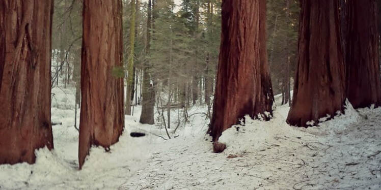
The Tuolumne and Merced Groves of Giant Sequoias will also close on Saturday. (The Mariposa Grove is closed, meaning no access to giant sequoia groves in Yosemite.) These closures are due to human waste and safety reasons.
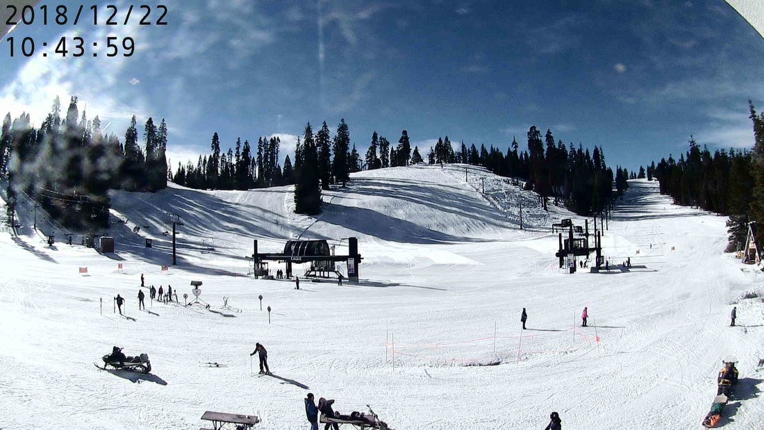
Yosemite Ski and Snowboard area is closed this weekend during the storm.
The ice rink will close for safety and maintenance reasons through January 17 (opening January 18).
Upper Pines Campground will be unstaffed this weekend, but reservations will remain valid. Visitors seeking first-come, first-served camping must follow posted guidance at both Upper Pines Campground and Camp 4 (the only two open campgrounds in Yosemite).
If visiting this weekend, be prepared for rocks, trees, ice, and snow on roads, which may result in closures, chain requirements, and/or delays. Call 209/372-0200 (then 1, 1) to check current road conditions.
Visit https://www.nps.gov/yose/planyourvisit/shutdown.htm for more information.
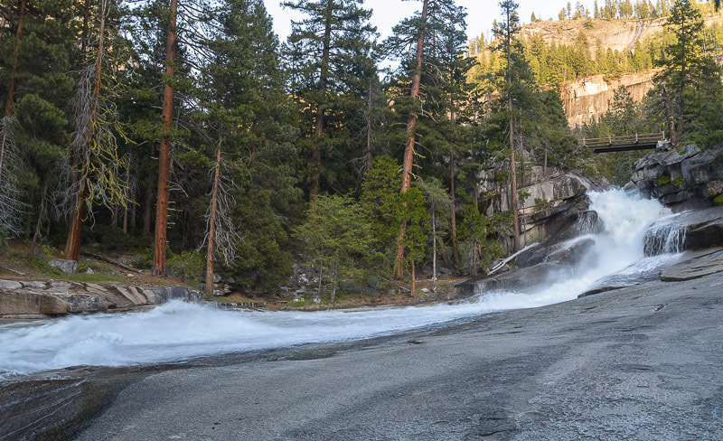
Man falls and dies in Yosemite on Christmas Day
Three people have died in national parks since shutdown began
Fresno Bee - A man died after suffering a head injury in Yosemite National Park above Vernal Fall on Christmas, three days into the government shutdown.
Andrew Muñoz, acting chief of public and congressional affairs for the National Park Service’s Pacific West Region, said on Friday that the man was retrieved from the water in the Silver Apron area – a large, sloping granite area that the Merced River flows over, located between Vernal Fall and Nevada Fall, just east of Yosemite Valley.
After receiving a 911 call, “rangers were on scene in less than an hour and the visitor was removed from the water,” Muñoz wrote in an email. “Medical attention was provided to the visitor, but he died from his injuries.”
“We aren’t releasing more detail because the incident remains under investigation, which is taking longer than usual because of the shutdown. A news release wasn’t issued because of the shutdown.”
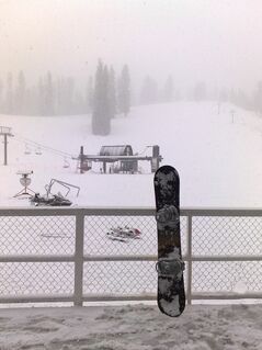
Yosemite Ski and Snowboard Area closed January 5-6
Winter storm forecast this weekend; be prepared for road closures and chain controls
Expect road closures and tire chain requirements beginning Saturday, January 5. Badger Pass Road and Yosemite Ski and Snowboard Area will be closed January 5-6. Call 209/372-0200 (then 1, 1) for current road status within Yosemite National Park.
Yosemite Implementing New Regulations During Government Shutdown
Posted by: gina clugston January 2, 2019 -
YOSEMITE – As the federal government shutdown drags on into the new year, Yosemite National Park remains open, however it is turning into what some describe as a disaster area.
Reports have been flooding in of people using the roadsides as bathrooms, discarding trash everywhere and endangering natural resources.
Park officials announced today that there will now be limited access to the park along the Highway 41 corridor from the South Entrance to the Badger Pass Road during the hours of highest visitation due to continuing issues with human waste and resource damage.
In an attempt to mitigate the damage, park rangers will staff a check point at the South Entrance to Yosemite National Park from 9 a.m. to 6 p.m. Anyone arriving at the checkpoint with a reservation for lodging or camping inside the park will be allowed to proceed. All other visitors will be asked to enter Yosemite using the Highway 140 entrance and enter the park via the El Portal Road.
Local residents and guests staying in Yosemite Valley, Yosemite West and Wawona will be permitted access to drive along Highway 41 (Wawona Road).
Day visitors with no lodging reservations planning to visit the Yosemite Ski and Snowboard Area will be asked to enter the park via Highway 140.
Visitor services are limited due to the lapse in federal appropriations. During the government shutdown, national parks are working to remain as open and accessible to the American people as possible, say park officials.
Unfortunately, the following facilities and areas inside Yosemite National Park are closed due to impacts from human waste and public safety concerns: Wawona Campground, Hodgdon Meadow Campground, the Mariposa Grove of Giant Sequoias, Crane Flat Snow Play Area, and Goat Meadow Snow Play Area, located just outside the South Entrance of Yosemite National Park. All park visitor centers remain closed.
All normal park rules and regulations still apply and violators will be cited. Dogs are not permitted on park trails. Dogs must be on a leash at all times and are permitted in developed areas, on sidewalks, and on bicycle paths. For more information on pet regulations, please visit https://www.nps.gov/yose/planyourvisit/pets.htm.
Restroom facilities are very limited throughout the park, especially along Wawona Road (Highway 41), El Portal Road (Highway 140), and Big Oak Flat Road (Highway 120 West). Visitors are encouraged to stop and use restroom facilities in the gateway communities before entering the park. Visitors are also encouraged to practice "leave no trace" principles and please pack in and pack out all trash. Custodial services are very limited at this time.
All roads within the park are subject to chain control or temporary closures due to hazardous winter driving conditions. All motorists are required to carry tire chains, even if their car is equipped with four-wheel drive, while driving in the park during the winter months.
Additional facilities and areas may close within Yosemite National Park at any time for the health and safety of park visitors.
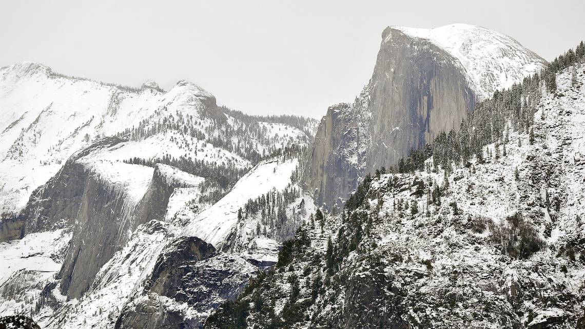
Planning on heading to Yosemite? These areas are closed due to federal shutdown
BY ASHLEIGH PANOO
If you’re going to Yosemite National Park anytime in the near future, be prepared that some park services might not be available due to the federal government shutdown.
Yosemite National Park sent a news release Friday evening of all the services that are closed for the time being, including campground use.
Wawona Campground and Hogden Meadow Campgrond are closed.
The Mariposa Grove of Giant Sequoias will close on Saturday due to impacts from human waste and traffic safety concerns along Wawona Road and Highway 41, said park spokeswoman Jamie Richards.
Bathrooms are also limited throughout the park, and visitors are encouraged to use the bathroom before entering, Richards said. Visitors should also plan to pack in and pack out all trash, as custodial services are very limited.
Visitor centers are also closed and all park programs are canceled during the shutdown.
The park announced earlier in the week that concession services will remain open, including restaurants, lodging, the shuttle system, and Upper Pines Campground and Camp 4.
All normal park rules still apply, Richards said, including pet regulations that say dogs must be kept on a leash and off park trails.
In addition, motorists are required to carry tire chains and should watch for temporary or unexpected road closures.
Richards said additional facilities and areas within the park may close at any time for the health and safety of visitors.
Yosemite is Open: Operations During Government Shutdown
Below is a list of services and facilities that are open or closed.
Visitor services may be diminished or areas may be closed due to environmental, public safety, or other unknown factors. We are not be able to update road and weather information.
Emergency Services
In case of emergency, dial 911 for emergency services. Response time may be increased. The Yosemite Medical Clinic remains open during normal operating hours and days: Monday through Friday, 9 am to 5 pm, except holidays (which includes December 24 and 25, and January 1).
Roads
Visitor InformationNational Park Service-provided information and orientation are not available. Entrance stations are unstaffed (but open). Visitor centers and the Yosemite Museum are closed. The public information office phone line is not staffed. All National Park Service programs are cancelled (programs offered by other organizations, such as park concessioners, may operate).
Concession Run Facilities
Concession services normally provided at this time of year remain open. This includes lodging, tours, restaurants, stores, Yosemite Valley shuttle system, and gas stations provided by our three concessioners (Yosemite Hospitality, The Ansel Adams Gallery, and El Portal Market). Additionally, commercial use authorization holders are able to enter the park.
Restrooms and Trash Removal
National Park Service-provided services are limited. Restrooms at or near concession facilities remain open. Facilities not located near concession facilities are closed due to reductions in staffing. Dispose of trash in a dumper or trash can that is not full in order to protect wildlife and avoid a citation/fine. Do not leave trash on top of or next to a dumpster or trash can, or stuff trash into a full one. Carry your trash to a dumpser or trash can at a hotel or store that is open and has a dumpster or trash can that is not full.
Campgrounds
Upper Pines Campground and Camp 4 are open but unstaffed and will remain open unless there is a life/safety risk. Reservations are not being honored. Due to their proximity to concession facilities, the restrooms at these campgrounds are open. Wawona and Hodgdon Meadow Campgrounds are closed, as are other campgrounds normally closed in winter.
Hiking
Hiking trails normally open at this time of year remain open, conditions permitting.
Free shuttle service is available in Yosemite Valley, as usual. For information on public transportation to Yosemite, visit www.yarts.com.
Below is a list of services and facilities that are open or closed.
Visitor services may be diminished or areas may be closed due to environmental, public safety, or other unknown factors. We are not be able to update road and weather information.
Emergency Services
In case of emergency, dial 911 for emergency services. Response time may be increased. The Yosemite Medical Clinic remains open during normal operating hours and days: Monday through Friday, 9 am to 5 pm, except holidays (which includes December 24 and 25, and January 1).
Roads
Visitor InformationNational Park Service-provided information and orientation are not available. Entrance stations are unstaffed (but open). Visitor centers and the Yosemite Museum are closed. The public information office phone line is not staffed. All National Park Service programs are cancelled (programs offered by other organizations, such as park concessioners, may operate).
Concession Run Facilities
Concession services normally provided at this time of year remain open. This includes lodging, tours, restaurants, stores, Yosemite Valley shuttle system, and gas stations provided by our three concessioners (Yosemite Hospitality, The Ansel Adams Gallery, and El Portal Market). Additionally, commercial use authorization holders are able to enter the park.
Restrooms and Trash Removal
National Park Service-provided services are limited. Restrooms at or near concession facilities remain open. Facilities not located near concession facilities are closed due to reductions in staffing. Dispose of trash in a dumper or trash can that is not full in order to protect wildlife and avoid a citation/fine. Do not leave trash on top of or next to a dumpster or trash can, or stuff trash into a full one. Carry your trash to a dumpser or trash can at a hotel or store that is open and has a dumpster or trash can that is not full.
Campgrounds
Upper Pines Campground and Camp 4 are open but unstaffed and will remain open unless there is a life/safety risk. Reservations are not being honored. Due to their proximity to concession facilities, the restrooms at these campgrounds are open. Wawona and Hodgdon Meadow Campgrounds are closed, as are other campgrounds normally closed in winter.
Hiking
Hiking trails normally open at this time of year remain open, conditions permitting.
- The Mist Trail from its junction with the John Muir Trail above Vernal Fall footbridge to the top of Vernal Fall and the John Muir Trail from Clark Point to near the top of Nevada Fall (the "ice cut") are closed for the winter. It is possible to hike to the top of Vernal and Nevada Falls using still-open sections of trail, however, conditions may be snowy and/or icy.
- The Four Mile Trail is closed for the season below Union Point. It is possible hike from Yosemite Valley to below Union Point (about halfway up the trail), with nice views.
Free shuttle service is available in Yosemite Valley, as usual. For information on public transportation to Yosemite, visit www.yarts.com.

National parks to stay open without staff in government shutdown
BY MIRANDA GREEN - 12/21/18 01:38 PM EST - The Hill
As the hours tick down toward a potential government shutdown, the National Park Service (NPS) is gearing up to clear out its staff across all national parks, but the parks will keep their gates open.
National parks across the country will remain open to visitors under a shutdown but most facilities — including bathrooms — will be shuttered, according to the Interior Department’s 2018 contingency plan.
That means visitors who planned to visit a national park over the holidays will still be able to do so but will have to go without guidance from any NPS officials.
Visitors centers, bathrooms, campsites, trash collection and road maintenance will all be closed and halted in a potential shutdown, according to the federal plan. NPS employees will have as little as four hours to complete their “shutdown activities” before entering furlough status.
“Effective immediately upon a lapse in appropriations, the National Park Service will take all necessary steps to suspend all activities and secure national park facilities that operate using appropriations that are now lapsed, except for those that are essential to respond to emergencies involving the safety of human life or the protection of property,” according to the plan.
Free standing gift shops, lodging and gas stations will remain open if they don't require assistance by federal employees, according to a NPS spokesperson.
"In the event of a government shutdown national parks will remain as accessible as possible while still following all applicable laws and procedures. For example, this means that roads that have already been open will remain open (think snow removal) and vault toilets (wilderness type restrooms) will remain open," the spokesperson told The Hill.
"However services that require staffing and maintenance such as campgrounds and full service restrooms, will not be operating."
The spokesperson noted that war memorials and "open air parks" will remain open to the public in Washington, D.C.
Interior similarly kept its park gates open during the shutdown back in late January of this year, which led to a number of land misuses including the illegal hunting of a pregnant elk in Utah's Zion National Park and a snowmobiler who got a little too close to Yellowstone National Park's iconic Old Faithful geyser.
Environmental and conservation groups are worried about the impacts of another period of time where parks are not overlooked by trained staff.
“Visitors from around the world who have planned their trips to our national parks months in advance now face the possibility of disruption and disappointment when they arrive at parks only to find closed visitor centers, locked restrooms and unplowed roads,” Theresa Pierno, president of the National Parks Conservation Association, said.
“Local businesses and park concessioners also face the possibility of having to re-route passengers to other tours or cancel excursions altogether, threatening $18 million in economic activity that our national parks support on average each day during the month of December.”
The Environmental Protection Agency (EPA) announced that, like last year, it has enough funds to remain open for a week in the event of a shutdown. The agency will remain funded through Dec. 28, according to a memosent out Thursday by acting Administrator Andrew Wheeler. Further updates will be provided if a shutdown exceeds those dates. In the past, a shutdown at the EPA meant the closure of 134 facilities across the country.
Nearly 14,000 employees would be furloughed under a shutdown, according to the EPA’s contingency plan. Only national security and emergency staff will remain on under a shutdown.
Activities that are likely to be halted in the case of a shutdown include hazardous waste cleanup efforts at Superfund sites, on-site inspections at power plants, reviews of toxic substances and pesticides, and responses to Freedom of Information Act requests.
Environmentalists warned that a closure of such activities, even for a short period of time, will have negative environmental and economic effects.
”Even a shutdown for a small amount of time can set administrative and organizational productivity back for weeks, preventing the public from accessing important information and delaying lifesaving activities at the EPA,” said Elizabeth Gore, senior vice president of political affairs at the Environmental Defense Fund.
“For example, the EPA would be forced to pause hazardous waste cleanups, regulatory inspections and approvals. Without these critical services, the true victim of a government shutdown is the American public. Moving the funding bill forward is necessary to our nationwide fight against threats to our health and environment."

Wawona school is interested in rejoining MCUSD
| December 20, 2018
By MATT JOHNSON
Assistant Editor
The potential return of a school in Wawona to the Mariposa County Unified School District was discussed at last Thursday’s MCUSD board meeting. It drew a lot of interest from the community. Yosemite National Park Superintendent Mike Reynolds spoke briefly in support of the school. Photo by Matt Johnson
A small school in Wawona which operates under the Madera County Office of Education had to close its doors prior to the 2018-19 school year, but there is an interest in reopening under the Mariposa County Unified School District, if possible.
Representatives from the Wawona Charter Elementary School attended last Thursday’s MCUSD board meeting to inquire about the possibility of rejoining MCUSD.
The school was part of MCUSD until 1992, when the territory was annexed to the Madera County Office of Education, the Bass Lake School District and Yosemite High School District — in the Oakhurst community.
“Realizing this may take a long time — several months, a year, two years or two-and-a-half — we are asking for Mariposa County and the school board, to support, if necessary, the disengagement of the Wawona school and Mariposa from the Madera County and Bass Lake school system,” said Wayne Heringer, a supporter of the school.
The school has been both a K-6 and K-8 one-room school at various times, serving the children of National Park Service employees, concessionaire employees, community members and Fish Camp residents dating back to the 1890s.
Shown is the Wawona School, a place officials are hoping may one day open again and be a part of the Mariposa school district. Submitted photo
Over the last decade or so, the school has gone through a few different iterations, including operating as a home school before eventually reopening as a charter school in 2014.
But in 2018, the school had to close due to a last minute loss of staff. There were also funding issues tied to the school, as it had an inadequate funding source to supplement the budget.
Issues
One of the first issues is that children who were attending the school have been farmed out to other schools in the region, with some even being forced to home school.
One of the biggest issues from a monetary standpoint is that the Madera County Office of Education continues to receive Mariposa County education tax dollars (property taxes), even though the Bass Lake School District closed the school in 2010. The tax amount could increase dramatically when the Silver Tip project in Fish Camp is completed.
The Silver Tip proposal calls for a massive hotel with 30 cabins and other features located in Fish Camp.
Then there are the funding concerns. The school needs to find a way to sustain itself if it continues as a charter school or becomes part of a school district again. As a charter, it would need to finance the maintenance of school buildings, housing for teachers and more.
Trying to find solutions
That’s where MCUSD comes into the picture.
Community members interested in the school returning to MCUSD have met with Superintendent Robin Hopper and other MCUSD officials.
Hopper and her leadership team studied the issue further and their research determined:
• Each county has a “County Committee on School District Organization” that is reviewed by the State Board of Education.
• In this case, per MCUSD attorneys Atkinson, Andelson, Loya, Rudd & Romo, in a document dated Oct. 14, 2010, the school districts could not simply rescind the original agreement or enter into a new one to restore the area and school to MCUSD. They would have to “mutually initiate” the statutory transfer of a territory under education code.
“If Mariposa wanted to and Madera did not want to, or vice versa, it would not happen,” said MCUSD Chief Business Officer Norma Dwyer.
• The proposal must be approved by both Madera and Mariposa County committees.
• Final action may be taken by each county committee only after receiving the findings of the other.
• MCUSD would not become the “School District of Residence” unless a transfer of property is completed and returned to Mariposa; otherwise taxes stay with Madera.
The following funding options, if the school were to rejoin MCUSD, were studied as well by MCUSD staff: as a dependent charter with MCUSD; as an independent charter authorized through MCUSD; or as a necessary small school with MCUSD.
The analysis was prepared using the MCUSD 2018-19 adopted budget.
The result of those funding options were, according to MCUSD officials, that the most beneficial option for Wawona School — if it were to rejoin MCUSD — is to operate as a necessary small school.
The issue is that education code only allows for five necessary small schools, at a maximum, and MCUSD already has five necessary small schools within the district. There are exceptions, but it would be very difficult to add another necessary small school, Dwyer said.
“The model only allows for five necessary small schools,” Dwyer said. “It’s not impossible, it would just be a huge undertaking and we’d have to go through the CDE to get that changed and approved.”
Dwyer said those factors aside, “the point I really want to make is it needs to be an agreement between Madera and Mariposa. Not knowing where that is, these factors aren’t even a consideration at this time.”
Supporters speak out
Several supporters of the school were in attendance, including Yosemite National Park Superintendent Mike Reynolds.
“I come very quickly tonight to support the citizens of Wawona and to let you know that I would come as a full partner in trying to keep this school open and be there,” said Reynolds. “A school is a cornerstone of community and it is a center of community. We’re trying to keep our communities healthy in the park. … I can only attract really good, quality people from around the country to work in Yosemite if we offer a school.”
Mariposa County Supervisor Miles Menetrey — who represents the district Wawona is located in — also backed the proposal, saying the supervisors support “whatever we have to do to get the situation rectified.”
Next step
Following last Thursday’s MCUSD board meeting, the next step became clear.
Before any talks continue, the group representing the school in Wawona needs to meet with Madera County education officials to discuss the situation and what possibilities are available on that end.
A Million California Buildings Face Wildfire Risk
By DOUG SMITH AND BEN WELSH - Los Angeles Times
Minutes after fire broke out in Woolsey Canyon, a community 12 miles to the south went into action.
Alerted by 911 calls they were monitoring on a red-flag day, volunteers with the Topanga Coalition for Emergency Preparedness headed to the town’s emergency operations center to open back channels to county sheriff’s and fire officials, answer hotline calls, tweet updates and, if it came to that, help send out the evacuation order.
In one sense Topanga is a rarity — a hypervigilant community still roused by the memory of a 1993 fire that left three people dead and destroyed nearly 400 houses.
But there is nothing unusual about the risk of living there.
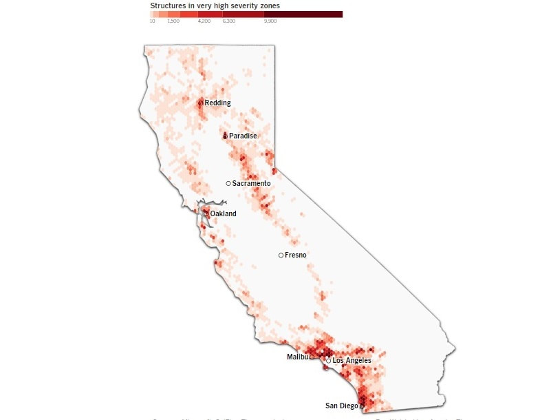
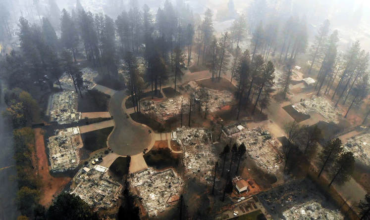
A Times analysis of wildfire hazard across California found that hundreds of communities from Redding to San Diego are at high risk of deadly wildfires like those in Paradise and Malibu last month.
More than 1.1 million structures, or roughly 1 in 10 buildings in California, lie within the highest-risk fire zones in maps drawn by the Department of Forestry and Fire Protection, the analysis showed.
The findings follow a fire season of unprecedented destruction — nearly 20,000 homes lost, more than 100 people killed — that showed what damage can be done if Californians fail to address a widespread risk.
“Now that they’ve got these areas mapped out, what’s going to happen?” said Richard Halsey, director of the California Chaparral Institute, a nonprofit that advocates for government and private interventions. “It’s so frustrating. Everybody sees the information, and they sit on their thumbs and talk.”
Where the risk is
At least 1.1 million California buildings are in a very severe hazard zone. Here are the greatest concentrations.
Los Angeles tops the list with at least 114,000 structures in the highest hazard zone, including tens of thousands of Westside and San Fernando Valley houses in the Santa Monica, Santa Susana and San Gabriel mountains. Those include houses, businesses, factories and other buildings, such as barns.
San Diego is second with more than 88,000 structures. Among the top 10 are Santa Clarita, Thousands Oaks and Glendale, along with the combined four cities of the Palos Verdes Peninsula, whose 23,000 structures are nearly all in the highest severity zone.
The total number at risk is probably higher, because the Microsoft database of building footprints employed in the analysis, among the most complete lists available, is not comprehensive.
Topanga is one of 174 communities that are nearly entirely at risk, with 90% or more of its buildings in the red zone. Paradise and Malibu were both among them.
“It’s not a good feeling to look back on how we mapped Paradise — it’s almost all red — and then having this event come through that validates the map,” said Dave Sapsis, researcher with the state’s Fire and Resource Assessment Program. “We’ve really got to address this trend. These are unacceptable outcomes.”
The risk maps, drawn by state scientists in 2007, are created by a computerized model that considers terrain, vegetation and the location of past fires.
Although they identify areas where stricter building standards and brush clearance are required, the maps do not directly trigger land-use restrictions or funds to make communities less vulnerable. They do give notice to local agencies, insurance companies and residents, and they support requests for fire planning and mitigation grants.
The devastation of the last two fire seasons has raised calls for new development to be restricted in fire-prone areas — and even for prohibitions on rebuilding destroyed homes — but The Times’ analysis highlights the scale of the threat that already exists.
As persistent drought and the warming climate are making wildfire a more frequent and severe threat, the vast extent of vulnerable communities shows the need for action by state and local governments, and the communities themselves, to reduce the risk.
Nearly 60% of the state’s at-risk structures are in incorporated cities or counties, placing the burden of preparing them on local fire departments, overwhelmingly in Southern California.
The maps should put communities on notice that they need to adapt to the certainty of fire, said Scott Ferguson, chairman of Topanga’s emergency response group.
“It keeps driving home that point that you have to take some extraordinary steps,” Ferguson said. “There are a whole lot of things you have to do in your daily life to make yourself safer.”
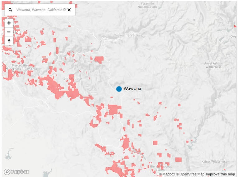
The state has 8,900 very severe hazard zones. Mapped below are some of those zones close to Wawona.
Beyond mapping the hazardous areas, the state does too little to address the causes of the risk, Halsey said.
What’s needed, he said, is legislation requiring a comprehensive plan for every high-severity hazard zone, including “a retrofit plan, mitigation plan, evacuation plans, planning in terms of how to keep more dangerous houses from being built there.”
Current state law provides limited tools to reduce the vulnerability of fire-prone communities beyond the requirement for defensible space around homes. The state building code requires new homes in those areas to use fire-adapted materials and designs such as ember-resistant attic vents and fire-rated siding and roofs.
But it has no provision for upgrading existing homes, often built decades before the threat was identified and new standards were enacted.
“This is the part that is hard about all of this,” said Michael Jarred, policy consultant with the California Senate Office of Research. “We’re adding a lot of requirements for new developments, but more time must be spent on figuring out what can be done for existing structures.”
New laws adopted after last year’s fires will require the state fire marshal to publish a catalog of low-cost retrofits and conduct a survey to identify communities like Paradise where evacuation routes would be inadequate in a disaster, Jarred said.
Like the hazard maps, though, those laws will provide information but not require it to be acted upon.
Given the limitations, the onus for fire prevention largely falls on communities and the local fire agencies that serve them.
“Get the communities involved,” Halsey said. “It’s not that difficult.”
