WawonaNews.com - May 2013
New Yosemite Falls streaming webcam
The Yosemite Conservancy has just launched a new streaming webcam of Yosemite Falls. The image allows viewers to see water falling in real time. Our webcam section, accessed here from the "Yosemite Area Webcams" link, under "More" on the top menu, will feature this webcam on a permanent basis, along with the rest of the area webcams already there.
Rainbow View Fire
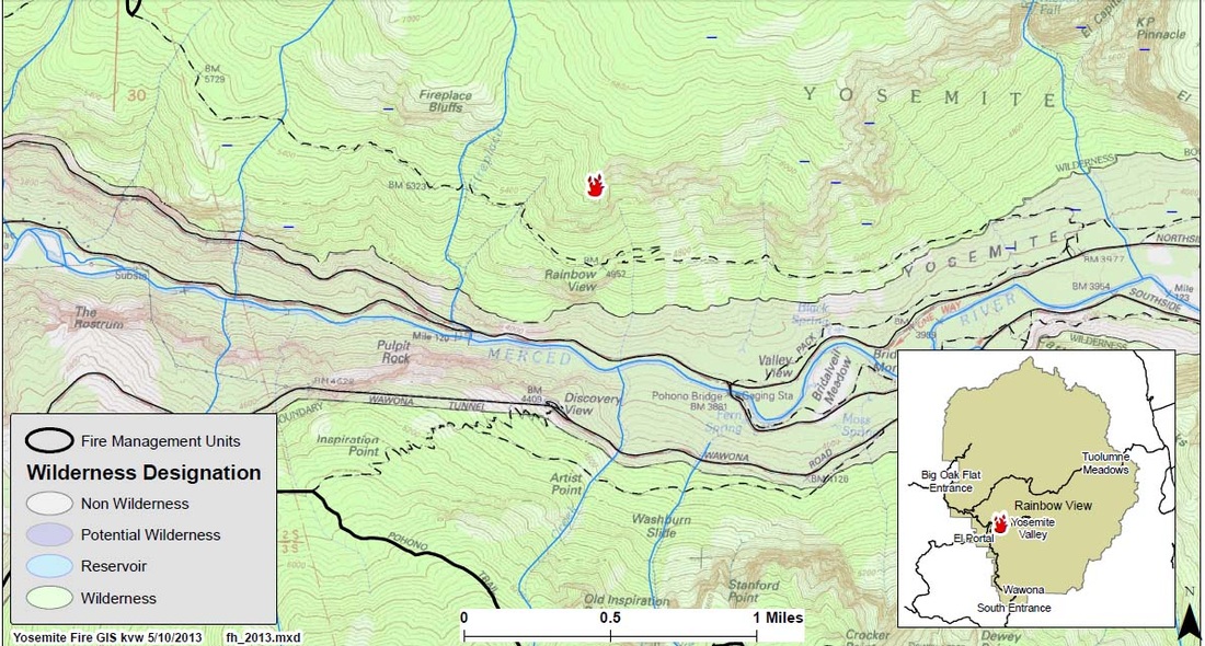
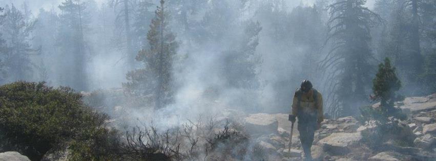
Rainbow View (37 43.594 x 119 40.495; 6000’el., Mariposa Co., found May 10.) This probable lightning caused fire was reported on the evening of May 9. A thunderstorm, accompanied with nearly two inches of rain, occurred Friday in the fire area. A single snag (dead standing tree) is burning and smoldering. One quarter acre has burned. The fire is surrounded by rock and scree and has low potential for growth. The fire is on the north rim of Yosemite Valley, above Rainbow View, east of Fireplace Bluffs and near the Old Big Oak Flat Road into the Valley. The smoke from this fire will be visible from Tunnel View. The fire is on a cliff and due to inacessability, firefighters will monitor this fire for now. The fire poses no threat to visitors, trails, park service buildings, infrastructure or roads.
For additional Information:
Ø Fire Information Officer Gary Wuchner at: [email protected] (209) 372-0480 or 375-9574.
Ø Yosemite National Park Web page: http://www.nps.gov/yose/parkmgmt/current_fire.htm.
Ø Yosemite Fire Twitter: http://twitter.com#!/YosemiteFire
Ø Yosemite Fire Facebook: http://www.facebook.com/pages/Yosemite-Wildland-Fire/124632964255395
Tioga Road opens tomorrow - May 11
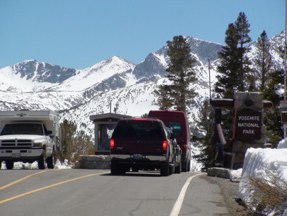
The Tioga Road in Yosemite National Park will open for the season tomorrow, Saturday, May 11, at noon for all vehicular traffic.
The Tioga Road, bounded on both sides by State Highway 120, is the popular east-west crossing of the Sierra Nevada. Vault toilets are available in several locations along the road. Limited visitor services will be available over the next several weeks.
Due to a light snowpack this past winter (approximately 50 percent of normal), the Tioga Road was able to be cleared of snow early into the summer season. Snow and icy conditions may still exist on hiking trails at the higher elevations. Visitors are urged to be prepared for snowy conditions and possible treacherous stream crossings while hiking the backcountry in the early season.
All campgrounds along the Tioga Road are closed. All commercial services, including the gas station, store, and village grill, are also closed. There are no anticipated opening dates for any of these facilities at this time.
Pile Burning to Resume
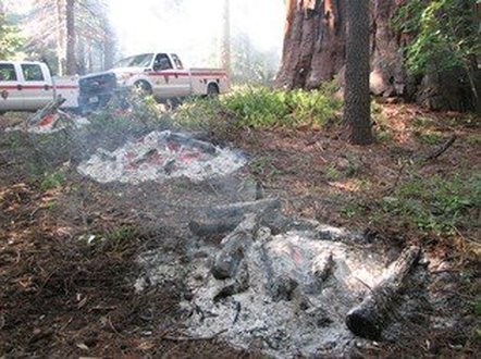
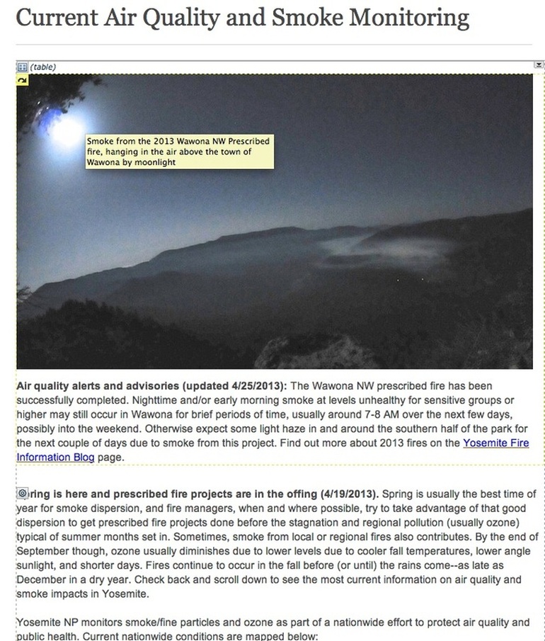
The recent rain storms have provided opportunities to resume pile burning in Foresta and the larger vegetation debris piles in El Portal, Foresta and Wawona. If time allows, firefighters will also resume burning of vegetation piles at Hetch Hetchy. The recent wet weather has improved the air quality in the Wawona Northwest prescribed fire area. However, as the fire area dries out, smoke may again become visible from unburned islands within the fire perimeter. Firefighters will mop-up those areas of continuing heat to improve air quality within the community of Wawona.
Yosemite Wildlife Management Branch
Tailgate Safety Briefing
Mountain
Lion Encounters
Part 1: Avoidance and Responses
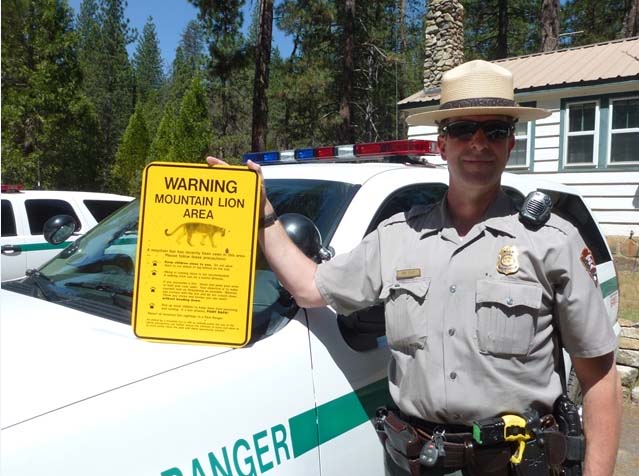
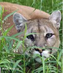
Mountain Lions live throughout Yosemite, at all elevations, and in a wide array of habitat types. The chance of lion attack on humans is extremely low, compared to other threats inherent in working in the field. Fatal lion attacks have, however, occurred in the western U.S. in the last several decades. While the chance of lion attack is very low, they can be further reduced by following some simple precautions:
· Do not hike alone, especially after dark.
· Be alert and aware of your surroundings, by visually scanning along the trail ahead and behind.
If you encounter a lion:
· Remain calm. Don’t run! Lions instinctually chase running prey.
· Do not turn your back on the lion. Maintain eye contact, and stand your ground or back slowly away
· Talk to the lion in a loud, firm, confident voice.
If a lion moves toward you, does not move away, or behaves aggressively:
· Try to appear as large as possible, by holding your coat open, or raising and waving your arms.
· Stare at the lion and yell in a loud, low voice.
· If with others, stand together to give a more imposing impression.
· Arm yourself. Pick up a club-sized stick. Pelt the lion with rocks and sticks. Your goal is to convince the lion that you are not prey, and that you are a danger to it.
If a lion attacks:
· FIGHT BACK! Do not play dead! Fight as if your life depends on it, because it does.
Mountain Lion Encounters
Part 2: Interpretation of Lion Behavior - Risk and Response
The circumstances of lion encounters vary widely, but can be divided into broad categories. In each encounter, the lion’s behavior can give you an indication of its intentions, and how you should react to increase your safety.
Incidental Sightings
· Description – Sighting of lion from a distance. Lion does not stop and hold eye contact, but runs or walks out of sight. This is by far the most common type of lion sighting.
· Interpretation – Avoidance behavior. Lion being secretive.
· Risk of Attack – Low.
· Your Reaction – Make noise to keep the lion heading away. You should leave the area.
Defensive Aggression
· Description – Surprise encounter with a lion at close range. The lion reacts by hissing, snarling, and other vocalizations. Baring of teeth, ears laid back.
· Interpretation – Defensive behavior. A kill or a den with cubs could be nearby. Attack is possible.
· Risk of Attack – Moderate, depending on the distance between you and the lion, and your reaction.
· Your Reaction – Immediately back away while facing the lion and staring at it. Report the encounter to Wildlife Management or a Protection Ranger.
Predatory – Prey Assessment and Stalking
· Description – Lion stares intensely. Exhibits following and hiding behavior. The lion stays nearby and stares at you. The lion may face you or try to circle around you, generally maintaining a constant distance.
· Interpretation – Lion assessing you as potential prey, and chances of a successful attack.
· Risk of Attack – Moderate to high, depending on distance, and intensity of behavior.
· Your Reaction – Stare at the lion while making noise, and throwing rocks and sticks at the lion. Alert other people in the area. When the lion leaves, so should you, staying alert for the lion as you go. Report the encounter to Wildlife Management or a Protection Ranger.
Predatory – Pre-attack
· Description – Crouching; tail twitching; staring intensely; body low to ground; head may be up.
· Interpretation – Pre-attack.
· Risk of Attack – High.
· Your Reaction – Stare and yell at the lion; throw rocks and sticks to scare away the lion. Find a weapon, like a stick to use as a club. When the lion leaves, so should you, staying alert for the lion as you go. Report the encounter to Wildlife Management or a Protection Ranger.
Predatory – Attack Imminent
· Description – Fur fluffed out; tail twitching; body and head low to ground; rear legs pumping.
· Interpretation – Attack imminent.
· Risk of Attack – Very high and immediate.
· Your Reaction – Face and stare at the lion; yell loudly; throw rocks and sticks; find a weapon, like a fist-sized rock or club-like stick. If the lion makes contact, fight back as if your life depends on it, because it does. If you are able to repel the lion, leave the area, staying alert for the lion as you go. Report attack to a Protection Ranger.
WAWONA TOWN PLANNING ADVISORY COMMITTEE
Wawona Community Center
Saturday, May 18, 2013, 9 a.m.
1. Call to Order 9 a.m.
2. Introductions
3. Approve February 12, 2011 meeting minutes
4. Public comments on non-agenda items. Note: The public may speak on any item not on the printed agenda. No action may be taken by the Committee. The public will also be given the opportunity to comment before or during the committee’s consideration of items.
5. Discussion / Action Items
a. Possible Brown Act Violations (Action may include recommendation to Board of Supervisors)
i. WTPAC committee members / WAPOA Board members
b. Review of MOU between Mariposa County and National Park Service
c. Elections of Officers, including Chair, Vice-Chair and Secretary
6. Proposed Solid Waste Fee Increase – Discussion and Possible Recommendation to Board of Supervisors
7. Information and Report Items
a. Supervisor, District 5
b. Planning Commissioner, District 5
c. National Park Service
8. Next meeting: Date and Agenda
9. Adjournment
Wawona NW Prescribed Fire - May 3
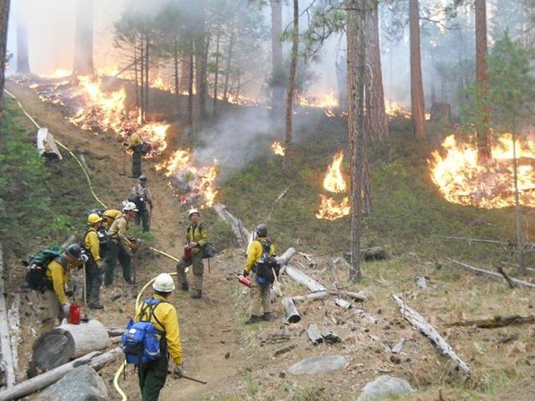
Yosemite National Park fire managers began burning the 150 acre Wawona Northwest Segment B Prescribed Fire on April 21, 2013. Ignitions were completed on Tuesday, April 22.
Since April 22, fire crews continue to diligently work to mop-up and cool with water smoking trees and underbrush. Areas with more moisture, deep needles, and large logs produce more smoke for longer periods of time. The highest concentration of smoke being produced is in the creek drainage near Spelt Road. Data from smoke monitors show less smoke production each day.
If you have low tolerances for smoke take these suggested measures to help reduce your exposure:
Ø Stay indoors when the greatest amount of smoke is present – 8 PM to 8 AM.
Ø Close windows, doors and outside vents when it is smoky.
Ø Ventilate your home, cabin or work place during the day.
Fire managers continue to work with the Mariposa County Air Pollution District (MCAPCD).
The primary objective of this prescribed fire was met to reduce hazardous fuels within the mixed conifer forest adjacent to the Wildland Urban Interface (WUI) community of Wawona. This project creates a continuous area of reduced fuel by linking together multiple previous fires and treatments including the 2007 and 2008 Wawona Northwest prescribed fires, the 2007 Jack wildfire, which was caused by lightning, and a series of mechanical vegetation thinning projects in the 2000’s.
A secondary objective is ecosystem restoration. Applying fire under prescribed conditions mimics the frequent, low intensity lightning caused fires that occurred in Sierras prior to the exclusion of fire which began over 100 years ago under aggressive fire suppression policies. Historically, natural fire burned an average of 16,000 acres annually in Yosemite and played an integral role in shaping Yosemite’s ecosystems. In the absence of frequent fire, unnatural levels of forest biomass have accumulated which has put many of Yosemite’s values at risk, including neighboring communities, and natural and cultural features. As climate changes, these values become increasingly vulnerable to catastrophic wildfire.
For additional Information
· Fire Information and Education: [email protected]; (209) 375-9574
· Yosemite Fire Management Website: http://www.nps.gov/yose/parkmgmt/current_fire.htm.
· Air Quality: http://www.nps.gov/yose/naturescience/aqmonitoring.htm
· Park WEBCAMS: Park http://www.nps.gov/yose/photosmultimedia/webcams.htm
· Facebook: http://www.facebook.com/pages/Yosemite-Wildland-Fire/124632964255395
· Twitter: http://twitter.com/#!/YosemiteFire
Glacier Point Road in Yosemite National Park to Open Friday, May 3
- news release Scenic Road Provides Access to Spectacular Vista Scott Gediman 209-372-0248 Kari Cobb 209-372-0529
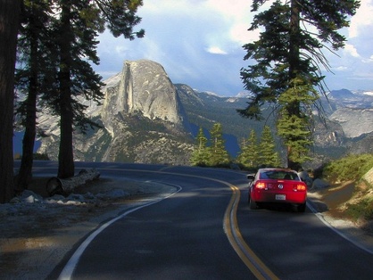
The Glacier Point Road in Yosemite National Park will open for the season tomorrow, Friday, May 3, 2013, at 12:00 p.m. There will be limited visitor services available at Glacier Point. Vault toilets will be available, and there will be no running water. There is no projected opening date for the Bridalveil Creek Campground. Visitors are urged to drive slowly and with caution, as wildlife may be present on or near the roadway. Additionally, road surfaces may be wet due to snow melt. The Tioga Road is tentatively scheduled to open for the season on Saturday, May 11, 2013. For up to date, 24 hour road and weather information, please call 209-372-0200. (K. Cobb)
Search for pilot to resume in June
Solvang resident went missing in December

Santa Maria Times - April 29
Yosemite National Park officials expect to resume their search for missing Solvang pilot Nicol Wilson in June at the earliest, a spokeswoman said last week.
Wilson, the only occupant of a single-engine 1966 Mooney M20F, left Dec. 17 from Santa Ynez Airport and was reported missing by his family that evening when he failed to arrive on schedule at Mammoth Lakes Airport, on the east side of the Sierra Nevada.
Due to heavy snowfall and strong winds in December, search efforts — which had turned up no clues or signs of the aircraft — were suspended until weather and snow conditions improved.
The four-seat aircraft disappeared from radar near North Dome. Aerial search efforts began Dec. 18 but were stalled by poor weather and lack of visibility.
More than five feet of new snow had accumulated at the higher elevations of the park, including the search area off Tioga Pass between 8,000 and 10,000 feet, roughly 600 square miles.
“The high country is still very covered in snow,” said Kari Cobb, a spokeswoman for Yosemite National Park.
Santa Ynez Valley News - April 18
Nick Wilson was born in Kilmarnock, Scotland in 1944, to James and Undine Wilson. His dad owned a carpet wool business and was away fighting in the Second World War when Nick was born. He grew up in Kilmarnock with his three sisters. Early on Nick demonstrated a keen interest in inventing and tinkering. He attended boarding school at Campusdoon and then Fettes and went on to receive a degree from Strathclyde University.
After graduating from university, Nick had planned to travel for a year and return to Scotland. However he fell in love with the beauty of California and decided to make it his home.
His first job was at Mattel designing toys. One year later, as a legal resident of the U.S., he was drafted and fought in Viet Nam. Surviving unscathed, he returned to work at Mattel for another 10 years. Nick was a very talented engineer and mechanism guy and made major contributions to many complicated and successful toys including Barbie, Chatty Cathy, Tina Tell Time, Baby That-Away and other famous toys that talked, crawled or cried. More than that, Nick was liked and respected by all at Mattel for his strong sense of right and wrong and his willingness to step up and help. Nick worked for Denis Bosley and Derek Gable both of who greatly appreciated his contribution and friendship.
When Nick left Mattel, he used his cleverness and amazing versatility to maintain a successful freelance business. He created Horizon Concepts, specializing in prototype design and product development for many diverse industries including; the well-known Pelican flashlights and the Multacc advanced type of Real Estate Lock Box.
He met his wife, Connie, in traffic school and they married in 1988. They moved from Redondo Beach to Solvang where they raised their son, Gavin and daughter Melinda.
He loved hiking, skiing, flying, and anything that involved being outside. His favorite place was his cabin in Mammoth. Among his many passions was collecting old cars - an E-type Jag, a 1957 Desoto, and a Toyota land Cruiser which took him up many mountains.
Tragically, he was lost in a plane crash in December of 2012 in the Yosemite mountains.
He is survived by his family, Connie, Gavin and Melinda, His sisters, Rosalind, Jassamyn, and Valerie, and many nieces and nephews. He was a wonderful friend, husband, father, uncle and brother. He will always be remembered for his selflessness, courage, and kindness.
A celebration of his life will be held on April 20that 11:00am at St. Marks-in-the-Valley in Los Olivos, Ca.
Wawona Northwest Prescribed Fire
April 25, 2013
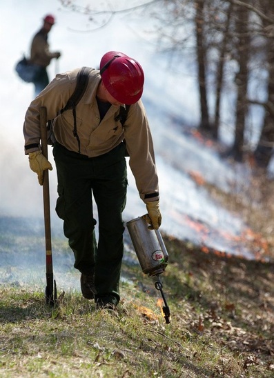
Fire crews are continuing mop-up operations along the fire perimeter. Areas with more moisture, deep needles, and large logs produce more smoke for longer periods of time.
Smoke will be present particularly during late evening and early morning hours. The fire crews will continue working through the weekend to mop-up and cool the fire line. Those efforts will help mitigate and lessen smoke production each day. If you have low tolerances for smoke take these suggested measures to help reduce your exposure:
Ø Stay indoors when the greatest amount of smoke is present – 6 to 8AM.
Ø Close windows, doors and outside vents when it is smoky.
Ø Ventilate your home, cabin or work place during periods when it is least smoky.
Fire managers have been working with the Mariposa County Air Pollution District (MCAPCD) to time the project to coincide with favorable weather that will facilitate good air quality, and disperse smoke into the atmosphere away from the community. Prior to ignition, a burn permit was issued to the park by MCAPCD and smoke monitoring equipment was installed in the community.
Yosemite National Park fire managers began burning the 150 acre Wawona Northwest Segment B Prescribed Fire on April 21, 2013. Ignitions were completed on Tuesday, April 22.
The primary objective of this prescribed fire was met to reduce hazardous fuels within the mixed conifer forest adjacent to the Wildland Urban Interface (WUI) community of Wawona. This project creates a continuous area of reduced fuel by linking together multiple previous fires and treatments including the 2007 and 2008 Wawona Northwest prescribed fires, the 2007 Jack wildfire, which was caused by lightning, and a series of mechanical vegetation thinning projects in the 2000’s.
A secondary objective is ecosystem restoration. Applying fire under prescribed conditions mimics the frequent, low intensity lightning caused fires that occurred in Sierras prior to the exclusion of fire which began over 100 years ago under aggressive fire suppression policies. Historically, natural fire burned an average of 16,000 acres annually in Yosemite and played an integral role in shaping Yosemite’s ecosystems. In the absence of frequent fire, unnatural levels of forest biomass have accumulated which has put many of Yosemite’s values at risk, including neighboring communities, and natural and cultural features. As climate changes, these values become increasingly vulnerable to catastrophic wildfire.
Fire managers will begin releasing fire crews from outside of the park over the weekend.
For additional Information
- Fire Information and Education: [email protected]; (209) 375-9574
- Yosemite Fire Management Website: http://www.nps.gov/yose/parkmgmt/current_fire.htm.
Wawona Prescribed Fire - "Finishing Touches"
Fire crews are continuing mop-up activities along the fire perimeter. For your safety, residents and visitors are asked not to hike into the fire area or along fire lines. Hazards include hot stump holes and ash, snags (standing dead trees) that may fall without a sound, and falling, fire damaged, tree limbs.
Above is a new video showing smoke movement through three days of the prescribed fire project. It begins on April 21 and through April 24.
Lee Tarnay, Ph.D., Yosemite National Park Air Quality Specialist points out a couple of points: "Cloud formation appeared top be enhanced in the humid air above the fire on the second day of ignitions (April 22)."
"This is due to smoke particle providing extra area for water vapor in humid air to condense (a process called nucleation); just as the sides of a glass of water gets condensation on a humid/hot day."
Yosemite says Tioga Road will open May 11
By Mark Grossi - The Fresno Bee
Tuesday, Apr. 23, 2013 | 03:33 PM
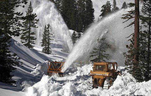
Yosemite National Park on Tuesday announced Tioga Road, a key east-west artery across the Sierra Nevada, is scheduled to open Saturday, May 11, unless a spring storm drops more snow on the high country.
Snow plows will begin clearing the road Monday, and the work should go fast because of a dry winter, said Yosemite spokesman Scott Gediman.
"It's great news," he said. "Tioga is an important road linking the east and west sides of the Sierra for tourists and travelers."
Businesses on both sides of the mountain range look forward to the reopening of Tioga each year.
Yosemite usually does not project opening dates for Tioga or other snowbound roads. But because of the dry winter, Mariposa Grove Road already is open, and Glacier Point Road is expected to open on Friday, May 3.
Gediman said the road-clearing work usually costs $50,000 to $60,000, depending on the size of the snowpack. This year, Yosemite leaders anticipate spending $10,000 or less.
Wawona Northwest Prescribed Fire - April 23 update
Yosemite National Park firefighters conducted
two days of ignition operations and completed the 150 acre Wawona
Northwest Segment B Prescribed Fire Monday evening, April 22. Firefighters have begun mop-up activities to
secure the fire perimeter. Those actions may include burning out of interior
islands and pockets of unburned fuel that could flare up and threaten existing fire
perimeter lines. Active burn down will last 1 – 2 weeks. Community members and visitors will continue
to observe crews from various federal and state agencies conducting mop-up
operations.
The primary objective of the prescribed fire was to reduce hazardous fuels within the mixed conifer forest adjacent to the Wildland Urban Interface (WUI) community of Wawona. This project creates a continuous area of reduced fuel by linking together multiple previous fires and treatments including the 2007 and 2008 Wawona Northwest prescribed fires, the 2007, lightning caused, Jack wildfire, and a series of mechanical vegetation thinning projects in the 2000’s.
A secondary objective is ecosystem restoration. Applying fire under prescribed conditions mimics the frequent, low intensity lightning caused fires that occurred in Sierras prior to the exclusion of fire which began over 100 years ago under aggressive fire suppression policies. Historically, natural fire burned an average of 16,000 acres annually in Yosemite and played an integral role in shaping Yosemite’s ecosystems. In the absence of frequent fire, unnatural levels of forest biomass have accumulated which has put many of Yosemite’s values at risk, including neighboring communities, and natural and cultural features. As climate changes, these values become increasingly vulnerable to catastrophic wildfire.
Smoke will be present during the mop-up activities particularly during late evening and early morning hours. Smoky conditions will diminish each day as the fire area cools. Fire managers will continue working with the Mariposa County Air Pollution District (MCAPCD). A burn permit was issued to the park by MCAPCD prior to the start of ignitions. Smoke monitoring equipment was installed within the community and will continue to be monitored. Community members who are sensitive to smoke may want to close their windows and doors during the evening hours in order to reduce their exposure.
For additional Information
- Fire Information and Education: [email protected]; (209) 375-9574
- Yosemite Fire Management Website: http://www.nps.gov/yose/parkmgmt/current_fire.htm.
- Park WEBCAMS: Park http://www.nps.gov/yose/photosmultimedia/webcams.htm
- Facebook: http://www.facebook.com/pages/Yosemite-Wildland-Fire/124632964255395
- Twitter: http://twitter.com/#!/YosemiteFire
Wawona NW Prescribed Fire Started
|
|
April 21, 2013
Yosemite National Park fire managers began burning the 150 acre Wawona Northwest Segment B Prescribed Fire on April 21, 2013. A test burn was started and conditions were favorable to continue the prescribed fire project. Ignition will take 2 – 4 days and active burn down will last 1 – 2 weeks. The primary objective is to reduce hazardous fuels within the mixed conifer forest adjacent to the Wildland Urban Interface (WUI) community of Wawona. This project creates a continuous area of reduced fuel |
by linking together multiple previous fires and treatments including the 2007 and 2008 Wawona Northwest prescribed fires, the 2007 Jack wildfire, which was caused by lightning, and a series of mechanical vegetation thinning projects in the 2000’s.
A secondary objective is ecosystem restoration. Applying fire under prescribed conditions mimics the frequent, low intensity lightning caused fires that occurred in Sierras prior to the exclusion of fire which began over 100 years ago under aggressive fire suppression policies. Historically, natural fire burned an average of 16,000 acres annually in Yosemite and played an integral role in shaping Yosemite’s ecosystems. In the absence of frequent fire, unnatural levels of forest biomass have accumulated which has put many of Yosemite’s values at risk, including neighboring communities, and natural and cultural features. As climate changes, these values become increasingly vulnerable to catastrophic wildfire.
Community members and visitors can expect to see crews from various federal and state agencies conducting burn operations in the coming days.
Smoke will be present during the prescribed fire, particularly during late evening and early morning hours. Fire managers are working with the Mariposa County Air Pollution District (MCAPCD) to time the project to coincide with favorable weather that will facilitate good air quality, and disperse smoke into the atmosphere away from the community. Prior to ignition, a burn permit was issued to the park by MCAPCD and smoke monitoring equipment was installed in the community. Community members who are sensitive to smoke may want to close their windows and doors and/or consider leaving the area during active ignition of the project in order to reduce their exposure.
For additional Information
- Fire Information and Education: [email protected]; (209) 375-9574
- Yosemite Fire Management Website: http://www.nps.gov/yose/parkmgmt/current_fire.htm.
- Park WEBCAMS: Park http://www.nps.gov/yose/photosmultimedia/webcams.htm
- Facebook: http://www.facebook.com/pages/Yosemite-Wildland-Fire/124632964255395
- Twitter: http://twitter.com/#!/YosemiteFire
Prescribed Fire Postponed
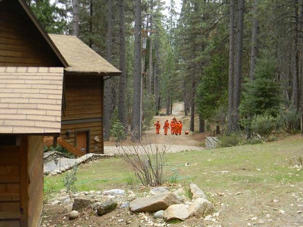
Apr. 16 - Due to the predicted rain and snow storm the Wawona Northwest prescribed fire project is postponed. If the weather clears and winds are favorable fire officials will begin ignitions later this week.
Public Comment Period for the Merced River Plan Extended through April 30, 2013
Yosemite National Park announces the extension of the public comment period for the Merced Wild and Scenic River Draft Comprehensive Management and Environmental Impact Statement (MRP) through Tuesday, April 30, 2013. Previously, the public comment period was slated to close on Thursday, April 18, 2013.
“The MRP is an expansive document which guides park management actions for many years. We want to make sure the public has a thorough opportunity to review the draft plan and submit comments,” stated Kathleen Morse, Yosemite National Park’s Chief of Planning.
This extension adds twelve days to the one hundred day the public comment period. The document was released for public review and comment on January 8, 2013. So far, the park has received about 25,000 comments.
For a copy of the plan and a complete description of all alternatives, please visit the park’s website at www.nps.gov/yose/parkmgmt/mrp.htm.
Comments on the MRP can be made through the, and Public Comment (PEPC) website at http://parkplanning.nps.gov/mrp_deis. Comments made through the PEPC website are the preferred method of submission. However, comments can also be sent via email to [email protected] or via U.S. mail to:
Superintendent
Yosemite National Park
Attn: Merced River Plan
P.O. Box 577
Yosemite, CA 95389
Based on a Settlement Agreement the park reached with the plaintiffs in September 2009, the MRP is mandated to be completed by the end of July 2013. The extension of the comment period will allow for park staff to collect and analyze all public comments which will become a part of the Final Merced River Plan.
Helpful MRP Review Tips
An overview of the Merced River draft Plan can be found online: http://www.nps.gov/yose/parkmgmt/mrp-deis.htm
To assist you in your review of the draft plan, consider starting with the following sections:
- Goals of the Merced River Plan (Chapter 1: page 1-3)
- Merced River Plan / DEIS Document Organization (Chapter 1: page 1-4)
- Identification of Planning Issues: Public and Internal Scoping (Chapter 2: pages 2-13 to 2-18)
- Part III User Capacity Discussion (Chapter 6: pages 6-12 to 6-43)
- Alternatives (Chapter 8)
- Process Used to Develop the Alternatives (Chapter 8: pages 8-1 to 8-7)
- Actions Common to Alternatives 2-6 (Chapter 8: pages 8-53 to 8-102)
- Alternative 1 (No Action) Overview (Chapter 8: pages 8-13 to 8-28)
- Alternative 2 Overview (Chapter 8: pages 8-103 to 8-118)
- Alternative 3 Overview (Chapter 8: pages 8-145 to 8-160)
- Alternative 4 Overview (Chapter 8: pages 8-187 to 8-203)
- Alternative 5 (Preferred) Overview (Chapter 8: pages 8-231 to 8-246)
- Alternative 6 Overview (Chapter 8: pages 8-273 to 8-288)
