WawonaNews.com - September 2017
Sky Ranch Road Evacuated, Railroad Fire Bears Down On Cedar Valley
Posted by: gina clugston September 3, 2017 - 5:22 pm
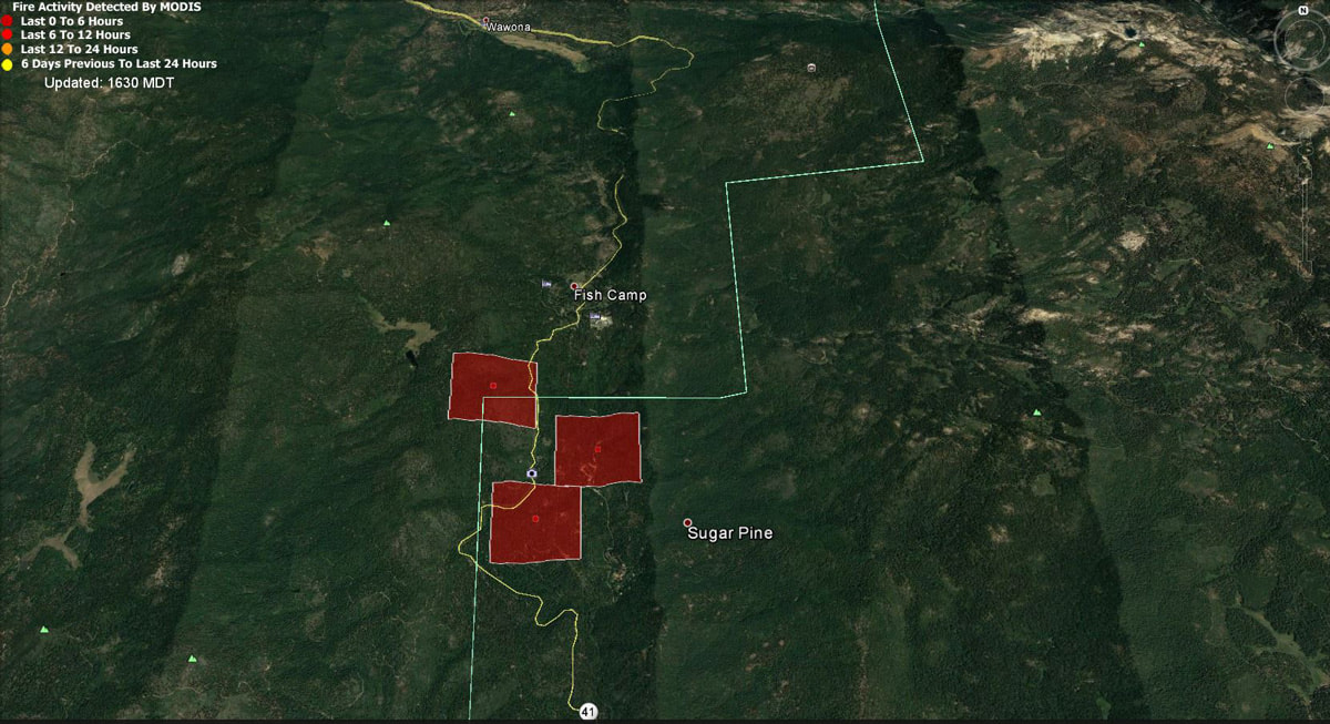
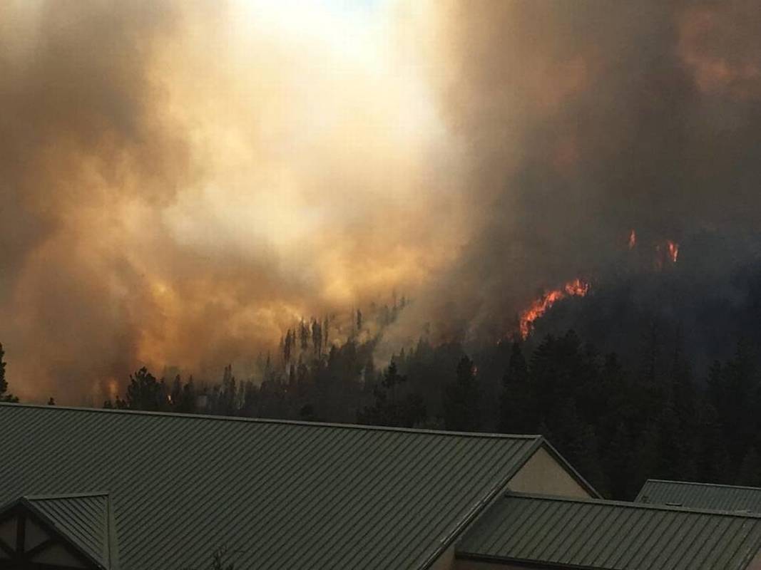
FISH CAMP — Sky Ranch Road is now being evacuated as the Railroad Fire continues its push south toward Cedar Valley.
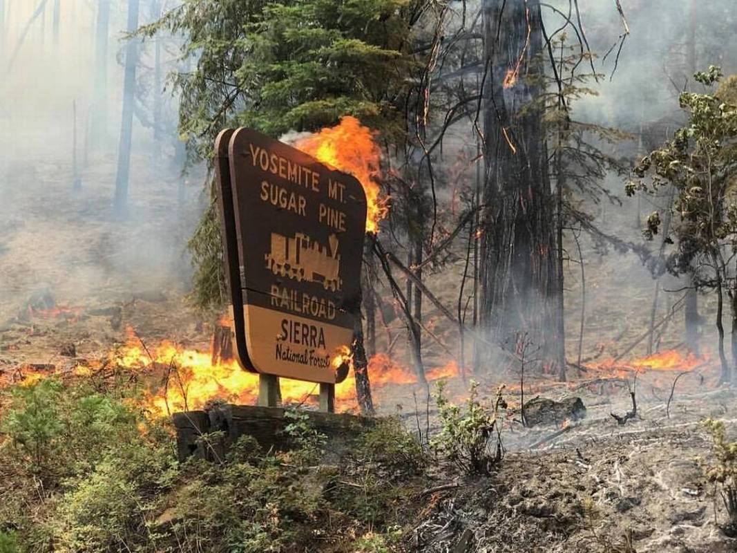
This morning the fire spotted across the lines near Sugar Pine, prompting the evacuation of Cedar Valley.
By 4:30 p.m., the fire was reported as having moved south past the Lewis Creek Trailhead, and deputies fanned out across the Sky Ranch Road area to notify residents to get out.
The evacuation includes all of Sky Ranch Road and these side roads:
- Sky Ranch Lane
- Sugar Pine Drive
- Sugar Pine Court
- Oak Lane
- Mountain View Court
- Country Club Drive
- Sky Acres Court
- Buckskin Lane
- Sunny Oaks Lane
Resources were requested this afternoon as two new fires broke out at the same time, just after 1 p.m. – the Peak Fire near Usona Road in Mariposa County, and the Mission Fire in North Fork. Both prompted immediate evacuations, and the Mission Fire had grown to 350 acres by 4 p.m., and to 500 acres by 5 p.m., destroying three structures.
We will update on the Railroad Fire after the evening briefing. With all three fires going at once, attendance in person at Fire Camp will not be possible tonight, but we will update as completely as possible from the information released.
Closures and evacuations on the Railroad Fire (in addition to Sky Ranch):
At 10 a.m. this morning, a mandatory evacuation order was issued for the Cedar Valley Subdivision.
This evacuation notice includes the following roads:
- Cedar Valley Drive
- Deer Run Trail
- Lazy Oak Drive
- Cedar Brook Road
- Cedar Springs Road
- Mountain Meadow Road
- Chu Ranch Road
- Tolladay Road
- Jackson Road
- Cedar Ridge Circle North and South
- ManzanitA Drive
- Three Springs Road
- Lakeside Drive
- Cedar Place
Road closures include all Highway 41 offshoots between Cedar Valley Road and Summerdale Campground north of Fish Camp, in both Madera County and Mariposa County, and Road 630 (Sugar Pine Road) and all cross streets, including Sugar Pine Christian Camps.
Jackson Road (6S07) is closed from Fish Camp to Beasore Road.
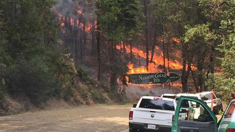
A mandatory evacuation is in place for the the community of Fish Camp, the Tenaya Lodge, the Narrow Gauge Inn, the Yosemite Mountain Sugar Pine Railroad, the community of Sugar Pine including the Christian Camp, Cedar Valley, Big Sandy Campground and Summerdale Campground.
Sky Ranch (Road 632) is under an evacuation order. The road is closed and evacuations ordered for Nelder Grove, Camp Redwood, Paradise Springs, Calvin Crest, and Soquel and Texas Flat campgrounds.
There have been some changes to this list of Forest road closures:
- Road 632
- Forest Road 5S10 at 5S39
- Forest Road 6S13 at Road 274
- Forest Road 6S08 at 6S36
- Forest Road 6S10 at 6S39
- Forest Road 6S99 at Beasore Road
- Forest Road 6S40 at Beasore Road
- Forest Road 6S40X at Beasore Road
- Forest Road 5S40Y at Beasore Road
- Worman Road one mile in from Highway 49 (at Road 601).
The Red Cross Evacuation Center at the Oakhurst Community Center has been reopened at 39880 Road 425B.
Also, the Central California Animal Disaster Team has re-activated a small animal shelter at the Oakhurst Community Center Pavillion Building. Large animals can be sheltered at the Coarsegold Rodeo Grounds, at 44777 Rodeo Grounds Lane in Coarsegold. The phone number is 559-676-7864.
For animal evacuations, people will need to call the Sheriff’s Office Dispatch at (559) 675-7770 to request help. CCADT will be working with Madera County Animal Control to help with evacs if needed
The hot line number for the Red Cross is 559-343-2549.
All roads past Wawona inside Yosemite are open, except Glacier Point Road, which was closed last Sunday due to increased fire activity on the Empire Fire.
For fire updates, residents and visitors can message RAILROADFIRE (one word) to 888777.
A fire information line has been established for the Railroad Fire at 559-373-0040.
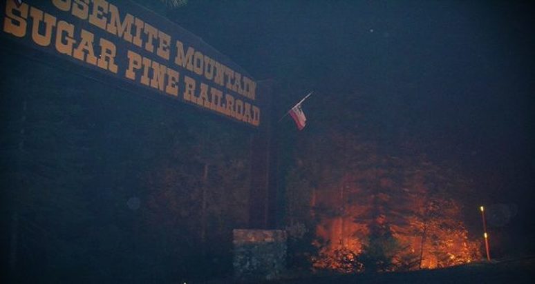
The Railroad Fire was reported at 12:20 p.m. on Tuesday, Aug. 29, just south of the Yosemite Mountain Sugar Pine Railroad on the west side of Highway 41. It is burning on the Bass Lake Ranger District of the Sierra National Forest.
The estimated date for containment is Friday, Sept. 8.
The cause of the fire is under investigation.
Hundreds forced to flee their homes as new fires erupt near Mariposa, North Fork
BY MARK EVAN SMITH
[email protected]
SEPTEMBER 03, 2017 3:15 PM
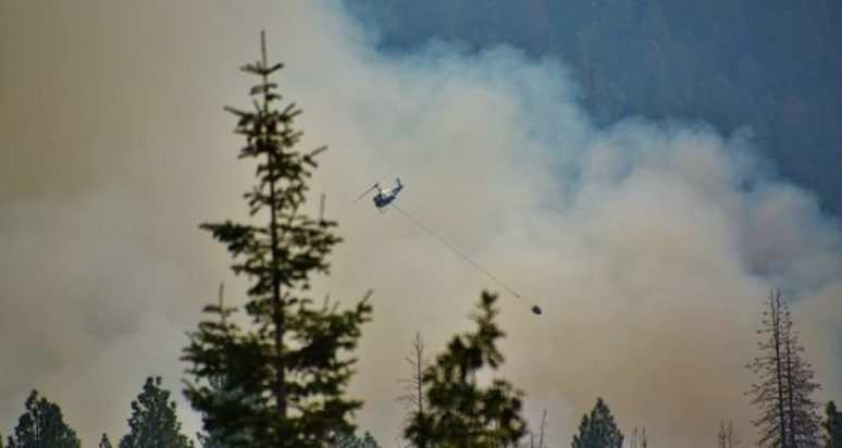
Air attack crews were placed on orders Sunday afternoon that they would remain on two new fires, near Mariposa and North Fork, that burst into flame and burned residences while threatening people who might have been trapped inside.
The Mission Fire, reported around 1 p.m., reached 350 acres an a mere two hours later, and threatened hundreds of homes in the Cascadel Heights area, located east of North Fork.
At least three structures have been destroyed, officials confirmed. What kind of structures were lost was not yet known. At least 200 more were threatened.
Mandatory evacuation orders were issued for the area.
At least 50 people were trapped in Cascadel Meadows, Madera County District 5 Supervisor Tom Wheeler confirmed around 4 p.m. He said the Madera County Sheriff’s Office was able to escort them out of the area by half an hour later.
Road closures were issued for Road 225 at Douglas Ranger Station Road, and Road 225 at Boulder Creek. By 4 p.m., Highway 49 remained open to traffic.
Erratic winds were expected, as flames were reportedly spreading in several directions. A thunderstorm with lightning and gusty winds was forecast for the evening.
Some reports over emergency radio scanners indicated that air attack crews were being ordered not to divert to any other fire, as human life was threatened.
Evacuees were being directed to the Cascadel clubhouse, or toward an evacuation shelter at Oakhurst Community Center.
In Mariposa, the Peak Fire, also reported around 1 p.m., grew to around 50 to 60 acres by 2:45 p.m. as it burned on Usona Road, near India Peak. At least eight structures were threatened, but those numbers were likely to increase.
Evacuations were ordered on Usona Road, from India Peak to Highway 49. Those evacuees were also being directed to the shelter at Oakhurst Community Center.
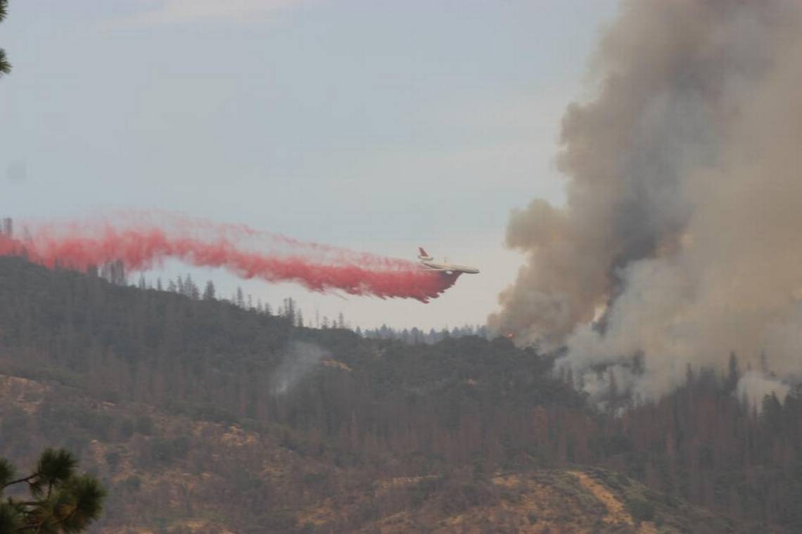
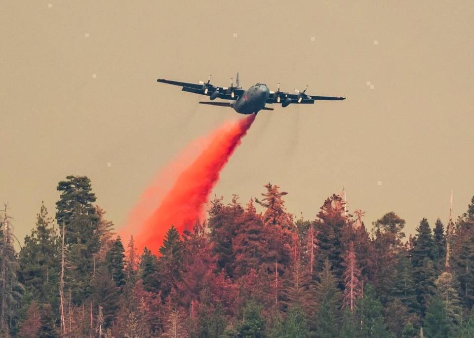
A repurposed 747 Supertanker was among air attack crews being called in to try and take down the Mission Fire Sunday afternoon.
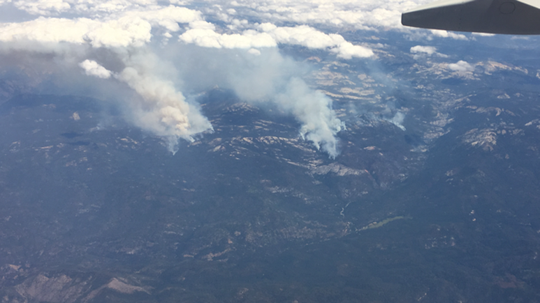
The fires join the ongoing Railroad Fire near Fish Camp, which grew to 5,414 acres by Sunday morning as it forced evacuations of Cedar Valley.
The cause of all three fires is under investigation.
New Fire Destroys Three Structures, Now 350 Acres
Posted by: gina clugston September 3, 2017 - 3:53 pm
NORTH FORK — The Mission Fire continues burning along Road 233 and into Cascadel Woods. It has forced the evacuation of hundreds of people and is threatening about over 200 homes.
At this time, deputies have gone door to evacuate everyone on Road 233 (Cascadel Road) and all extension roads including Mission Drive and Peckinpah Acres, everyone in Cascadel Heights and Cascadel Woods, and residents along Road 225 in the vicinity.
The fire was reported just after 1 p.m., and at last report was 350 acres.
Three structures have been confirmed lost as of 3:50 p.m.
The incident commander immediately ordered a total of 7 air tankers, 4 helicopters and more engines. All of those tankers have been put on a “no divert” order for any other fires due to the immediate and serious threat to human life. A VLAT should arrive shortly from San Bernardino.
Eight dozers are also on order.
This fire moved very quickly. By 2:06 p.m., it had reached Cascadel Heights, and by 2:15, it was at the arches to Cascadel Woods.
There is only one way out of Cascadel Woods. Anyone unable to get out was sheltering in place in the meadow near the Clubhouse.
The primary danger to residents of Cascadel is that there is only one way out — Road 233. The Forest road up to Whiskey Falls washed out during the winter rains, leaving the only way out as the back gate, which is kept locked by a resident. The condition of that road after years of disuse is described as a 4-wheel-drive road, that runs up through the Sierra National Forest toward Mammoth Pool Road.
It was reported that the back gate had been opened by the resident who lives there.
Douglas Ranger Station Road has been closed to the public and the residents have been given an evacuation advisory to be prepared to leave if necessary.
An Incident Command Post is being established at Madera County Fire Station 11 at Old Mill Site.
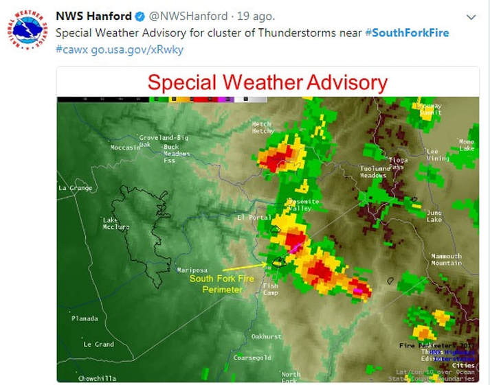
As the fire builds, so do the clouds and the wind gusts. Thunderstorms have been predicted over the Sierra today as tropical storm Lidia sends moisture and unstable air our way.
PG&E has confirmed that all the power lines from Douglas Ranger Station to Cascadel have been deenergized.
A Red Cross Evacuation Center has been opened for this fire, the Railroad Fire, and the Peak Fire (which started at the same time) at Oakhurst Community Center on Road 425B.
Deputies have gone door-to-door to evacuate, and CHP is en route to assist with traffic control.
The Fresno Sheriff’s Office has been called in to assist.
Several people have refused to evacuate ahead of this very dangerous fire.
We will update this article as conditions change.
The cause of the fire is under investigation.
Yosemite Fires Update September 3rd
There are multiple fires burning in Yosemite National Park's wilderness A high pressure system remains in place with higher temperatures and increased cloud cover which will limit smoke dispersion. Thunderstorms are possible this afternoon into the early evening. Thunderstorms produce gusty and erratic winds.
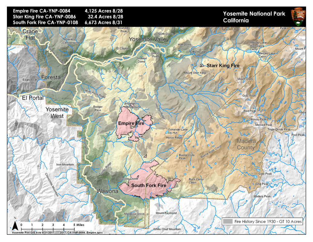
The Railroad fire is 5,800 acres and 15% contained with a total of 823 personnel working on the fire. There will be a community meeting for employees and residents at 5 P.M. this evening in Wawona at the Wawona Community Center as it pertains to the Mariposa Grove. This fire is burning on the Sierra National Forest just south of Yosemite National Park . For the most up-to-date information visit inciweb: https://inciweb.nwcg.gov/incident/5553/
There are no new maps for any of the fires.
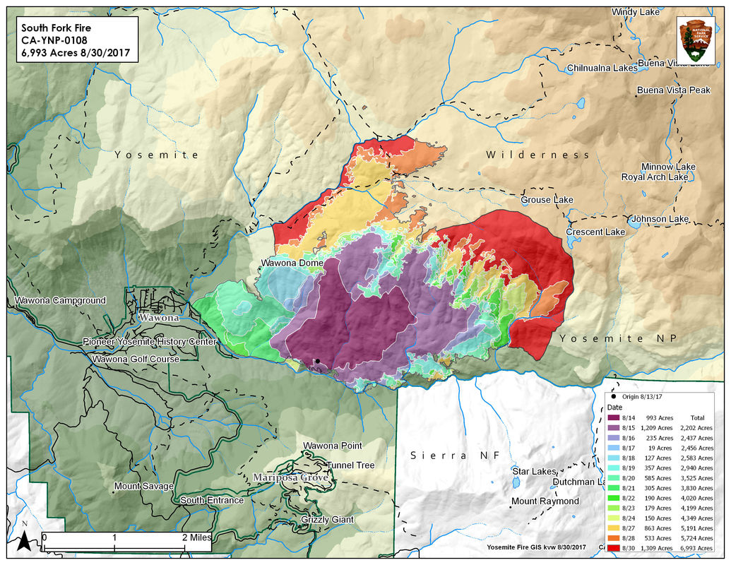
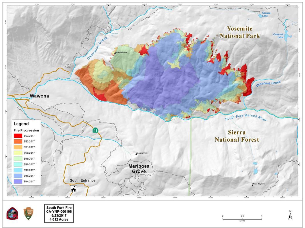
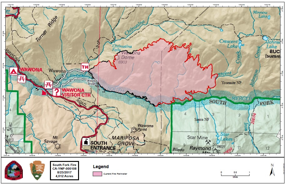
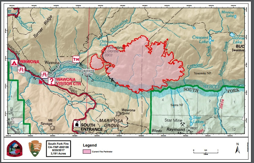
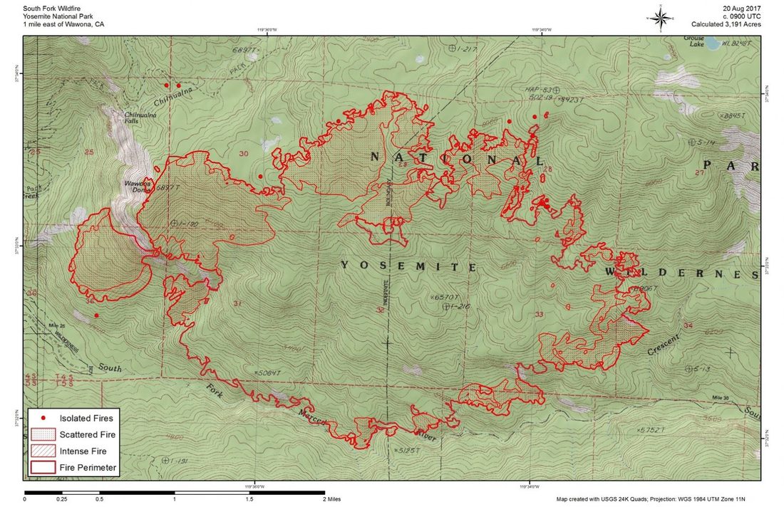
South Fork
Discovered: 8/13/17
Location: N 37°32 '15" x W 119° 35'54"
Size: 7,200 acres Cause: Unknown Containment: 47% Fuels: Mixed conifer and red fir
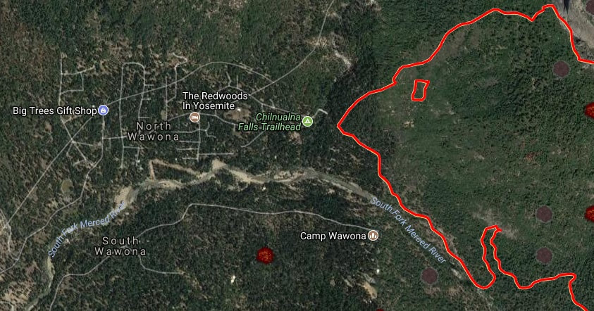
The majority of the fire was quiet yesterday. Fire is holding on the flanks near the community of Wawona and remains quiet. The most activity yesterday was on the southeastern edge where fire continued to back and flank down to the South Fork of the Merced through scattered pockets of heavy fuel, there were a couple spots picked up on the southeast edge across the river. Thunderstorms are predicted this afternoon as well as high temperatures. Thunderstorms produce gusty and erratic winds.
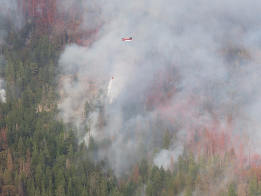
Fire crews are utilizing natural features, handline, and small scale burning to contain fire spread to the north along Chilnualna Creek. Patrols continue along portions of the fire closest to Wawona. Bucket work will be continued on the southern boundary of the fire. Crews were inserted yesterday to secure active edges of spot fires with hose lays and hand line. This area is incredibly steep and rugged. Sections of the north flank and the entire east flank are continuing to burn in the wilderness, and will be monitored by aircraft. As fire burns into the high country wilderness it will burn actively through pockets of dense vegetation but will then slow down as it progresses into sparse vegetation and natural granite barriers limiting smoke production. This high country wilderness area has minimal values at risk.
Area and trail closures are in place follow posted closure orders and maps.
Empire
Discovered: 8/1/17
Location: N 37° 38.673' x W 119° 37.096' at roughly 7300 feet elevation, 1 mile east of Yosemite Ski and Snowboard Area and 3/4 mile south of Glacier Point Road
Size: 4,750 acres Cause: Lightning Containment: 55% Fuels: Red fir
Fire activity was minimal yesterday. The primary focus for operations is assessing the possibility of opening up Glacier Point Road and holding the south flank of the fire. Weather forecast for today predicts possible thunderstorms over the wildfire location, which could bring gusty and erratic winds. A cooling trend with increased relative humidity is expected over the next 24 to 48 hours.
Fire crews are implementing a perimeter control strategy for the north, west, and southern flanks of the fire to protect Bridalveil Campground, Yosemite Ski and Snowboard Area, Yosemite West subdivision, Wawona Road (Highway 41), and Glacier Point road. The north, west and south flanks of the fire are contained and holding. Areas of new smoke may be seen as the fire cleans up areas of unburnt fuel interior. Fire management personnel are implementing this strategy on three sides of the fire to minimize further smoke production in heavy fuels. The east flank is being allowed to move towards the Illilouette basin to continue to enhance forest resiliency in a fire adapted ecosystem. Fire camp at Bridalveil Camp Ground, was relocated to Yosemite Ski and Snowboard area due to prolong smoke exposure to the fire fighters and camp ground host.
Yosemite National Park has managed fire in this wilderness area for decades. This high country wilderness area is very steep and rugged with numerous natural barriers and minimal values at risk.
Starr King
Discovered: 8/2/17
Location: N 37° 42.965' x W 119° 29.588' at approximately 7800 feet elevation
Size: 32.4 acres Cause: Lightning Spread Potential: Low/ Moderate
Fuels: Red fir/ Lodgepole Strategy: Monitor
Activity has picked up and smoke will be visible from high elevation viewpoints.
Tropical moisture is now in place, so clouds could prevent the late afternoon/evening clearing near the fire, so very unhealthy is possible near the Railroad fire. On the other hand fire activity should go down with more humidity and less sun. Split the difference and called for very unhealthy close to the fires today, but back unhealthy tomorrow for Wawona and Oakhurst.
https://www.wildlandfiresmoke.net/outlooks/2017/CentralSierraFires#Area2
https://app.airsis.com/USFS/UnitMap?custId=11&unitId=1011&isHistoric=False
Growth Of Railroad Fire Slows As Lower Temps Are Forecast
Posted by: gina clugston September 3, 2017 - 9:08 am
FISH CAMP – The Railroad Fire continues its push to the north and east, but firefighters are expected to get a bit of relief from the triple digit temperatures today.
The fire grew by less than 400 acres in the past 24 hours, and is now estimated at 5,800 acres with 15 percent containment. There are currently 823 personnel assigned to the incident.
Caltrans continues their work along the Highway 41 corridor. Crews are removing hundreds of hazard trees. Once all the work of falling and removing the hazards is done, they will sweep all the debris from the roadway. They must also replace the highway signs destroyed by the fire.
PG&E has assessed the lines in the fire zone, and their crews continue to replace or reset poles that have been damaged. They also have to remove hazard trees that threaten to fall over the lines.
While everyone is anxious to return to their homes and have Highway 41 reopened, the dangers to the public are still very real. Cooperators are working closely together and focusing on the end goal – to repopulate and reopen when everything is safe. No one is taking lightly the inconvenience and financial impact of these closures. We anticipate it will be at least another 48 hours until any news of reopening the area, but there is no estimate given from fire officials.
Though lines around the community of Fish Camp have been holding strong for the past 48 hours, the fire continues to push north, just east of Highway 41. With the forecasted thunderstorms a concern for outflow winds, there is always the chance that the fire could hook back around to the west, as happened just a few weeks ago with the South Fork Fire in Yosemite. The west flank of that fire looked pretty secure, until an erratic wind event pushed it west, back across the line near Wawona Dome, threatening the community of Wawona once again. Fire officials don’t want to repopulate only to have to evacuate all over again.
The fire continues to spot over Road 6S90 near the community of Sugar Pine, and dozers have been doing a lot of work in that area to secure the line there.
Moderate to long range spotting continues to challenge firefighters and planners in the northeast corner. The fire spotted over the primary indirect line last night as down-canyon winds kicked up about 3 a.m. It also spotted north across Jackson Road, but is still south of the creek.
The fire continues to spread east toward Big Sandy and downslope from Speckerman Mountain Peak.
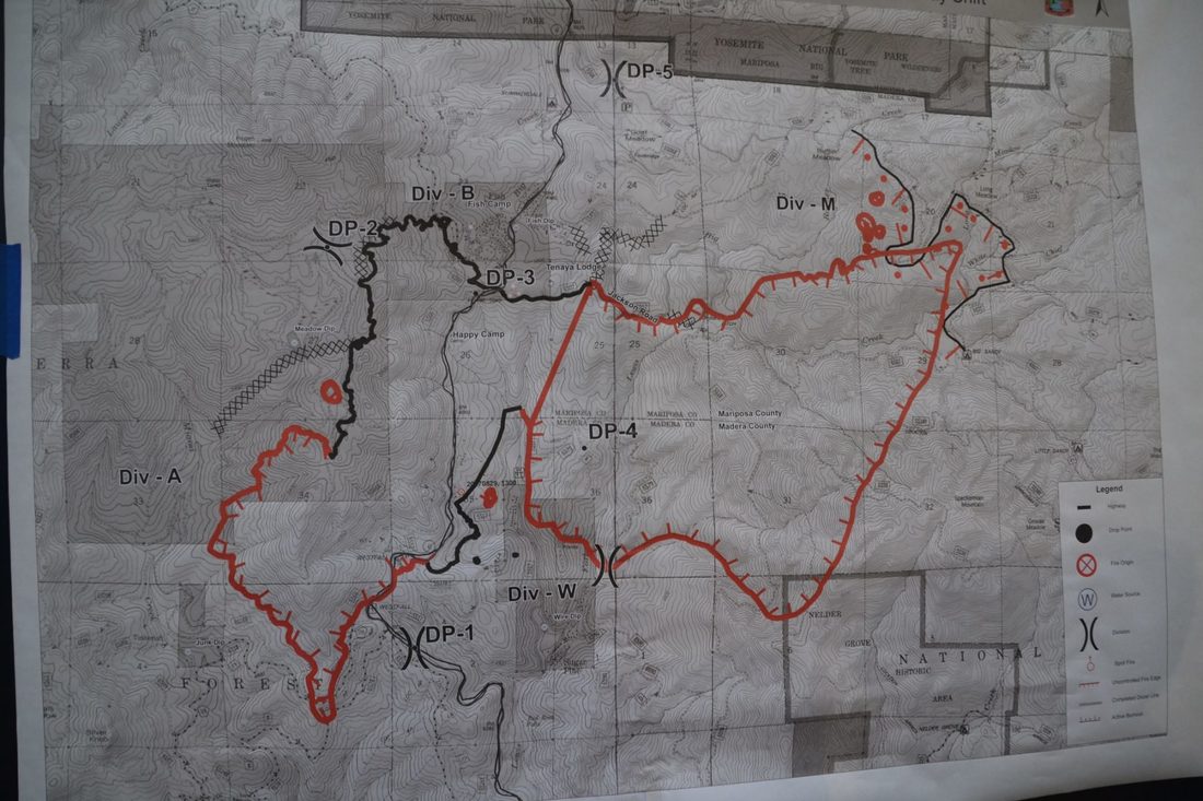
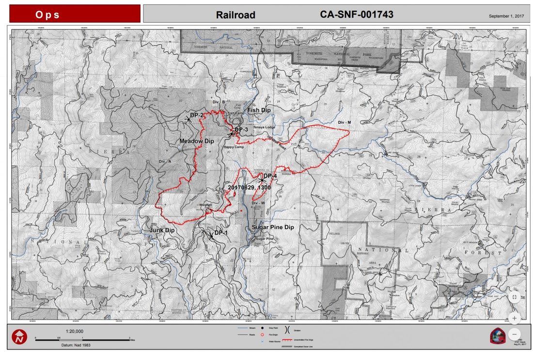
A new division was added yesterday — Division Q (see map below) — and there were numerous spot fires there as well, ranging from one-half to four acres. They were able to get dozers and an engine strike team in there and got line around each one. This part of the fire is rather a thermal belt, and temperatures haven’t been dropping below the 70s overnight.
On the southwest perimeter near Miami Mountain, crews got a lot of good work done over the past 24 hours, and are strengthening the line, manning the hose lays that were completed yesterday, and doing mop-up work. The goal for today is to get that section buttoned up so that resources can be reassigned to other priorities on the fireline.
The fire continues to work its way south into Nelder Grove. It is burning and creeping along the ground, staying out of the crowns up to now. It has burned past the Hawksworth and Granddad trees according to this map of the fireline (click to enlarge), and is approaching The Leaner, where Nelder Creek crosses The Graveyard of the Giants Trail. We will do our best to get details of the burn inside the Grove, but none are available at this point.
Moisture is moving up from former tropical storm Lidia, spinning near Baja California, bringing a chance of afternoon thunderstorms over the fire. The general storm motion will be from southeast to the northwest. The biggest concern is for lightning and gusty, erratic winds. The system could produce some wetting rains. Temperatures will be slightly lower and humidity slightly higher as the high pressure ridge begins to weaken. The forecast is for temps into the lower 90s on the firelines, and close to 100 in Base Camp.
Though the community of Wawona is not under direct threat at this time, Yosemite National Park officials will host an informational briefing on Sunday, Sept. 3, at 5 p.m. at the Wawona Community Center, for employees and members of the community.
There have been no reports of more structures lost. Seven were destroyed in the first day of the fire.
Closures and evacuations on the Railroad Fire:
**UPDATE 10 A.M. — A mandatory evacuation order is being issued for the Cedar Valley Subdivision as of 10 a.m. today., due to an unexpected spot fire over the line from the #RailroadFire. This includes the following roads: Cedar Valley Drive, Deer Run Trail, Lazy Oak Drive, Cedar Brook Road, Cedar Springs Road, Mountain Meadow Road, Chu Ranch Road, Tolladay Road, Jackson Road, Cedar Ridge Circle North and South, ManzanitA Drive, Three Springs Road, Lakeside Drive, and Cedar Place. The Sheriff’s Office strongly encourages you to take important documents, plus pets and medications. You will not be allowed to return until the danger has passed. A shelter will be established at the Oakhurst Community Center, 39880 Road 425B.**
Highway 41 remains closed in both directions from Cedar Valley on the south (about three miles north of Oakhurst), to Wawona inside Yosemite National Park. Yosemite visitors should use Highway 49 to Highway 140 or 120 for entrance to the National Park.
Road closures include all Highway 41 offshoots between Cedar Valley Road and Summerdale Campground north of Fish Camp, in both Madera County and Mariposa County, and Road 630 (Sugar Pine Road) and all cross streets, including Sugar Pine Christian Camps.
Jackson Road (6S07) is closed from Fish Camp to Beasore Road.
A mandatory evacuation is in place for the the community of Fish Camp, the Tenaya Lodge, the Narrow Gauge Inn, the Yosemite Mountain Sugar Pine Railroad, the community of Sugar Pine including the Christian Camp, Big Sandy Campground and Summerdale Campground.
Sky Ranch (Road 632) is under an evacuation advisory from Highway 41 to Buckskin Lane. The road is closed beyond that point, and evacuations ordered for Nelder Grove, Camp Redwood, Paradise Springs, Calvin Crest, and Soquel and Texas Flat campgrounds.
There have been some changes to this list of Forest road closures:
The Red Cross Evacuation Center at the Oakhurst Community Center has been closed down due to lack of need, as has the one in Yosemite Valley. However, they are on standby and prepared to get back up and running again within two hours.
“Just because we’re closed doesn’t mean we’ve left,” says Red Cross Disaster Program Manager Katrina Poitras. “You can still call, and we will provide assistance, or connect you with other resources who can help you.”
The hot line number for the Red Cross is 559-343-2549.
The Central California Animal Disaster Team has activated a small animal shelter at the Oakhurst Community Center Pavillion Building. Small animals can also be sheltered at the Mariposa SPCA, 5599 Highway 49 in Mariposa. The phone number is 209-966-5275. Large animals can be sheltered at the Coarsegold Rodeo Grounds, at 44777 Rodeo Grounds Lane in Coarsegold. The phone number is 559-676-7864.
All roads past Wawona inside Yosemite are open, except Glacier Point Road, which was closed last Sunday due to increased fire activity on the Empire Fire.
For fire updates, residents and visitors can message RAILROADFIRE (one word) to 888777.
A fire information line has been established for the Railroad Fire at 559-373-0040.
The Railroad Fire was reported at 12:20 p.m. on Tuesday, Aug. 29, just south of the Yosemite Mountain Sugar Pine Railroad on the west side of Highway 41. It is burning on the Bass Lake Ranger District of the Sierra National Forest.
The estimated date for containment is Friday, Sept. 8.
The cause of the fire is under investigation.
FISH CAMP – The Railroad Fire continues its push to the north and east, but firefighters are expected to get a bit of relief from the triple digit temperatures today.
The fire grew by less than 400 acres in the past 24 hours, and is now estimated at 5,800 acres with 15 percent containment. There are currently 823 personnel assigned to the incident.
Caltrans continues their work along the Highway 41 corridor. Crews are removing hundreds of hazard trees. Once all the work of falling and removing the hazards is done, they will sweep all the debris from the roadway. They must also replace the highway signs destroyed by the fire.
PG&E has assessed the lines in the fire zone, and their crews continue to replace or reset poles that have been damaged. They also have to remove hazard trees that threaten to fall over the lines.
While everyone is anxious to return to their homes and have Highway 41 reopened, the dangers to the public are still very real. Cooperators are working closely together and focusing on the end goal – to repopulate and reopen when everything is safe. No one is taking lightly the inconvenience and financial impact of these closures. We anticipate it will be at least another 48 hours until any news of reopening the area, but there is no estimate given from fire officials.
Though lines around the community of Fish Camp have been holding strong for the past 48 hours, the fire continues to push north, just east of Highway 41. With the forecasted thunderstorms a concern for outflow winds, there is always the chance that the fire could hook back around to the west, as happened just a few weeks ago with the South Fork Fire in Yosemite. The west flank of that fire looked pretty secure, until an erratic wind event pushed it west, back across the line near Wawona Dome, threatening the community of Wawona once again. Fire officials don’t want to repopulate only to have to evacuate all over again.
The fire continues to spot over Road 6S90 near the community of Sugar Pine, and dozers have been doing a lot of work in that area to secure the line there.
Moderate to long range spotting continues to challenge firefighters and planners in the northeast corner. The fire spotted over the primary indirect line last night as down-canyon winds kicked up about 3 a.m. It also spotted north across Jackson Road, but is still south of the creek.
The fire continues to spread east toward Big Sandy and downslope from Speckerman Mountain Peak.
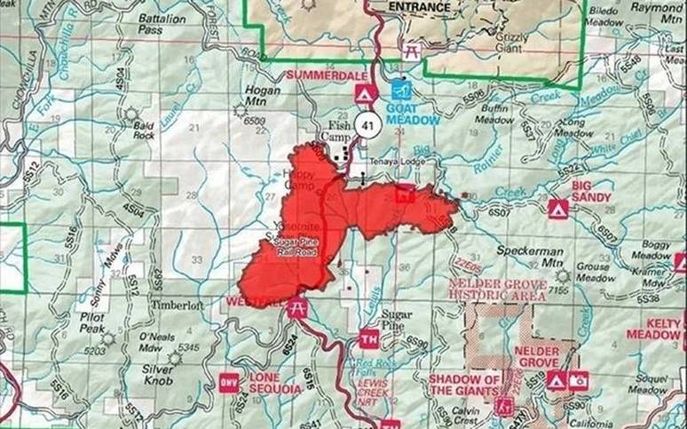
A new division was added yesterday — Division Q (see map below) — and there were numerous spot fires there as well, ranging from one-half to four acres. They were able to get dozers and an engine strike team in there and got line around each one. This part of the fire is rather a thermal belt, and temperatures haven’t been dropping below the 70s overnight.
On the southwest perimeter near Miami Mountain, crews got a lot of good work done over the past 24 hours, and are strengthening the line, manning the hose lays that were completed yesterday, and doing mop-up work. The goal for today is to get that section buttoned up so that resources can be reassigned to other priorities on the fireline.
The fire continues to work its way south into Nelder Grove. It is burning and creeping along the ground, staying out of the crowns up to now. It has burned past the Hawksworth and Granddad trees according to this map of the fireline (click to enlarge), and is approaching The Leaner, where Nelder Creek crosses The Graveyard of the Giants Trail. We will do our best to get details of the burn inside the Grove, but none are available at this point.
Moisture is moving up from former tropical storm Lidia, spinning near Baja California, bringing a chance of afternoon thunderstorms over the fire. The general storm motion will be from southeast to the northwest. The biggest concern is for lightning and gusty, erratic winds. The system could produce some wetting rains. Temperatures will be slightly lower and humidity slightly higher as the high pressure ridge begins to weaken. The forecast is for temps into the lower 90s on the firelines, and close to 100 in Base Camp.
Though the community of Wawona is not under direct threat at this time, Yosemite National Park officials will host an informational briefing on Sunday, Sept. 3, at 5 p.m. at the Wawona Community Center, for employees and members of the community.
There have been no reports of more structures lost. Seven were destroyed in the first day of the fire.
Closures and evacuations on the Railroad Fire:
**UPDATE 10 A.M. — A mandatory evacuation order is being issued for the Cedar Valley Subdivision as of 10 a.m. today., due to an unexpected spot fire over the line from the #RailroadFire. This includes the following roads: Cedar Valley Drive, Deer Run Trail, Lazy Oak Drive, Cedar Brook Road, Cedar Springs Road, Mountain Meadow Road, Chu Ranch Road, Tolladay Road, Jackson Road, Cedar Ridge Circle North and South, ManzanitA Drive, Three Springs Road, Lakeside Drive, and Cedar Place. The Sheriff’s Office strongly encourages you to take important documents, plus pets and medications. You will not be allowed to return until the danger has passed. A shelter will be established at the Oakhurst Community Center, 39880 Road 425B.**
Highway 41 remains closed in both directions from Cedar Valley on the south (about three miles north of Oakhurst), to Wawona inside Yosemite National Park. Yosemite visitors should use Highway 49 to Highway 140 or 120 for entrance to the National Park.
Road closures include all Highway 41 offshoots between Cedar Valley Road and Summerdale Campground north of Fish Camp, in both Madera County and Mariposa County, and Road 630 (Sugar Pine Road) and all cross streets, including Sugar Pine Christian Camps.
Jackson Road (6S07) is closed from Fish Camp to Beasore Road.
A mandatory evacuation is in place for the the community of Fish Camp, the Tenaya Lodge, the Narrow Gauge Inn, the Yosemite Mountain Sugar Pine Railroad, the community of Sugar Pine including the Christian Camp, Big Sandy Campground and Summerdale Campground.
Sky Ranch (Road 632) is under an evacuation advisory from Highway 41 to Buckskin Lane. The road is closed beyond that point, and evacuations ordered for Nelder Grove, Camp Redwood, Paradise Springs, Calvin Crest, and Soquel and Texas Flat campgrounds.
There have been some changes to this list of Forest road closures:
- Road 632 at Buckskin Lane
- Forest Road 5S10 at 5S39
- Forest Road 6S13 at Road 274
- Forest Road 6S08 at 6S36
- Forest Road 6S10 at 6S39
- Forest Road 6S99 at Beasore Road
- Forest Road 6S40 at Beasore Road
- Forest Road 6S40X at Beasore Road
- Forest Road 5S40Y at Beasore Road
- Worman Road one mile in from Highway 49 (at Road 601).
The Red Cross Evacuation Center at the Oakhurst Community Center has been closed down due to lack of need, as has the one in Yosemite Valley. However, they are on standby and prepared to get back up and running again within two hours.
“Just because we’re closed doesn’t mean we’ve left,” says Red Cross Disaster Program Manager Katrina Poitras. “You can still call, and we will provide assistance, or connect you with other resources who can help you.”
The hot line number for the Red Cross is 559-343-2549.
The Central California Animal Disaster Team has activated a small animal shelter at the Oakhurst Community Center Pavillion Building. Small animals can also be sheltered at the Mariposa SPCA, 5599 Highway 49 in Mariposa. The phone number is 209-966-5275. Large animals can be sheltered at the Coarsegold Rodeo Grounds, at 44777 Rodeo Grounds Lane in Coarsegold. The phone number is 559-676-7864.
All roads past Wawona inside Yosemite are open, except Glacier Point Road, which was closed last Sunday due to increased fire activity on the Empire Fire.
For fire updates, residents and visitors can message RAILROADFIRE (one word) to 888777.
A fire information line has been established for the Railroad Fire at 559-373-0040.
The Railroad Fire was reported at 12:20 p.m. on Tuesday, Aug. 29, just south of the Yosemite Mountain Sugar Pine Railroad on the west side of Highway 41. It is burning on the Bass Lake Ranger District of the Sierra National Forest.
The estimated date for containment is Friday, Sept. 8.
The cause of the fire is under investigation.
Railroad Fire Continues To Push East, Moves Farther Into Nelder Grove
Posted by: gina clugston September 2, 2017 - 7:51 pm
FISH CAMP — Crews made good progress on the southwest perimeter of the Railroad Fire today, while still dealing with multiple spot fires on the northeast.
The estimate on acreage remains the same as this morning — 5,414 acres. As of this evening, it is 15 percent contained.
Resources continue to arrive at Base Camp, and head out to the lines. There are now 823 personnel assigned to the incident including 58 engines, 12 crews, 8 dozers, 12 water tenders and 4 helicopters. Air tankers have been ordered and will support the fire as they become available.
The Incident Management Team continues to work closely with PG&E and Caltrans to get power systems back up and running and remove any hazard trees from along roadways. There is no estimate as to when residents will be allowed to return home, or Highway 41 will be opened.
Crews were successful in getting a combination of hand and dozer line constructed all the way up the left flank, from the Miami Mountain area up to the line southwest of Fish Camp that was call contained as of this morning. They also got hose lays in along that entire line.
After just a short time on the job today, all the air tankers on this incident were diverted to other fires, says Operations.
There was a breakout north of Jackson Road today near Rainier Creek but officials believe that portion of the fire will be stopped with a bit of help from the creek, which is fairly wide and still contains a good amount of water.
Crews conducted burning operations on the northeast perimeter today to remove unburned fuels inside the line. That section of the fire continues to challenge firefighters as spot fires are a daily occurrence. Crews and dozers on the night shift assigned to that division will focus on strengthening that line and wrapping up those hot spots.
The lines between the Yosemite Mt. Sugar Pine Railroad and the community of Sugar Pine appear to be holding at this point, though the southward spread toward Sugar Pine continues. Dozer line was cut last night to check the progression in that area.
There are no problems reported around Fish Camp or the Tenaya Lodge.
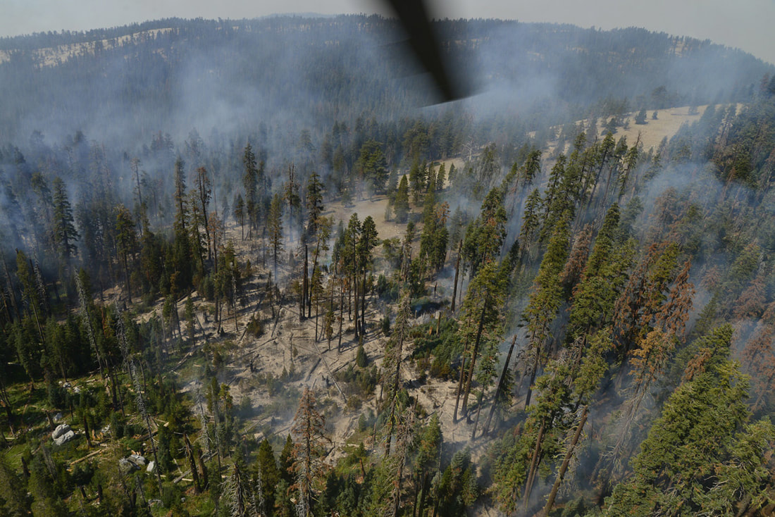
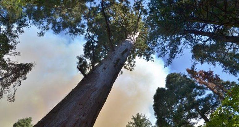
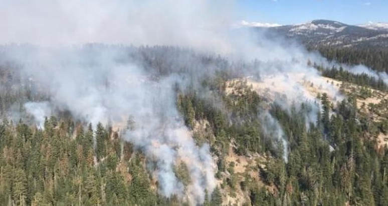
The fire continues its push into the Nelder Grove of giant sequoias. It is reportedly moving south along the ground and has not moved into the crowns of the trees. There are very heavy fuels in the Grove, which hasn’t seen a fire of any significance in over 100 years. The fire behavior and the heat with which it burns will be the major factor in whether the ancient trees will survive.
The fire continues to be dominated by unseasonably hot and dry weather. Temperatures will continue to be above normal with low relative humidity levels until early next week when the remnants of a tropical storm in Baja California will promote cooling, however, it will also increase the risk for thunderstorms.
Even with these extreme conditions and the constant threat from dead trees falling, there have been no injures to firefighters reported thus far.
As the fire pushes east, there is more to consider than just keeping would-be campers out of the danger zone through the holiday weekend.
Ranchers with cattle in the high country near Kelty Meadow, east of Speckerman Mountain, will be bringing them out a little early this year. Stock trucks and trailers headed up Sky Ranch Road today to load up their livestock ahead of the fire.
The Madera County Sheriff’s Office has deputies assigned to the fire Management Team, as well as the patrol of the Sugar Pine and Highway 41 areas, and roads in the high country. Citizens on Patrol volunteers are securing road closures, and Search & Rescue Volunteers are on standby with OHV equipment if needed to evacuate injured firefighters.
Though the community of Wawona is not under direct threat at this time, members of the South Central Sierra Interagency Incident Management Team and Yosemite National Park officials will host an informational briefing on Sunday, Sept. 3, at 5 p.m. at the Wawona Community Center, for employees and members of the community.
Closures and evacuations on the Railroad Fire:
Highway 41 remains closed in both directions from Cedar Valley on the south (about three miles north of Oakhurst), to Wawona inside Yosemite National Park. Yosemite visitors should use Highway 49 to Highway 140 or 120 for entrance to the National Park.
Road closures include all Highway 41 offshoots between Cedar Valley Road and Summerdale Campground north of Fish Camp, in both Madera County and Mariposa County, and Road 630 (Sugar Pine Road) and all cross streets, including Sugar Pine Christian Camps.
Jackson Road (6S07) is closed from Fish Camp to Beasore Road.
A mandatory evacuation is in place for the the community of Fish Camp, the Tenaya Lodge, the Narrow Gauge Inn, the Yosemite Mountain Sugar Pine Railroad, the community of Sugar Pine including the Christian Camp, Big Sandy Campground and Summerdale Campground.
Sky Ranch (Road 632) is under an evacuation advisory from Highway 41 to Buckskin Lane. The road is closed beyond that point, and evacuations ordered for Nelder Grove, Camp Redwood, Paradise Springs, Calvin Crest, and Soquel and Texas Flat campgrounds.
There have been some changes to this list of Forest road closures:
- Road 632 at Buckskin Lane
- Forest Road 5S10 at 5S39
- Forest Road 6S13 at Road 274
- Forest Road 6S08 at 6S36
- Forest Road 6S10 at 6S39
- Forest Road 6S99 at Beasore Road
- Forest Road 6S40 at Beasore Road
- Forest Road 6S40X at Beasore Road
- Forest Road 5S40Y at Beasore Road
- Worman Road one mile in from Highway 49 (at Road 601).
The Red Cross Evacuation Center at the Oakhurst Community Center has been closed down due to lack of need, as has the one in Yosemite Valley. However, they are on standby and prepared to get back up and running again within two hours.
“Just because we’re closed doesn’t mean we’ve left,” says Red Cross Disaster Program Manager Katrina Poitras. “You can still call, and we will provide assistance, or connect you with other resources who can help you.”
The hot line number for the Red Cross is 559-343-2549.
The Central California Animal Disaster Team has activated a small animal shelter at the Oakhurst Community Center Pavillion Building. Small animals can also be sheltered at the Mariposa SPCA, 5599 Highway 49 in Mariposa. The phone number is 209-966-5275. Large animals can be sheltered at the Coarsegold Rodeo Grounds, at 44777 Rodeo Grounds Lane in Coarsegold. The phone number is 559-676-7864.
All roads past Wawona inside Yosemite are open, except Glacier Point Road, which was closed on Sunday due to increased fire activity on the Empire Fire.
For fire updates, residents and visitors can message RAILROADFIRE (one word) to 888777.
A fire information line has been established for the Railroad Fire at 559-373-0040.
The Railroad Fire was reported at 12:20 p.m. on Tuesday, Aug. 29, just south of the Yosemite Mountain Sugar Pine Railroad on the west side of Highway 41. It is burning on the Bass Lake Ranger District of the Sierra National Forest.
The estimated date for containment is Friday, Sept. 8.
The cause of the fire is under investigation.
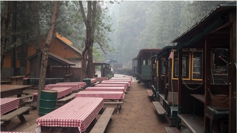
Wildfire singed its core, but Sugar Pine railroad determined to ‘keep going’
BY CARMEN GEORGE
[email protected]
FISH CAMP
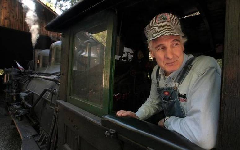
Walking through a train yard surrounded by burned trees and ash, Greg Haywood pats the side of a steam locomotive with pride and relief.
“This is Max’s gal, ol’ No. 10,” says the locomotive engineer.
Haywood is talking about Max Stauffer, whose parents immigrated from Switzerland more than 50 years ago to start Yosemite Mountain Sugar Pine Railroad, now within the boundary of a large wildfire threatening communities just south of Yosemite National Park. Stauffer ran the family business for decades. He died of cancer in March.
It means a lot to Haywood to see Stauffer’s favorite locomotive unscathed on Saturday. “This is the flagship right here. This is what built this place.”
Haywood and around a dozen other railroad employees were on the front lines Tuesday afternoon as the wildfire ignited, called the Railroad Fire because of its proximity to the business. Employees there spotted a plume of smoke across Highway 41 shortly before the 12:30 p.m. train ride, says manager Shane Blackwell, who rushed up the hill to try and find the source of the blaze.
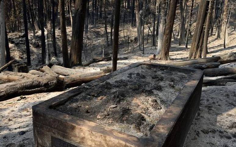
A home on that mountainside, along with at least five other homes closer to the railroad, have been destroyed by the fire. An orange sun visible through smoky skies Saturday illuminated the little that remains around those destroyed homes, including a scorched apple orchard and the concrete crypt of a pioneer woman who died in 1945.
Blackwell says within about 15 minutes of spotting smoke, the fire reached the highway and embers flew across the road, igniting at least half a dozen small fires on railroad property.
“It created its own wind,” Blackwell says. “It was just pulling oxygen.”
Around a dozen employees working Tuesday were able to extinguish the spot fires using a water truck, fire hoses and fire equipment owned by the railroad. Blackwell says he also filled a Caltrans water truck twice for a state employee who was working alongside railroad employees to extinguish the blaze before firefighters arrived. They were later told to evacuate.
“That day we kind of said goodbyes to our place and to each other – we didn’t know that it would be here,” Blackwell says. “There’s just so much fuel in the area.”
The following evening, on Wednesday, the wildfire burned an old locomotive that wasn’t being used, along with a passenger car, snowplow, side dump car and refrigerator car that were attached to it, and more than 200 wooden railroad ties.
“Some pieces of history can’t be replaced,” Blackwell says of equipment once used to transport lumber around the turn of the century.
The 1928 steam locomotive used to give most train rides, No. 10, was unharmed, along seven other passenger cars, two other locomotives, and the railroad’s buildings. It’s a relief to Blackwell, but he knows danger is still at their doorstep.
“There’s still a ton of fuel below here,” he says, “and being on the uphill side of the fire is a lot worse. All it would take is sparks or embers to fly.”
The Railroad Fire was just 10 percent contained Saturday afternoon and had engulfed more than 5,400 acres. It was mostly growing east, toward Big Sandy and Sugar Pine. Flames crossed the northwest boundary of Nelder Grove on Friday, but fire officials said the blaze isn’t expected to reach the dozens of ancient giant sequoias growing there.
The railroad, which normally operates into October and currently employs around 25 people, should be able to reopen quickly once firefighters say it’s safe for visitors to return.
It’s been a hard year for the railroad, including the death of not only Stauffer, but also his mother. Then there were the heavy winter rains that washed out sections of the train tracks.
“Floods in the winter,” Blackwell says, “fire in the summer.”
But Blackwell is trying to stay positive.
“In a couple years this forest is going to be, because of this fire, more lush than it’s ever been,” he says. “It’s a nature reset.”
The employees are eager to keep the railroad going. They love seeing the joy that their historic train rides bring families.
“Max and his family, they had a way of instilling in you the love of what they did,” Haywood says, “and they passed it on. … It’s a generational thing that’s being passed down, and I want this here for generations to come. We all do.”
Carmen George: 559-441-6386, @CarmenGeorge
Railroad Fire Meeting in Wawona, Sept. 3, 5 PM
There will be a Railroad Fire informational briefing provided by members of Yosemite NP and the South Central Sierra Incident Mgt. Team (SCSIMT) tomorrow, Sunday at 5pm at the Wawona Community Center for employees, residents and members of the community. It will be an opportunity to get an update on the this fire, and to ask questions.
I want to emphasize that there is still no current threat to the Wawona community at this time.
Thanks,
Eric Scott
Wawona District Ranger
Yosemite National Park
Office: (209) 375-9520
I want to emphasize that there is still no current threat to the Wawona community at this time.
Thanks,
Eric Scott
Wawona District Ranger
Yosemite National Park
Office: (209) 375-9520
Empire Fire Update #27 September 2nd, 2017
Location: 1 mile east of Yosemite Ski and Snowboard Area and 3/4 mile south of Glacier Point Road
Discovery Date: July 31st, 2017 Size: 4,550 acres Containment: 55%
Incident Personnel: 45 Cause: Lightning Helicopters: 1
Fire activity was moderated yesterday due to shading from the Railroad fire smoke. The east flank showed increased activity yesterday with some spotting on the northeast near Ostrander Ski Trail. Weather forecast for today predicts hotter and dryer conditions through the end of the week and into early next week.
Fire crews are implementing a perimeter control strategy for the north, west, and southern flanks of the fire to protect Bridalveil Campground, Yosemite Ski and Snowboard Area, Yosemite West subdivision, Wawona Road (Highway 41), and Glacier Point road. The north and west flanks of the fire are contained and holding. Crews tied the south flank into natural barriers and will continue to hold and monitor. Fire management personnel are implementing this strategy on three sides of the fire to minimize further smoke production in heavy fuels. Spot fires on the northeast flank near Ostrander Ski Trail are being monitored. The east flank is being allowed to move towards the Illilouette basin to continue to enhance forest resiliency in a fire adapted ecosystem. Fire camp at Bridalveil Camp Ground, was relocated to Yosemite Ski and Snowboard area due to prolong smoke exposure to the fire fighters and camp ground host.
Yosemite National Park has managed fire in this wilderness area for decades. This high country wilderness area is very steep and rugged with numerous natural barriers and minimal values at risk.
Glacier Point road is closed due to active fire near the road; conditions are being assessed as to when the road can be opened again. Additional crews and engines are on order to support these operations.
The following trail and area closures are in place until further notice:
- Glacier Point Road
- Bridalveil Campground
- Ostrander Trail
- Bridalveil Trail
- Alder Creek Trail
- Mono Meadow Trail
- Turner Meadow Trail
South Fork Fire Update #20 September 2nd, 2017
Start date: 8/13/17 2:30 p.m. Size: 6,985 acres Containment: 47%
Incident Personnel: 49 Cause: Unknown Helicopters: 1
Fuels: Mixed conifer and red fir
Yesterday the northern and eastern flanks were active again as the fire burned into scattered pockets of heavy fuel, interior of containment lines. This fire behavior will continue as long as the warm dry weather pattern persists.
Fire crews will be utilizing natural features, handlines and small scale burning to contain fire spread to the north along Chilnualna Creek, as well as continue to patrol for hotspots in the portions of the fire closest to Wawona. Bucket work will be continued as needed on the southern boundary of the fire. Sections of the north flank and the entire east flank are continuing to burn in the wilderness, and will be monitored by aircraft due to inaccessible and steep terrain. As fire burns into the high country wilderness it will burn actively through pockets of dense vegetation but will then slow down as it progresses into sparse vegetation and natural granite barriers limiting smoke production. This high country wilderness area has minimal values at risk.
The following trail and area closures are in place until further notice:
- The Swinging Bridge Trail on both the north and south sides of the South Fork of the Merced River.
- The Chilnualna Falls Trail from Wawona Trailhead to the top of Chilnualna Falls.
- The two mile connecting trail heading north from the top of Chilnualna Falls to the intersection of the Buena Vista Trail.
- The Chilnualna Creek Trail from the top of Chilnualna Falls east to the intersection of the Buena Vista and Buck Camp trails (Just east of Johnson Lake).
- Turner Meadow Trail
- Turner Meadow intersection east to Buena Vista trail
- Off-trail areas in the vicinity of the South Fork Fire Area, including the swimming holes north of Chilnualna Creek.
- All climbing routes on and around Wawona Dome are closed.
Air quality will remain moderate to poor at times, especially closer to the fire and usually during the nighttime and morning hours, while a strong high pressure system sits over the area. Fire Managers are working with the local Air Quality Districts and will be monitoring smoke impacts to the park and local communities. Community members who are sensitive to smoke may want to close their windows and doors at night and monitor the air quality forecast linked below for changes to the forecasted patterns and best times to plan outdoor activities.
Attached is the Central Sierra Smoke/AQ Outlook for Friday, September 2nd.
https://www.wildlandfiresmoke.net/outlooks/2017/CentralSierraFires#Area1
https://www.wildlandfiresmoke.net/outlooks/2017/CentralSierraFires#Area2
--
Yosemite Fire and Aviation Information
[email protected]
209-379-1493
Crews Secure Lines Around Fish Camp On Railroad Fire
Posted by: gina clugston September 2, 2017 - 7:48 am
FISH CAMP – For the first time since the Railroad Fire started on Tuesday, there is significant black line on the fire map — meaning those parts of the perimeter are secure and can be noted as “contained.”
The fire is now estimated at 5,414 acres with 10 percent containment.
Crews continued to work the slop-over from Thursday night on the southwest corner of the fire near Miami Mountain Road.
Along the southern perimeter between Sugar Pine and Cedar Valley, two dozers worked through the night across about 10 miles of road system, all the way over to Sky Ranch Road.
The fireline from Westfall Ranger Station, up past the Yosemite Mountain Sugar Pine Railroad above Sugar Pine is now contained.
Most of the activity continues to be on the northeast corner of the fire between Buffin Meadow and Long Meadow. There were some significant spot fires there last night, and the day shift will continue to work those spots.
Two Hot Shot Crews and a Cal Fire Strike Team set up a spike camp in that area last night, and began burnout operations this morning to remove fuels from inside containment lines.
The fire began pushing into Nelder Grove late yesterday. We will update on that situation later today.
The line is secure and contained from the Tenaya Lodge west, around Fish Camp and about halfway down the west flank. Structure protection was in place in Fish Camp overnight, and no issues were reported.
Air Operations has requested two VLATs, four Type 1s and five Type 3 air tankers today. There are five Type 2 helicopters working the fire.
Temperatures are expected to be even hotter today than yesterday, climbing into the mid to upper 90s on the fireline, and well into triple digits at the Incident Command Post.
Relative humidity will drop into the teens again today, with readings reported in the single digits yesterday. Conditions continue to be dangerously hot and dry.
Winds will pick up in the afternoon, gusting up to 20 mph later on exposed ridgetops. Easterly winds are forecast to push the smoke to the west.
Additional resources continue to arrive on the fire, and there are now 590 personnel assigned to the incident.
The biggest question for many is “when can I go home?” And when will Highway 41 reopen.
There are still very real dangers to both firefighters and the public inside the fire’s perimeter. Caltrans and contractors continue to remove hazard trees, PG&E crews are replacing and resetting power poles, and Sierra Tel is repairing their infrastructure.
It will be 24-48 hours until fire officials can consider a plan for repopulation and reopening Highway 41. People are asked to be patient and understand the very hazardous situation that still exists.
Closures and evacuations on the Railroad Fire:
There is a mandatory evacuation order for Big Sandy Campground and Summerdale Campground.
Sky Ranch is under an evacuation advisory from Highway 41 to Buckskin Lane. The road is closed beyond that point, including Soquel and Texas Flat campgrounds, Nelder Grove and Calvin Crest.
The road closure on Highway 41 northbound is at Cedar Valley about three miles north of Oakhurst, and southbound inside Yosemite National Park at Wawona. Yosemite visitors should use Highway 49 to Highway 140 or 120 for entrance to the National Park.
Road closures include all Highway 41 offshoots between Cedar Valley Road and Summerdale Campground in both Madera County and Mariposa County, and Road 630 (Sugar Pine Road) and all cross streets, including Sugar Pine Christian Camps.
Jackson Road (6S07) is closed from Fish Camp to Beasore Road.
A mandatory evacuation is in place for the the community of Fish Camp, the Tenaya Lodge, the Narrow Gauge Inn, the Yosemite Mountain Sugar Pine Railroad, the community of Sugar Pine including the Christian Camp, and all homes and businesses in the immediate vicinity. Evacuations also run north from Fish Camp to the Summerdale Campground.
Also closed are these Forest roads:
The Red Cross Evacuation Center at the Oakhurst Community Center has been closed down due to lack of need, as has the one in Yosemite Valley. However, they are on standby and prepared to get back up and running again within two hours.
“Just because we’re closed doesn’t mean we’ve left,” says Red Cross Disaster Program Manager Katrina Poitras. “You can still call, and we will provide assistance, or connect you with other resources who can help you.”
The hot line number for the Red Cross is 559-343-2549.
The Central California Animal Disaster Team has activated a small animal shelter at the Oakhurst Community Center Pavillion Building. Small animals can also be sheltered at the Mariposa SPCA, 5599 Highway 49 in Mariposa. The phone number is 209-966-5275. Large animals can be sheltered at the Coarsegold Rodeo Grounds, at 44777 Rodeo Grounds Lane in Coarsegold. The phone number is 559-676-7864.
All roads past Wawona inside Yosemite are open, except Glacier Point Road, which was closed on Sunday due to increased fire activity on the Empire Fire.
For fire updates, residents and visitors can message RAILROADFIRE (one word) to 888777.
A fire information line has been established for the Railroad Fire at 559-373-0040.
The Railroad Fire was reported at 12:20 p.m. on Tuesday, Aug. 29, just south of the Yosemite Mountain Sugar Pine Railroad on the west side of Highway 41. It is burning on the Bass Lake Ranger District of the Sierra National Forest.
The estimated date for containment is Friday, Sept. 8.
The cause of the fire is under investigation.
FISH CAMP – For the first time since the Railroad Fire started on Tuesday, there is significant black line on the fire map — meaning those parts of the perimeter are secure and can be noted as “contained.”
The fire is now estimated at 5,414 acres with 10 percent containment.
Crews continued to work the slop-over from Thursday night on the southwest corner of the fire near Miami Mountain Road.
Along the southern perimeter between Sugar Pine and Cedar Valley, two dozers worked through the night across about 10 miles of road system, all the way over to Sky Ranch Road.
The fireline from Westfall Ranger Station, up past the Yosemite Mountain Sugar Pine Railroad above Sugar Pine is now contained.
Most of the activity continues to be on the northeast corner of the fire between Buffin Meadow and Long Meadow. There were some significant spot fires there last night, and the day shift will continue to work those spots.
Two Hot Shot Crews and a Cal Fire Strike Team set up a spike camp in that area last night, and began burnout operations this morning to remove fuels from inside containment lines.
The fire began pushing into Nelder Grove late yesterday. We will update on that situation later today.
The line is secure and contained from the Tenaya Lodge west, around Fish Camp and about halfway down the west flank. Structure protection was in place in Fish Camp overnight, and no issues were reported.
Air Operations has requested two VLATs, four Type 1s and five Type 3 air tankers today. There are five Type 2 helicopters working the fire.
Temperatures are expected to be even hotter today than yesterday, climbing into the mid to upper 90s on the fireline, and well into triple digits at the Incident Command Post.
Relative humidity will drop into the teens again today, with readings reported in the single digits yesterday. Conditions continue to be dangerously hot and dry.
Winds will pick up in the afternoon, gusting up to 20 mph later on exposed ridgetops. Easterly winds are forecast to push the smoke to the west.
Additional resources continue to arrive on the fire, and there are now 590 personnel assigned to the incident.
The biggest question for many is “when can I go home?” And when will Highway 41 reopen.
There are still very real dangers to both firefighters and the public inside the fire’s perimeter. Caltrans and contractors continue to remove hazard trees, PG&E crews are replacing and resetting power poles, and Sierra Tel is repairing their infrastructure.
It will be 24-48 hours until fire officials can consider a plan for repopulation and reopening Highway 41. People are asked to be patient and understand the very hazardous situation that still exists.
Closures and evacuations on the Railroad Fire:
There is a mandatory evacuation order for Big Sandy Campground and Summerdale Campground.
Sky Ranch is under an evacuation advisory from Highway 41 to Buckskin Lane. The road is closed beyond that point, including Soquel and Texas Flat campgrounds, Nelder Grove and Calvin Crest.
The road closure on Highway 41 northbound is at Cedar Valley about three miles north of Oakhurst, and southbound inside Yosemite National Park at Wawona. Yosemite visitors should use Highway 49 to Highway 140 or 120 for entrance to the National Park.
Road closures include all Highway 41 offshoots between Cedar Valley Road and Summerdale Campground in both Madera County and Mariposa County, and Road 630 (Sugar Pine Road) and all cross streets, including Sugar Pine Christian Camps.
Jackson Road (6S07) is closed from Fish Camp to Beasore Road.
A mandatory evacuation is in place for the the community of Fish Camp, the Tenaya Lodge, the Narrow Gauge Inn, the Yosemite Mountain Sugar Pine Railroad, the community of Sugar Pine including the Christian Camp, and all homes and businesses in the immediate vicinity. Evacuations also run north from Fish Camp to the Summerdale Campground.
Also closed are these Forest roads:
- Road 632 at Buckskin Lane
- Forest Road 6S13 at Road 274
- Forest Road 6S40 at Beasore Road
- Forest Road 6S08 at 6S36
- Forest Road 5S39 at 5S90
- Forest Road 5S40Y at Beasore Road.
The Red Cross Evacuation Center at the Oakhurst Community Center has been closed down due to lack of need, as has the one in Yosemite Valley. However, they are on standby and prepared to get back up and running again within two hours.
“Just because we’re closed doesn’t mean we’ve left,” says Red Cross Disaster Program Manager Katrina Poitras. “You can still call, and we will provide assistance, or connect you with other resources who can help you.”
The hot line number for the Red Cross is 559-343-2549.
The Central California Animal Disaster Team has activated a small animal shelter at the Oakhurst Community Center Pavillion Building. Small animals can also be sheltered at the Mariposa SPCA, 5599 Highway 49 in Mariposa. The phone number is 209-966-5275. Large animals can be sheltered at the Coarsegold Rodeo Grounds, at 44777 Rodeo Grounds Lane in Coarsegold. The phone number is 559-676-7864.
All roads past Wawona inside Yosemite are open, except Glacier Point Road, which was closed on Sunday due to increased fire activity on the Empire Fire.
For fire updates, residents and visitors can message RAILROADFIRE (one word) to 888777.
A fire information line has been established for the Railroad Fire at 559-373-0040.
The Railroad Fire was reported at 12:20 p.m. on Tuesday, Aug. 29, just south of the Yosemite Mountain Sugar Pine Railroad on the west side of Highway 41. It is burning on the Bass Lake Ranger District of the Sierra National Forest.
The estimated date for containment is Friday, Sept. 8.
The cause of the fire is under investigation.
Railroad Fire burns southeast of Fish Camp, threatens historic Nelder Grove, 10% Contained
BY MARK EVAN SMITH
[email protected]
UPDATE (8 p.m.): Alex Olow, information officer with the South Central Sierra Interagency Management Team, confirmed that the Railroad Fire breached Nelder Grove’s northwester corner by Friday evening, while growing to 4,160 acres with 10% contained. Click here for the updated story, and what crews will do during the night to stop the blaze’s rampage.
ORIGINAL STORY (Originally published at 5:22 p.m.):
With constant air attacks and tireless efforts of ground crews facing high temperatures and shifting winds, the battle against a growing blaze near Yosemite National Park continued Friday.
In the early afternoon, reports came in that due to a shift in erratic winds, the flames, which were moving northeast, shifted south and began to approach the historic Nelder Grovesoutheast of Fish Camp.
Some reports indicated the fire made it past the grove’s northern boundary by 6:30 p.m., but that information has yet to be confirmed.
Numerous air resources have been attacking the flames to support ground crews as they work to save the grove, home to about 100 mature sequoia trees in a sprawling wilderness of more than 1,500 acres.
Alex Olow, information officer with the South Central Sierra Interagency Management Team, said based on the most recent reports around 5:15 p.m., the fire was at the boundary of the grove to the north. Air attack crews were making heavy drops in that area, Olow said.
er Interpretive Ranger with the U.S. Forest Service who has published a book about the history of the grove, said she felt the sequoias on Nelder Ridge, near Road 5S18 at the grove’s northwestern boundary, would be the most susceptible to flames.
She said if the flames got into that area, and followed a trail leading east, iconic sights like the Hawksworth and Granddad trees would be threatened.
“If it reaches that area and heads east, it will get to Nelder Basin where a majority of our mature trees are, including the 22nd largest sequoia in the Sierra Nevadas, the Nelder Tree,” Negley said. “It is extremely dense there. The (Hawksworth and Granddad trees) are just inside the Nelder Grove’s boundary.”
In a positive sign, on Friday, more than a dozen firefighting trucks from the California Governor’s Office of Emergency Services were seen in Oakhurst, headed to stage at the base camp at Ahwahnee Hills Regional Park.
Other updatesAdditional road closures were put in place throughout the day, on Road 630 at Buckskin Lane, and on several forest roads: 6S13 at Road 274, 6S40 at Beasore Road, 6S40X at Beasore Road, 6S08 at 6S36, 5S39 at 5S90, and 5S40Y at Beasore Road.
The Railroad Fire has proven a continuous challenge for firefighters as winds, often erratic in nature, coupled with rising temperatures and low humidity, make conditions difficult.
Early in the morning, initial reports from officials indicated the fire shrunk in size, from 2,185 acres Thursday night to 2,130. But less than an hour later, more accurate maps were provided showing a sharp increase to 2,971.
Main attack was directed at the fire’s eastern edge as it traveled towards Big Sandy - where the campground area was evacuated Thursday - especially considering lower amounts of activity on the fire’s northern, western, and southwestern flanks over previous days.
Around 11:45 a.m., reports indicated strong winds from the southwest began to push flames uphill towards the northeast.
Around 1:30 p.m., multiple tanker drops were still seen overhead in the skies of Oakhurst as repeated DC-10 flights made their way to drop retardant on the flame, in support of ground crews building lines in the areas of Fish Camp, Sugar Pine, and the grove.
The Madera County Sheriff’s Office reported around 4:30 p.m. that ash was falling in areas like Ahwahnee on Highway 49.
The cause of the Railroad Fire is under investigation. An evacuation shelter is at Yosemite Valley Visitors Center.
Small animals can be accepted at the Mariposa SPCA building, while large animals are being taken at the Coarsegold Rodeo Grounds, similar to the Detwiler Fire in July. Tanner Tweed can be contacted there at (559) 994-2794.
Another shelter, courtesy of the Central California Disaster Team, will be available at the Oakhurst Community Center.
Smoke completely blanketed areas in Fish Camp near the fire Friday, and was particularly strong in parts of Oakhurst and Ahwahnee. Ash was seen falling in Ahwahnee and Oakhurst in the morning, and other surrounding communities.
Those with sensitivity to smoky conditions are advised to consult with their physicians, and remain inside with the windows closed. Smoke is typically strongest in the mornings, officials said, and clears from the afternoon into the evening.
Temperatures are forecast in much of the Mountain Area to approach or reach triple digits Saturday and Sunday, then to head into the triple digits Saturday and Sunday, then begin to decline to the low 90s through the week.
Highway 41 remains closed in the Cedar Valley area, with no traffic allowed through to Yosemite National Park. Drivers are being detoured onto Highway 49 in Oakhurst along to the park’s entrance on Highway 140.
The South Central Sierra Interagency Incident Management Team, which is overseeing efforts on the Railroad Fire, can be reached by phone at (559) 373-0040. More information is available by visiting https://inciweb.nwcg.gov/incident/5553/, or the Sierra National Forest’s Facebook or Twitter pages.
The Mariposa and Madera County sheriff’s offices provide updates on their Facebook pages, oftentimes with photos or information about road and area closures.
Members of the public can also text “RAILROADFIRE” (one word) to 888777 to receive regular updates in their area.
Library Sale Canceled
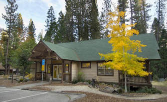
The 21st Annual Wawona Friends of the Library Book/Bake/Craft Sale ( scheduled for Saturday, September 2) has been canceled for the following reasons:
-Highway 41 closure south of the park due to the Railroad Fire
-Temperatures predicted higher than normal
-Impact of smoke in the area
-Highway 41 closure south of the park due to the Railroad Fire
-Temperatures predicted higher than normal
-Impact of smoke in the area
Lack Of Resources Continues To Hamper Efforts On Railroad Fire
Posted by: gina clugston September 1, 2017 - 8:09 am
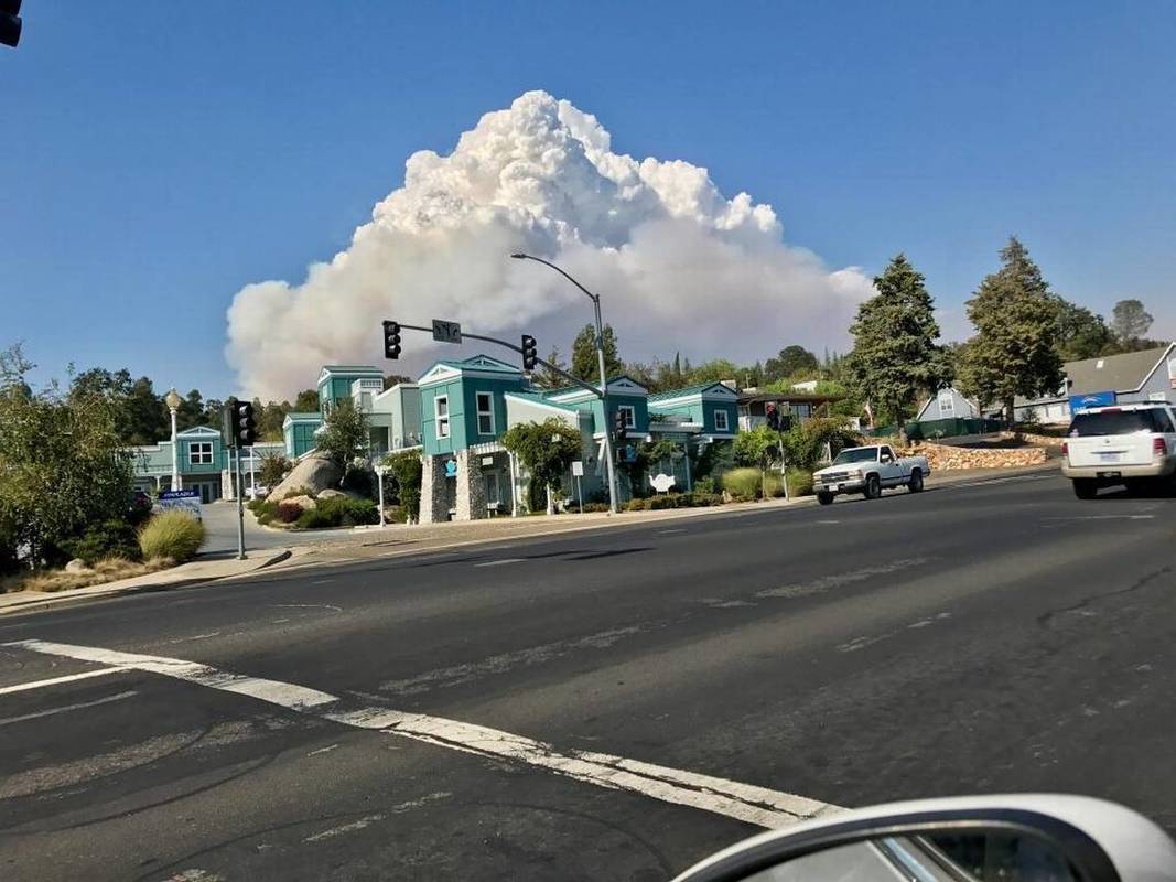
FISH CAMP — Mountain area residents awoke today to the glow of the Railroad Fire up on the mountain, cars dusted with ash, and a deep orange sunrise.
The new estimate on the Railroad Fire after last night’s flyover is now 2,971 acres with zero percent. containment.
There are currently 437 personnel assigned to the incident including 35 engines, 10 crews, 4 helicopters, 6 dozers and 12 water tenders. More resources have been requested.
Seven structures have been destroyed and over one hundred more are threatened.
There was a bit of slop-over on the southwest perimeter last night along the 4S04 road, and crews had to back off to Miami Mountain and look at new options to strengthen that line.
The area to the west of Fish Camp looked good overnight, with just a couple spot fires on the north side, which were handled. Crews continue to do structure protection in that area.
The northeast portion of the fire is where most of the activity has been concentrated over the last day. Dozer line is being constructed to tie in to the 5S43 road, and spot fires have been pushing the perimeter farther to the east.
The fire is expected to continue to spread east toward Big Sandy and southeast toward Sugar Pine and Speckerman Mountain Peak.
Crews continue to strengthen the lines to the south and east of the Yosemite Mt. Sugar Pine Railroad.
Temperatures are expected to reach nearly 105 degrees at the Incident Command Post in Ahwahnee today, with only slight relief in the higher elevations. Humidity will be dangerously low, dropping into the teens by afternoon.
Yesterday’s unstable atmosphere continued to contribute to large vertical plume development in the afternoon. Temperatures will continue to be above normal with low relative humidity levels dominating the area. Extreme heat is expected to stay in the area through the weekend.
Tree mortality is creating an increased safety risk for personnel engaged on this fire. Crews are reporting tree failures occurring at high rates after being weakened by the fire’s passage.
There is a need for mechanical equipment for felling and moving large quantities of dead trees to minimize exposure to hand fallers and crews.
The continuing theme of this fire is the difficulty in getting more resources on the lines and aircraft overhead.
“The fire is getting bigger, but the crowd isn’t,” was the way someone put it at this morning’s briefing.
Yesterday, the Super Tanker 747 made two drops over the fire. Today, a request has been made for two VLATs, four Type 1s and four Type 2 air tankers. It isn’t known if those resources will be available.
Helicopters are operating out of Batterson north of Oakhurst, and out of Mariposa.
PG&E will be going into the fire area, wherever it is safe to do so, to begin repairs and snag removal along their lines, and get poles replanted, so as to be ready to bring everyone back online when the area is re-populated. Sierra Tel will also be working to repair infrastructure as needed, and Caltrans will be removing hazard trees along Highway 41.
Though the active fire may have moved out of some residential areas, the threat is still very real. Trees weakened by fire and years of drought are an ever-present danger to firefighters and contractors as the suppression work continues, and also pose a threat to any residents returning home, and to motorists on the roadways.
Highway 41 will remain closed at least through the weekend. There is no estimated date to reopen. There is also no indication of when residents may be allowed to return home.
New road closures were announced at 10:25 a.m. today due to increased fire activity:
- Road 630 at Buckskin Lane
- Forest Road 6S13 at Road 274
- Forest Road 6S40 at Beasore Road
- Forest Road 6S40X at Beasore Road
- Forest Road 6S08 at 6S36
- Forest Road 5S39 at 5S90
- Forest Road 5S40Y at Beasore Road.
“Just because we’re closed doesn’t mean we’ve left,” says Disaster Program Manager Katrina Poitras. “You can still call, and we will provide assistance, or connect you with other resources who can help you.”
The hot line number for the Red Cross is 559-343-2549.
A fire information line has been established for the Railroad Fire at 559-373-0040.
Closures and evacuations on the Railroad Fire:
At 2:40 p.m. yesterday, a mandatory evacuation order was issued for Big Sandy Campground. The area of Sky Ranch is under an evacuation advisory at this time.
Sheriff’s deputies also advised anyone at Soquel and Texas Flat campgrounds to be aware of the danger and be ready to evacuate if necessary.
The road closure on Highway 41 northbound is at Cedar Valley about three miles north of Oakhurst. The road is closed to southbound traffic inside Yosemite National Park at Wawona.
Road closures include Highway 41 and all offshoots between Cedar Valley Road and Summerdale Campground in both Madera County and Mariposa County, and Road 630 (Sugar Pine Road) and all cross streets, including Sugar Pine Christian Camps. Jackson Road is closed to Fresno Dome.
A mandatory evacuation is in place for the the community of Fish Camp, the Tenaya Lodge, the Narrow Gauge Inn, the Yosemite Mountain Sugar Pine Railroad, the community of Sugar Pine including the Christian camp, and all homes and businesses in the immediate vicinity. Evacuations run north from Fish Camp to the Summerdale Campground.
Also closed are these Forest roads:
- Road 630 at Buckskin Lane
- Forest Road 6S13 at Road 274
- Forest Road 6S40 at Beasore Road
- Forest Road 6S40X at Beasore Road
- Forest Road 6S08 at 6S36
- Forest Road 5S39 at 5S90
- Forest Road 5S40Y at Beasore Road.
The Central California Animal Disaster Team has activated a small animal shelter at the Oakhurst Community Center Pavillion Building. Small animals can also be sheltered at the Mariposa SPCA, 5599 Highway 49 in Mariposa. The phone number is 209-966-5275. Large animals can be sheltered at the Coarsegold Rodeo Grounds, at 44777 Rodeo Grounds Lane in Coarsegold. The phone number is 559-676-7864.
All roads past Wawona inside Yosemite are open, except Glacier Point Road, which was closed on Sunday due to increased fire activity on the Empire Fire.
For fire updates, residents and visitors can message RAILROADFIRE (one word) to 888777.
The Railroad Fire was reported at 12:20 p.m. on Tuesday, Aug. 29, just south of the Yosemite Mountain Sugar Pine Railroad on the west side of Highway 41. It is burning on the Bass Lake Ranger District of the Sierra National Forest.
The cause of the fire is under investigation.
Yosemite Fires Update September 1st, 2017
There are multiple fires burning in Yosemite National Park's wilderness Smoke will be present due to a high pressure system which brings higher temperatures and lower relative humidities. Hot and dry weather will persist through the weekend and into early next week.
The Railroad fire is 2,971 acres and 0% contained being managed by the South Central Sierra Interagency Management Team. An update is attached with the map. For the Most up-to-date information : https://inciweb.nwcg.gov/incident/5553/
South Fork
Discovered: 8/13/17 Location: N 37°32 '15" x W 119° 35'54"
Size: 6,705 acres Cause: Unknown
Containment: 47% Fuels: Mixed conifer and red fir
Acreage was reduced due to more accurate mapping, the north and east flanks were most active yesterday as it burned into scattered heavy pockets of fuel. The south and west flanks of the fire are contained, some smoke and glow at night will be visible from Wawona as logs and brush burn interior. Weather will continue to be hot and dry through the weekend and into early next week. Fire will continue to back and flank on the north and east flanks and become more active as this weather pattern persists.
Crews will continue to patrol and mop-up the flanks closest to the community of Wawona and Mariposa Grove. Containment strategy is to tie containment lines into natural features on the north end of the fire as well as hold and secure handline from Chilnualna Creek south towards Wawona Dome. Bucket work will be continued as needed on the southern boundary of the fire. Sections of the north flank and the entire east flank are continuing to burn in the wilderness, and will be monitored by aircraft due to inaccessible and steep terrain. As fire burns into the high country wilderness it will burn actively through pockets of dense vegetation but will then slow down as it progresses into sparse vegetation and natural granite barriers limiting smoke production. This high country wilderness area has minimal values at risk.
Area and trail closures are in place follow posted closure orders and maps.
Empire
Discovered: 8/1/17 Location:1 mile east of Yosemite Ski and Snowboard Area and 3/4 mile south of Glacier Point Road
Size: 4,350 acres Cause: Lightning
Containment: 55% Fuels: Red fir
Fire activity was moderated yesterday due to shading from the Railroad fire smoke. The east flank showed moderate growth yesterday with some spotting on the northeast near Ostrander Ski Trail. Weather forecast for today predicts hotter and dryer conditions through the end of the week and into early next week.
Fire crews are implementing a perimeter control strategy for the north, west, and southern flanks of the fire to protect Bridalveil Campground, Yosemite Ski and Snowboard Area, Yosemite West subdivision, Wawona Road (Highway 41), and Glacier Point road. The north and west flanks of the fire are contained and holding. Crews tied the south flank into natural barriers and will continue to hold and monitor. Fire management personnel are implementing this strategy on three sides of the fire to minimize further smoke production in heavy fuels. Spot fires on the northeast flank near Ostrander Ski Trail are being assessed for direct line. The east flank is being allowed to move towards the Illilouette basin to continue to enhance forest resiliency in a fire adapted ecosystem.
Yosemite National Park has managed fire in this wilderness area for decades. This high country wilderness area is very steep and rugged with numerous natural barriers and minimal values at risk.
Glacier Point road is closed due to active fire near the road; conditions are being assessed as to when the road can be opened again. Additional crews and engines are on order to support these operations.
Starr King
Discovered: 8/2/17 Location: N 37° 42.965' x W 119° 29.588' at approximately 7800 feet elevation
Size: 32.4 acres Cause: Lightning Spread Potential: Low/ Moderate
Fuels: Red fir/ Lodgepole Strategy: Monitor
Activity has picked up and smoke will be visible from high elevation viewpoints.
Attached is the Central Sierra Smoke/AQ Outlook for Friday, September 1st.
https://www.wildlandfiresmoke.net/outlooks/2017/CentralSierraFires#Area1
https://www.wildlandfiresmoke.net/outlooks/2017/CentralSierraFires#Area2
Video Footage of Railroad Fire by Fresno Bee
Homeward Bound From Railroad Fire, Battalion Chief Dies In Traffic Accident
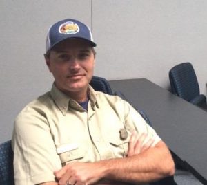
Posted by: Kellie Flanagan August 31, 2017 - 6:43 pm
SANTA MARIA – Station KEYT is reporting that a Battalion Chief returning home from the Railroad Fire has died following a traffic accident.
Oscar Flores says Los Padres National Forest officials announced that Santa Lucia District Battalion Chief Gary Helming was killed in a car crash early Thursday morning, Aug. 31, while returning home from an assignment on the Railroad Fire in the Sierra National Forest.
Helming, reportedly a married father of three children, was a past Elks’ Firefighter of the Year for the Los Padres National Forest, according to the agency.
No Estimated Date To Reopen Highway 41, Say Railroad Fire Officials
Sierra Star Online
Livestream of meeting at Oakhurst Community Center on the #RailroadFire. UPDATE (9 p.m.): Hi everyone! Mark from the Sierra Star here, and the reporter who shot this live video from tonight's...
Posted by: gina clugston August 31, 2017 - 9:06 pm
OAKHURST — To say it was standing room only would be a compete understatement, as hundreds crowded into the Oakhurst Community Center to hear from fire and law enforcement officials what they can expect in the coming days of the Railroad Fire.
The fire is now estimated at 2,185 acres with zero percent containment. However, Incident Commander Deron Mills wanted to make it clear that doesn’t mean they’re not making headway.
“We like to let sections cool off and burn down for about 24 hours before we call them contained,” said Mills.
He also pointed out that there are currently 20,000 firefighters assigned to incidents across the country, and that there have been several new fires in California over the past few days. That is putting quite a strain on resources as agencies approach total draw-down, and this fire is not likely to get all the resources it needs in the next couple days.
This was the first full day that the South Central Sierra Interagency Incident Management Team has been running the fire, and Operations Section Chief Jeff Hinson commended the local forest team for the great job of initial attack, giving the incoming managers something to work from.
Hinson went through each section of the fire on a big map, to give everyone an idea of where the successes have been, and what challenges remain.
Crews are working on the southwest perimeter near Miami Mountain Road, getting those lines establish to turn the corner to the north, and come up the west flank toward Fish Camp, he said.
He also said that Jackson Road below Fish Camp and the Tenaya Lodge is holding, and crews are keeping the fire south of that road for about a mile-and-a-half to the east.
“The fire is pretty well checked up on Jackson,” said Hinson. “That part is cooling off, but the fire is still running toward Big Sandy, and is about three-quarters of a mile from there.”
There were some slop-overs on the northeast part of the fire today, putting up the huge smoke that everyone saw mid-afternoon.
Air tankers were utilized all day from Big Creek down to just north of Sugar Pine, and between Westfall and Sugar Pine Christian Camp, and they have been quite successful, said Hinson.
“Of most concern right now is the eastern shoulder,” he said, which still has a lot of heat and is headed toward Speckerman Mountain.
This meeting was an opportunity for residents to ask questions, and the first one was from a resident of the Sugar Pine Community who was concerned that they just didn’t know where the fire is headed, “to us or away from us. We’re not sure.”
“The forward progress toward Sugar Pine has been stopped to date,” said Hinson. “On the bottom of the 6S07 road, we have uncontained fire backing up into the Big Creek area. It’s backing and flanking along the slope toward the Sugar Pine community, but is still about a mile away. With the good air tanker work we had today, we’re hoping it buys us some time to get more resources in there.”
One person addressed recent reports that the fire was moving southwest toward Ahwahnee.
“We’ve had some thunderstorms and winds played games and shifted around,” said Hinson, “but we’ve had some pretty good success keeping the west side buttoned up and the forward progress stopped.”
Of course, everyone wants to know when Highway 41 will open.
“We don’t know,” said Mills. “It’s a process, and we know the Park and the CHP and the Sheriffs definitely want it open, but it’s a matter of public safety. As fire moves through and weakens all those dead trees — well, we’ll coordinate with law enforcement when it’s safe, but with the way this fire is moving around, it’s too early to predict when that will be.”
A Wawona resident was concerned that they would be evacuated for the second time in less than a month, and wanted to know what was being done to stop the spread into the park.
“What resources are being put in place to make sure that doesn’t happen again,” was the question. “Dozer work, tanker drops?
“In the Summit Road area, we used dozers and hand crews to stop the forward spread north,” said Hinson.
“There’s a lot of distance between there and Wawona, and our comfort level is good it’s not going to happen,” said Mills. “Of course, there’s no assurance with fire, and I’m not going to make any promises, but west of Highway 41 to the north, the fire hasn’t moved since Monday. Dozers, hand crews and engines are working that piece of line.
“We are fully aware of the impact this is having on the community,” said Mills, “and our number one objective is to return this area to a sense of normalcy, get the highway open and get tourism flowing.”
A question about structures lost was answered with the number seven – six homes and one barn-type structure, generally in the area of the point of origin of the fire.
One Fish Camp resident was concerned that the fire seemed very near her house, and was reassured that there is hand and dozer line coming up the flank in that area. The statement “all the houses are still standing” drew loud applause.
As did the request that everyone recognize and appreciate all the firefighters who are out there working so hard to bring this fire under control.
The issue of the Sky Ranch evacuation advisory was addressed and clarified by the Sheriff’s Office.
“The evacuation advisory is primarily for folks in the forest land,” said Cmdr. Tyson Pogue. “For everybody else it’s not mandatory, but they’re reminded to be prepared.”
Surprising enough, the question of “when do we get to go home,” was not asked during the public question period. However, all of the hundreds of people present were invited to stay after the questions ended and have one-on-one conversations with any of the fire officials, forest officers or law enforcement personnel in attendance.
Closures and evacuations on the Railroad Fire:
At 2:40 p.m. today, a mandatory evacuation order was issued for Big Sandy Campground. The area of Sky Ranch is under an evacuation advisory at this time.
Sheriff’s deputies also advised anyone at Soquel and Texas Flat campgrounds to be aware of the danger and be ready to evacuate if necessary.
The road closure on Highway 41 northbound is at Cedar Valley about three miles north of Oakhurst. The road is closed to southbound traffic inside Yosemite National Park at Wawona.
Road closures include Highway 41 and all offshoots between Cedar Valley Road and Summerdale Campground in both Madera County and Mariposa County, and Road 630 (Sugar Pine Road) and all cross streets, including Sugar Pine Christian Camps. Jackson Road is closed to Fresno Dome.
A mandatory evacuation is in place for the the community of Fish Camp, the Tenaya Lodge, the Narrow Gauge Inn, the Yosemite Mountain Sugar Pine Railroad, the community of Sugar Pine including the Christian camp, and all homes and businesses in the immediate vicinity. Evacuations run north from Fish Camp to the Summerdale Campground.
The community of Wawona is also being warned of the possible threat potential from this fire. Residents and visitors are encouraged to make appropriate pre-evacuation preparations.
A Red Cross evacuation center has been established at the Oakhurst Community Center, 39800 Road 425B. A second shelter is in Yosemite National Park at the Valley Visitors Center at 9035 Village Drive.
The Central California Animal Disaster Team has activated a small animal shelter at the Oakhurst Community Center Pavillion Building. Small animals can also be sheltered at the Mariposa SPCA, 5599 Highway 49 in Mariposa. The phone number is 209-966-5275. Large animals can be sheltered at the Coarsegold Rodeo Grounds, at 44777 Rodeo Grounds Lane in Coarsegold. The phone number is 559-676-7864.
All roads past Wawona inside Yosemite are open, except Glacier Point Road, which was closed on Sunday due to increased fire activity on the Empire Fire.
For fire updates, residents and visitors can message RAILROADFIRE (one word) to 888777.
The Railroad Fire was reported at 12:20 p.m. on Tuesday, Aug. 29, just south of the Yosemite Mountain Sugar Pine Railroad on the west side of Highway 41.
The cause of the fire is under investigation.
WAPOA Meeting Canceled

Due to the recent new Railroad Fire, road closures, smoke from multiple fires creating poor air quality, and fires still not contained, the upcoming September 9th WAPOA Meeting/Picnic is hereby cancelled.
Notifications will be mailed out in the future for next WAPOA meetings.
Thoughts and prayers for the firefighters, for safety of all those in the areas affected, and for completed containment.
Sincerely,
Cheryl Kanaan
WAPOA President
[email protected]
Notifications will be mailed out in the future for next WAPOA meetings.
Thoughts and prayers for the firefighters, for safety of all those in the areas affected, and for completed containment.
Sincerely,
Cheryl Kanaan
WAPOA President
[email protected]
ABC30 News Report, August 31, 6:30 PM
Railroad Fire Continues To Grow, More Evacuations And Warnings
Posted by: gina clugston August 31, 2017 - 4:17 pm
FISH CAMP — After a night of very active fire behavior, crews had their work cut out for them today on the Railroad Fire, especially in the northeast section.
A heavy layer of smoke once again blanketed the area, but by about 11 a.m. the inversion had lifted on the south, and temperatures were headed to triple digits and winds picked up. Gusts of up to 20 mph were forecast on the ridgetops.
A major plume of smoke became visible at about 2 p.m. this afternoon. This shot is taken from Highway 41 south of Westfall. Speckerman Mountain is east-northeast of Sugar Pine.
At 2:40 p.m., a mandatory evacuation order was issued for Big Sandy Campground. The area of Sky Ranch is under an evacuation advisory at this time.
Sheriff’s deputies also headed out to Soquel and Texas Flat campgrounds to advise anyone there to be aware of the danger and be ready to evacuate if necessary.
At 3 p.m., the Mariposa County Sheriff’s Office advised that there has been a lot of smoke and fire activity in the Fish Camp area today, but that there is no imminent danger to the Ponderosa Basin.
The fire is also reportedly moving northwest toward Hogan Mountain.
Once again, fire managers were not able to get all the air resources they requested, due to the number of wildfires burning across the region.
We will get more details on the fire activity and estimated acreage during the 6 p.m. briefing and later at the community meeting, and will post another update by 9 p.m. The Incident Management Team will be talking about the fire and answering questions from the public at the Oakhurst Community Center, 39800 Road 425B at 7 p.m.
A drive up Highway 41 to Fish Camp will give you a look at some of the areas people are asking about. The first signs of fire activity was near Westfall Ranger Station, where a fire storm ignited the forest on the east side of the road yesterday. All structures are still standing, thanks to some incredible work by firefighters in extreme conditions. The forest across the road is completely burned.
A stop in at the Yosemite Mountain Sugar Pine Railroad confirmed that everything is still intact, save for the equipment on the siding that was damaged by the fire last night. The hope is that repairs can salvage some of it.The Narrow Gauge Inn is also untouched, though the forest floor on the opposite side of the road is ashes. The Sugar Pine Christian Camp has also been spared as of today.
Power lines have been de-energized along most of the route to ensure firefighters can work as safely as possible, and falling trees don’t land across power lines, causing even more problems.
A visit to the Tenaya Lodge led to a chance encounter with Jeremiah Trygsland, the manager of the water treatment plant for the facility. He and co-worker Jonas Gonzalez are making sure all systems are go in order to prove free access to their hydrants so that water tenders and engines can refill at will.
Trygsland says they are operating at 100 percent capacity.
Engines from Cal Fire MMU and Cal OES are staged in the parking lot to provide structure protection to the large resort.
During a side trip down Jackson Road, the sound of chainsaws and helicopters pierced the smoky haze along the route, where the Kings River Hotshots have been working for two days to hold the fire to the south, along with the Fresno Four Crew.
All along the route there are contractors, PG&E crews, Forest Service law enforcement officers, Sheriff’s deputies, tree contractors, water tenders, fallers and dozer transports. It is a very busy place, and still very dangerous as drought- and now fire-weakened trees are a threat at every turn.
There are also caches of water and Gatorade at random spots along the road, as dehydration is one of the primary dangers to firefighters working in these conditions.
Our friend Donn Harter, chairman of the Fish Camp Volunteer Fire Association, provided this update to his neighbors who are evacuated:
Homes in Fish Camp have been protected from any immediate danger. The fire is still burning east, south and west of FC.
Smoke in the area is critical and Hwy 41 is closed to all but emergency vehicles. Seven homes east of Hwy 41 in Kane Ranch and Sugar Pine have been destroyed after the fire jumped Hwy 41 on Tuesday afternoon. In the FC area the corral, hay, and three snow mobiles were lost adjacent the Gateway House on the Mountain Ranch, but the house was saved.
Tuesday evening the heroic efforts of 40 members of the USFS Hot Shot team dug a cold line around the 11 homes west of Summit Road and back-fired into the oncoming fire. Cal Fire had engines at all residential sites. All were saved. Hot Shot members are patrolling Summit Road to spot and extinguish any embers jumping east of the road.
Wednesday, as the fire progressed up the Lewis Creek canyon toward the Tenaya, a successful stand was made at the waste treatment facility to save that structure and any advance to the lodge. The fire did advance up the south side of Big Creek and was stopped near the stables where some out buildings were destroyed.
Helicopters have been hitting the fire every 4 to 5 minutes during the daylight hours. We have no bombers, most likely because that are on Nevada and Oregon fires.
Electrical power has been off since 6 p.m. on Tuesday.
I have met with PG&E and their efforts to get into the Lewis Creek canyon to replaced burned poles has been thwarted by ground fire in the area. I have been in close contact with the Mariposa County Sheriff’s deputies, CHP, CDF, and USFS fire personnel.
Aspen and I are fine holding down the fort.
Most of Highway 41 between Westfall Ranger Station and the Cottages at the Tenaya Lodge looks like this photo, except for the aforementioned establishments and the homes that were saved by firefighters – which is most of them.
In some spots, the trees are torched and the ground is ash, and in others, the fire crept along the ground through bear clover and never crowned out.
There is a community meeting tonight at 7 p.m. at the Oakhurst Community Center, 39800 Road 425A. The Incident Management Team will talk to the public about the fire and answer their questions.
The Oakhurst Community Center is the location of the Red Cross Evacuation Center, and the Central California Animal Disaster Team has set up a small animal shelter.
Fire Update From Eric Scott, Wawona District Ranger
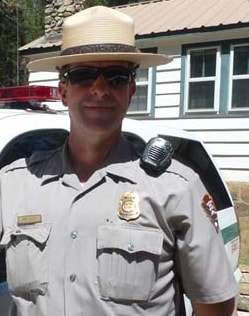
Last night Kelly Martin, Yosemite Fire Management Officer and Eric Scott,Wawona District Ranger, attended the evening operational briefing that was held at Batterson, a USFS workstation just north of Oakhurst. The South Central Sierra Interagency Incident Management Team assumed command of the Railroad Fire, located on the Sierra National Forest, at 1800 last night.
Active fire was observed around Westfall and behind Tenaya Lodge. Highway 41 is closed due to active fire on both sides of the highway and to allow fire crews the ability to work from the road. Crews worked hard all day and all last night to protect structures and to halt forward progress as best they could.
The USFS/IMT has identified at least 4 roads east of 41 from Tenaya Lodge north to Yosemite NP boundary which run in an east/west direction that will be used to as containment opportunities to halt fire spread from threatening the Mariposa Grove and Wawona.
Challenges for containing fire spread includes heavy tree mortality, no previous fire history, steep slopes, stiff up canyon winds, and hot and dry weather for the next week. As of 8:10am today, the fire is estimated at 1901 acres.
The South Central Sierra Incident Management Team will distribute public information today. For more information on the Railroad Fire, text “Railroadfire” (one word) to 888777, or visit https://inciweb.nwcg.gov/incident/5553/. The SSCIMT has scheduled a community meeting tonight at 7 PM in Oakhurst at the Oakhurst Community Center. They will give an update and answer questions from the community.
While there is always potential for change in fire behavior, there is no increased risk to the Wawona community at this time, and we are not currently raising the pre-evacuation status. Should this change in the next 24 hrs., trigger points have been identified between YNP and the IMT that would elevate that status.
--
Eric Scott
Wawona District Ranger
Yosemite National Park
Sent from my iPad
Fire Update August 31th, 2017
There are multiple fires burning in Yosemite National Park's wilderness Smoke will be present due to a high pressure system which brings higher temperatures and lower relative humidities.
An update of the Railroad fire is attached, this fire is not in Yosemite National Park. For the latest information on the Raildroad fire follow Inciweb:https://inciweb.nwcg.gov/state/5/#
Hot and dry weather will persist through the weekend and into early next week.
South Fork
Discovered: 8/13/17
Size: 7,800 acres Cause: Unknown
Containment: 47% Fuels: Mixed conifer and red fir
The north and east flanks were most active yesterday as it burned into scattered heavy pockets of fuel. The south and west flanks of the fire are contained, some smoke and glow at night will be visible from Wawona as logs and brush burn interior. Weather will continue to be hot and dry through the weekend and into early next week. Fire will continue to back and flank on the north and east flanks and become more active as this weather pattern persists.
Crews will continue to patrol and mop-up the flanks closest to the community of Wawona and Mariposa Grove. Containment strategy is to hold and secure handline from Chilnualna Creek south towards Wawona Dome. Sections of the north flank and the entire east flank of the fire is continuing to burn in the wilderness, and will be monitored by aircraft due to inaccessible and steep terrain. As fire burns into the high country wilderness it will burn actively through pockets of dense vegetation but will then slow down as it progresses into sparse vegetation and natural granite barriers limiting smoke production. This high country wilderness area has few high values at risk.
Area and trail closures are in place follow posted closure orders and maps.
Empire
Discovered: 8/1/17 Location: 1 mile east of Yosemite Ski and Snowboard Area and 3/4 mile south of Glacier Point Road
Size: 4,250 acres Cause: Lightning
Containment: 55% Fuels: Red fir
Yesterday fire activity was moderate with some interior single tree torching due to early morning precipitation. The north and west flanks of the fire are contained and holding. The east flank showed little growth yesterday and was moderated with milder weather conditions. Weather forecast for today predicts hotter and dryer conditions through the end of the week and into early next week.
Fire crews are implementing a perimeter control strategy for the north, west, and southern flanks of the fire to protect Bridalveil Campground, Yosemite Ski and Snowboard Area, Yosemite West subdivision, Wawona Road (Highway 41), and Glacier Point road. Firing operations were successful on the south flank yesterday; today crews will hold and patrol the south flank and continue direct line construction around spot fires on the northeast flank near Ostrander trail.
Fire management personnel are implementing this strategy on three sides of the fire to minimize further smoke production in heavy fuels. The east flank is being allowed to move towards the Illilouette basin to continue to enhance forest resiliency in a fire adapted ecosystem. Yosemite National Park has managed fire in this wilderness area for decades. This high country wilderness area is very steep and rugged with numerous natural barriers and few high values at risk.
Glacier Point road is closed to the public due to fire fighter safety to conduct tree felling and vegetation clearance; conditions are being assessed as to when the road can be opened again. Additional crews and engines are on order to support these operations.
Starr King
Discovered: 8/2/17 Location: N 37° 42.965' x W 119° 29.588' at approximately 7800 feet elevation
Size: 32.4 acres Cause: Lightning Spread Potential: Low/ Moderate
Fuels: Red fir/ Lodgepole Strategy: Monitor
Activity has picked up and smoke will be visible from high elevation viewpoints
Attached is the Central Sierra Smoke/AQ Outlook for Thursday August 31st. Currently heavy smoke is sitting under an inversion through the Main and South Fork of the Merced River drainages.
https://www.wildlandfiresmoke.net/outlooks/2017/CentralSierraFires#Area1
https://www.wildlandfiresmoke.net/outlooks/2017/CentralSierraFires#Area2
For Real Time Smoke Monitoring in Yosemite National Park:
https://app.airsis.com/USFS/UnitMap?custId=11&unitId=1011&isHistoric=False
Very Active Fire Behavior Overnight On The Railroad Fire
Posted by: gina clugston August 31, 2017 - 7:47 am
FISH CAMP — The Railroad Fire was very active overnight, pushing to the east along Jackson Road (6S07), and to the southwest behind Westfall Ranger Station.
The fire is now estimated at 1,901 acres. Yesterday’s estimated containment was 5 percent, but with the fire pushing out on so many parts of the perimeter, the containment is likely negligible at this point.
All closures and evacuations remain in place (see list below), and all areas of the fire continue to pose great risks to firefighters. The word of the day from Incident Commander Deron Mills is “snags,” and he warned crews that there is just no place on this fire where you are out from under them.
Night Ops Section Chief Robert Sanders said that the Yosemite Mountain Sugar Pine Railroad has not suffered any further damage, beyond the loss of equipment on the siding late last night. All structures and other rolling stock were protected by crews who staged there overnight.
After the wind event that kicked up fire activity around the Westfall Ranger Station yesterday afternoon, it appears that the station suffered no damage.
The fire pushed hard to the east overnight, burning about 50 acres southeast of the Tenaya Lodge along Jackson Road. It was also very active on the west side of Highway 41 from Westfall north.
Air Ops will be requesting two heavies and two of “any other type” of air tankers today, but will have to wait and see what is available.
Fire managers expect more of the same type of activity they saw yesterday, with elevated fire behavior as temperatures rise. It is expected to reach into triple digits today, with dangerously low humidity between 16 and 21 percent. Wind gusts are expected to reach up to 20 mph on the ridgetops this evening.
The fire is expected to spread north and east near the community of Fish Camp and Yosemite Mountain Ranch property.
Logistics personnel worked throughout the night at the Ahwahnee Hills Regional Park, literally carving out space for the Incident Command Post. Sleeper trailers, shower facilities and portable office units continue to roll in, meal facilities are up and running, and communications set-ups are being put in place. When the fire is over, they will return the property to its pre-fire condition.
Shift change on the fire takes place twice a day, from about 5:30 to 6:30, a.m. and p.m. The public is asked to be aware of large equipment on Highway 41 and Highway 49 during those hours.
There will be a community meeting tonight, Thursday, Aug. 31, at 7 p.m. at the Oakhurst Community Center. The South Central Interagency Incident Management Team will be present to give an update on the Railroad Fire and answer questions from the public.
Road closures include Highway 41 and all offshoots between Cedar Valley Road and Summerdale Campground in both Madera County and Mariposa County, and Road 630 (Sugar Pine Road) and all cross streets, including Sugar Pine Christian Camps. Jackson Road is closed to Fresno Dome.
The road closure on Highway 41 northbound is at Cedar Valley about three miles north of Oakhurst. The road is closed to southbound traffic inside Yosemite National Park at Wawona.
A mandatory evacuation is in place for the the community of Fish Camp, the Tenaya Lodge, the Narrow Gauge Inn, the Yosemite Mountain Sugar Pine Railroad, the community of Sugar Pine including the Christian camp, and all homes and businesses in the immediate vicinity. Evacuations run north from Fish Camp to the Summerdale Campground.
The community of Wawona is also being warned of the possible threat potential from this fire. Residents and visitors are encouraged to make appropriate pre-evacuation preparations.
A Red Cross evacuation center has been established at the Oakhurst Community Center, 39800 Road 425B. A second shelter is in Yosemite National Park at the Valley Visitors Center at 9035 Village Drive.
The Central California Animal Disaster Team will activate a small animal shelter at the Oakhurst Community Center Pavillion Building by 4 p.m. today. Small animals can also be sheltered at the Mariposa SPCA, 5599 Highway 49 in Mariposa. The phone number is 209-966-5275. Large animals can be sheltered at the Coarsegold Rodeo Grounds, at 44777 Rodeo Grounds Lane in Coarsegold. The phone number is 559-676-7864.
All roads past Wawona inside Yosemite are open, except Glacier Point Road, which was closed on Sunday due to increased fire activity on the Empire Fire.
For fire updates, residents and visitors can message RAILROADFIRE (one word) to 888777.
The Railroad Fire was reported at 12:20 p.m. on Tuesday, Aug. 29, just south of the Yosemite Mountain Sugar Pine Railroad on the west side of Highway 41.
The cause of the fire is under investigation.
Historic Equipment Burns At Yosemite Mt. Sugar Pine Railroad
Posted by: gina clugston August 31, 2017 - 3:06 am
FISH CAMP — The Railroad Fire started just across the road from the Yosemite Mountain Sugar Pine Railroad. Hence the name.
It burned to the north, past the Narrow Gauge Inn which is just feet away, then crossed the road to the east and destroyed several homes. But the railroad was spared.
That was day one. On day two, erratic winds pushed the fire back to the south and east, and spot fires all around the historic property challenged firefighters all afternoon.
Late yesterday, fire on the southern end of the 10-acre property finally crept in and claimed a few treasured pieces of history – burning equipment that wasn’t part of the main rolling stock, but was stored on a side track.
Much of the equipment at the YMSPRR was brought to Fish Camp from the West Side Lumber Company – the last of the narrow-gauge logging companies operating in the American West, hauling logs from the forests of the Sierra down the mountain to the mill in Tuolumne City.
Both steam locomotives that run at the railroad — the No. 10 and the No. 15 — came from the West Side. And both of those locomotives have survived the Railroad Fire thus far, along with all the structures on the property.
The equipment that was destroyed in last night’s fire included a dump car, a flatcar that had been converted from a refrigerator car, and a log car — all from the West Side Lumber Company.
Also on the siding was a small diesel engine, a tanker car, about eight sets of locomotive wheels, and a snow plow that attaches to the front of the locomotive. About 200 new railroad ties also lent fuel to the fire.
At midnight last night, there were crews on site protecting the structures and monitoring the fire as it burned along the south side of the property.
Anyone who has ever visited the railroad knows that owner Max Stauffer, who passed away in March of this year, kept the grounds immaculate, always had beautiful flowers growing all along the walkways, and kept the dust down by running sprinklers on the grounds. Those sprinklers came in very handy last night.
It was a beautiful sight to see the everything still standing in the early morning hours – the engine house, the museum, the bookstore, the gift shop, the rail cars, the passenger cars, and both steam locomotives. But the Yosemite Mountain Sugar Pine Railroad is all about history, and the loss of those connections to the past erases just one more little piece of that history.
Railroad Fire prompts evacuation of Tenaya Lodge and damages historic trains
By Cory James
Thursday, August 31, 2017 12:54AM
Fresno, Calif. (KFSN) --
All day the work of firefighters could be heard as they battled day two of a raging blaze in Madera and Mariposa Counties. You could see them in the Sierra National Forest, dousing hot flames with water-- a blaze that ran up countless trees and nearly hopped Highway 41.
While both Sugar Pine and Fish Camp are under mandatory evacuation orders, there were some like Bob Keller who stayed behind.
Keller has been without power for more than a day, but he said for now he holds the comfort in knowing his 60-year-old Fish Camp home is ok.
"We've had nothing but help, the Forest Service, Cal Fire-- and they were a great help to keep things under control."
However, there are dozens of others who do not have that peace of mind.
On our Twitter page, a few people reached out asking if their properties were safe. So we drove by Anthony Avila's vacation rental to give him the good news he could not see for himself.
"I'm definitely thankful-- really happy actually. It's scary knowing everything can go in a second. Without hearing from you guys and ABC30 it's kind of hard to know what going on."
As crews used a nearby pond for resources to tackle the growing fire the owners of the historic landmark Sugar Pine Railroad are left on edge. At least one train and rail car were burned in the fire and there is no telling if it will happen to the others.
The US Forest Service said no update will be given Wednesday night, but what we do know from an earlier release is that the Railroad Fire has already burned 1,200 acres and was only five-percent contained.
Firefighters said heat and strong winds made it difficult to contain
The fast moving flames also prompted evacuations at the Tenaya Lodge in Fish Camp. Just last week the hotel was providing shelter to evacuees of the South Fork Fire near Wawona.
More than half of the guests staying at the hotel were visiting Yosemite National Park at the time of the evacuation. On Wednesday the CHP escorted visitors to the hotel to gather their belongings and leave.
Around 20 employees are staying the night to protect the property and aid in the firefight.
Railroad Fire Incident Report
Railroad Fire, Sierra National Forest (NF), California.
The Railroad Fire started August 29, 2017 at approximately 1300 hrs. West of Highway 41, near the community of Sugar Pine, South of Yosemite National Park and Fish Camp.
It is a vegetation fire burning on the Sierra NF. The fire is burning in steep terrain, with difficult access and heavy fuel loading. Potential for this fire is high.
Fire activity this afternoon has increased due to high temperatures and stiff up canyon winds.
Mandatory evacuations are in place for the community of Sugar Pine and Sugar Pine Camp and the community of Fish Camp.
There are 100 structures threatened. Seven structures have been destroyed.
Highway 41 is in a hard closure north of Cedar Valley Drive to the South entrance to Yosemite National Park and Highway 41 southbound from Wawona to the South entrance of Yosemite. Yosemite visitors are to use Highway 49 to Highway 140 or 120 for entrance to the National Park. Jackson Road Campgrounds on the Sierra National Forest are also closed.
Presently the fire has consumed approximately 1200 acres and is 5% contained, cause of the fire is under investigation. Reduced wind speeds and temperatures moderated fire behavior allowing fire crews to make good progress last night.
Resources on this fire consist of 26 Fire Engines, 7 Hand Crews, 2 Helicopters, 3 Air Tankers
Total Personnel: 350
Community Meeting in Oakhurst August 31 at 7 pm
There will be a community meeting Thursday August 31 at 7 pm at the Oakhurst Community Center. The South Central Interagency Incident Management Team will be present to give an update on the Railroad Fire and and answer questions from the community.
Wind shifts dramatically on Railroad Fire, spot fires push in several directions
BY MARK EVAN SMITH
[email protected]
AUGUST 30, 2017 4:24 PM
A turbulent shift in the winds on the Railroad Fire in Fish Camp Wednesday afternoon pushed it in a southwest direction, but there were no immediate dangers to Ahwahnee.
The fire was at least 3 to 4 miles from that community information officer Daniel Tune said at 5:15 p.m., meaning the fire would have to double or triple in size to get close. He said that was extremely unlikely.
“What happens with smoke like this is a kind of optical illusion where it looks closer than it actually is, like it looks close to Oakhurst, but not really,” Tune said. “It’s still miles away.”
At least one strike team was regrouping at Cal Fire Station 12 in Oakhurst around 4 p.m. to determine the best plans to move forward. Flames leaping as high as 100 feet were being reported, and were seen near the Westfall Ranger Station near Miami Motorcycle Mountain Road in Fish Camp.
Minor damage was also reported, via scanners, to one of the historic railroad cars at Yosemite Mountain Sugar Pine Railroad. The fire was also reportedly pushing back towards Fish Camp, with spot fires reported across Highway 41 to the east, from the blaze’s origins on the western side. Winds were constantly shifting throughout the day.
Numerous additional resources were requested.
The cause of the fire is under investigation.
All of Fish Camp and Sugar Pine, including the railroad, Tenaya Lodge, and Narrow Gauge Inn, remain under mandatory evacuation. Highway 41 is closed in the Cedar Valley area, with no entry to Yosemite National Park.
According to ongoing scanner reports, the fire is burning towards the southwest, the southeast, and east, from its origin point on the west side of Highway 41, near Mill Canyon Road in Fish Camp, around 12:30 p.m. Tuesday.
Fish Camp Volunteer Fire BBQ & Auction Canceled
Donn Harter has cancelled the September 3 Fish Camp Volunteer Fire BBQ & Auction fundraiser in consideration of the heat and smoke. Currently the Railroad Fire is not fully contained and there is no date for containment established. The raffle will be held at a later date when things calm down.
Thank you to all who have supported the annual Fish Camp BBQ fundraiser.
Thank you to all who have supported the annual Fish Camp BBQ fundraiser.
Spot Fires Increase As Smoke Hampers Air Attack Of Railroad Fire
Posted by: gina clugston August 30, 2017 - 11:19 am
FISH CAMP — As temperatures rise, fire activity is increasing on the Railroad Fire burning near Fish Camp.
By 8 o’clock this morning, crews were reporting flame lengths of up to 100 ft. in some areas.
Firefighters moved in to cut line around the community of Fish Camp, and helicopters focused their bucket work on that area and the northeast leading edge of the fire.
Crews also have been doing structure protection, and according to reports from Fish Camp resident Donn Harter this morning, houses on both sides of Summit Road have been saved. However, as Donn said in his message, due to heat and conditions, the situation may change.
Though Operations requested up to six air tankers, getting them will not likely be possible as three are committed to the Pier Fire, a 4,600-acre fire burning southeast of Visalia on the Sequoia National Forest.
The dense smoke continues to limit the hours of attack from air resources, forcing at least one loaded tanker to return to base at about 9:45 a.m., until conditions clear.
At about the same time, Air Attack reported a 40-acre spot fire outside the lines near Road 6S07 east of Fish Camp.
At 10:55 a.m., deputies reported that they will start evacuating the entire length of Jackson Road including campgrounds.
Just after 11 a.m., Air Attack reported conditions on the south end of the fire were improving and they are checking availability of air tankers.
Immediately thereafter, word came in that fire activity is picking up just south and east of the Tenaya Lodge on the 6S07 road, about one-half mile from Highway 41. Two helicopters are being diverted to that area, and as soon as tankers can begin their work, they will drop retardant along the eastern edge of the fire.
The South Central Sierra Interagency Incident Management Team took over operation of the Railroad Fire at 10 a.m. this morning. This is the same team that successfully managed the South Fork Fire and protected the community of Wawona earlier this month. It is headed up by Deron Mills, who is also the Deputy Fire Chief in Yosemite.
A check on the Yosemite Mountain Sugar Pine Railroad this morning by steam locomotive engineer Greg Haywood, showed that though the smoke is thick and ash is blanketing everything, all the buildings and equipment are still intact, along with the Narrow Gauge Inn next door.
However, there is a spot fire burning at the bottom of the railroad circuit to the northwest of the Lewis Creek. There is Hot Shot crew, along with two engines and dozer actively working this spot fire.
The Railroad Fire was estimated at 920 acres with 5 percent containment this morning.
Seven structures have been lost, and one hundred more are threatened.
Closures include Highway 41 and all offshoots between Cedar Valley Road and Summerdale Campground in both Madera County and Mariposa County, and Road 630 (Sugar Pine Road) and all cross streets, including Sugar Pine Christian Camps.
The road closure on Highway 41 northbound is at Cedar Valley about three miles north of Oakhurst. The road is closed to southbound traffic inside Yosemite National Park at Wawona.
A mandatory evacuation is in place for the the community of Fish Camp, the Tenaya Lodge, the Narrow Gauge Inn, the Yosemite Mountain Sugar Pine Railroad, the community of Sugar Pine including the Christian camp, and all homes and businesses in the immediate vicinity. Evacuations run north from Fish Camp to the Summerdale Campground.
The community of Wawona – which is still dealing with a recent evacuation from the South Fork Fire – is also being warned of the possible threat potential from this fire. Residents and visitors are encouraged to make appropriate pre-evacuation preparations.
A Red Cross evacuation center has been established at the Oakhurst Community Center, 39800 Road 425B. A second shelter is in Yosemite National Park at the Valley Visitors Center at 9035 Village Drive.
The Central California Animal Disaster Team will activate a small animal shelter at the Oakhurst Community Center Pavillion Building by 4 p.m. today. Small animals can also be sheltered at the Mariposa SPCA, 5599 Highway 49 in Mariposa. The phone number is 209-966-5275. Large animals can be sheltered at the Coarsegold Rodeo Grounds, at 44777 Rodeo Grounds Lane in Coarsegold. The phone number is 559-676-7864.
All roads past Wawona inside Yosemite are open, except Glacier Point Road, which was closed on Sunday due to increased fire activity on the Empire Fire.
For fire updates, residents and visitors can message RAILROADFIRE (one word) to 888777.
The Railroad Fire was reported at 12:20 p.m. on Tuesday, Aug. 29, just south of the Yosemite Mountain Sugar Pine Railroad on the west side of Highway 41.
The cause of the fire is under investigation.
Empire Fire Update #24 August 30th, 2017
Location: 1 mile east of Yosemite Ski and Snowboard Area and 3/4 mile south of Glacier Point Road
Discovery Date: July 31st, 2017 Incident Personnel: 45
Size: 4,150 acres Helicopters: 1
Containment: 55%
Cause: Lightning
Yesterday growth of the fire was moderated due to lower temperatures, higher humidities and cloud cover. Light precipitation was received over the fire area this morning. The west and northwest flanks of the fire are contained and showed minimal activity.
Fire crews are implementing a perimeter control strategy for the north, west, and southern flanks of the fire to protect Bridalveil Campground, Yosemite Ski and Snowboard Area, Yosemite West subdivision, Wawona Road (Highway 41), and Glacier Point road. There was a firing operation on the south flank of the fire to tie in containment lines on the Deer Camp trail. Fire management personnel are implementing this strategy on three sides of the fire to also limit further smoke production in heavy fuels. Strategy for the east flank of the fire is to steer fire east deeper into the wilderness where there is sparse vegetation and natural granite barriers, which will slow spread and limit smoke production. This high country wilderness area is very steep and rugged and has few high values at risk.
Glacier Point road is closed to the public due to fire fighter safety to conduct tree felling and vegetation clearance; conditions are being assessed as to when the road can be opened again. Additional crews and engines are on order to support these operations.
The following trail and area closures are in place until further notice:
All closed trailheads and junctions will be posted with a trail closure order and map.
Smoke and poor air quality will persist at least through the first part of September. Fire Managers are working with the local Air Quality Districts and will be monitoring smoke impacts to the park and local communities. Community members who are sensitive to smoke may want to close their windows and doors and monitor the air quality link below.
Attached is the Central Sierra Smoke/AQ Outlook for Wednesday August 30th. A new fire popped up yesterday around 1:00 PM on the Sierra National Forest called the Railroad Fire. The Railroad Fire will aid in potential degraded air quality conditions in the area.
https://www.wildlandfiresmoke.net/outlooks/2017/CentralSierraFires#Area1
https://www.wildlandfiresmoke.net/outlooks/2017/CentralSierraFires#Area2For additional Information:
Discovery Date: July 31st, 2017 Incident Personnel: 45
Size: 4,150 acres Helicopters: 1
Containment: 55%
Cause: Lightning
Yesterday growth of the fire was moderated due to lower temperatures, higher humidities and cloud cover. Light precipitation was received over the fire area this morning. The west and northwest flanks of the fire are contained and showed minimal activity.
Fire crews are implementing a perimeter control strategy for the north, west, and southern flanks of the fire to protect Bridalveil Campground, Yosemite Ski and Snowboard Area, Yosemite West subdivision, Wawona Road (Highway 41), and Glacier Point road. There was a firing operation on the south flank of the fire to tie in containment lines on the Deer Camp trail. Fire management personnel are implementing this strategy on three sides of the fire to also limit further smoke production in heavy fuels. Strategy for the east flank of the fire is to steer fire east deeper into the wilderness where there is sparse vegetation and natural granite barriers, which will slow spread and limit smoke production. This high country wilderness area is very steep and rugged and has few high values at risk.
Glacier Point road is closed to the public due to fire fighter safety to conduct tree felling and vegetation clearance; conditions are being assessed as to when the road can be opened again. Additional crews and engines are on order to support these operations.
The following trail and area closures are in place until further notice:
- Glacier Point Road
- Bridalveil Campground
- Ostrander Trail
- Bridalveil Trail
- Alder Creek Trail
- Mono Meadow Trail
- Turner Meadow Trail
All closed trailheads and junctions will be posted with a trail closure order and map.
Smoke and poor air quality will persist at least through the first part of September. Fire Managers are working with the local Air Quality Districts and will be monitoring smoke impacts to the park and local communities. Community members who are sensitive to smoke may want to close their windows and doors and monitor the air quality link below.
Attached is the Central Sierra Smoke/AQ Outlook for Wednesday August 30th. A new fire popped up yesterday around 1:00 PM on the Sierra National Forest called the Railroad Fire. The Railroad Fire will aid in potential degraded air quality conditions in the area.
https://www.wildlandfiresmoke.net/outlooks/2017/CentralSierraFires#Area1
https://www.wildlandfiresmoke.net/outlooks/2017/CentralSierraFires#Area2For additional Information:
- Fire Information: [email protected], (209) 379-1493
- Yosemite National Park Fire Information website: http://www.nps.gov/yose/blogs/fireinfo.htm
- Facebook: Search-- Yosemite Fire and Aviation: @YosemiteFire
- Twitter: Search @YosemiteFire https://twitter.com/YosemiteFire
- Air Quality: https://www.nps.gov/yose/learn/nature/aqmonitoring.htm
- Inciweb: https://inciweb.nwcg.gov/incident/5475/
South Fork Fire Update #17 August 30th, 2017
Start date: 8/13/17 2:30 p.m.
Size: 6,100 acres
Containment: 44% Incident Personnel: 128
Cause: Unknown Helicopters: 1
Fuels: Mixed conifer, oak and brush
The north flank was most active yesterday as it burned into intermittent heavy pockets of fuel. The south and west flanks of the fire are contained, some smoke and glow at night will be visible form Wawona as logs and brush burn in the interior. Light precipitation was received over the fire area this morning.
Crews will continue to patrol and monitor the flanks closest to the community of Wawona and Mariposa Grove. Crews are continuing containment strategies on the north-west edge of the fire and to keep fire south and south-east of Chilnualna Creek. The north and east flank of the fire is continuing to burn in the wilderness, and will be monitored by aircraft due to inaccessible and steep terrain. As fire burns into the high country wilderness it will burn actively through pockets of dense vegetation but will then slow down as it progresses into sparse vegetation and natural granite barriers limiting smoke production. This high country wilderness area has few high values at risk.
The following trail and area closures are in place until further notice:
· The Swinging Bridge Trail on both the north and south sides of the South Fork of the Merced River.
· The Chilnualna Falls Trail from Wawona Trailhead to the top of Chilnualna Falls.
· The two mile connecting trail heading north from the top of Chilnualna Falls to the intersection of the Buena Vista Trail.
· The Chilnualna Creek Trail from the top of Chilnualna Falls east to the intersection of the Buena Vista and Buck Camp trails (Just east of Johnson Lake).
· Turner Meadow Trail
· Turner Meadow intersection east to Buena Vista trail
· Off-trail areas in the vicinity of the South Fork Fire Area, including the swimming holes north of Chilnualna Creek.
· All climbing routes on and around Wawona Dome are closed.
Smoke and poor air quality will persist at least through the first part of September. Fire Managers are working with the local Air Quality Districts and will be monitoring smoke impacts to the park and local communities. Community members who are sensitive to smoke may want to close their windows and doors and monitor the air quality link below.
Attached is the Central Sierra Smoke/AQ Outlook for Wednesday August 30th. A new fire popped up yesterday around 1:00 PM on the Sierra National Forest called the Railroad Fire. The Railroad Fire will aid in potential degraded air quality conditions in the area.
https://www.wildlandfiresmoke.net/outlooks/2017/CentralSierraFires#Area1
https://www.wildlandfiresmoke.net/outlooks/2017/CentralSierraFires#Area2
For additional information:
· Fire Information: [email protected], (209) 379-1493
· Yosemite National Park Fire Information website: http://www.nps.gov/yose/blogs/fireinfo.htm
· Facebook, search: Yosemite Fire and Aviation
· Twitter, search @YosemiteFire : http://www.twitter.com/YosemiteFire
· Air Quality: https://www.nps.gov/yose/learn/nature/aqmonitoring.htm
· Inciweb: https://inciweb.nwcg.gov/incident/5502/
Hot Temps And Low Humidity Challenges Crews On The Railroad Fire
Posted by: gina clugston August 30, 2017 - 7:29 am
FISH CAMP — In a surreal juxtaposition of fire, rain, lightning and smoke, the management team on the Railroad Fire gathered at Batterson Work Station at 6 a.m. to go over the day’s objectives and operations plans.
With more accurate overnight mapping, the fire is now estimated at 920 acres with 5 percent containment.
There are currently 350 personnel assigned to the incident including 26 engines, 7 hand crews, 6 dozers, 2 helicopters and 3 air tankers, with more resources arriving and even more on order.
Seven structures have been destroyed, and about 100 more are threatened.
The Yosemite Mountain Sugar Pine Railroad, the Narrow Gauge Inn, the Tenaya Lodge, and the communities of Fish Camp and Sugar Pine have not suffered any damage.
Dozer lines on the southwest perimeter of the fire held overnight, while several spot fires were dealt with on the northeast, just south of Jackson Road.
Temperatures are expected to be in the mid-90s today, with humidity extremely low — between 18 and 23 percent.
Afternoon winds are forcasted to be upslope at 3 – 6 mph with gusts from 6 – 10 mph out of the southwest, pushing the fire towards Fish Camp.
Fire officials expect huge vertical growth if the fire gets into heavy fuel this afternoon.
With the live fuel moisture at critical levels, combined with the massive tree mortality, the situation is expected to be volatile.
The greatest danger for firefighters is the amount of dead trees. A trip up Highway 41 to the heart of the Railroad Fire yesterday made it very clear that the roadway is not just closed so fire trucks can get through – it’s closed because it’s extremely dangerous. The noise in the middle of the fire is not just from the aircraft and the engines, it’s from the trees exploding, snapping off and falling over.
Once the vegetation has been burned away, large boulders are being released from the steep hillsides and are crashing down into the roadway. The near-zero visibility in some areas creates even more hazards as those boulders can’t be seen until one is right on top of them.
Caltrans will be patrolling the roadway to find those hazards and remove them.
A Type 2 Incident Management Team will take over the fire later today. An Incident Command Post will be set up, likely at the Ahwahnee Hills Regional Park.
Highway 41 will not open today, and all evacuations will remain in place. Visitors who were evacuated from the Tenaya Lodge who need to return to retrieve their belongings can meet at the Highway 41 road closure in Wawona to be escorted to the hotel at 10 a.m. today. This is for hotel guests ONLY.
Closures include Highway 41 and all offshoots between Cedar Valley Road and Summerdale Campground in both Madera County and Mariposa County, and Road 630 (Sugar Pine Road) and all cross streets, including Sugar Pine Christian Camps.
The road closure on Highway 41 northbound is at Cedar Valley about three miles north of Oakhurst. The road is closed to southbound traffic inside Yosemite National Park at Wawona.
A mandatory evacuation is in place for the the community of Fish Camp, the Tenaya Lodge, the Narrow Gauge Inn, the Yosemite Mountain Sugar Pine Railroad, the community of Sugar Pine including the Christian camp, and all homes and businesses in the immediate vicinity. Evacuations run north from Fish Camp to the Summerdale Campground.
The community of Wawona – which is still dealing with a recent evacuation from the South Fork Fire – is also being warned of the possible threat potential from this fire. Residents and visitors are encouraged to make appropriate pre-evacuation preparations.
A Red Cross evacuation center has been established at the Oakhurst Community Center, 39800 Road 425B. A second shelter is in Yosemite National Park at the Valley Visitors Center at 9035 Village Drive.
The Central California Animal Disaster Team is on standby to assist the Madera County Sheriff’s Office/ Animal Control with animal evacuation and emergency animal sheltering if needed.
All roads past Wawona inside Yosemite are open, except Glacier Point Road, which was closed on Sunday due to increased fire activity on the Empire Fire.
For fire updates, residents and visitors can message RAILROADFIRE (one word) to 888777.
The cause of the fire is under investigation.
Video Shows Fire Damage All Along Hwy. 41 This Morning - Aug. 30
Vanessa Vasconcelos ABC30
RailroadFire Latest: 1,000+ acres. 5% contained.
ABC30 News Report on Railroad Fire - August 30
LATEST: Guests staying at Tenaya Lodge who need to return to the lodge to retrieve their belongings can meet at the Hwy 41 road closure in Wawona to be escorted to the hotel at 10 a.m.
By Cory James and Vanessa Vasconcelos
FRESNO, Calif. (KFSN) --
The blaze was aggressive, fast moving, and relentless; racing up countless trees in the Sierra National Forest that are infested with bark beetle.
The fire even threatened Sugar Pine Railroad and forced employees to move the historic attraction's trains to safer ground.
But Tenaya Lodge, which is a few miles up the road, was in danger too. A family from the Netherlands was staying there until the road closure sent them without their belongings to a hotel in Oakhurst for the night.
"No swimming for us today, unless it's in the nude but it's not allowed over here," said Frank Bakker, tourist from the Netherlands.
Those same road closures along Highway 41 between Cedar Valley Road and Summerdale Campground also created problems for Todd Finnigan. He and his family traveled from England to visit Yosemite.
"Frustrating because we've been driving all day."
The Sierra National Forest said the fire is burning in steep terrain with heavy fuel. They also said hot weather and strong winds made it difficult for crews.
Dan Tune, with the Sierra National Forest, said, "Trees have been weakened so they are coming down, so we have to be real careful with our firefighters putting them out there under some of these things."
Now with 920 acres burned, firefighters who are working throughout the night are hoping a shift in winds will allow them to make more progress.
So far the fire is only five-percent contained.
While 100 structures are threatened there is no word on how many are damaged or destroyed.
Railroad Fire Incident Overview
The Railroad Fire started August 29, 2017 at approximately 1300 hrs. West of Highway 41, near the community of Sugar Pine, South of Yosemite National Park and Fish Camp.
It is a vegetation fire burning on the Sierra NF. The fire is burning in steep terrain, with difficult access and heavy fuel loading. Potential for this fire is high.
Mandatory evacuations are in place for the community of Sugar Pine and Sugar Pine Camp with an evacuation advisory for the community of Fish Camp.
There are 100 structures threatened.
Highway 41 is in a hard closure from Westphal to the South entrance to Yosemite National Park. Yosemite visitors are to use Highway 49 and Highway 140 for entrance to the National Park.
Presently the fire has consumed approximately 920 acres and is 5% contained, cause of the fire is under investigation.
Resources on this fire consist of 26 Fire Engines, 7 Hand Crews, 3 Helicopters, 10 Air Tankers
Total Personnel: 350
Assisting Agencies: CAL FIRE, Madera County Sheriffs Office and Madera County Fire.
Additional resources are on order.
Pre-Evacuation Alert Issued For Wawona
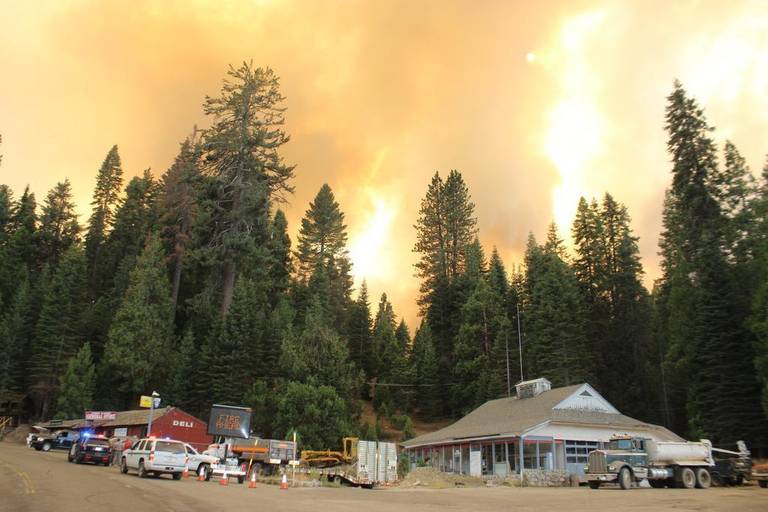
Looking southwest from Highway 41 in Fish Camp, with the Railroad Fire roaring behind the Fish Camp General Store. By Tuesday evening, the fire was reported at 1,000 acres with 0% contained, and evacuations in place in all of Fish Camp, at Tenaya Lodge, and along Highway 41. Highway 41 was also closed from the area to Yosemite National Park. Brian Wilkinson Sierra Star
A Hazard Alert Message is being issued for the Wawona community due to a nearby wildfire in Fish Camp. It is currently at low threat potential for Wawona, that may require evacuation in 24 hours or more. Residents and visitors are encouraged to make appropriate pre-evacuation preparations.
Railroad Fire Now Over 1,000 Acres
Posted by: gina clugston August 29, 2017 - 5:28 pm
FISH CAMP — The Railroad Fire has forced the closure of Highway 41, the evacuation of hundreds of residents and visitors, and continues to grow.
The fire is now estimated at over 1,000 acres, with spot fires out ahead of the blaze, and a potential for up to 5,000 acres, with zero percent containment. It is moving toward the park boundary.
Three structures have been confirmed lost. About a quarter mile north of the Narrow Gauge Inn, the fire crossed the road and it appears that it destroyed several structures in the area on the east side of the road.
The fire started directly across the road from the Yosemite Mountain Sugar Pine Railroad and burned to the north and west. The fire is still being contained to the west side of the road, with a few spot fires on the east that have been handled by firefighters.
The Railroad itself is being used as the Incident Command Post at this time, where firefighters and other resources are staging.
The Railroad, Narrow Gauge Inn, communities of Sugar Pine and Fish Camp, and the Tenaya Lodge are not in imminent danger at this time, according to Sierra National Forest Community Protection Officer Dan Tune.
The fire is burning in mixed conifer forest and bear clover and it has moved rapidly throughout the afternoon. As we move into the nighttime hours, and temperatures drop, the winds generally shift back to downslope, pushing the fire back into the areas already burned, and limiting the intensity.
Heavy smoke has limited access to aircraft, and steep terrain with falling trees is endangering firefighters.
Fire managers continue to request additional resources to the incident, as Paid Call Firefighters are called up to cover Cal Fire stations left unmanned.
The road closure on Highway 41 has been moved south from Road 630 to Cedar Valley. On the north it is closed at Wawona.
A mandatory evacuation is in place for the the community of Fish Camp, the Tenaya Lodge, the Narrow Gauge Inn, the Yosemite Mountain Sugar Pine Railroad, the community of Sugar Pine including the Christian camp, and all homes in the immediate vicinity. Evacuations run as far north as the Summerdale Campground.
All traffic is being sent into Yosemite from Fish Camp, and the outbound traffic from the park is being stopped at the south entrance.
Officials report zero visibility on the roadway in the Fish Camp area, so everyone is being warned to use extreme caution and headlights.
A Red Cross evacuation center has been established at the Oakhurst Community Center, 39800 Road 425B.
The Central California Animal Disaster Team is on standby to assist the Madera County Sheriff’s Office/ Animal Control with animal evacuation and emergency animal sheltering if needed.
For fire updates, residents and visitors can message RAILROADFIRE (one word) to 888777.
The cause of the fire is under investigation.
MODIS hot spot map of the Railroad Fire
Counties, the state, and federal agencies join forces as Railroad Fire grows near Yosemite
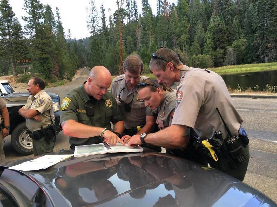
Deputies from the Madera and Mariposa County sheriff’s offices, as well as Yosemite National Park rangers and Wawona residents, Eric Scott, Heidi Edgecomb, and Chad Andrews and state responders, prepare to go door-to-door on around 50 homes and some 50 cabins in the general area of Fish Camp as flames approached from the Railroad Fire Tuesday afternoon. Brian Wilkinson Sierra Star
Yosemite BY MARK EVAN SMITH
[email protected]
AUGUST 29, 2017 4:10 PM
Numerous deputies, firefighters, and other responders from the Madera and Mariposa county areas quickly got to work Tuesday on something nobody ever wants to see - a raging blaze forcing people from resorts and their homes near Yosemite National Park.
The Railroad Fire was estimated at around 300 acres in the afternoon, after it was first reported about 12:30 p.m. near Highway 41 and Mill Canyon Road, close to Yosemite Mountain Sugar Pine Railroad and Narrow Gauge Inn.
Numerous agencies have joined forces to help residents and guests evacuate, while bringing the flames under control. Those include Cal Fire, the U.S. Forest Service, Caltrans, and the sheriff’s offices and road and fire departments from both Madera and Mariposa counties, among others.
The highway remains closed at Road 630 while Tenaya Lodge, the inn, and other hotel locations have been evacuated. At least three homes have been claimed by the blaze.
An evacuation shelter has been opened at the Oakhurst Community Center.
Video From Railroad Fire (ABC30 News)
Here's a look at the damage. Several tress have fallen. You can pockets in the forest where flames are still burning @ABC30 pic.twitter.com/RiXS5Tsz9M
— Cory James (@CoryABC30) August 29, 2017
Video From Railroad Fire (Fox 26)
Video From Railroad Fire (Fresno Bee)
Railroad Fire closes Highway 41 and forces evacuations in Fish Camp
BY MARK EVAN SMITH
[email protected]m
AUGUST 29, 2017 1:28 PM
A blaze near Yosemite Mountain Sugar Pine Railroad in Fish Camp, reported around 12:30 p.m. Tuesday, grew to 300 acres by 3 p.m., with the potential to grow to 5,000. Evacuations and road closures have been ordered.
Closures on Highway 41 have been shifted since they were first put in place near Tenaya Lodge around 12:40 p.m. As of 2:45 p.m., the highway is closed in Cedar Valley, and at Summit Road in Fish Camp.
By 1 p.m., Narrow Gauge Inn and the communities of Sugar Pine and Sugar Pine Camp had been completely evacuated.
Shortly before 2:15 p.m., authorities prepared to request evacuation of Tenaya Lodge. Around 30 minutes later, mandatory evacuations were issued for the resort, and requested for the entire Fish Camp area. A very large air tanker was being requested at that time to support numerous air attack crews and ground equipment.
An evacuation center was being set up by the American Red Cross at Oakhurst Community Center, with plans for it to be opened around 3 p.m.
The fire was first reported near Highway 41 and Mill Canyon Road in Fish Camp.
By 3 p.m., the blaze was estimated at 300 acres. It started to the west side of Highway 41, and was spreading to the east. Air attack crews were overhead earlier in the afternoon to make retardant and water drops, and remained overhead at that time. Reportedly, some air attack teams were having trouble on the fire’s eastern flank due to smoke impacting their visibility.
Some air resources were reportedly being diverted from the South Fork and Empire fires in Yosemite National Park.
At least three houses were reportedly under threat, with the possibility of many more. Most locations in Fish Camp, including the railroad and Narrow Gauge Inn, were reportedly under threat.
Railroad Fire Now Over 300 Acres And Growing
ABC30 News - FRESNO, Calif. (KFSN) --
Evacuation Orders have been issued for all of Fish Camp from the Mariposa County Line to the Yosemite National Park Entrance.
The Mariposa County Sheriff's Office said residents will need to evacuate using Highway 41 north through Yosemite National Park.
A Red Cross Shelter is located at the Oakhurst Community Center at 39800 Fresno Flats Rd, Oakhurst, CA 93644.
Highway 41 is closed 4.6 miles north of Oakhurst for northbound traffic and at the Tenaya Lodge for southbound traffic as a wildfire burns across from the Sugar Pine Railroad near Fish Camp.
The fire has burned about 60 acres and is threatening about 100 structures.
Madera County, Mariposa County and U.S. Forest Service authorities are responding to the incident.
Tenaya Lodge evacuated as Railroad Fire roars through Fish Camp
Sheriff deputies and Citizens on Patrol are deployed across the area making notifications and setting up along side roads such as Miami Mountain and Worman, to keep people from entering the fire zone.
The fire was reported at 12:20 p.m., and the initial report said a crew cutting trees in the area had dropped a limb on a power line. That has not been confirmed as the cause of the fire.
More resources are being ordered, including more engines, crews, strike teams, water tenders, helicopters and air tankers.
At 1:35 p.m., sheriff’s personnel reported spot fires on the east side of the highway.
No Relief On Disasters: Now New Fire in Fish Camp Area
Posted by: gina clugston August 29, 2017 - 2:51 pm
FISH CAMP — The Railroad fire continues to grow as fire managers have difficulty getting large air tankers over the incident.
As of 2:45 p.m., the fire was estimated at 300 acres, with spot fires out ahead of the blaze, and a potential for up to 5,000 acres. It is moving toward the park boundary.
Three structures have been lost.
The road closure on Highway 41 has been moved south from Road 630 to Cedar Valley. On the north it is closed at Summit Road in Fish Camp.
A mandatory evacuation is in place for the Narrow Gauge Inn, the Yosemite Mountain Sugar Pine Railroad, the community of Sugar Pine including the christian camp, and all homes in the immediate vicinity.
At 2:53 p.m., the Sheriff’s Office initiated evacuations of the Fish Camp and Tenaya Lodge areas. All traffic is being sent into Yosemite from Fish Camp, and the outbound traffic at the south entrance is being stopped.
Officials report zero visibility on the roadway in the Fish Camp area, so everyone is being warned to use extreme caution and headlights.
A Red Cross evacuation center has been established at the Oakhurst Community Center, 39800 Road 425B.
The Central California Animal Disaster Team is on standby to assist the Madera County Sheriff’s Office/ Animal Control with animal evacuation and emergency animal sheltering if needed.
Empire and South Fork Fires From Air Today - Aug. 29
Updates on Empire and South Fork Fires - August 28
Tori James, MML News ReporterSonora, CA –
South Fork Fire Update
Wildfires already burning in the Yosemite Wilderness may be visible as firefighters continue to manage them for protection and resource objectives.
Of the two major ones, the South Fork Fire, which ignited near the community of Wawona on Aug. 13 is still reported as being 44 percent contained although the size has crept to 5,191 acres. While possibly lightning-caused, the official determination has yet to be made by fire officials. At last check 101 personnel and two helicopters were assigned to the incident.
Officials say that yesterday the fire was most active on the north and northeast flanks while the east flank is being slowed by natural barriers and sparse vegetation. Crews are continuing to patrol the flank nearest the community of Wawona and the Mariposa Grove with aircraft assisting in securing the line as needed. Repair and rehabilitation have begun within the Yosemite Wilderness. While smoke and poor air quality continue to be an issue in the park all roads within it remain open to travel.
The following trail and area closures remain in place: Swinging Bridge Trail on both the north and south sides of the South Fork of the Merced River; Chilnualna Falls Trail from Wawona Trailhead to the top of Chilnualna Falls; the two-mile connecting trail heading north from the top of Chilnualna Falls to the intersection of the Buena Vista Trail; Chilnualna Creek Trail from the top of Chilnualna Falls east to the intersection of the Buena Vista and Buck Camp trails, east of Johnson Lake; off-trail areas in the vicinity of the South Fork Fire Area, including the swimming holes north of Chilnualna Creek; all climbing routes on and around Wawona Dome.
Empire Fire Update
The Empire Fire, which was induced by a lightning strike on July 31 is now at 2,770 acres. Two helicopters are also assigned to it, along with 35 personnel.
Yesterday, fire officials describe the most active portion of the fire as being on the east and southeast flank while the north end of the fire above Bridalveil Campground was relatively quiet. Currently they say the fire is holding as crews continue to monitor it. The spot near Glacier Point Road and Bridalveil Campground is secure and contained. Growth is expected today due to higher temperatures and relative humidities in the forecast.
The following areas are closed: Ostrander Trail; Bridalveil Creek Campground at the second junction with the Ostrander trail and from Westfall Meadow to the Turner junction, along Alder Creek; Bridalveil Trail to Turner Meadow Junction.
While Bridalveil Creek Campground is open today, visitors should check with Yosemite National Park Camp Ground Reservations for further information. Off trail areas are closed within the vicinity of the fire. It will be visible from the high country and may be seen from multiple viewpoints in the immediate area off Glacier Point Road, including Sentinel and Washburn Points. Travelers should be cautious of smoke along road and hikers should exercise extra caution.
To view the latest fire maps, click into the image box slideshow.
Written by Tori James
South Fork Fire Update #14 August 27th, 2017
Start date: 8/13/17 2:30 p.m.
Size: 4,430 acres Containment: 44%
Cause: Unknown Incident Personnel: 108
Fuels: Mixed conifer, oak and brush Helicopters: 2
Yesterday the fire was flown on the north end, and was creeping and smoldering along the perimeter. The east flank of the fire was most active, in heavy fuels, but is being held and slowed by natural barriers and sparse vegetation. Crews on the south and west flanks will continue to mop up (extinguish hot spots on the fire’s edge). Aircraft will assist in securing the line as needed. Repair and rehabilitation have begun within the Yosemite Wilderness.
The fire has burned into the fire-adapted wilderness. Allowing fires to burn naturally can result in healthier, more diverse ecosystems. Reducing fuel buildup minimizes the potential for future severe fires.
The following trail and area closures are in place until further notice:
· The Swinging Bridge Trail on both the north and south sides of the South Fork of the Merced River.
· The Chilnualna Falls Trail from Wawona Trailhead to the top of Chilnualna Falls.
· The two mile connecting trail heading north from the top of Chilnualna Falls to the intersection of the Buena Vista Trail.
· The Chilnualna Creek Trail from the top of Chilnualna Falls east to the intersection of the Buena Vista and Buck Camp trails (Just east of Johnson Lake).
· Off-trail areas in the vicinity of the South Fork Fire Area, including the swimming holes north of Chilnualna Creek.
· All climbing routes on and around Wawona Dome are closed.
Smoke and poor air quality continue to be an issue in the park. A warmer and dryer weather system will persist through Tuesday. All roads within the park remain open to travel.
Fire Managers are working with the local Air Quality Districts and will be monitoring smoke impacts to the park and local communities. Community members who are sensitive to smoke may want to close their windows and doors and monitor the air quality links below.
For additional information:
· Fire Information: [email protected], (209) 379-1493
· Yosemite National Park Fire Information website: http://www.nps.gov/yose/blogs/fireinfo.htm
· Facebook, search: Yosemite Fire and Aviation
· Twitter, search @YosemiteFire : http://www.twitter.com/YosemiteFire
· Air Quality: https://www.nps.gov/yose/learn/nature/aqmonitoring.htm
Map of Trail Closures in Wawona Area
South Fork Fire: There has not been significant change in the South Fork Fire, and no update will be issued today.
Empire Fire Update #20 August 26th, 2017
Location: N 37° 38' 40" x W 119° 37' 6" at approximately 7300 feet elevation
Discovery Date: July 31st, 2017
Size: 2,230 acres
Cause: Lightning
The Empire Fire is being managed for both resource and protection objectives. It is approximately 1 mile south of the Bridalveil Campground east of Alder Creek drainage and west of Bridalveil Creek drainage, burning in Red fir. Fire behavior has been actively flanking and backing with some single and group tree torching. The fire is burning in heavy pockets of dead and down timber, reducing fuels buildup which increases forest resiliency. Projected fire growth is expected in the northeast and southeast flanks.
The affected area is in a fire-adapted wilderness. Allowing fires to burn naturally can result in healthier, more diverse ecosystems. Reducing fuels buildup minimizes the potential for future severe fires. Although the current fire may have transient, moderate smoke impacts, more severe fires can cause unhealthy levels of smoke for extended periods, over a much wider area.
Trails are closed from Bridalveil Creek Campground at the second junction with the Ostrander trail and from Westfall Meadow to the Turner junction, along Alder Creek. Bridalveil Trail to Turner Meadow Juction is closed. Bridalveil Creek Campground is open today; please check with Yosemite National Park Camp Ground Reservations for further information.
The fire will be visible from the high country and may be seen from multiple viewpoints in the immediate area off Glacier Point Road including Sentinel and Washburn Points. Travelers should be cautious of smoke along road.
Fire Managers are working with the local Air Quality Districts and will be monitoring smoke impacts to the park and local communities. Community members who are sensitive to smoke may want to close their windows and doors and monitor the air quality links below.
For additional Information:
- Fire Information: [email protected]
- Yosemite National Park Fire Information website: http://www.nps.gov/yose/blogs/fireinfo.htm
- Facebook: Search-- Yosemite Fire and Aviation: @YosemiteFire
- Twitter: Search @YosemiteFire https://twitter.com/YosemiteFire
- Air Quality: https://www.nps.gov/yose/learn/nature/aqmonitoring.htm
The 21st Annual Book, Bake, and Craft Sale
The 21st Annual Book, Bake, and Craft Sale will be held on Labor Day Saturday, September 2, from 9 a.m. until 3 p.m. in the Wawona Bassett Memorial Library parking lot. (Wawona Community Center if it rains) Dave Sischo birdhouses and carved birds will be available. We will be accepting handmade craft items until the day of the sale. They may be dropped off at the library in Wawona or you can call Pat at 209-375-6273 to make arrangements to have them picked up. Many great titles, both hardcover and paperback, have been donated for the sale. Paperbacks will sell for 3 for $1 and hardcover books will sell for $1 each. After 2 p.m. you may fill a bag of books for only $1! What a bargain! Donated baked items may be dropped off at the library the day before the sale or after 8 a.m. the morning of the sale. Wawona has the best bakers in the park! Buy some books and a baked treat for that quiet afternoon or evening of reading and snacking. We look forward to seeing you Saturday, September 2nd at the Bassett Memorial Library in Wawona Book, Bake, and Craft Sale.
Massive Damage Means Tioga Pass Resort Won’t Open Until 2019
Posted by: gina clugston - SierraNewsOnline
YOSEMITE — After the Tioga Pass Resort suffered massive damage from the record snowfall this past winter, the owners have been evaluating their situation over the summer months.
After realizing they couldn’t possibly open this summer, sadly, it has become apparent that the damage is too extensive to even anticipate opening for the 2018 season.
Resort staff posted this message on their Facebook page on Tuesday:
Hi everyone. Somewhat long and overdue post ahead. I’ve been hesitating because there aren’t a whole lot of specifics yet to report, but I also understand that many are eager for information.
The unfortunate reality is that the resort is profoundly damaged. The pictures most of you have probably seen by now only begin to tell the story. The lodge, motel, and cabins 1-3 (the collective historic “heart” of TPR) have suffered very complex crush damage that has distorted them structurally.
Of course most anything can be fixed/restored with the right amount(s) of expertise, effort, time, and money, but there is a complex road before us to navigate in this pursuit, and resources are not unlimited. Insurance companies…government agencies…historic construction experts. You get the picture.
TPR will not operate in 2018. The balance of this season (2017) will be dedicated to further evaluation, demo, and stabilization. We then hope to hit the ground running in late-spring 2018 on the restoration /rebuild with the goal of a full re-opening in 2019.
We are humbled by the numerous parties who have so generously offered donations of money, time, and skill thus far. Quite simply, we are just not there yet. The possibility of a Kickstarter type campaign down the road certainly appeals, but we’d definitely want to provide tangible rewards in return.
It is most important to us that this calamity ultimately be managed to the end result of a better and stronger TPR. At various future points there may be opportunity for our enthusiasts to weigh in with input and actual assistance, especially in the finish stages.
Right now though, structural/foundational evaluation continues to be the priority. As such, anyone with specific log cabin and/or historic construction expertise who is interested in participating is encouraged to reach out to us via [email protected] ASAP.
Ultimately, I envision a re-invigorated TPR with a revised food service schematic, expanded seating areas (inside and out), enhanced ambience & amenity (think unpretentious beer & wine bar tucked into the main room), and more refined retail. Don’t worry though, you won’t see us going all “boutique” on you. TPR is first and foremost a place for everyone.
South Fork Fire 44% Contained - August 25th,
Start date: 8/13/17 2:30 p.m.
Size: 4,330 acres Containment: 44%
Cause: Unknown Incident Personnel: 304
Fuels: Mixed conifer, oak and brush
All evacuations have been lifted at this time. Trails within the fire area will remain closed until further notice. Wawona Campground has reopened.
Crews will continue to mop up (extinguish hot spots on the fire’s edge) and monitor the perimeter of the fire. Aircraft will assist in securing the line as needed. Repair and rehabilitation have begun within the Yosemite Wilderness.
Smoke and poor air quality continue to be an issue in the park. Temperatures are predicted to be near normal and the threat of storms is greatly decreased for the rest of the week. All roads within the park remain open to travel.
The Yosemite National Park Type 3 Incident Management Team has assumed command as of 06:00 today. For more information about the South Fork Fire, call 209-379-1493 or email [email protected].
For additional information:
· Fire Information: [email protected]
· Yosemite National Park Fire Information website: http://www.nps.gov/yose/blogs/fireinfo.htm
· Facebook, search: Yosemite Fire and Aviation
· Twitter, search @YosemiteFire : http://www.twitter.com/YosemiteFire
· Air Quality: https://www.nps.gov/yose/learn/nature/aqmonitoring.htm or Current PM2.5 conditions
Summary of these last 10 days
Reducing South Fork Fire Resources
08/24/2017 7:17 am PST
B.J. Hansen, MML News DirectorYosemite, CA — With 25-percent containment reached on the South Fork Fire, including a strong line near the community of Wawona, many of the resources are starting to be released from the incident.
The number of firefighters assigned has dropped to 422. On Tuesday there were 765 firefighters. Work has wrapped up on building and strengthening containment lines along the edge that borders Wawona. There was very small growth on the fire yesterday bringing the acreage to 4,188. Most of the current spread is occurring along the opposite, southeast and northern edge. Firefighters are using a combination of air support, direct line construction, and natural barriers to contain the blaze. It is situated in the South Fork Drainage of the Merced River. Drift smoke will continue to be an issue near the fire area.
Update On The South Fork Fire Thursday 7 AM
Posted by: gina clugston August 24, 2017 - 7:43 am
YOSEMITE — The evacuation order for residents of the community of Wawona was lifted yesterday morning, and today at 7 a.m., the public was allowed to return.
The fire is now estimated at 4,188 acres and is 25 percent contained.
There are currently 422 personnel assigned to the incident including 8 hand crews, 5 helicopters and 10 engines. Some crews are being demobilized to return to their home units.
Last night’s infrared flight shows significant reduction in heat in the western half of the fire. The fire is still active in the portion north of the river.
Smoke continues to be dense in the valleys in and surrounding the Yosemite area, especially in the morning hours. Oakhurst and Mariposa are experiencing smoky conditions into the afternoon.
Poor air quality continue to be an issue in the park.
Firelines around the community of Wawona have been secured. The fire remains active in the northeast, and natural barriers are being utilized as much as possible in securing the fire’s edge in that area, where there is a lot of rocky terrain.
Crews continue to hit hot spots and secure lines in the southeast portion in an effort to halt the eastern spread of the fire.
Crews will continue to do mop-up and monitor the perimeter, and aircraft will assist in securing the line as needed, and as conditions allow after the inversion lifts.
Temperatures are predicted to be near normal and the threat of storms is greatly decreased for the rest of the week.
The incident is scheduled to transition from the South Central Sierra Interagency Incident Management Team to a Type 3 organization on Friday, Aug. 25, at 6 a.m. The new team will continue to update the fire. For information about the South Fork Fire after today, call 209-379-1493 or email [email protected].
For the rest of today, the live information phone number and email for the South Fork Fire will be answered at 209-379-5322, or email [email protected].
All roads within the park remain open to travel.
The cause of the fire is under investigation.
The estimated date of containment is Sunday, Sept. 3.
As of 7 a.m. today, the following areas remain closed until further notice. We will update here if any of these are lifted today:
- The Swinging Bridge Trail on both the north and south sides of the South Fork of the Merced River.
- The Chilnualna Falls Trail from Wawona Trailhead to the top of Chilnualna Falls.
- The two mile connecting trail heading north from the top of Chilnualna Falls to the intersection of the Buena Vista Trail.
- The Chilnualna Creek Trail from the top of Chilnualna Falls east to the intersection of the Buena Vista and Buck Camp trails (Just east of Johnson Lake).
- Off-trail areas in the vicinity are closed (i.e. all areas within the shaded circle on the map below).
- All climbing routes on and around Wawona Dome are closed.
- Bridalveil Creek Campground closed to accommodate firefighters.
- Wawona trail (mule) rides are not operating.
- Big Trees Golf Course is closed.
- The Badger Pass-Glacier Point shuttle will not operate until further notice as the incident command post is occupying the Yosemite Ski and Snowboard Area facility and parking lot.
- The Glacier Point Road will will remain open to the public however it will close periodically between 10 a.m. and 5 p.m. each day when parking at Glacier Point fills to capacity (and will reopen when sufficient space is available). Traffic delays should be expected.
- A voluntary ban on wood fires is in place in Yosemite Valley to reduce smoke. A mandatory ban may be instituted in the days to come.
- Rapid Notify is a community alert system for rapid event notifications. Register by visiting www.alert.rapid notify.com
- Nixle is a public-safety notification system. Sign up for emergency alerts by texting 95389 to 888-777 or visit their website at www.nixle.com
- Fire Information: [email protected]
- Yosemite National Park Fire Information website: http://www.nps.gov/yose/blogs/fireinfo.htm
- Facebook, search: Yosemite Fire and Aviation
- Twitter, search @YosemiteFire : http://www.twitter.com/YosemiteFire
https://app.airsis.com/USFS/UnitMap
https://www.nps.gov/yose/learn/nature/aqmonitoring.htm
Click here for a detailed IAP map.
Click here for a heat map.
Click here for interactive map.
South Fork Fire Update #12 August 24th, 2017
Start date: 8/13/17 2:30 p.m.
Size: 4,188 acres Containment: 25%
Cause: Unknown Incident Personnel: 422
Fuels: Mixed conifer, oak and brush
The mandatory evacuation of Wawona has been completely lifted starting today at 7:00 am. Residents, visitors and guests are allowed back in to all areas of the Wawona community. Trails within the fire area will remain closed until further notice.
Last night’s infrared flight shows significant reduction in heat in the western half of the fire. The fire is still active in the portion of the fire north of the river.
Crews will continue to mop up (extinguish hot spots on the fire’s edge) and monitor the perimeter of the fire. Aircraft will assist in securing the line as needed. Repair and rehabilitation have begun within the Yosemite Wilderness.
Smoke and poor air quality continue to be an issue in the park. Temperatures are predicted to be near normal and the threat of storms is greatly decreased for the rest of the week. All roads within the park remain open to travel.
This will be the last update prepared by the South Central Sierra Interagency Incident Management Team. The team will transition to a Type 3 organization on Friday at 6:00 am, who will continue to issue updates on the fire. For information about the South Fork Fire after today, call 209-379-1493 or [email protected].
There are currently 422 personnel assigned to the fire: 8 hand crews, 5 helicopters, 10 engines.
For additional information:
· Fire Information: [email protected]
· Yosemite National Park Fire Information website: http://www.nps.gov/yose/blogs/fireinfo.htm
· Facebook, search: Yosemite Fire and Aviation
· Twitter, search @YosemiteFire : http://www.twitter.com/YosemiteFire
· Air Quality: https://www.nps.gov/yose/learn/nature/aqmonitoring.htm or Current PM2.5 conditions
South Central Sierra Interagency Incident Management Team
Fire Information: 209-379-5322 [email protected]
For additional information visit: http://inciweb.nwcg.gov/incide
South Fork Fire and Wawona Repopulation Update
With South Fork Fire pre-evacuation warnings since Sunday, August 13 for the Camp Wawona area, Wawona residents were aware of the seriousness of the fire which started that day.
At the Wawona community meeting Monday morning, August 14, Park Law Enforcement and Fire gave us the latest fire information and what we would need to do if the fire increased past pre-evacuation.
Another Wawona community meeting was held Wednesday evening, August 16. Again, fire updates were provided and many questions were answered regarding how to prepare for evacuation when/if it became necessary.
On Saturday morning, August 19, at 11 a.m., an evacuation notice was provided by the Park, a Nixle Alert, and door-to-door notification that Wawona would need to be evacuated by 4 p.m.
On Saturday evening, August 19, a Wawona community meeting was held at the Tenaya Lodge in Fish Camp. A Red Cross Evacuation Center was set up at the Tenaya Lodge.
With successful burning operations, residents, homeowners, and employees were allowed to return to the community at 7 a.m. on Wednesday, August 23. Residents, homeowners, and employees could return after they produced identification.
We arrived back in Wawona a little after 10 a.m. on August 23. The air outside was a little smokey and there were specks of ash on the deck. The air inside our home was clear and no smell of smoke.
It was good to be home and seeing other friends and neighbors returning.
By noon the smoke had lifted and it was bright and sunny. Lunch on the deck made it feel like a return to normalcy.
Our gratitude goes out to Yosemite Fire and Law Enforcement and the South Central Sierra Interagency Management Team who are managing the South Fork Fire.
Pat Sischo
Visitors, East Wawona Residents Return To Wawona, Too
|
August, 23 - After residents and employees were allowed to return to Wawona today, residents of East Wawona (other side of Chilnualna Bridge) and visitors will also follow tomorrow, Thursday, August 24, beginning at 7:00 AM. There is no longer and immediate or predicted threat to the Wawona Community. Smoke near Wawona, however, will again be dense through noon, improving through the afternoon. |
YOSEMITE-WAWONA ELEMENTARY CHARTER SCHOOL
Board of Directors – Emergency Meeting
Wednesday August 23, 2017 at 1 PM
Oakhurst Community Park
49074 Civic Circle,
Oakhurst, California 93644
AGENDA
1. CALL TO ORDER
2. ROLL CALLMONTHLY ITEMS AND FINANCIAL REPORTS
3. CONSENT AGENDANOTE: The Board will be asked to approve all of the following items by a single vote, unless any member of the Board or of the public asks that an item be removed from the consent agenda and considered and discussed separately.
3.1. Approval of agenda
4. HEARING OF PERSONS WISHING TO ADDRESS THE BOARDThe public may address the Board on any matter pertaining to the school that is not on the agenda. There will be no Board discussion and no action will be taken unless listed on a subsequent agenda.
ACTION ITEMS
5. Discuss back-up options and policies due to Wawona’s South Fork Fire and related health and safety issues concerning students and staff
6. Discuss and approve additional associated costs for educatorsand gas to transport students to and from school on Mondays-Thursdays in the school's 3 leased vehicles until the bus can be utilized
7. Discuss use of school's 3 leased vehicles and need for additional parent volunteer vehicles for field studies until the bus can be utilized
8. Discuss and approve associated costs for school bus driver training
INFORMATION ITEMS
9. BOARD MEMBER COMMENTS
10. STAFF REPORTS
10.1. L CAP Update
11. NEXT MEETING DATE
12. CLOSED SESSION Personnel/Negotiations/LitigationNOTE: The Board will consider and may act upon any of the following items in closed session. Any action taken will be reported publicly at the end of the closed session as required by law.
12.1. Employee Negotiations (Gov. Code 54957.6)
12.2. Personnel (Gov. Code 54957)
13. RECOVENE IN OPEN SESSION: ANNOUNCE CLOSED SESSION ACTIONS
14. ADJOURNMENT
South Fork Fire Update #11 August 23rd, 2017
Start date: 8/13/17 10:30 a.m.
Size: 4,012 acres Containment: 22%
Cause: Unknown Incident Personnel: 581
Fuels: Mixed conifer, oak and brush
The mandatory evacuation of Wawona has been lifted for residents only on the west side of Chilnualna Creek starting today at 7:00 am. Visitors and residents east of the creek will be able to return tomorrow.
Burning operations above Wawona were completed yesterday. Last night’s infrared flight shows significant reduction in heat in the western half of the fire. Firefighters continue to build direct line on the southeast portion of the fire to check the eastern spread and monitor the fireline north of the river.
Crews will continue to mop up (extinguish hot spots on the fire’s edge) and monitor the perimeter of the fire. Aircraft will assist in securing the line as needed.
A chance of thunderstorms continues through today. Storms are predicted to decrease for the rest of the week as temperatures are expected to rise and humidity decreases.
There are currently 581 personnel assigned to the fire: 14 hand crews, 5 helicopters, 15 engines.
For additional information:
· Rapid Notify is a community alert system for rapid event notifications. Register by visitinghttp://www.rapidnotify.com/customer/Yosemite.html or https://alert.rapidnotify.com/.
· Nixle is a public-safety notification system. Sign up for emergency alerts by texting 95389 to 888-777 or visit their website at www.nixle.com
· Fire Information: [email protected]
· Yosemite National Park Fire Information website: http://www.nps.gov/yose/blogs/fireinfo.htm
· Facebook, search: Yosemite Fire and Aviation
· Twitter, search @YosemiteFire : http://www.twitter.com/YosemiteFire
· Air Quality: https://www.nps.gov/yose/learn/nature/aqmonitoring.htm or Current PM2.5 conditions
Pretty Close, No Cigar
Growth Of South Fork Fire Slows, Evacuations Lifted
Posted by: gina clugston August 23, 2017 - 7:11 am
YOSEMITE — With the success of the burning operations on the west flank of the South Fork Fire, residents are being allowed to return to their homes this morning in the community of Wawona.
Residents, homeowners and employees will be required to provide identification before being allowed to enter. The area will remain closed to the public until Thursday, Aug. 24 at 7 a.m.
The area east of Chilnualna Creek remains closed. Visitors and residents east of the creek will be able to return tomorrow. There is no immediate or predicted threat to the Wawona Community.
The fire is now estimated at 4,012 acres with 22 percent containment. There are 581 personnel assigned to the incident including 14 hand crews, 5 helicopters and 15 engines.
As has been the case since the start of this fire, dense smoke continues to limit air operations, grounding aircraft until mid-day.
Burning operations above Wawona were completed yesterday. Last night’s infrared flight shows significant reduction in heat in the western half of the fire. Firefighters continue to build direct line on the southeast portion of the fire to check the eastern spread and monitor the fireline north of the river.
Crews will continue to mop up (extinguish hot spots on the fire’s edge) and monitor the perimeter of the fire. Aircraft will assist in securing the line as needed.
Strengthening of contingency lines around the community of Wawona have been completed. Line construction and holding operations are proceeding well on the west flank of the fire. Spot fires near the South Fork of the Merced River have been lined and suppression activity should be near completion.
A chance of thunderstorms continues through today. Storms are predicted to decrease for the rest of the week as temperatures are expected to rise and humidity decreases.
Seasonable temperatures are forecasted through Friday with a warming trend beginning this weekend into early next week. Thunderstorms will be possible over the Sierra Nevada generally from Sequoia National Park northward each afternoon and early evening through Thursday.
There is a live information phone number and email for the South Fork Fire. The phone will be answered from 8 a.m. to 8 p.m. daily at 209-379-5322, or email [email protected].
The cause of the fire is under investigation.
The estimated date of containment is Sunday, Sept. 3.
The following areas are closed until further notice:
- The Swinging Bridge Trail on both the north and south sides of the South Fork of the Merced River.
- The Chilnualna Falls Trail from Wawona Trailhead to the top of Chilnualna Falls.
- The two mile connecting trail heading north from the top of Chilnualna Falls to the intersection of the Buena Vista Trail.
- The Chilnualna Creek Trail from the top of Chilnualna Falls east to the intersection of the Buena Vista and Buck Camp trails (Just east of Johnson Lake).
- Off-trail areas in the vicinity are closed (i.e. all areas within the shaded circle on the map below).
- All climbing routes on and around Wawona Dome are closed.
- Bridalveil Creek Campground closed on Wednesday morning.
- Wawona trail (mule) rides are not operating.
- Big Trees Golf Course is closed.
- The Badger Pass-Glacier Point shuttle will not operate until further notice as the incident command post is occupying the Yosemite Ski and Snowboard Area facility and parking lot.
- The Glacier Point Road will will remain open to the public however it will close periodically between 10 a.m. and 5 p.m. each day when parking at Glacier Point fills to capacity (and will reopen when sufficient space is available). Traffic delays should be expected.
- A voluntary ban on wood fires is in place in Yosemite Valley to reduce smoke. A mandatory ban may be instituted in the days to come.
- Rapid Notify is a community alert system for rapid event notifications. Register by visiting www.alert.rapid notify.com
- Nixle is a public-safety notification system. Sign up for emergency alerts by texting 95389 to 888-777 or visit their website at www.nixle.com
- Fire Information: [email protected]
- Yosemite National Park Fire Information website: http://www.nps.gov/yose/blogs/fireinfo.htm
- Facebook, search: Yosemite Fire and Aviation
- Twitter, search @YosemiteFire : http://www.twitter.com/YosemiteFire
https://app.airsis.com/USFS/UnitMap
https://www.nps.gov/yose/learn/nature/aqmonitoring.htm
Click here for a detailed IAP map.
Click here for a heat map.
Click here for interactive map.
South Fork Fire Now 22% Contained
inciweb-8/23
The mandatory evacuation of Wawona has been lifted for residents only on the west side of Chilnualna Creek starting today at 7:00 am. Visitors and residents east of the creek will be able to return tomorrow.
Burning operations above Wawona were completed yesterday. Last night’s infrared flight shows significant reduction in heat in the western half of the fire. Firefighters continue to build direct line on the southeast portion of the fire to check the eastern spread and monitor the fireline north of the river.
Crews will continue to mop up (extinguish hot spots on the fire’s edge) and monitor the perimeter of the fire. Aircraft will assist in securing the line as needed.
A chance of thunderstorms continues through today. Storms are predicted to decrease for the rest of the week as temperatures are expected to rise and humidity decreases.
There are currently 581 personnel assigned to the fire: 14 hand crews, 5 helicopters, 15 engines.
For additional information:
Current as of8/23/2017, 11:23:16 AM
Incident TypeWildfire
CauseUnknown
Date of OriginSunday August 13th, 2017 approx. 02:30 AM
Location.75 mile east of the community of Wawona
Incident CommanderDeron Mills
Incident DescriptionSupression
Current Situation
Total Personnel581
Size4,012 Acres
Percent of Perimeter Contained22%
Estimated Containment DateSunday September 03rd, 2017 approx. 12:00 AM
Fuels InvolvedTimber (Litter and Understory) Brush (2 feet)
Significant EventsModerate
Outlook
Planned ActionsLine construction in Division J and suppression repair on the west flank of the fire are proceeding well. Strengthening of contingency lines around the community of Wawona have been completed. Natural barriers are being used as much as possible in securing the fires edge in Division J.
Projected Incident Activity12 hours: Fire remains active along the northeastern edge in Division J. All crews have completed firing operations located east of Wawona and are conducting line holding operations. Crews have been inserted into Division J in an effort to slow the fires eastward progress and redirect it to the north.
24 hours: Secure south edge of fire and keep contained to south fork of Merced, secure west flank.
RemarksA glide path to release resources had begun and resources are being released. Crews continue to hotspot and cold trail southeast portion of the fire in Div. J in an effort to halt the eastern spread of the fire. Thunderstorm activity is expected to continue over the high Sierra for the next couple of days. A combination of air support, direct line construction and natural barriers are the current tactics being implemented to meet protection objectives. The fire is located in the South Fork Drainage of the Merced River.
Current Weather
Weather ConcernsSeasonable temperatures hrough Friday with a warming trend beginning this weekend into early next week. Thunderstorms will be possible over the Sierra Nevada generally
from Sequoia National Park northward each afternoon and early evening through Thursday.
The mandatory evacuation of Wawona has been lifted for residents only on the west side of Chilnualna Creek starting today at 7:00 am. Visitors and residents east of the creek will be able to return tomorrow.
Burning operations above Wawona were completed yesterday. Last night’s infrared flight shows significant reduction in heat in the western half of the fire. Firefighters continue to build direct line on the southeast portion of the fire to check the eastern spread and monitor the fireline north of the river.
Crews will continue to mop up (extinguish hot spots on the fire’s edge) and monitor the perimeter of the fire. Aircraft will assist in securing the line as needed.
A chance of thunderstorms continues through today. Storms are predicted to decrease for the rest of the week as temperatures are expected to rise and humidity decreases.
There are currently 581 personnel assigned to the fire: 14 hand crews, 5 helicopters, 15 engines.
For additional information:
- Rapid Notify is a community alert system for rapid event notifications. Register by visiting http://www.rapidnotify.com/customer/Yosemite.html or https://alert.rapidnotify.com/.
- Nixle is a public-safety notification system. Sign up for emergency alerts by texting 95389 to 888-777 or visit their website at www.nixle.com
- Fire Information: [email protected]
- Yosemite National Park Fire Information website: http://www.nps.gov/yose/blogs/fireinfo.htm
- Facebook, search: Yosemite Fire and Aviation
- Twitter, search @YosemiteFire : http://www.twitter.com/YosemiteFire
- Air Quality: https://www.nps.gov/yose/learn/nature/aqmonitoring.htm or Current PM2.5 conditions
Current as of8/23/2017, 11:23:16 AM
Incident TypeWildfire
CauseUnknown
Date of OriginSunday August 13th, 2017 approx. 02:30 AM
Location.75 mile east of the community of Wawona
Incident CommanderDeron Mills
Incident DescriptionSupression
Current Situation
Total Personnel581
Size4,012 Acres
Percent of Perimeter Contained22%
Estimated Containment DateSunday September 03rd, 2017 approx. 12:00 AM
Fuels InvolvedTimber (Litter and Understory) Brush (2 feet)
Significant EventsModerate
Outlook
Planned ActionsLine construction in Division J and suppression repair on the west flank of the fire are proceeding well. Strengthening of contingency lines around the community of Wawona have been completed. Natural barriers are being used as much as possible in securing the fires edge in Division J.
Projected Incident Activity12 hours: Fire remains active along the northeastern edge in Division J. All crews have completed firing operations located east of Wawona and are conducting line holding operations. Crews have been inserted into Division J in an effort to slow the fires eastward progress and redirect it to the north.
24 hours: Secure south edge of fire and keep contained to south fork of Merced, secure west flank.
RemarksA glide path to release resources had begun and resources are being released. Crews continue to hotspot and cold trail southeast portion of the fire in Div. J in an effort to halt the eastern spread of the fire. Thunderstorm activity is expected to continue over the high Sierra for the next couple of days. A combination of air support, direct line construction and natural barriers are the current tactics being implemented to meet protection objectives. The fire is located in the South Fork Drainage of the Merced River.
Current Weather
Weather ConcernsSeasonable temperatures hrough Friday with a warming trend beginning this weekend into early next week. Thunderstorms will be possible over the Sierra Nevada generally
from Sequoia National Park northward each afternoon and early evening through Thursday.
KSEE 24 News Report for August 22
South Fork Fire
Fire crews continue to battle the almost 4,000 acre wild fire burning in Yosemite. Evacuation orders from the South Fork Fire for the community of Wawona will be lifted for residents and employees starting Wednesday morning.
ABC30 News Report For August 22
Evacuation Order Lifted Beginning Wednesday, 7:00 AM
The Mariposa County Sheriff´s Office is informing per decision by the Incident Management Team and the National Park Service that the evacutaion order for Wawona will be lifted tomorrow, Wednesday, Aug. 23, at 7:00 AM for residents and employees only. Identification will be required. Area east of Chilnualna Creek remains closed. Public closure remains in effect.
Today's ABC30 News Report
South Fork Fire Update, 8 AM, August 22
Inciweb.org - Burning operations above Wawona were successful yesterday as crews brought the fire down the containment line to the South Fork of the Merced. Today crews will finish burning the lower area along the river and continue to mop up on the west side. Firefighters have been inserted into the southeast portion of the fire to check the eastern spread and monitor the fireline north of the river.
Mandatory evacuations will remain in place in Wawona for the area east of Highway 41 on Forest Dr. and Chilnualna Falls Rd. until further notice.
A glide path to release resources has begun as containment increases. Strategic objectives remain the same: continue suppression efforts by utilizing air and ground resources to hold the western and southern flanks while monitoring the northern and eastern edges. Minimal Impact Suppression Tactics are being used in the Yosemite Wilderness to manage the area of the fire, using natural barriers such as rocks or streams, trails, and other minimal disturbance methods to contain the fire.
Thunderstorm activity is expected again today and may cause erratic winds over the fire area. Storms are predicted to decrease throughout the week as system of higher pressure moves into the region.
There are currently 765 personnel assigned to the fire: 22 hand crews, 7 helicopters, 20 engines.
For additional information:
Basic Information
Current as of8/22/2017, 11:16:17 AM
Incident TypeWildfire
CauseUnknown
Date of OriginSunday August 13th, 2017 approx. 02:30 AM
Location.75 mile east of the community of Wawona
Incident CommanderDeron Mills
Incident DescriptionSupression
Current Situation
Total Personnel765
Size3,820 Acres
Percent of Perimeter Contained17%
Estimated Containment DateSunday September 03rd, 2017 approx. 12:00 AM
Fuels InvolvedTimber (Litter and Understory) Brush (2 feet)
Significant EventsModerate, backing, creeping
Outlook
Planned ActionsHolding operation and line construction continue on the west flank of the fire. Spot fires in Division X now have access and suppression activity will be expedited. Strengthening of contingency lines around the community of Wawona continues. Natural barriers are being utilized as much as possible. Security for area closures and security in evacuated areas.
Projected Incident Activity12 hours: Mandatory evacuations will remain in place for Wawona. Fire remains active along the western and eastern edges. Crew continue to strengthen lines with firing operations located east of Wawona in Division A. Heavy inversions continue to ground aircraft until late afternoon. When these inversions lift, fire activity increases.
24 hours: Mandatory evacuations will remain in place for Wawona. Fire remains active along the western and eastern edges. Crew continue to strengthen lines with firing operations located east of Wawona in Division A. Heavy inversions continue to ground aircraft until late afternoon. When these inversions lift, fire activity increases.
48 hours: Mandatory evacuations will remain in place for Wawona. Continue to aggressively suppress fire spread toward community of Wawona on the west flank of the fire.
RemarksCrews are being inserted into the southeast portion of the fire in an effort to halt the eastern spread of the fire.
Thunderstorm activity is expected to cause erratic winds over the fire area through mid-week. Gusty erratic winds associated with thunderstorms could cause problematic fire activity in Division A and the firing operations should they materialize. Crews continue to spike in an effort to utilize as much daylight as possible. The west flank of the fire is approximately 1/4 mile east of Wawona. The fire continues to pose a threat to Wawona, the Mariposa Grove of Giant Sequoias. A combination of firing operations, air support, direct line construction and use of natural barriers are the current tactics being implemented to meet protection objectives.
Current Weather
Weather ConcernsA weak area of low pressure will remain anchored off the Southern California coast through Wednesday and bring a threat of thunderstorms to mainly the Sierra each afternoon and evening. Generally light slope and terrain winds can be expected through the period with little diurnal change in temperatures and humidity. A slightly drier, warmer and more stable air mass will move into the district Thursday and continue through Saturday.
Mandatory evacuations will remain in place in Wawona for the area east of Highway 41 on Forest Dr. and Chilnualna Falls Rd. until further notice.
A glide path to release resources has begun as containment increases. Strategic objectives remain the same: continue suppression efforts by utilizing air and ground resources to hold the western and southern flanks while monitoring the northern and eastern edges. Minimal Impact Suppression Tactics are being used in the Yosemite Wilderness to manage the area of the fire, using natural barriers such as rocks or streams, trails, and other minimal disturbance methods to contain the fire.
Thunderstorm activity is expected again today and may cause erratic winds over the fire area. Storms are predicted to decrease throughout the week as system of higher pressure moves into the region.
There are currently 765 personnel assigned to the fire: 22 hand crews, 7 helicopters, 20 engines.
For additional information:
- Rapid Notify is a community alert system for rapid event notifications. Register by visiting http://www.rapidnotify.com/customer/Yosemite.html or https://alert.rapidnotify.com/.
- Nixle is a public-safety notification system. Sign up for emergency alerts by texting 95389 to 888-777 or visit their website at www.nixle.com
- Fire Information: [email protected]
- Yosemite National Park Fire Information website: http://www.nps.gov/yose/blogs/fireinfo.htm
- Facebook, search: Yosemite Fire and Aviation
- Twitter, search @YosemiteFire : http://www.twitter.com/YosemiteFire
- Air Quality: https://www.nps.gov/yose/learn/nature/aqmonitoring.htm or Current PM2.5 conditions
Basic Information
Current as of8/22/2017, 11:16:17 AM
Incident TypeWildfire
CauseUnknown
Date of OriginSunday August 13th, 2017 approx. 02:30 AM
Location.75 mile east of the community of Wawona
Incident CommanderDeron Mills
Incident DescriptionSupression
Current Situation
Total Personnel765
Size3,820 Acres
Percent of Perimeter Contained17%
Estimated Containment DateSunday September 03rd, 2017 approx. 12:00 AM
Fuels InvolvedTimber (Litter and Understory) Brush (2 feet)
Significant EventsModerate, backing, creeping
Outlook
Planned ActionsHolding operation and line construction continue on the west flank of the fire. Spot fires in Division X now have access and suppression activity will be expedited. Strengthening of contingency lines around the community of Wawona continues. Natural barriers are being utilized as much as possible. Security for area closures and security in evacuated areas.
Projected Incident Activity12 hours: Mandatory evacuations will remain in place for Wawona. Fire remains active along the western and eastern edges. Crew continue to strengthen lines with firing operations located east of Wawona in Division A. Heavy inversions continue to ground aircraft until late afternoon. When these inversions lift, fire activity increases.
24 hours: Mandatory evacuations will remain in place for Wawona. Fire remains active along the western and eastern edges. Crew continue to strengthen lines with firing operations located east of Wawona in Division A. Heavy inversions continue to ground aircraft until late afternoon. When these inversions lift, fire activity increases.
48 hours: Mandatory evacuations will remain in place for Wawona. Continue to aggressively suppress fire spread toward community of Wawona on the west flank of the fire.
RemarksCrews are being inserted into the southeast portion of the fire in an effort to halt the eastern spread of the fire.
Thunderstorm activity is expected to cause erratic winds over the fire area through mid-week. Gusty erratic winds associated with thunderstorms could cause problematic fire activity in Division A and the firing operations should they materialize. Crews continue to spike in an effort to utilize as much daylight as possible. The west flank of the fire is approximately 1/4 mile east of Wawona. The fire continues to pose a threat to Wawona, the Mariposa Grove of Giant Sequoias. A combination of firing operations, air support, direct line construction and use of natural barriers are the current tactics being implemented to meet protection objectives.
Current Weather
Weather ConcernsA weak area of low pressure will remain anchored off the Southern California coast through Wednesday and bring a threat of thunderstorms to mainly the Sierra each afternoon and evening. Generally light slope and terrain winds can be expected through the period with little diurnal change in temperatures and humidity. A slightly drier, warmer and more stable air mass will move into the district Thursday and continue through Saturday.
South Fork Fire Now 3,800 Acres, 17% Contained
Posted by: gina clugston August 22, 2017 - 7:46 am
YOSEMITE — Firing operations on the South Fork Fire have proceeded according to plan as crews continue to focus on protecting the community of Wawona.
The fire is now estimated at 3,820 acres with 17 percent containment. There are 765 personnel assigned to the incident including 22 hand crews, 7 helicopters and 20 engines, with air tankers as available.
There is no new word on when the mandatory evacuation order for Wawona may be lifted, but we will update this article throughout the day as new information comes in.
Crews are staged throughout the community of Wawona for structure protection and security patrols are on duty 24/7 to ensure that vacant homes are secure. Roadblocks remain in place.
Dense smoke continues to hamper air operations in the morning hours.
The fire remains active along the western and eastern edges. Crew continue to strengthen lines with firing operations located east of Wawona in Division A. Heavy inversions are still grounding aircraft until late afternoon. When these inversions lift, fire activity increases.
A weak area of low pressure will remain anchored off the Southern California coast through Wednesday and bring a threat of thunderstorms to mainly the Sierra each afternoon and evening. Generally light slope and terrain winds can be expected through the period with little diurnal change in temperatures and humidity. A slightly drier, warmer and more stable air mass will move into the district Thursday and continue through Saturday.
A Red Cross Evacuation Center has been set up at the Tenaya Lodge, and the Central California Animal Disaster Team has a small animal emergency shelter in Fish Camp at the old volunteer fire station, 7724 Summit Road. For information on the animal shelter, please text CCADT at 559-433-9663. Texting is preferred since cell reception can be a problem in the area.
To read about Saturday night’s community meeting at the Tenaya Loge, click here.
There is a live information phone number and email for the South Fork Fire. The phone will be answered from 8 a.m. to 8 p.m. daily at 209-379-5322, or email [email protected].
The cause of the fire is under investigation.
The estimated date of containment is Sunday, Sept. 3.
The following areas are closed until further notice:
- The Swinging Bridge Trail on both the north and south sides of the South Fork of the Merced River.
- The Chilnualna Falls Trail from Wawona Trailhead to the top of Chilnualna Falls.
- The two mile connecting trail heading north from the top of Chilnualna Falls to the intersection of the Buena Vista Trail.
- The Chilnualna Creek Trail from the top of Chilnualna Falls east to the intersection of the Buena Vista and Buck Camp trails (Just east of Johnson Lake).
- Off-trail areas in the vicinity are closed (i.e. all areas within the shaded circle on the map below).
- All climbing routes on and around Wawona Dome are closed.
- Bridalveil Creek Campground closed on Wednesday morning.
- Wawona trail (mule) rides are not operating.
- Big Trees Golf Course is closed.
- The Badger Pass-Glacier Point shuttle will not operate until further notice as the incident command post is occupying the Yosemite Ski and Snowboard Area facility and parking lot.
- The Glacier Point Road will will remain open to the public however it will close periodically between 10 a.m. and 5 p.m. each day when parking at Glacier Point fills to capacity (and will reopen when sufficient space is available). Traffic delays should be expected.
- A voluntary ban on wood fires is in place in Yosemite Valley to reduce smoke. A mandatory ban may be instituted in the days to come.
- Rapid Notify is a community alert system for rapid event notifications. Register by visiting www.alert.rapid notify.com
- Nixle is a public-safety notification system. Sign up for emergency alerts by texting 95389 to 888-777 or visit their website at www.nixle.com
- Fire Information: [email protected]
- Yosemite National Park Fire Information website: http://www.nps.gov/yose/blogs/fireinfo.htm
- Facebook, search: Yosemite Fire and Aviation
- Twitter, search @YosemiteFire : http://www.twitter.com/YosemiteFire
https://app.airsis.com/USFS/UnitMap
https://www.nps.gov/yose/learn/nature/aqmonitoring.htm
Click here for a detailed IAP map.
Click here for a heat map.
Click here for interactive map.
ABC30 News Report From Fish Camp
Scenes From Wawona Ghost Town
Photos courtesy of Chad Andrews, Supervisory U.S. Park Ranger, Wawona District. The "X" posted on homes and other buildings certifies the structure has been evacuated.
Wawona Community Still Unaffected by Fire
The community and all of it's structures are currently still unaffected by the fire. Crews continue to prepare for structure protection measures. There are 20 engines with 5 crew members each, one dozer, and several hand crews in and around Wawona. Hand lines and hose lays have been established around the north and east edges of town. Law Enforcement is conducting patrols of the area 24/7. Please be assured that everything is being done to protect your homes. Information will be forthcoming in the next day or two regarding re-entry. Thank you all for your patience and understanding.
Chad Andrews
Supervisory U.S. Park Ranger
Wawona District
Yosemite National Park
Chad Andrews
Supervisory U.S. Park Ranger
Wawona District
Yosemite National Park
South Fork Fire Update #9 August 21st, 2017
Start date: 8/13/17 2:30 p.m.
Size: 3,473 acres Containment: 10%
Cause: Unknown Incident Personnel: 758
Fuels: Mixed conifer, oak and brush
Crews made significant progress yesterday building and strengthening line on the west side of the fire above Wawona. Contingency lines were also established to the northwest leading to Turner Ridge. Firefighters now have access to the South Fork and have been inserted to extinguish spot fires that have been occurring the past few days. Today crews will continue burning operations above Wawona from the fireline to the S. Fork of the Merced. Mandatory evacuations will remain in place in Wawona for the area east of Highway 41 on Forest Dr. and Chilnualna Falls Rd. until further notice.
The fire remains active on the west and south edges. Crews continue to spike in an effort to utilize as much daylight as possible. A combination of firing operations, air support, and direct line construction will continue. Aircraft will assist ground crews when conditions allow generally beginning mid-day.
Strategic objectives remain the same: continue suppression efforts by utilizing air and ground resources to hold the western and southern flanks while monitoring the northern and eastern edges. Minimal Impact Suppression Tactics are being used in the Yosemite Wilderness to manage the area of the fire, using natural barriers such as rocks or streams, trails, and other minimal disturbance methods to contain the fire.
Thunderstorm activity is expected to cause erratic winds over the fire area through mid-week. Gusty winds associated with thunderstorms could cause problematic fire activity near the fire if they materialize.
There are currently 758 personnel assigned to the fire: 22 hand crews, 7 helicopters, 20 engines.
For additional information:
· Rapid Notify is a community alert system for rapid event notifications. Register by visiting http://www.rapidnotify.com/customer/Yosemite.html orhttps://alert.rapidnotify.com/.
· Nixle is a public-safety notification system. Sign up for emergency alerts by texting 95389 to 888-777 or visit their website at www.nixle.com
· Fire Information: [email protected]
· Yosemite National Park Fire Information website: http://www.nps.gov/yose/blogs/fireinfo.htm
· Facebook, search: Yosemite Fire and Aviation
· Twitter, search @YosemiteFire : http://www.twitter.com/YosemiteFire
· Air Quality: https://www.nps.gov/yose/learn/nature/aqmonitoring.htm or Current PM2.5 conditions
South Fork Fire Now Just 1/4 Mile From Wawona
Posted by: Gina Clugston August 21, 2017 - 7:56 am
YOSEMITE — Wawona residents evacuated from their homes on Saturday can only watch and wait for a change in the erratic weather that has increased activity on the west flank of the South Fork Fire. The fire is now estimated at 3,473 acres with 10 percent containment. As the threat to the community of Wawona has grown with the daily thunderstorms pushing the fire west, additional resources have been requested. There are currently 758 personnel assigned to the incident. Steep rocky terrain on South Fork of the Merced River – photo NPS Crews made significant progress yesterday building and strengthening line on the west side of the fire above Wawona. Contingency lines were also established to the northwest leading to Turner Ridge.
Firefighters now have access to the South Fork and have been inserted to extinguish spot fires that have been occurring the past few days. They are working in steep and inaccessible terrain with heavy fuel loads.
The west flank of the fire is approximately 1/4 mile east of Wawona. The fire continues to pose a threat to the community, along with the Mariposa Grove of Giant Sequoias.
Today crews will continue burning operations above Wawona from the fireline to the South Fork of the Merced River. A combination of firing operations, air support, and direct line construction will continue.
Aircraft are assisting ground crews when conditions allow, though morning hours are very smoky, keeping aircraft grounded until about mid-day.
The strategic objectives remain the same: utilize air and ground resources to hold the western and southern flanks while monitoring the northern and eastern edges.
Thunderstorm activity is expected to cause erratic winds over the fire area through mid-week. Gusty, erratic winds associated with thunderstorms could cause problematic fire activity on the west flank, should they materialize, and affect the firing operations.
Crews continue to use spike camps in an effort to utilize as much daylight as possible.
The Incident Command Post is located at the Yosemite Ski & Snowboard Area (Badger Pass). Firefighters are being “housed” there or in the Bridalveil Campground, which is closed to the public.
Firefighters are staged throughout the community of Wawona for structure protection. No structures have been damaged or destroyed. Law enforcement, rangers and security personnel are patrolling, and 24/7 roadblocks have been set up to secure and protect the evacuated area.
Some 200 guests were evacuated from the Big Trees Lodge (formerly known as the Wawona Hotel) on Saturday morning.
A Red Cross Evacuation Center has been set up at the Tenaya Lodge, and the Central California Animal Disaster Team has a small animal emergency shelter in Fish Camp at the old volunteer fire station, 7724 Summit Road. For information on the animal shelter, please text CCADT at 559-433-9663. Texting is preferred since cell reception can be a problem in the area.
There is a live information phone number and email for the South Fork Fire. The phone will be answered from 8 a.m. to 8 p.m. daily at 209-379-5322, or email [email protected].
The following areas are closed until further notice:
- The Swinging Bridge Trail on both the north and south sides of the South Fork of the Merced River.
- The Chilnualna Falls Trail from Wawona Trailhead to the top of Chilnualna Falls.
- The two mile connecting trail heading north from the top of Chilnualna Falls to the intersection of the Buena Vista Trail.
- The Chilnualna Creek Trail from the top of Chilnualna Falls east to the intersection of the Buena Vista and Buck Camp trails (Just east of Johnson Lake).
- Off-trail areas in the vicinity are closed (i.e. all areas within the shaded circle on the map below).
- All climbing routes on and around Wawona Dome are closed.
- Bridalveil Creek Campground closed on Wednesday morning.
- Wawona trail (mule) rides are not operating.
- Big Trees Golf Course is closed.
- The Badger Pass-Glacier Point shuttle will not operate until further notice as the incident command post is occupying the Yosemite Ski and Snowboard Area facility and parking lot.
- The Glacier Point Road will will remain open to the public however it will close periodically between 10 a.m. and 5 p.m. each day when parking at Glacier Point fills to capacity (and will reopen when sufficient space is available). Traffic delays should be expected.
- A voluntary ban on wood fires is in place in Yosemite Valley to reduce smoke. A mandatory ban may be instituted in the days to come.
The estimated date of containment is Sunday, Sept. 3.
To read about Saturday night’s community meeting at the Tenaya Loge, click here.
For additional information:
- Rapid Notify is a community alert system for rapid event notifications. Register by visiting www.alert.rapid notify.com
- Nixle is a public-safety notification system. Sign up for emergency alerts by texting 95389 to 888-777 or visit their website at www.nixle.com
- Fire Information: [email protected]
- Yosemite National Park Fire Information website: http://www.nps.gov/yose/blogs/fireinfo.htm
- Facebook, search: Yosemite Fire and Aviation
- Twitter, search @YosemiteFire : http://www.twitter.com/YosemiteFire
https://app.airsis.com/USFS/UnitMap
https://www.nps.gov/yose/learn/nature/aqmonitoring.htm
Click here for a perimeter map.
Click here for interactive map.
South Fork Fire Personnel Now at 758
Crews made significant progress yesterday building and strengthening line on the west side of the fire above Wawona. Contingency lines were also established to the northwest leading to Turner Ridge. Firefighters now have access to the South Fork and have been inserted to extinguish spot fires that have been occurring the past few days. Today crews will continue burning operations above Wawona from the fireline to the S. Fork of the Merced. Mandatory evacuations will remain in place in Wawona for the area east of Highway 41 on Forest Dr. and Chilnualna Falls Rd. until further notice.
The fire remains active on the west and south edges. Crews continue to spike in an effort to utilize as much daylight as possible. A combination of firing operations, air support, and direct line construction will continue. Aircraft will assist ground crews when conditions allow generally beginning mid-day.
Strategic objectives remain the same: continue suppression efforts by utilizing air and ground resources to hold the western and southern flanks while monitoring the northern and eastern edges. Minimal Impact Suppression Tactics are being used in the Yosemite Wilderness to manage the area of the fire, using natural barriers such as rocks or streams, trails, and other minimal disturbance methods to contain the fire.
Thunderstorm activity is expected to cause erratic winds over the fire area through mid-week. Gusty winds associated with thunderstorms could cause problematic fire activity near the fire if they materialize.
There are currently 758 personnel assigned to the fire: 22 hand crews, 7 helicopters, 20 engines.
For additional information:
Basic Information
Current as of8/21/2017, 11:47:31 AM
Incident TypeWildfire
CauseUnknown
Date of OriginSunday August 13th, 2017 approx. 02:30 AM
Location.75 mile east of the community of Wawona
Incident CommanderDeron Mills
Incident DescriptionSupression
Current Situation
Total Personnel758
Size3,473 Acres
Percent of Perimeter Contained10%
Estimated Containment DateSunday September 03rd, 2017 approx. 12:00 AM
Fuels InvolvedTimber (Litter and Understory) Brush (2 feet)
Significant EventsModerate, backing, creeping
Outlook
Planned ActionsHolding operation and line construction continue on the west flank of the fire. Spot fires in Division X now have access and suppression activity will be expedited. Strengthening of contingency lines around the community of Wawona continues. Natural barriers are being utilized as much as possible. Security for area closures and security in evacuated areas.
Projected Incident Activity12 hours: Mandatory evacuations will remain in place for Wawona. Fire remains active along the western and eastern edges. Crew continue to strengthen lines with firing operations located east of Wawona in Division A. Heavy inversions continue to ground aircraft until late afternoon. When these inversions lift, fire activity increases.
24 hours: Mandatory evacuations will remain in place for Wawona. Fire remains active along the western and eastern edges. Crew continue to strengthen lines with firing operations located east of Wawona in Division A. Heavy inversions continue to ground aircraft until late afternoon. When these inversions lift, fire activity increases.
48 hours: Mandatory evacuations will remain in place for Wawona. Continue to aggressively suppress fire spread toward community of Wawona on the west flank of the fire.
RemarksCrews are being inserted into the southeast portion of the fire in an effort to halt the eastern spread of the fire.
Thunderstorm activity is expected to cause erratic winds over the fire area through mid-week. Gusty erratic winds associated with thunderstorms could cause problematic fire activity in Division A and the firing operations should they materialize. Crews continue to spike in an effort to utilize as much daylight as possible. The west flank of the fire is approximately 1/4 mile east of Wawona. The fire continues to pose a threat to Wawona, the Mariposa Grove of Giant Sequoias. A combination of firing operations, air support, direct line construction and use of natural barriers are the current tactics being implemented to meet protection objectives.
Current Weather
Weather ConcernsA weak area of low pressure will remain anchored off the Southern California coast through Wednesday and bring a threat of thunderstorms to mainly the Sierra each afternoon and evening. Generally light slope and terrain winds can be expected through the period. However, winds will be gusty and erratic in the vicinity of thunderstorms. Little diurnal change in temperatures and humidity is expected through the period.
The fire remains active on the west and south edges. Crews continue to spike in an effort to utilize as much daylight as possible. A combination of firing operations, air support, and direct line construction will continue. Aircraft will assist ground crews when conditions allow generally beginning mid-day.
Strategic objectives remain the same: continue suppression efforts by utilizing air and ground resources to hold the western and southern flanks while monitoring the northern and eastern edges. Minimal Impact Suppression Tactics are being used in the Yosemite Wilderness to manage the area of the fire, using natural barriers such as rocks or streams, trails, and other minimal disturbance methods to contain the fire.
Thunderstorm activity is expected to cause erratic winds over the fire area through mid-week. Gusty winds associated with thunderstorms could cause problematic fire activity near the fire if they materialize.
There are currently 758 personnel assigned to the fire: 22 hand crews, 7 helicopters, 20 engines.
For additional information:
- Rapid Notify is a community alert system for rapid event notifications. Register by visiting http://www.rapidnotify.com/customer/Yosemite.html orhttps://alert.rapidnotify.com/.
- Nixle is a public-safety notification system. Sign up for emergency alerts by texting 95389 to 888-777 or visit their website at www.nixle.com
- Fire Information: [email protected]
- Yosemite National Park Fire Information website: http://www.nps.gov/yose/blogs/fireinfo.htm
- Facebook, search: Yosemite Fire and Aviation
- Twitter, search @YosemiteFire : http://www.twitter.com/YosemiteFire
- Air Quality: https://www.nps.gov/yose/learn/nature/aqmonitoring.htm or Current PM2.5 conditions
Basic Information
Current as of8/21/2017, 11:47:31 AM
Incident TypeWildfire
CauseUnknown
Date of OriginSunday August 13th, 2017 approx. 02:30 AM
Location.75 mile east of the community of Wawona
Incident CommanderDeron Mills
Incident DescriptionSupression
Current Situation
Total Personnel758
Size3,473 Acres
Percent of Perimeter Contained10%
Estimated Containment DateSunday September 03rd, 2017 approx. 12:00 AM
Fuels InvolvedTimber (Litter and Understory) Brush (2 feet)
Significant EventsModerate, backing, creeping
Outlook
Planned ActionsHolding operation and line construction continue on the west flank of the fire. Spot fires in Division X now have access and suppression activity will be expedited. Strengthening of contingency lines around the community of Wawona continues. Natural barriers are being utilized as much as possible. Security for area closures and security in evacuated areas.
Projected Incident Activity12 hours: Mandatory evacuations will remain in place for Wawona. Fire remains active along the western and eastern edges. Crew continue to strengthen lines with firing operations located east of Wawona in Division A. Heavy inversions continue to ground aircraft until late afternoon. When these inversions lift, fire activity increases.
24 hours: Mandatory evacuations will remain in place for Wawona. Fire remains active along the western and eastern edges. Crew continue to strengthen lines with firing operations located east of Wawona in Division A. Heavy inversions continue to ground aircraft until late afternoon. When these inversions lift, fire activity increases.
48 hours: Mandatory evacuations will remain in place for Wawona. Continue to aggressively suppress fire spread toward community of Wawona on the west flank of the fire.
RemarksCrews are being inserted into the southeast portion of the fire in an effort to halt the eastern spread of the fire.
Thunderstorm activity is expected to cause erratic winds over the fire area through mid-week. Gusty erratic winds associated with thunderstorms could cause problematic fire activity in Division A and the firing operations should they materialize. Crews continue to spike in an effort to utilize as much daylight as possible. The west flank of the fire is approximately 1/4 mile east of Wawona. The fire continues to pose a threat to Wawona, the Mariposa Grove of Giant Sequoias. A combination of firing operations, air support, direct line construction and use of natural barriers are the current tactics being implemented to meet protection objectives.
Current Weather
Weather ConcernsA weak area of low pressure will remain anchored off the Southern California coast through Wednesday and bring a threat of thunderstorms to mainly the Sierra each afternoon and evening. Generally light slope and terrain winds can be expected through the period. However, winds will be gusty and erratic in the vicinity of thunderstorms. Little diurnal change in temperatures and humidity is expected through the period.
South Fork Fire Nearly 3,200 Acres
Posted by: gina clugston August 20, 2017 - 8:14 am
YOSEMITE — After increased fire activity on the west flank of the South Fork Fire forced residents of Wawona from their homes yesterday morning, they gathered at the Tenaya Lodge last night to hear from fire officials about the current situation.
Incident Commander Deron Mills assured everyone that the decision to evacuate was not taken lightly.
“We struggled with this decision and apologize that there wasn’t more time,” said Mills. “It’s not only the fire threat; we need room to operate large equipment and conduct air support. About 95 percent of our resources are focused on Wawona, and protection of the community is our number one priority.”
Law Enforcement Ranger Chad Andrews said public safety was foremost in their decision.
“We have a lot of staff living in Wawona, and this is personal to all of us,” he said, thanking the community for being prepared and for understanding. He also sought to assuage fears about the security of unoccupied homes.
“We have fire trucks parked in driveways and security patrols, rangers, and roadblocks that are manned 24/7. There will be no random people driving in. Your homes are secure.”
As of this morning, the South Fork Fire is estimated at 3,191 acres with 10 percent containment.
No structures have been damaged or destroyed.
There are currently 522 personnel assigned to the incident, but after the increase in fire activity on the west flank and southern perimeter, the Incident Commander says they have more resources on order and will be nearly doubling the size of the operation.
Thunderstorm activity near the fire is creating high, gusty winds and significant down drafts, and that pattern is expected to continue for the next few days. Erratic winds blowing back to the west is what sparked the spot fire outside the containment lines on Friday night and prompted officials to make the difficult decision to evacuate.
Operations Section Chief Jeff Hinson said fireline has been constructed from the Swinging Bridge up toward Wawona Dome, and that line has hose plumbed in and ready to go.
Crews have also been focused on the southern perimeter which runs along the South Fork of the Merced River. Several spot fires have started across the line to the south, and with the very steep terrain and dense brush, firefighters have rappelled from helicopters to handle those fires, as hiking in has been tried and is not possible.
Spike camps are being utilized as a way for firefighters to use as many of the daylight hours as possible.
The fire has remained active along the western and southern flanks following yesterday’s thunderstorms. Crews continued to strengthen contingency lines located east of Wawona. Heavy inversions cause aircraft to be grounded until late afternoon. When these inversions lift, fire activity increases.
Fire officials have asked for and obtained permission from the park superintendent to use dozers and chainsaws for line construction on the west flank, even though it is a wilderness area. Burn-out operations will be conducted in that very steep, brushy area as conditions allow.
Though fire activity has increased in the south and west, Hinson says most of the interior is burned out and smouldering.
Due to the dense smoke, aircraft were only able to operate from about 1 to 3 p.m. yesterday, and then from about 5:30 to 8 p.m.
The Incident Command Post is located at the Yosemite Ski & Snowboard Area (Badger Pass). Firefighters are being “housed” there or in the Bridalveil Campground, which is closed to the public.
Some 200 guests were evacuated from the Big Trees Lodge (formerly known as the Wawona Hotel) on Saturday morning.
A Red Cross Evacuation Center has been set up at the Tenaya Lodge, and the Central California Animal Disaster Team has a small animal emergency shelter in Fish Camp at the old volunteer fire station, 7724 Summit Road. For information on the animal shelter, please text CCADT at 559-433-9663. Texting is preferred since cell reception can be a problem in the area.
Though all eyes are focused on Wawona, Jamie Richards, Yosemite National Park Ranger and spokesperson, assures everyone that the park is still open and welcoming visitors.
“We are keeping as many visitor services open as possible, including the Wawona store and gas station,” says Richards. “Highway 41 is open to the Valley and we invite guests to come and enjoy the park.”
There is a new live information phone number and email for the South Fork Fire. The phone will be answered from 8 a.m. to 8 p.m. daily at 209-379-5322, or email
In order to maintain the safety of park visitors and allow fire management operations to continue unimpeded, the Superintendent of Yosemite National Park is designating the following area as closed until further notice is given:
- The Swinging Bridge Trail on both the north and south sides of the South Fork of the Merced River.
- The Chilnualna Falls Trail from Wawona Trailhead to the top of Chilnualna Falls.
- The two mile connecting trail heading north from the top of Chilnualna Falls to the intersection of the Buena Vista Trail.
- The Chilnualna Creek Trail from the top of Chilnualna Falls east to the intersection of the Buena Vista and Buck Camp trails (Just east of Johnson Lake).
- Off-trail areas in the vicinity are closed (i.e. all areas within the shaded circle on the map below).
- All climbing routes on and around Wawona Dome are closed.
- Bridalveil Creek Campground closed on Wednesday morning.
- Wawona trail (mule) rides are not operating.
- Big Trees Golf Course is closed.
- The Badger Pass-Glacier Point shuttle will not operate until further notice as the incident command post is occupying the Yosemite Ski and Snowboard Area facility and parking lot.
- The Glacier Point Road will will remain open to the public however it will close periodically between 10 a.m. and 5 p.m. each day when parking at Glacier Point fills to capacity (and will reopen when sufficient space is available). Traffic delays should be expected.
- A voluntary ban on wood fires is in place in Yosemite Valley to reduce smoke. A mandatory ban may be instituted in the days to come.
Heavy smoke continues to impact Wawona and the areas surrounding Yosemite, especially overnight and through the morning hours, adding more smoke to what is being produced by the Empire Fire near Bridalveil Campground, which is now estimated at 1,400 acres.
Air quality in Wawona is expected to be extremely smoky and to reach unhealthy/ hazardous conditions. Smoke is expected to fill the canyons west of Wawona to Mariposa, and affect visibility along Highway 140 from El Portal to Mariposa, Wawona Road south to Fish Camp, and roads along Tioga Pass to the Mono Lake area.
Some of the agencies assisting on the fire, in addition to the National Park Service, include the U.S. Forest Service, BLM, Cal Fire, Mariposa County Fire, Kern County Fire, and a host of county and city fire departments and federal resources.
The cause of the fire is under investigation.
The estimated date of containment is Sunday, Sept. 3.
For additional information:
- Rapid Notify is a community alert system for rapid event notifications. Register by visiting www.alert.rapid notify.com
- Nixle is a public-safety notification system. Sign up for emergency alerts by texting 95389 to 888-777 or visit their website at www.nixle.com
- Fire Information: [email protected]
- Yosemite National Park Fire Information website: http://www.nps.gov/yose/blogs/fireinfo.htm
- Facebook, search: Yosemite Fire and Aviation
- Twitter, search @YosemiteFire : http://www.twitter.com/YosemiteFire
https://app.airsis.com/USFS/UnitMap
https://www.nps.gov/yose/learn/nature/aqmonitoring.htm
Click here for a perimeter map.
Click here for interactive map.
South Fork Fire Update #8 August 20th, 2017, 2:30 PM
Start date: 8/13/17 2:30 p.m.
Size: 3,191 acres Containment: 10%
Cause: Unknown Incident Personnel: 522
Fuels: Mixed conifer, oak and brush
The fire grew minimally yesterday as thunderstorms skirted the perimeter. Mandatory evacuations will remain in place in Wawona for the area east of Highway 41 on Forest Dr. and Chilnualna Falls Rd.
The fire remains active in all divisions. Crews are working in steep and inaccessible terrain with heavy fuel loads. Firefighters will continue to strengthen the firelines located east of Wawona and suppress spot fires occurring on the south of the South Fork of the Merced. A combination of firing operations, air support, and direct line construction will continue.
Aircraft will assist ground crews when conditions allow generally beginning mid-day. Strategic objectives remain the same: utilize air and ground resources to hold the western and southern flanks while monitoring the northern and eastern edges. Minimal Impact Suppression Tactics are being used in the Yosemite Wilderness to manage the area of the fire, using natural barriers such as rocks or streams, trails, and other minimal disturbance methods to contain the fire.
Thunderstorm activity is expected to cause erratic winds over the fire area throughout the week.
There are currently 522 personnel assigned to the fire: 13 hand crews, 7 helicopters, 13 engines.
For additional information:
· Rapid Notify is a community alert system for rapid event notifications. Register by visiting http://www.rapidnotify.com/customer/Yosemite.html or https://alert.rapidnotify.com/.
· Nixle is a public-safety notification system. Sign up for emergency alerts by texting 95389 to 888-777 or visit their website at www.nixle.com
· Fire Information: [email protected]
· Yosemite National Park Fire Information website: http://www.nps.gov/yose/blogs/fireinfo.htm
· Facebook, search: Yosemite Fire and Aviation
· Twitter, search @YosemiteFire : http://www.twitter.com/YosemiteFire
· Air Quality: https://www.nps.gov/yose/learn/nature/aqmonitoring.htm or Current PM2.5 conditions
