WawonaNews.com - August 2013
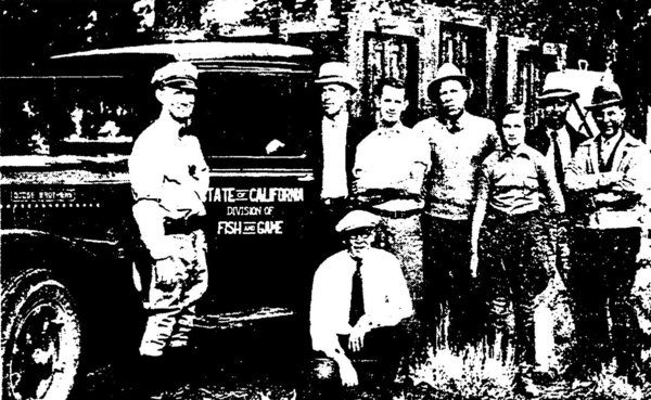
A November 16, 1933 Los Angeles Times column describes how a "truckload" of Yosemite bears were released at Big Bear
A hungry bear will go just about anywhere – and do just about anything – to find food. But the black bears of Southern California can trace their lineage some 300 miles north, to ancestors whose antics got them kicked out of a national park.
By Kate Mather
August 5, 2013
Los Angeles Times
On a mid-November day in 1933, seven men and one woman crowded around a pickup parked near Big Bear Lake, wooden crates stacked high in the bed.
The cargo came from Yosemite National Park, part of a pilot program that officials hoped would flourish in the forests of Southern California. The containers were opened and the group waited, a camera at the ready.
Then came the bears.
“One bear leaped from the open door of its cage, charged at the camera and when within a dozen feet of it, suddenly sat down and quietly studied the strange contraption,” a Los Angeles Times article reported, “allowing plenty of time for a picture before it scampered off into the woods.”
The six black bears that tumbled out of the crates and into the wild that day weren’t just any animals. Along with 21 others sent south from Yosemite, they were the forefathers of the bears that roam the San Bernardino and San Gabriel mountains today
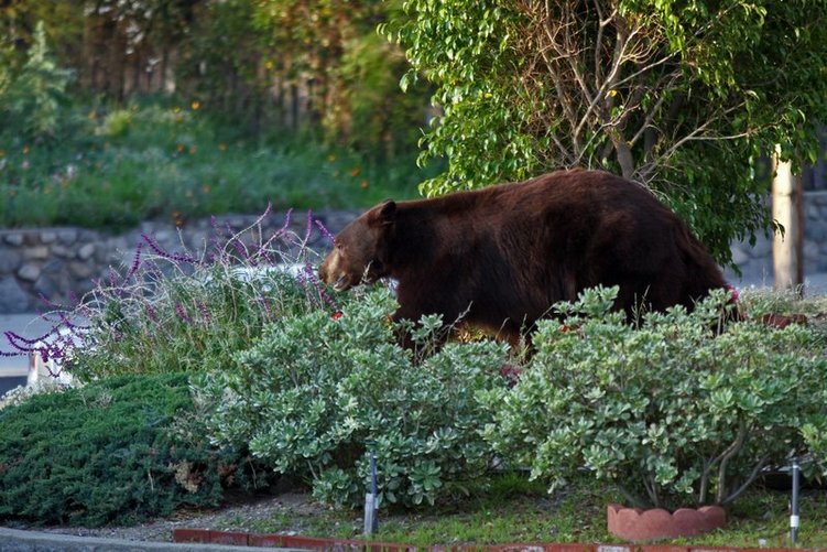
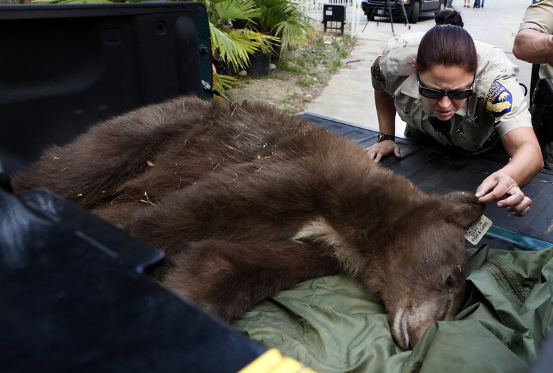
A black bear weighing more than 400 pounds strolls through the frontyard of a home in La Crescenta. The bear was relocated after being shot with four tranquilizer darts. (Irfan Khan, Los Angeles Times)
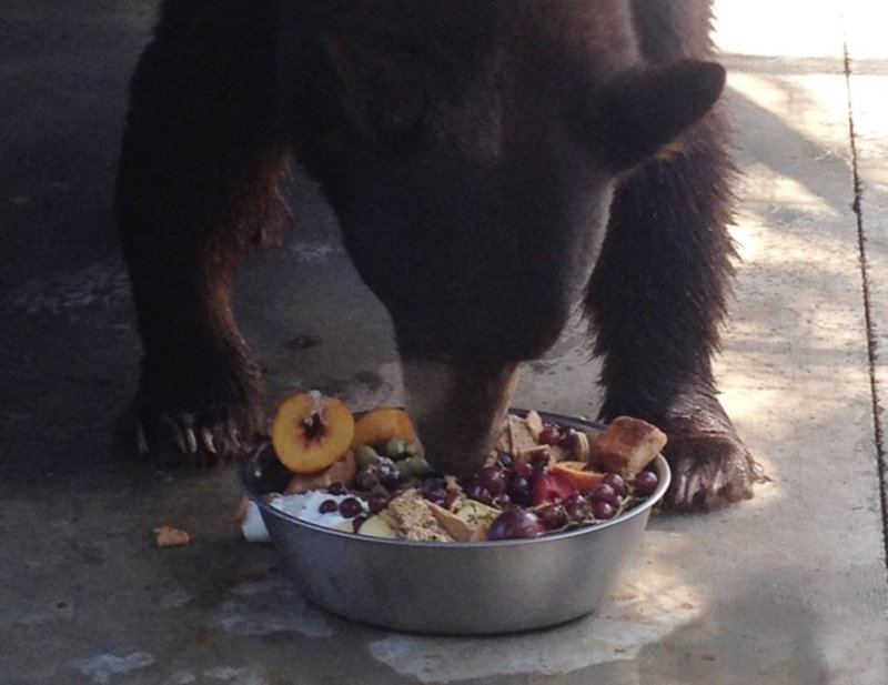
Everyone knows Southern California’s celebrity bears: Glen Bearian, whose appetite for frozen Costco meatballs helped him earn 10,000 Twitter followers, and Samson, who fancied avocados and splashing in Monrovia’s Jacuzzis.
But these bears might just have mischief in their DNA: Their ancestors earned a one-way ticket south with high jinks of their own that exasperated wildlife officials — and entertained tourists.
“If they thrive, they will become a real attraction to the thousands of visitors who spend summers and weekends in the mountain playgrounds,” a December 1933 report by the state Fish and Game Commission read. “Their comical, clownish appearance and actions are a never-ending source of amusement to youngsters and adults alike.”
In other words, like father, like son.
The “bear pits” built in Yosemite in the 1920s and ’30s weren’t as glamorous as those in Yellowstone National Park — those had bleachers — but were popular just the same.
Rangers would dump trash on the platforms and encourage visitors to watch the bears feast; one 1938 park document notes that six to eight bears showed up to nightly feedings, except when the arenas flooded, “spoiling this evening feature.”
“The emphasis was on visitor entertainment,” said Steve Thompson, who heads Yosemite’s wildlife management division.
“I’m glad I wasn’t a ranger back then,” he joked.
Both the humans and the bears grew bolder. Visitors tried to feed the animals themselves, while the bears resorted to unruly behavior in their search for dinner, raiding cabins and ice chests looking for food.
Enter J. Dale Gentry, a San Bernardino businessman who became the president of the state Fish and Game Commission.
At the time, there were no black bears in Southern California. As more bears flooded the Yosemite Valley, Gentry “expressed a desire” to bring some south.
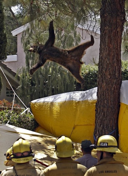
A bear falls out of tree tranquilized by Department of Fish and Game
“They were killing two birds with one stone,” Thompson said.
But the implications of the decision became increasingly noticeable as people flocked to the foothills, neighborhoods creeping higher up the hillsides and closer to the bears’ turf. Wildlife officials had a new concern — one they still face today.
How do you balance the needs of the bears and the people?
Marc Kenyon, who heads the state’s black bear program, believes they would have wandered down to Southern California on their own — the mountains were an open range, and the state’s growing bear population has spread to previously uninhabited areas, such as Monterey County.
“I think that all we did in the 1930s was speed up the process,” he said.
No matter how long it would have taken them to trek south, the result now is the same.
“When you have so many bears and so many people,” Kenyon said, “you’re going to have conflicts erupting.”
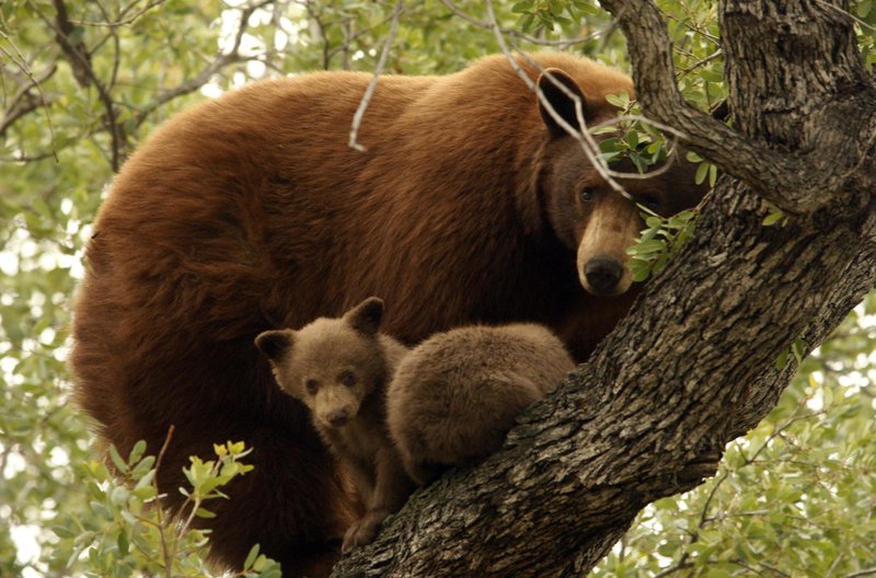
Keith Miller had just stepped outside his Altadena home to get the paper one May morning in 2012 when he saw it: a cinnamon-colored bear, who had been snacking on some leftover birthday cake thrown in the garbage the night before.
Miller did an about-face and started back for the house.
“I thought, ‘What the hell?’” he said. “So then I turned around.”
The bear turned around too.
“I said, ‘Whoa,’ and I looked up into the tree and saw two cubs,” Miller said. “I thought, ‘I’m out of here. Feet don’t fail me now.’”
But he soon shrugged the sighting off and went to the gym. When he came back, reporters and sheriff’s deputies were camped outside.
The bear and her cubs had settled down for a nap in a large oak tree curling over Miller’s driveway.
The bear seemed very familiar with the neighborhood, his wife, Judy, said. “That bear’s been here before.”
Of the 28 bears caught in Yosemite for relocation, one died during the trapping and transport, but the rest found new mountain homes in sunny Southern California.
Eleven were released near Crystal Lake in Los Angeles County, 10 in Santa Ana Canyon and six near Big Bear Lake. Their arrival was recorded in newspaper articles, one of which noted the concerns of area beekeepers, who worried their hives would become a target for a honey-loving bear.

Bears tipped over the trash can in Justin Lee's Monrovia home.
Before the bears were let loose, one Los Angeles Times article warned residents they “should not be surprised if they find, not the wolf, but a congenial bear sniffing at their doors.”
Sure enough, just days after the crates were opened at Big Bear Lake, one of the bears wandered 40 miles to what was then known as Cucamonga, “terrorizing children and housewives” as it walked city streets. It then made its way to Chino, devouring chickens and bothering beehives along the way.
The bear eventually scampered up a eucalyptus tree, where game wardens tried to lure it down with food, according to a Nov. 21, 1933, article in The Times. That didn’t work, and neither did “a few clouts with a club.”
Wardens then decided to build a cage at the base of the tree and wait the bear out. After a few days, it eventually “tired of tree-sitting,” the article said, “and clambered down.”
“The cage popped shut, making him a prisoner.”
Justin Lee was working upstairs at the Monrovia home he shares with his mother one March day when their Maltese-poodle mix started barking.
The dog didn’t stop, so Lee, 25, went to the staircase, where the dog stood staring at their living room. The sliding glass door leading from the backyard had been pried open and a bear had poked its head inside.
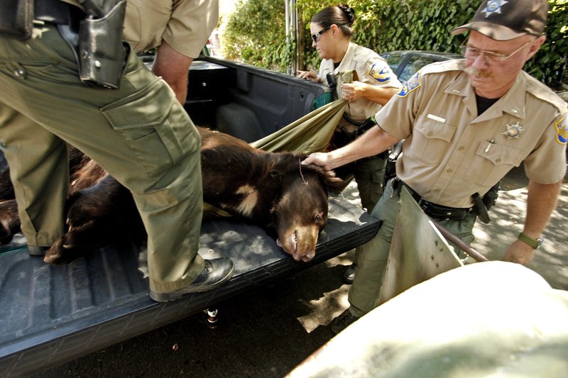
California Department of Fish and Game wardens Don Nelson, from left, Ilia Banks and Lt. Martin Wall, transfer a tranquilized bear into a cylinder-like trap with an exit door that will transport him back to the forest in Glendale. The bear became known to his social media fans as "Glen Bearian" and "Meatball." (Genaro Molina / Los Angeles Times
Lee grabbed the dog and ran into his bedroom. He called the police and glanced out the window, hoping the bear had left.
But another bear, twice the size of the first, was in the backyard, heading for the house. Lee heard the two rummaging through the rooms downstairs.
Wardens eventually waited the animals out, letting them leave Lee’s home on their own and roll around a flower garden before shooing them back into the forest with rubber bullets.
Lee said the bears went for some of his mother’s Chinese food left on a kitchen table, knocking dishes to the ground and tipping the trash can as they scooped the food off the plates.

A bear found himself inside Justin Lee's Monrovia home back in March 2013.
“They were surprisingly pretty clean eaters,” he said.
As officials hoped, the bears of 1933 thrived in Southern California.
The proof lies in research published by a UC Davis team in 2009. After analyzing teeth and gum tissue from more than 500 bears collected by hunters and researchers across the state, the team found that the DNA taken from the San Gabriel and San Bernardino animals were almost identical to those from the central Sierra Nevada, where Yosemite sits.
“The genetic similarity between Southern California bears and Yosemite-area bears was striking,” Holly Ernest, who led the research, wrote in an email. “That was important evidence to indicate that the bears moved there in the 1930s survived and produced offspring and family lines that exist to the current time.”
But was it a good idea to move the bears south? Kenyon, the state expert, declined to answer, saying he didn’t want to second-guess the decisions others made.
“I don’t think anybody in the ’30s anticipated the number of people and the human communities growing so fast in the area — that’s been a challenge,” he said. “Our bear population growing down there has also been a challenge.
“But I think that at some point, they would have reached this point. If it’s not a challenge for me, then it is for somebody two generations down the road from me.”
Complicating matters, he added, is the intense connection between a bear’s already-strong sense of smell and its memory. Bears remember when and where they find food — and will come back for seconds. Some, Kenyon said, have even been known to show up “at the same doorstep year after year at roughly the same date.”
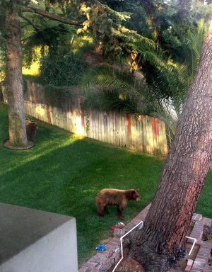
“Once a bear associates a specific location in time and space with food, that registers in their mind,” Kenyon said. “And they never seem to forget it.”
About three weeks after his encounter in Monrovia, Lee said one of the bears came back. He again watched from the staircase as the bear pawed at the sliding door. Lee knew it was locked, but worried that it hadn’t latched.
The bear eventually gave up and lumbered away. Lee went downstairs to investigate. The bear, it turns out, had slid the screen door open — but not the glass.
“They remembered their point of entry,” Lee said. “It was using the exact same method.
“It’s gotta be the same bears.”
Burned Area Emergency Rehab Team (BAER)
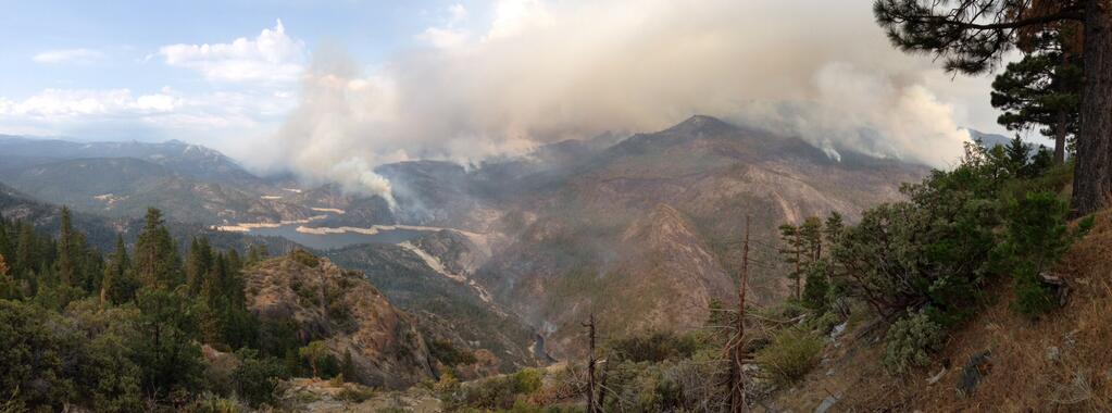
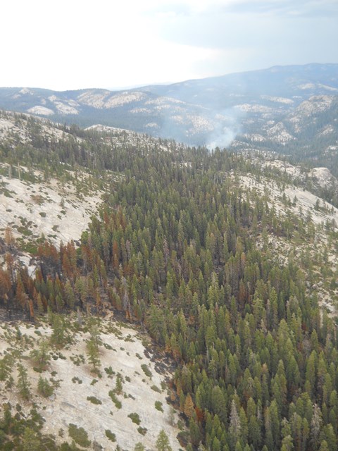
View of Mammoth Pool Reservoir looking south. Foreground and background has areas of high and moderate burn severity, as well as unburned areas.The Burned Area Emergency Response Team (BAER) for the Aspen Fire is working to complete its assessment and recommendations to lessen immediate hazards to public resources from effects of the fire. The team is led by geologist Alan Gallegos from the Sierra National Forest. The BAER team is made up of specialists from various disciplines; including hydrologist, soil scientists, geologists, road engineers, ecologists, botanists, and archaeologists. Team members have already started assessing the fire area to address potential values at risk related to life and property, water quality and critical plant and wildlife habitat.Burned Area Emergency ResponseThe purpose of the BAER assessment is to analyze fire effects on soils and watersheds, determine the potential for negative effects, and consider possible treatment options. The potential threat to life and property are always the number one concern and is the first focus of the burned area assessment. Forest roads including the Stump Springs road are a major concern from flood flows and rocks falling onto the road bed. Other values at risk are Mammoth Pool Reservoir and the hydropower facilities downstream of the fire. Soil productivity, water quality, and cultural resources are also potential values at risk when wildfire burns through an area followed by large storms, particularly during the first and second year following the Fire. The loss of natural vegetative cover allows water to runoff across bare soils with increased velocity. Fire also induces water repellency of varying degrees, reducing water infiltration, and increasing runoff. The net result under extreme conditions is a loss of soil, a loss of water control, and significant risk of flooding and debris flows downstream of the fire. BAER treatments such as hill slope mulching maybe recommended. Road storm proofing, storm patrol and culvert cleaning are important. Treatments may also prevent permanent loss of habitat for threatened and endangered species; and the spread of noxious weeds. Interagency coordination is necessary where downstream values at risk occur on private lands.
Basic InformationIncident TypeBurned Area Emergency ResponseBAER Team LeaderAlan Gallegos
Canadian Bears Got the Groove
Maybe that River Plan should include shipping Canadian bears to Wawona for a little "pole dancing" workshop. And while we're at it, we should have them ice skate in the Curry rink and rent a few bicycles. Then, rent a raft and float down the Merced. Might as well have them enjoy their stay before all that is gone...
Visit NBCNews.com for breaking news, world news, and news about the economy
Bulky Items Pick Up Rescheduled
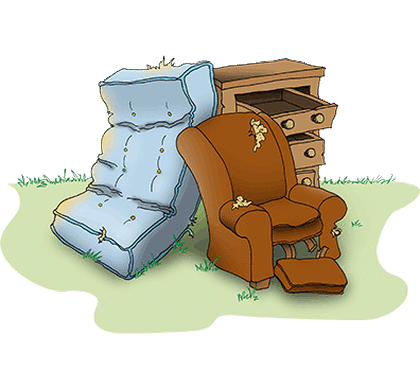
Due to staff shortages at the Landfill, we were unable to schedule the large item pick up on September 7th. The best we could do was September 14th. A flyer will be out soon.
John Carrier
Mariposa County
Supervisor District V
5100 Bullion St.
PO Box 784
Mariposa, CA 95338
209-966-3222
209-966-5147 Fax
[email protected]
Open House
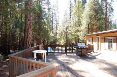
Bill & Kara Rosenberg, will be hosting an Open House on Friday, September 6, 2013.
There will be modest live music, an acoustic trio, on the deck and light refreshments.
Please stop by at 7979 Chilnualna Falls Road (AKA Cabin 42R), next to Deadhorse Creek, between 4 and 7 pm. Just slow down for the Little Green Man and you will be there.
Thanks,
-----Bill Rosenberg <[email protected]> 7979 Chilnualna Falls Road
Wawona, CA 95389
209-375-6558 Wawona
650-387-0166 Cell
Yosemite Bears Never This Hungry
Visit NBCNews.com for breaking news, world news, and news about the economy
Yosemite Conservancy invites you to the Fall Gathering in Wawona on October 5!
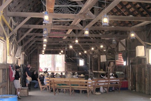
Meet Yosemite National Park leaders, listen to inspirational speakers, go on educational walks with naturalists and dance the night away in the Gray Barn. Bring the whole family to enjoy a day in Yosemite National Park. All 2013 donors of $25 or more are invited to join us for this great event.
For more information, including itinerary details, hotel reservations, courses offered and registration, please visit
YosemiteConservancy.org/FallGathering
Hotel reservations must be made by August 26. Reservations are confirmed on a first-come, first-served basis (hotel rooms fill up quickly). The event registration deadline is September 25.
If you have questions, please contact Sarah Campbell at 415-434-8446 x329 or [email protected]
See you in the park!
Water Conservation

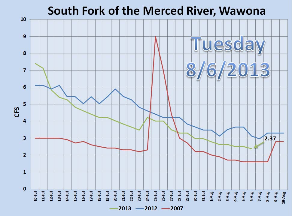
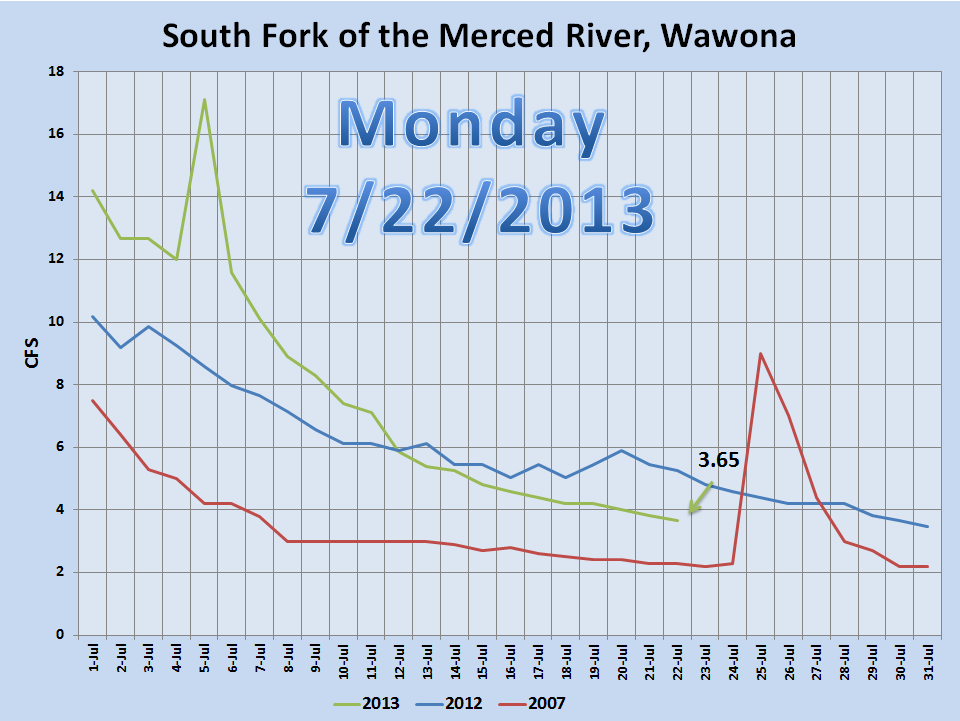
Dear Wawona community and friends: We continue to experience a very dry spring and summer and the water levels in the South Fork Merced have continued to decline. Yesterday, the South Fork Merced dipped below 3 cubic feet per second (cfs) – please exercise all water conservations measures possible and consult the Yosemite Water Conservation Plan. What to expect:Informative signs will be installed in the Wawona Campground. Entrance stations will advise campers about the water shortage and the need for water conservation. Park staff and volunteers will pass on conservation information during public contact opportunities and all interpretive programs. For residents, we ask that you review the Water Conservation Plan and practice these measures in the coming months as we continue into the driest part of the year. Some key measures we are asking you to do to help us all to conserve water are: · Check faucets, toilet, pipes, and other water sources for leaks and have them fixed. · Take shorter showers and install water-saving shower heads or flow restrictors. · Don‘t let the water run when brushing your teeth or shaving. Use a wash basin. · Don’t let the faucet run while preparing food or cleaning, and use your automatic washing-machine only for full loads. · Use a broom to clean driveways, sidewalks, and steps, and don’t run the hose while washing your car. · Water your lawn only when it needs it and only on cool and calm days. In Wawona, domestic water use will always take precedence over the irrigation of lawns. Now that the water levels have dropped below 3 cfs, there will be no irrigation of the Wawona Hotel lawns from the Wawona Water System. However, reclaimed water will be available for golf course irrigation. For a complete list of conservation measures, please refer to appendix B in the Water Conservation Plan. If you have any questions, please contact District Ranger Eric Scott at: 209-375-9520. We thank you for your attention and support as we all address this important issue. Through our combined efforts, we can work to maintain adequate domestic water use while still preserving the ecosystems of Yosemite National Park. - Don Neubacher, on behalf of the Executive Leadership TeamUseful Links: Water Conservation Plan http://www.nps.gov/yose/parkmgmt/op_plans.htm Yosemite hydrology http://www.nps.gov/yose/naturescience/hydrology.htm Water gauge at Wawona http://cdec.water.ca.gov/cgi-progs/queryFx?s=smw
--
Jana Friesen McCabePublic Involvement and Outreach
vox: 209/372-0288
--
Sean McCabeRealty Officer - Land Resources ProgramOffice of the SuperintendentYosemite National Park
209 372-0459 office
--
Jana Friesen McCabePublic Involvement and Outreach
vox: 209/372-0288
--
Sean McCabeRealty Officer - Land Resources ProgramOffice of the SuperintendentYosemite National Park
209 372-0459 office
South Fork Water Level Extremely Low
The water level in the South Fork has reached unusually low levels. Please conserve water!
Smoky Conditions throughout the Central Sierra of California
Ways to Reduce Your Exposure to Smoke

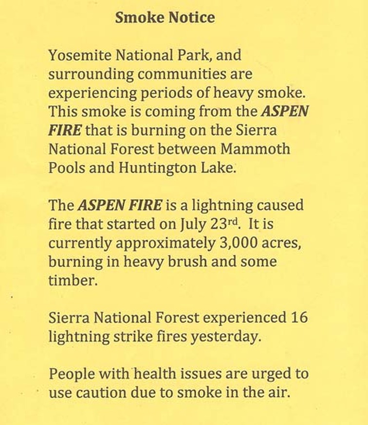
Wildfire is a reality in California and, with fire, there is smoke. Residents of the Central Sierra of California are experiencing smoky conditions because of the Aspen Fire burning on the Sierra National Forest.
Residents can take some basic steps to reduce their exposure to smoke:
- Close windows when smoke is present.
- Avoid prolonged exertion in heavy smoke especially if you are sensitive to smoke impacts.
- The young and the elderly are more sensitive to smoke impacts and should make extra efforts to limit their exposure to smoke.
- People with pre-existing conditions such as asthma or pulmonary disease are also more sensitive to smoke. Consult your physician for further guidance.
- Drink lots of water, eat a balanced diet, and get adequate rest. A healthy immune system is the best protection against the effects of smoke.
For additional information about the Aspen Fire, visit Inciweb or Twitter…
Aspen Fire Update
The fire burned actively throughout the day on Thursday growing to 4,500 acres and reached the slopes above the east side of Mammoth Pool Reservoir. On Friday firefighters will continue to construct firelines and aircraft will be utilized when possible. Heavy smoke and steep terrain makes access to the fire difficult and has inhibited the use of aircraft.
The wind on Friday should be a little stronger than on previous days, increasing to 8 to 10 mph out of the southwest in the afternoon. This may help the visibility problem for the aircraft, but could promote growth of the fire.
The wind on Friday should be a little stronger than on previous days, increasing to 8 to 10 mph out of the southwest in the afternoon. This may help the visibility problem for the aircraft, but could promote growth of the fire.
Aspen Fire
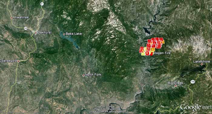
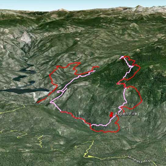
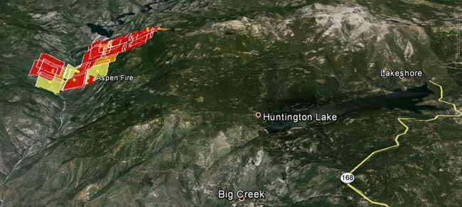
A new fire on the Sierra National Forest in California could turn out to have some potential. Started by lightning, the 2,500-acre Aspen Fire is in an area that last burned in 1938. The Forest got hammered by lightning over the last few days and this is one of 15 fires, but all of the others are less than a quarter of an acre. Estimating from the heat detected by a satellite, (shown in the two maps) it is approximately three miles long by one mile wide, just south of Mammoth Pool Reservoir, 16 miles south of Yosemite National Park, and 5 miles northwest of Huntington Lake.
Evacuations are occurring at Sample Meadow and West Kaiser Campgrounds.
The South Central Sierra Incident Management Team, with Incident Commander David Cooper, will be assuming command of the fire at 6 p.m. Wednesday.
It is burning in very steep country, with the elevation varying from 2,600 feet in the drainage to almost 7,000 near the head of the fire.
The weather forecast for the fire area on Thursday calls for moderate conditions — 92 degrees, west to southwest winds of 2 to 9 mph, 25 percent cloud cover, and a relative humidity around 30 percent. However the extremely dry drought-affected vegetation could bump up the fire behavior to levels higher than warranted strictly by the weather conditions. You can monitor the real time weather at the Minarets weather station 6 miles north of the fire.
Aspen Fire Smoke Notice
Water Conservation
Dear Wawona communities and friends,
This winter and spring have been exceptionally mild with regard to rain and snowfall. Like 2012, 2013 may go down as one of the driest years on record for Yosemite National Park. As a result, water levels in the rivers and streams are low for June and early July. Current data shows that the water level in the South Fork Merced River is dropping quickly and there is no significant precipitation forecasted in the near future.
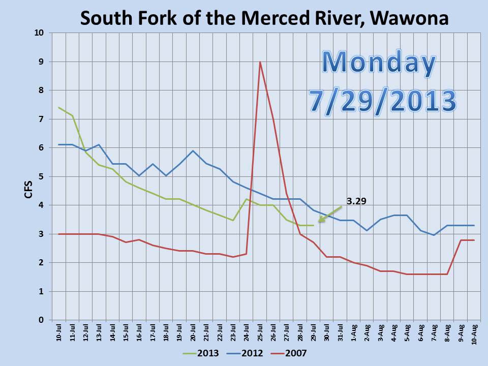
Water conservation measures are mandatory when flow rates drop below 6 cubic feet per second (CFS) in the South Fork Merced. As of July 11, the river-gauge has measured below 6 CFS (see chart below) which means that the Wawona community will need to implement conservation measures. We anticipate that the South Fork Merced will remain below these levels until significant rainfall occurs. We ask that residents and employees begin implementing the guidance and direction from water conservation plan. There is also a list of recommended measures below.
Attentive conservation measures are our best approach to ensure that water is available where needed for safety and health purposes, as well as protection of park resources. We ask that you consider your water consumption in the coming days and weeks and look for ways to conserve it. We will continue to share more information about the water levels and conservation practices as necessary.
We thank you for your attention and support as we address this important community issue. Through our combined efforts, we can work to maintain a sufficient water supply while still preserving the ecosystems of Yosemite National Park.
Here are some measures we are suggesting you take to help conserve water:
· If you see a leaky faucet or waterline, please fix it or let the owner know
· Wash vegetables over dish pans and bowls. Reuse leftover water for cleaning or watering of plants, etc.
· Catch shower water in a clean container while waiting for preferred water temperature. Use this water for cooking, cleaning, watering, etc.
· Take shorter showers. In the shower, get wet and then turn off the water for showering and cleaning. Restart and use water to rinse.
· Turn off the water while brushing your teeth.
· Only wash clothing when absolutely necessary. Consider using laundry services in other communities that are not under water restrictions.
· Water will be "on request only" at the dining room and other restaurants.
· Lawns around the hotels will only be watered in the early morning hours. We will stop watering should extensive conservation measures be put into place.
Water conservation is everyone’s issue. Last year we managed to cut water consumption in half. I believe that together we can achieve similar success in conserving our water this summer. Thank you for your efforts and continued attention on this important matter.
Don Neubacher, on behalf of the Executive Leadership Team.
The Wawona Friends of the Bassett Memorial Library are hosting a reception for local artist, Eve Davidson on Sunday, July 28, 2013 at 7 p.m. in the library. A painter since her teen years, Eve is inspired by people and nature. For Eve, art is a visual story of things that gladden or worry the heart, an expression of self, ones surroundings, hopes, and possibilities. Art can be a reality that perhaps others cannot see until it is drawn for them. Eve’s show in the Wawona library, which runs through the end of August, is her first art show. In addition to her art, Eve also is a poet, an author, and a musician. Join the Wawona Friends of the Library as they introduce Eve Davidson to Wawona. Refreshments will be served. There is no charge.
Wawona Water Conservation

Dear Wawona communities and friends,
This winter and spring have been exceptionally mild with regard to rain and snowfall. Like 2012, 2013 may go down as one of the driest years on record for Yosemite National Park. As a result, water levels in the rivers and streams are low for June and early July. Current data shows that the water level in the South Fork Merced River is dropping quickly and there is no significant precipitation forecasted in the near future.
Water conservation measures are mandatory when flow rates drop below 6 cubic feet per second (CFS) in the South Fork Merced. As of July 11, the river-gauge has measured below 6 CFS which means that the Wawona community will need to implement conservation measures. We anticipate that the South Fork Merced will remain below these levels until significant rainfall occurs. We ask that residents and employees begin implementing the guidance and direction from water conservation plan. There is also a list of recommended measures below.
Attentive conservation measures are our best approach to ensure that water is available where needed for safety and health purposes, as well as protection of park resources. We ask that you consider your water consumption in the coming days and weeks and look for ways to conserve it. We will continue to share more information about the water levels and conservation practices as necessary.
We thank you for your attention and support as we address this important community issue. Through our combined efforts, we can work to maintain a sufficient water supply while still preserving the ecosystems of Yosemite National Park.
Here are some measures we are suggesting you take to help conserve:
If you see a leaky faucet or waterline, please fix it or let the owner know.-Wash vegetables over dish pans and bowls. Reuse leftover water for cleaning or watering of plants, etc. -Catch shower water in a clean container while waiting for preferred water temperature. Use this water for cooking, cleaning, watering, etc.-Take shorter showers. In the shower, get wet and then turn off the water for showering and cleaning. Restart and use water to rinse. -Turn off the water while brushing your teeth.-Only wash clothing when absolutely necessary. Consider using laundry services in other communities that are not under water restrictions. -Water will be "on request only" at the dining room and other restaurants.-Lawns around the hotels will only be watered in the early morning hours. We will stop watering should extensive conservation measures be put into place.
Water conservation is everyone’s issue. Last year we managed to cut water consumption in half. I believe that together we achieve similar success in conserving our water this summer.
Thank you for your efforts and continued attention on this important matter. (M. Gauthier)
Yosemite Fire - Update #7 – July 18, 2013
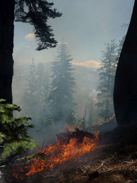
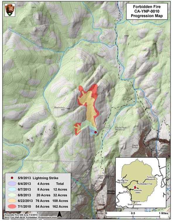
Forbidden (37 45.485 x -119 37.116; 7,400” el., Mariposa CO.) This lightning caused fire continues to moderate in activity and remains at approximately 165 acres. This fire began May 21, when a single tree was struck by lightning. The fire is west of the Eagle Peak Meadow and Creek, a tributary of Yosemite Creek, and is north of Eagle Peak, on the north rim of Yosemite Valley. It is burning through a predominately red fir forest.
The fire is showing minimal activity. The most active part of the perimeter and where smoke is showing the most is to the north east corner. The fire continues to slow as it smolders and creeps through sparse vegetation and other surface fuels in fields of decomposed granite. Periods of increased fire behavior and smoke may increase due to continued warm weather. Sparse fuels might prevent noticeable increases. Parts of the fire have been observed with 6-12 inch flame lengths as it burns through short brush patches and trees.
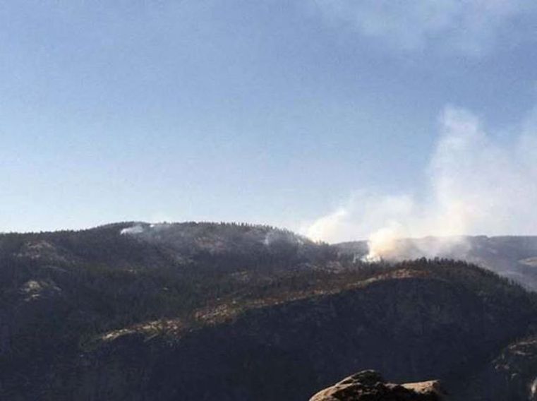
Although smoke is visible from various locations in the park, including Tioga Rd, Sentinel Dome and Glacier Point, there have been no smoke impacts to Yosemite Valley. Fire managers are working with Mariposa County Air Pollution Control District concerning potential air quality impacts to nearby smoke sensitive areas.
Fire crews utilized natural barriers to check the fire spread to the south on June 10. They last hiked into the fire area July 12, to further monitor the fire for growth, direction of spread, fire behavior and smoke production.
The Forbidden Fire meets the park’s fire management objectives of firefighter and the public safety, as the fire presents few risks to values. The fire poses no threat to park service buildings, roads or infrastructure. When appropriate, fire crews will utilize pack stock for logistical support on this fire in an effort to preserve wilderness character.
The fire was named for the Forbidden Wall along the Yosemite Falls trail.
For additional information:
· Fire Information: [email protected]; (209) 375-9574 or 372-0480
· Yosemite National Park Web page: http://www.nps.gov/yose/parkmgmt?current_fire.htm
· Yosemite Air Quality Web page: http://www.nps.gov/yose/naturescience/agmonitoring.htm
· Yosemite Wildland Fire Facebook: http://www.facebook.com/pages/Yosemtie-Wildland-Fire/124632964255395
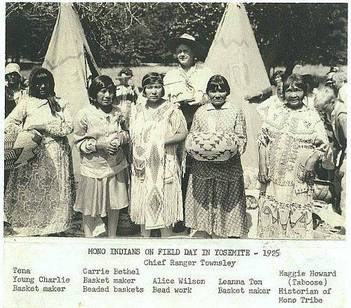
A Glimpse of the Wawona Miwok
SPECIAL PROGRAM !
A glimpse of the Wawona Miwok
Program is about 1 hour long.
Saturday July 13
at 1:00 pm
Meet at the Mountaineer Cabin in the
Pioneer Yosemite History
Center.
A glimpse of the Wawona Miwok
Program is about 1 hour long.
Saturday July 13
at 1:00 pm
Meet at the Mountaineer Cabin in the
Pioneer Yosemite History
Center.
Public Notice!
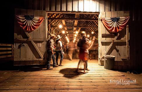
The National Park Service
cordially invites you to a
Barn Dance
8:00 pm to 10:00 pm
Saturday July 13
Pioneer Yosemite History
Center
in the Grey Barn
Beginners Welcome!
Instruction Provided!
cordially invites you to a
Barn Dance
8:00 pm to 10:00 pm
Saturday July 13
Pioneer Yosemite History
Center
in the Grey Barn
Beginners Welcome!
Instruction Provided!
The Gold Dust Dancers
The National Park Service and The Gold Dust Dancers cordially invite you to a
Barn Dance
7:00 pm – 9:30 pm
Saturday July 20
Pioneer Yosemite History Center
in the Grey Barn
Beginners Welcome!
Instruction Provided !
Barn Dance
7:00 pm – 9:30 pm
Saturday July 20
Pioneer Yosemite History Center
in the Grey Barn
Beginners Welcome!
Instruction Provided !
Plane, Body of Missing Pilot Found Near Vogelsang
Santa Maria Times
The body of Solvang pilot Nicol Wilson, missing since December, has been found in Yosemite National Park, a spokeswoman said Monday.
Wilson, the only occupant of a single-engine 1966 Mooney M20F, left Dec. 17 from Santa Ynez Airport and was reported missing by his family that evening when he failed to arrive on schedule at Mammoth Lakes Airport, on the east side of the Sierra Nevada.
Due to heavy snowfall and strong winds in December, search efforts — which had turned up no clues or signs of the aircraft — were suspended until weather and snow conditions improved.
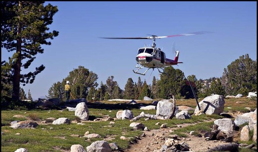
A park visitor Saturday near Vogelsang High Sierra Camp, an area in the rugged high country of Yosemite National Park, spotted the plane, which was largely intact, said Kari Cobb, a spokeswoman for Yosemite National Park.
On Sunday, Yosemite National Park Rangers hiked to the location and the body has been positively identified as Wilson, she said.
The four-seat aircraft disappeared from radar near North Dome. Aerial search efforts began Dec. 18 but were stalled by poor weather and lack of visibility.
More than 5 feet of new snow had accumulated at the higher elevations of the park, including the search area off Tioga Pass between 8,000 and 10,000 feet, roughly 600 square miles.
The plane will be removed from the backcountry over the next several weeks by Yosemite National Park rangers, Cobb said.
Yosemite Fire - Update #6 – July 3, 2013
Forbidden (37 45.485 x -119 37.116; 7,400” el., Mariposa CO.) This lightning caused fire is approximately 165 acres. A single tree was struck by lightning on May 21, 2013. The fire is west of the Eagle Peak Meadow and Creek, a tributary of Yosemite Creek, and is north of Eagle Peak, on the north rim of Yosemite Valley. It is burning through a predominately red fir forest.
The fire is showing minimal activity. The most active part of the perimeter and where smoke is showing the most is to the north east corner. The fire continues to slow as it smolders and creeps through sparse vegetation and other surface fuels in fields of decomposed granite. Fire behavior and smoke may increase later in the week, due to the continued warming trend. Sparse fuels might prevent noticeable increases. Parts of the fire have been observed with 6-12 inch flame lengths as it burns through short brush patches and trees.
Although smoke is visible from various locations in the park, including Tioga Rd, Sentinel Dome and Glacier Point, there have been no smoke impacts to Yosemite Valley. Fire managers are working with Mariposa County Air Pollution Control District concerning potential air quality impacts to nearby smoke sensitive areas.
Fire crews utilized natural barriers to check the fire spread to the south on June 10. They last hiked into the fire area June 21 to further monitor the fire for growth, direction of spread, fire behavior and smoke production.
The Forbidden Fire meets the park’s fire management objectives of firefighter and the public safety, as the fire presents few risks to values. The fire poses no threat to park service buildings, roads or infrastructure. When appropriate, fire crews will utilize pack stock for logistical support on this fire in an effort to preserve wilderness character.
The fire was named for the Forbidden Wall along the Yosemite Falls trail.
For additional information:
- Fire Information: [email protected]; (209) 375-9574 or 372-0480
- Yosemite National Park Web page: http://www.nps.gov/yose/parkmgmt?current_fire.htm
- Yosemite Air Quality Web page: http://www.nps.gov/yose/naturescience/agmonitoring.htm
- Yosemite Wildland Fire Facebook: http://www.facebook.com/pages/Yosemtie-Wildland-Fire/124632964255395
Snow Plants - New Video from Yosemite Nature Notes
Story Time at Wawona Library

Thursday, July 11
Parent-Tot time
Ages 3-6
3:00
Kids' Zone
Ages 6-11
4:00
30-minute class
· stories
· music
· games
· FUN!
