WawonaNews.com - August 2017
Small Animal Shelter in Fish Camp
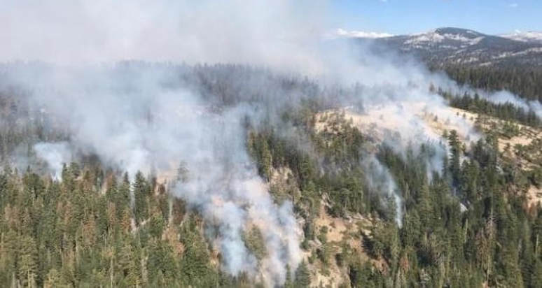
Incident: South Fork Fire Wildfire
Released: 8:30 AM, Aug. 20
The Central Ca Animal Disaster Team has activated a small animal emergency shelter in Fish Camp. The location is the OLD volunteer Fire Station, 7724 Summit Road. It is the red building with the green roof directly off of Highway 41. Please TEXT the CCADT at 559-433-9663 any other information you may require.
South Fork Fire Update For Sunday, August 20, 8 AM
Inciweb 8/20, 8 AM
The fire grew minimally yesterday as thunderstorms skirted the perimeter. Mandatory evacuations will remain in place in Wawona for the area east of Highway 41 on Forest Dr. and Chilnualna Falls Rd.
The fire remains active in all divisions. Crews are working in steep and inaccessible terrain with heavy fuel loads. Firefighters will continue to strengthen the firelines located east of Wawona and suppress spot fires occurring on the south of the South Fork of the Merced. A combination of firing operations, air support, and direct line construction will continue.
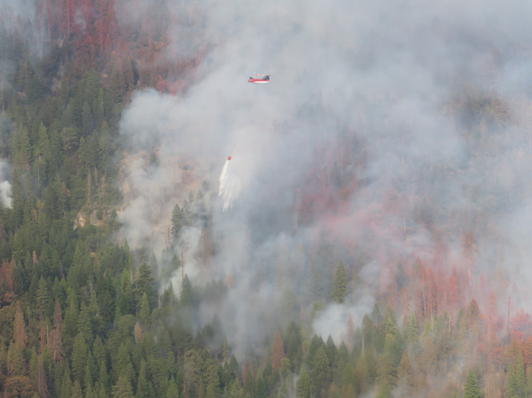
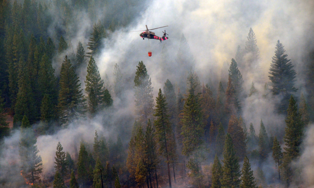
Aircraft will assist ground crews when conditions allow generally beginning mid-day. Strategic objectives remain the same: utilize air and ground resources to hold the western and southern flanks while monitoring the northern and eastern edges. Minimal Impact Suppression Tactics are being used in the Yosemite Wilderness to manage the area of the fire, using natural barriers such as rocks or streams, trails, and other minimal disturbance methods to contain the fire.
Thunderstorm activity is expected to cause erratic winds over the fire area throughout the week.
There are currently 522 personnel assigned to the fire: 13 hand crews, 7 helicopters, 13 engines.
For additional information:
Current as of8/20/2017, 11:19:21 AM
Incident TypeWildfire
CauseUnknown
Date of OriginSunday August 13th, 2017 approx. 02:30 AM
Location.75 mile east of the community of Wawona
Incident CommanderDeron Mills
Incident DescriptionSupression
Current Situation
Total Personnel522
Size3,191 Acres
Percent of Perimeter Contained10%
Estimated Containment DateSunday September 03rd, 2017 approx. 12:00 AM
Fuels InvolvedTimber (Litter and Understory) Brush (2 feet)
Significant EventsActive, running, torching
Outlook
Planned ActionsHolding operation and line construction continue on the west flank of the fire. Suppression of spot fire west of Division A continues. Spot fire in Division X continue to show up and require suppression activity. Strengthening of contingency lines around the community of Wawona. Natural barriers are being utilized as much as possible. As inversions lift, air resources are utilized to aid crews in line construction. Security for area closures and security in evacuated areas.
Projected Incident Activity12 hours: Mandatory evacuations will remain in place for Wawona. Fire remained active along the western and southern flanks following yesterday's thunderstorms. Crews continued to strengthen contingency lines located east of Wawona. Heavy inversions continue to grounded aircraft until late afternoon, when these inversions lift fire activity increases.
24 hours: Mandatory evacuations will remain in place for Wawona. Continue to aggressively suppress fire spread toward community of Wawona on west flank of fire. Continue to aggressively suppress spot fires occurring south of the South Fork Merced River. Additional water drops along spot fires on southern flank.
48 hours: Mandatory evacuations will remain in place for Wawona. Continue to aggressively suppress fire spread toward community of Wawona on west flank of fire.
72 hours: Secure south edge of fire and keep contained to south fork of Merced, secure west flank.
RemarksThunderstorm activity is expected to cause erratic winds over the fire area throughout the week. Gusty erratic winds associated with thunderstorms yesterday caused spot fires west of the fireline in Division A and also across the South Fork of the Merced River on the Sierra National Forest. Crews continue suppression efforts on these spots. The fire is located in the South Fork Drainage of the Merced River, very steep and inaccessible terrain. Crews continue to spike in an effort to utilize as much daylight as possible. The west flank of the fire is approximately 3/4 mile east of Wawona. The fire continues to pose a threat to Wawona, the Mariposa Grove of Giant Sequoias. A combination of firing operations, air support, direct line construction and use of natural barriers are the current tactics being implemented to meet protection objectives.
Current Weather
Weather ConcernsA chance of thunderstorms will continue over the Sierra Nevada Sunday afternoon. The best chance of storms will be primarily north of Sequoia National Park. A trough off the California coast will provide a moderate easterly flow aloft bringing a few showers or thunderstorms into the foothills during the evening on Sunday and Monday resulting in an increased threat of thunderstorms over the mountain and desert areas through mid week.
The fire grew minimally yesterday as thunderstorms skirted the perimeter. Mandatory evacuations will remain in place in Wawona for the area east of Highway 41 on Forest Dr. and Chilnualna Falls Rd.
The fire remains active in all divisions. Crews are working in steep and inaccessible terrain with heavy fuel loads. Firefighters will continue to strengthen the firelines located east of Wawona and suppress spot fires occurring on the south of the South Fork of the Merced. A combination of firing operations, air support, and direct line construction will continue.
Aircraft will assist ground crews when conditions allow generally beginning mid-day. Strategic objectives remain the same: utilize air and ground resources to hold the western and southern flanks while monitoring the northern and eastern edges. Minimal Impact Suppression Tactics are being used in the Yosemite Wilderness to manage the area of the fire, using natural barriers such as rocks or streams, trails, and other minimal disturbance methods to contain the fire.
Thunderstorm activity is expected to cause erratic winds over the fire area throughout the week.
There are currently 522 personnel assigned to the fire: 13 hand crews, 7 helicopters, 13 engines.
For additional information:
- Rapid Notify is a community alert system for rapid event notifications. Register by visiting http://www.rapidnotify.com/customer/Yosemite.html or https://alert.rapidnotify.com/.
- Nixle is a public-safety notification system. Sign up for emergency alerts by texting 95389 to 888-777 or visit their website at www.nixle.com
- Fire Information: [email protected]
- Yosemite National Park Fire Information website: http://www.nps.gov/yose/blogs/fireinfo.htm
- Facebook, search: Yosemite Fire and Aviation
- Twitter, search @YosemiteFire : http://www.twitter.com/YosemiteFire
- Air Quality: https://www.nps.gov/yose/learn/nature/aqmonitoring.htm or Current PM2.5 conditions
Current as of8/20/2017, 11:19:21 AM
Incident TypeWildfire
CauseUnknown
Date of OriginSunday August 13th, 2017 approx. 02:30 AM
Location.75 mile east of the community of Wawona
Incident CommanderDeron Mills
Incident DescriptionSupression
Current Situation
Total Personnel522
Size3,191 Acres
Percent of Perimeter Contained10%
Estimated Containment DateSunday September 03rd, 2017 approx. 12:00 AM
Fuels InvolvedTimber (Litter and Understory) Brush (2 feet)
Significant EventsActive, running, torching
Outlook
Planned ActionsHolding operation and line construction continue on the west flank of the fire. Suppression of spot fire west of Division A continues. Spot fire in Division X continue to show up and require suppression activity. Strengthening of contingency lines around the community of Wawona. Natural barriers are being utilized as much as possible. As inversions lift, air resources are utilized to aid crews in line construction. Security for area closures and security in evacuated areas.
Projected Incident Activity12 hours: Mandatory evacuations will remain in place for Wawona. Fire remained active along the western and southern flanks following yesterday's thunderstorms. Crews continued to strengthen contingency lines located east of Wawona. Heavy inversions continue to grounded aircraft until late afternoon, when these inversions lift fire activity increases.
24 hours: Mandatory evacuations will remain in place for Wawona. Continue to aggressively suppress fire spread toward community of Wawona on west flank of fire. Continue to aggressively suppress spot fires occurring south of the South Fork Merced River. Additional water drops along spot fires on southern flank.
48 hours: Mandatory evacuations will remain in place for Wawona. Continue to aggressively suppress fire spread toward community of Wawona on west flank of fire.
72 hours: Secure south edge of fire and keep contained to south fork of Merced, secure west flank.
RemarksThunderstorm activity is expected to cause erratic winds over the fire area throughout the week. Gusty erratic winds associated with thunderstorms yesterday caused spot fires west of the fireline in Division A and also across the South Fork of the Merced River on the Sierra National Forest. Crews continue suppression efforts on these spots. The fire is located in the South Fork Drainage of the Merced River, very steep and inaccessible terrain. Crews continue to spike in an effort to utilize as much daylight as possible. The west flank of the fire is approximately 3/4 mile east of Wawona. The fire continues to pose a threat to Wawona, the Mariposa Grove of Giant Sequoias. A combination of firing operations, air support, direct line construction and use of natural barriers are the current tactics being implemented to meet protection objectives.
Current Weather
Weather ConcernsA chance of thunderstorms will continue over the Sierra Nevada Sunday afternoon. The best chance of storms will be primarily north of Sequoia National Park. A trough off the California coast will provide a moderate easterly flow aloft bringing a few showers or thunderstorms into the foothills during the evening on Sunday and Monday resulting in an increased threat of thunderstorms over the mountain and desert areas through mid week.
Time Lapse Video Shows Shift in Winds, Spot Fires
Yosemite Fire and Aviation
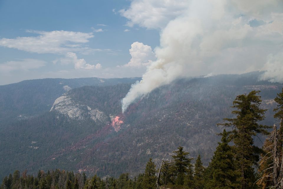
South Fork Fire time lapse video on August 18th, shows a 6 hour time lapse from 3 pm to 9 pm, which shows fire behavior, smoke impacts, weather conditions, and a spot fire below Wawona Dome which...
KSEE 24 News Report From Wawona And Tenaya Lodge Evacuation Site
South Fork Fire activity causes evacuations in Wawona
The entire community of Wawona was placed on mandatory evacuation order Saturday when South Fork Fire activity moved closer to town.
ABC 30 Action News Report at Tenaya Lodge Evacuation Site
Community Meeting Summary
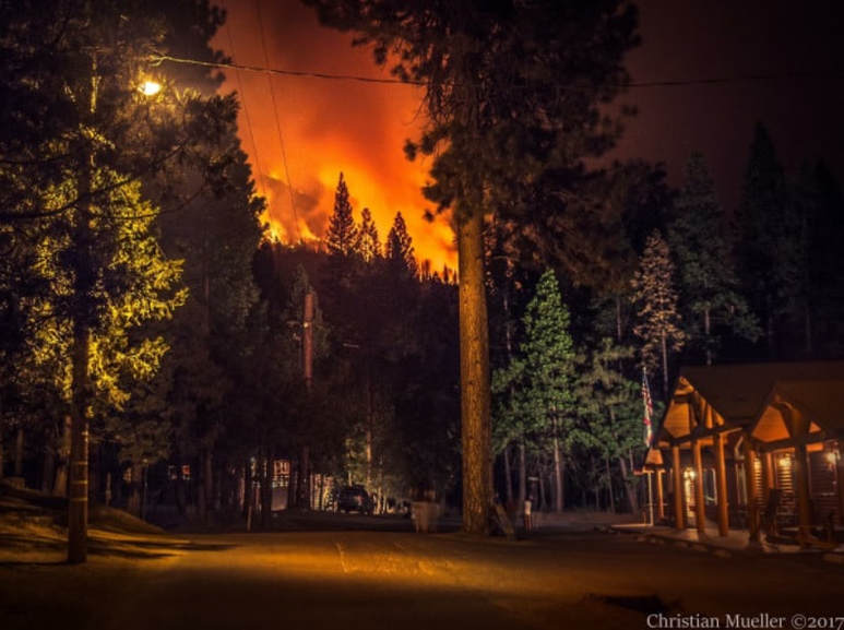
Christian Mueller, Manager of The Redwoods, provided a detailed account of the information that was shared by the fire management personnel at the Tenaya Lodge meeting last night (Aug. 19).
- 95% of the South Central Sierra Interagency Incident Management Team resources are now in Wawona, but more resources are ordered and on the way
- The fire management team is confident that the homes and structures in Wawona will remain safe
- Due to the recent shift of the wind direction to the east, flare ups and embers caused spot fires closer to Wawona (Ex. 50-75 acre spot fire on the map attached)
- More unfavorable weather and thunderstorms are expected in the next couple of days
- Air quality does not allow many tanker flyovers at this time
- Fire still slowly moving north east (away from Wawona)
- The nearest endangered structure is still 1 (one) mile away from the fire
- Main reasons behind the evacuation order were traffic and logistics not fire danger. In other words, more troops on the ground require less to no interference from the general public
- No estimated Fire Containment date is set. We will be notified via nixle or rapid notify alerts when the evacuation order is lifted
- Crews currently working on clearing fire fuel and laying more fire control lines
- Wawona Campground is OPEN
- Red Cross shelter is located in Tenaya Lodge
- YOUR HOME IS SAFE
Red Cross Sets Up Shelter Site at Tenaya Lodge
Wawona Webcam
null
null
With Wawona now being a ghost town after the evacuation order, we have posted the Yosemite SNRS live webcam, courtesy of Dr. Anne Kelly, UC Merced Wawona Field Station, so we can at least monitor the amount of smoke, and hopefully no more than that. Click on the image to enlarge. (Note: Snoopy's position is just coincidental and should not be misinterpreted.)
Mandatory Evacuation Issued for Wawona
A mandatory evacuation order has been issued for all Wawona residents. Residents must be out by 4 PM, today, Saturday, August 19.
Evacuation oder includes all areas east of Highway 41 along Chilnualna Falls Rd. and Forest Drive., including the Big Trees Lodge. Red Cross shelter at Tenaya Lodge.
Evacuation oder includes all areas east of Highway 41 along Chilnualna Falls Rd. and Forest Drive., including the Big Trees Lodge. Red Cross shelter at Tenaya Lodge.
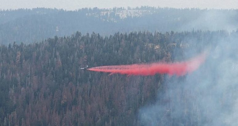
Plane drops retardant line over trees in the Wawona area
Watch puff of smoke from small @BLMNIFC leadplane then #MAFFS red retardant drops line over trees #southforkfire SE of Yosemite pic.twitter.com/EVIZxXgFPh
— MAFFS (@AEGMAFFS) August 19, 2017
Community meeting scheduled for tonight at 6 p.m. (Saturday, August 19) will be held at the Tenaya Lodge
A Mandatory Evacuation Order has been issued for the community of Wawona inside Yosemite National Park due to increased activity on the west flank of the South Fork Fire.
The evacuation order is for all areas east of Highway 41 along Chilnualna Falls Road and Forest Drive, including the Big Trees Lodge.
Residents and visitors must vacate by 4 p.m. today.
According to fire officials, a weather system with thunder cells brought outflow winds that pushed the fire back to the west last night. There is an isolated spot fire now outside the containment line in the Wawona Dome area. It is burning on very steep terrain covered with dead trees.
With no crews on the ground in that location due to the extreme danger, and heavy smoke limiting air operations, officials elected to put evacuations in place while there is time to get everyone out safely in a controlled manner, rather than waiting until conditions force more of a scramble to evacuate.
The fire meteorologist says there was a significant thunderstorm over the fire last night, and that behavior – bringing outflow winds to the fire area – is expected to continue through the next several days.
A Red Cross Shelter has been established at the Tenaya Lodge.
The community meeting scheduled for tonight at 6 p.m. will be held at the Tenaya Lodge.
Wawona Closed to Visitors - Possible Evacuation Today, Saturday, Aug. 19th
Saturday, Aug. 19 -
Due to increased fire activity and threat of thunderstorm downdrafts, the area east of Highway 41 on Forest Dr. and Chilnualna Falls Rd. is closed to visitors and guests. Permanent residents are advised to be ready to evacuate within 12-24 hours, however they should be ready to leave with shorter notice if conditions warrant. At this time, the fire remains within contingency lines.
Due to increased fire activity and threat of thunderstorm downdrafts, the area east of Highway 41 on Forest Dr. and Chilnualna Falls Rd. is closed to visitors and guests. Permanent residents are advised to be ready to evacuate within 12-24 hours, however they should be ready to leave with shorter notice if conditions warrant. At this time, the fire remains within contingency lines.
Astronomy Programs at UC Merced Field Station
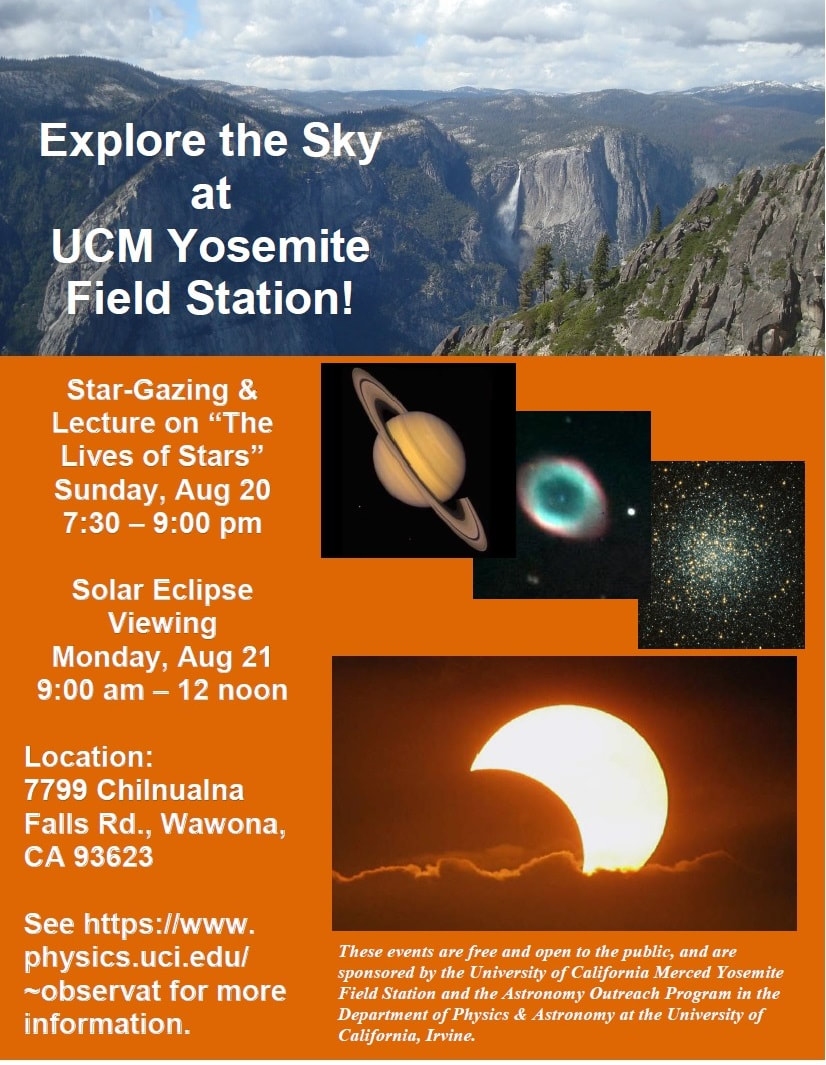
The UC Merced Yosemite Field Station is excited to host two back-to-back astronomy programs on Sunday, August 20 and Monday, August 21. Astronomers from UC Irvine will host a star party on the lawn of the field station office from 7:30-9pm on Sunday, August 20. Dr. Tammy Smecker-Hane will give a short talk on the Lives of Stars, followed by a guided stargazing tour hosted by several UCI astronomers. Join us, and bring a headlamp, binocs, and/or lawn chairs! On Monday, August 21 from 9am-12pm these astronomers will have solar telescopes and viewing glasses available so we can enjoy the partial solar eclipse! Please join us! 7799 Chilnualna Falls Rd, overflow parking near the Stables.
Anne Kelly
Director, UC Merced Yosemite and Sequoia Field Stations
7799 Chilnualna Falls Rd | Wawona, CA 95389
office 209-375-9917 | cell 209-628-1064
Anne Kelly
Director, UC Merced Yosemite and Sequoia Field Stations
7799 Chilnualna Falls Rd | Wawona, CA 95389
office 209-375-9917 | cell 209-628-1064
South Fork Fire Update #6 August 18th, 2017
Start date: 8/13/17 2:30 p.m.
Size: 2,407 acres Containment: 7%
Cause: Unknown Incident Personnel: 512
Fuels: Mixed conifer, oak and brush
Crews made progress constructing handline on the west flank of the fire north of Wawona Dome. Burning operations may continue today if conditions are favorable to secure the protection of the Wawona community and the Mariposa Sequoia Grove. Heavy inversions grounded aircraft until late afternoon yesterday. Flights will continue today when conditions warrant.
There will be a community meeting at the Wawona Community Center at 6pm on Saturday August 19th.
Strategic objectives remain the same: utilize air and ground resources to hold the western and southern flanks while monitoring the northern and eastern edges. Minimal Impact Suppression Tactics are being used in the Yosemite Wilderness to manage the area of the fire, using natural barriers such as rocks or streams, trails, and other minimal disturbance methods to contain the fire.
Smoke will continue to affect the Wawona area, particularly in the evenings and mornings. Community members who are sensitive to smoke should consult their physician and may want remain indoors or leave the area in periods of heavy smoke. Residents can monitor the air quality links below for current information.
A warming and drying trend will be present across the region through the first part of the weekend. A subtle cooling trend will begin Sunday into the first part of next week. Thunderstorms will be possible over the Sierra Nevada each afternoon and evening into the weekend.
The voluntary evacuation is still in place for the Wawona community.
There are currently 512 personnel assigned to the fire: 12 hand crews, 7 helicopters, 11 engines, 4 air tankers.
For additional information:
South Central Sierra Interagency Incident Management Team
Fire Information: 209-379-5322 [email protected]
For additional information visit: http://inciweb.nwcg.gov/incident/5502
Size: 2,407 acres Containment: 7%
Cause: Unknown Incident Personnel: 512
Fuels: Mixed conifer, oak and brush
Crews made progress constructing handline on the west flank of the fire north of Wawona Dome. Burning operations may continue today if conditions are favorable to secure the protection of the Wawona community and the Mariposa Sequoia Grove. Heavy inversions grounded aircraft until late afternoon yesterday. Flights will continue today when conditions warrant.
There will be a community meeting at the Wawona Community Center at 6pm on Saturday August 19th.
Strategic objectives remain the same: utilize air and ground resources to hold the western and southern flanks while monitoring the northern and eastern edges. Minimal Impact Suppression Tactics are being used in the Yosemite Wilderness to manage the area of the fire, using natural barriers such as rocks or streams, trails, and other minimal disturbance methods to contain the fire.
Smoke will continue to affect the Wawona area, particularly in the evenings and mornings. Community members who are sensitive to smoke should consult their physician and may want remain indoors or leave the area in periods of heavy smoke. Residents can monitor the air quality links below for current information.
A warming and drying trend will be present across the region through the first part of the weekend. A subtle cooling trend will begin Sunday into the first part of next week. Thunderstorms will be possible over the Sierra Nevada each afternoon and evening into the weekend.
The voluntary evacuation is still in place for the Wawona community.
There are currently 512 personnel assigned to the fire: 12 hand crews, 7 helicopters, 11 engines, 4 air tankers.
For additional information:
- Rapid Notify is a community alert system for rapid event notifications. Register by visiting http://www.rapidnotify.com/customer/Yosemite.html or https://alert.rapidnotify.com/.
- Nixle is a public-safety notification system. Sign up for emergency alerts by texting 95389 to 888-777 or visit their website at www.nixle.com
- Fire Information: [email protected]
- Yosemite National Park Fire Information website: http://www.nps.gov/yose/blogs/fireinfo.htm
- Facebook, search: Yosemite Fire and Aviation
- Twitter, search @YosemiteFire : http://www.twitter.com/YosemiteFire
- Air Quality: https://www.nps.gov/yose/learn/nature/aqmonitoring.htm or https://airnow.gov/index.cfm?action=airnow.local_city&mapcenter=0&cityid=533
South Central Sierra Interagency Incident Management Team
Fire Information: 209-379-5322 [email protected]
For additional information visit: http://inciweb.nwcg.gov/incident/5502
Meeting on South Fork Fire, Saturday, August 19th

National Park Service staff will hold a community meeting on Saturday, August 19th at 6 PM at the Wawona Community Center. Information regarding the South Fork Fire will be shared. An air quality specialist will be attending the meeting to answer any questions.
Wawona Road Delays--Update 8-18-17
Around South Entrance: Next week August 21st thru August 26th there will be 30-minute delays with single lane traffic control 6AM to 8PM as paving operations begin, so there will be extensive truck traffic around South Entrance as crews begin paving the parking lots. The following weeks of August 28th and September 5th the 30-minute delays will continue as crews continue paving operations and preparation for paving on Wawona Road and Mariposa Grove Road.
New Information Lines and Email for South Fork Fire

There is a new fire information line for the South Fork Fire. It will be staffed daily from 8 AM to 8 PM. There is also a new email for the fire. Both are below:
South Fork Fire Information Line: 209-379-5322
Email: [email protected]
Air Quality and other Information:
EBAM and Smoke Monitor Camera in Wawona:
http://cens.jamesreserve.edu/activejpg/YosemiteCam.jpg
https://app.airsis.com/USFS/Units/Details?custId=11&unitId=1011&isHistoric=False
Air quality forecast:
https://wildlandfiresmoke.net/outlooks/2017/CentralSierraFires#Main
Yosemite Park Fire Information phone line: 209-379-1493 (voice prompted only.)
Inciweb: https://inciweb.nwcg.gov/
Facebook: Yosemite Fire and Aviation https://www.facebook.com/Yosemite-Fire-and-Aviation-124632964255395/
Twitter: @YosemiteFire https://twitter.com/YosemiteFire?lang=en
South Fork Fire Update #5 August 17th, 2017
Start date: 8/13/17 2:30 p.m.
Size: 2,407 acres
Containment: 7%
Cause: Unknown
Incident Personnel: 449
Fuels: Mixed conifer, oak and brush
The South Fork Fire experienced minimal growth yesterday as weather conditions and high humidity levels held the fire within the western and southern containment lines. The fire continues to slowly spread to the northeast into the Yosemite Wilderness. Air resources will continue to assist the firefighting effort today as smoke levels allow. Direct line construction was tied into Wawona Dome on the west flank. Burning operations may begin today to allow for the protection of the Wawona community and the Mariposa Sequoia Grove.
Strategic objectives are to hold the western and southern flanks while monitoring the northern and eastern edges. Minimal Impact Suppression Tactics are being used to manage the area of the fire, using natural barriers such as rocks or streams, trails, and other minimal disturbance methods to contain the fire.
Smoke is expected to be heavy in the fire area and adjacent communities and is likely to be very dense in Wawona in the evenings and mornings. Community members who are sensitive to smoke should consult their physician and may want remain indoors or leave the area in periods of heavy smoke. Residents can monitor the air quality links below for current information.
There remains a threat of thunderstorm activity in the fire area today as a weak low pressure system remains over the region.
The South Central Sierra Interagency Incident Management Team (Deron Mills IC) assumed command of the fire at 6:00 AM on August 16th. The SCSIIMT is comprised of employees from state and federal agencies, municipalities, and several local resources to support firefighting personnel in their suppression efforts.
There is a voluntary evacuation in place for the Wawona community.
For additional information:
· Rapid Notify is a community alert system for rapid event notifications. Register by visiting www.alert.rapidnotify.com , http://www.rapidnotify.com/customer/Yosemite.html
· Nixle is a public-safety notification system. Sign up for emergency alerts by texting 95389 to 888-777 or visit their website at www.nixle.com
· Fire Information: [email protected]
· Yosemite National Park Fire Information website: http://www.nps.gov/yose/blogs/fireinfo.htm
· Facebook, search: Yosemite Fire and Aviation
· Twitter, search @YosemiteFire : http://www.twitter.com/YosemiteFire
· Air Quality: https://www.nps.gov/yose/learn/nature/aqmonitoring.htm or https://airnow.gov/index.cfm?action=airnow.local_city&mapcenter=0&cityid=533
Fire Officials Talk To Residents About South Fork Fire
Posted by: Gina Clugston August 17, 2017 - 8:52 am SierraNews
YOSEMITE — The community of Wawona gathered last night to hear from fire officials and law enforcement about suppression efforts and evacuation plans for the South Fork Fire.
The fire is now estimated at 2,407 acres with 7 percent containment.
Incident Commander Deron Mills of the South Central Sierra Interagency Incident Management Team is also the Deputy Fire Chief in Yosemite, so is on his home turf for this fire.
Mills said the objective is to keep the fire in check on the west and south, protect the community of Wawona and the significant resource that is the Mariposa Grove of Big Trees, and keep it from crossing the South Fork of the Merced River onto the Sierra National Forest.
To the north and east are a lot of rock barriers, said Mills who described those areas as “moonscapes,” and they are working to steer the fire into those natural barriers and get the fire to “confine itself.”
Fireline has been cut in on the west flank for protection of Wawona, and yesterday two Hot Shot crews and two Wildland Fire Modules were airlifted to the top of Wawona Dome where they set up a spike camp.
Those 60 firefighters will cut line to the north along the ridge above Chilnualna Creek and tie in to the trail to Buck Camp. As weather conditions allow, they will conduct burn-outs inside that line to remove fuel as the fire approaches from the east, and hold that western flank.
The fire is not being actively suppressed on the north and east, but is headed farther up into the wilderness area where it will do what fires naturally do, and remove decades of duff and dead vegetation, reducing fuel and renewing the forest.
There are currently 449 personnel assigned to the incident, and Mills believes those resources are sufficient to handle the fire.
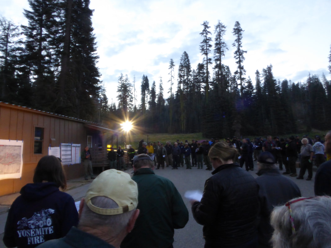
The main Incident Command Post has been established at the Yosemite Ski & Snowboard Area (Badger Pass) where the management team is operating and firefighters are being fed.
An inconvenient twist to the communications infrastructure is that the phone pedestal at Badger Pass was hit by lightning two weeks ago, so repairs had to be made to get things up and running.
Bridalveil and Wawona Campgrounds have been closed to the public in order to accommodate firefighters’ sleeping arrangements.
With the dangers posed to firefighters by very steep terrain and heavy tree mortality, there will be no night shift working this fire.
Heavy smoke held down by the inversion in the morning hours — and often well into the afternoon — has limited the number of hours aircraft can work this fire. The crews sent to Wawona Dome were not able to be airlifted until about 3 p.m. yesterday.
While the inversion limits attack from the air, it also dampens the fire behavior, says Mills, as was evidenced by the slower rate of spread yesterday.
Crews are also being assisted by higher humidity over the past two days. There was actually a bit of rain over the fire area yesterday.
On the weather front, a disturbance over the region is forcasted to produce locally breezy conditions over the next couple of days. Humidity trended higher for all locations along with cooler temperatures yesterday. A warming trend will begin on Thursday and continue into the weekend. Increased instability over the Sierra Nevada will bring slight chances of afternoon and early evening showers and thunderstorms through Friday. Otherwise, mostly clear skies will prevail over Central California.
NPS Law Enforcement Officer Chad Andrews talked last night about evacuation plans, should that become necessary, and urged residents to have their important items ready.
“Get yourselves prepared,” he said. “Have your medications and important documents by the door and ready to go.”
Andrews was clear that there is no imminent threat at this time, but that people should not create additional stress by waiting until the last minute.
In order to maintain the safety of park visitors and allow fire management operations to continue unimpeded, the Superintendent of Yosemite National Park is designating the following area as closed until further notice is given:
Yesterday morning, the Office of the Superintendent in Yosemite announced these operational changes:
Heavy smoke continues to impact Wawona and the areas surrounding Yosemite, especially overnight and through the morning hours, adding more smoke to what is being produced by the Empire Fire near Bridalveil Campground, which is now estimated at 1,400 acres.
Air quality in Wawona is expected to be extremely smoky and to reach unhealthy/ hazardous conditions. Smoke is expected to fill the canyons west of Wawona to Mariposa, and affect visibility along Highway 140 from El Portal to Mariposa, Wawona Road south to Fish Camp, and roads along Tioga Pass to the Mono Lake area.
Some of the agencies assisting on the fire, in addition to the National Park Service, include the U.S. Forest Service, BLM, Cal Fire, Mariposa County Fire, Kern County Fire, and a host of county and city fire departments and federal resources.
The cause of the fire is under investigation.
The estimated date of containment is Sunday, Sept. 3.
For additional information:
https://app.airsis.com/USFS/UnitMap
https://www.nps.gov/yose/learn/nature/aqmonitoring.htm
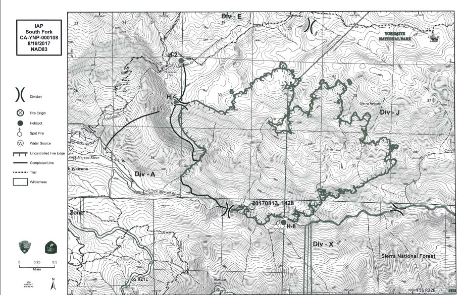
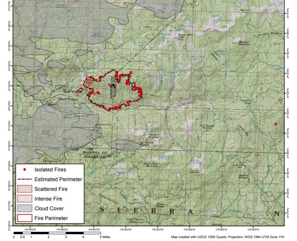
Click here for a perimeter map.
Click here for interactive map.
Trail closure map below.
YOSEMITE — The community of Wawona gathered last night to hear from fire officials and law enforcement about suppression efforts and evacuation plans for the South Fork Fire.
The fire is now estimated at 2,407 acres with 7 percent containment.
Incident Commander Deron Mills of the South Central Sierra Interagency Incident Management Team is also the Deputy Fire Chief in Yosemite, so is on his home turf for this fire.
Mills said the objective is to keep the fire in check on the west and south, protect the community of Wawona and the significant resource that is the Mariposa Grove of Big Trees, and keep it from crossing the South Fork of the Merced River onto the Sierra National Forest.
To the north and east are a lot of rock barriers, said Mills who described those areas as “moonscapes,” and they are working to steer the fire into those natural barriers and get the fire to “confine itself.”
Fireline has been cut in on the west flank for protection of Wawona, and yesterday two Hot Shot crews and two Wildland Fire Modules were airlifted to the top of Wawona Dome where they set up a spike camp.
Those 60 firefighters will cut line to the north along the ridge above Chilnualna Creek and tie in to the trail to Buck Camp. As weather conditions allow, they will conduct burn-outs inside that line to remove fuel as the fire approaches from the east, and hold that western flank.
The fire is not being actively suppressed on the north and east, but is headed farther up into the wilderness area where it will do what fires naturally do, and remove decades of duff and dead vegetation, reducing fuel and renewing the forest.
There are currently 449 personnel assigned to the incident, and Mills believes those resources are sufficient to handle the fire.
The main Incident Command Post has been established at the Yosemite Ski & Snowboard Area (Badger Pass) where the management team is operating and firefighters are being fed.
An inconvenient twist to the communications infrastructure is that the phone pedestal at Badger Pass was hit by lightning two weeks ago, so repairs had to be made to get things up and running.
Bridalveil and Wawona Campgrounds have been closed to the public in order to accommodate firefighters’ sleeping arrangements.
With the dangers posed to firefighters by very steep terrain and heavy tree mortality, there will be no night shift working this fire.
Heavy smoke held down by the inversion in the morning hours — and often well into the afternoon — has limited the number of hours aircraft can work this fire. The crews sent to Wawona Dome were not able to be airlifted until about 3 p.m. yesterday.
While the inversion limits attack from the air, it also dampens the fire behavior, says Mills, as was evidenced by the slower rate of spread yesterday.
Crews are also being assisted by higher humidity over the past two days. There was actually a bit of rain over the fire area yesterday.
On the weather front, a disturbance over the region is forcasted to produce locally breezy conditions over the next couple of days. Humidity trended higher for all locations along with cooler temperatures yesterday. A warming trend will begin on Thursday and continue into the weekend. Increased instability over the Sierra Nevada will bring slight chances of afternoon and early evening showers and thunderstorms through Friday. Otherwise, mostly clear skies will prevail over Central California.
NPS Law Enforcement Officer Chad Andrews talked last night about evacuation plans, should that become necessary, and urged residents to have their important items ready.
“Get yourselves prepared,” he said. “Have your medications and important documents by the door and ready to go.”
Andrews was clear that there is no imminent threat at this time, but that people should not create additional stress by waiting until the last minute.
In order to maintain the safety of park visitors and allow fire management operations to continue unimpeded, the Superintendent of Yosemite National Park is designating the following area as closed until further notice is given:
- The Swinging Bridge Trail on both the north and south sides of the South Fork of the Merced River.
- The Chilnualna Falls Trail from Wawona Trailhead to the top of Chilnualna Falls.
- The two mile connecting trail heading north from the top of Chilnualna Falls to the intersection of the Buena Vista Trail.
- The Chilnualna Creek Trail from the top of Chilnualna Falls east to the intersection of the Buena Vista and Buck Camp trails (Just east of Johnson Lake).
- Off-trail areas in the vicinity are closed (i.e. all areas within the shaded circle on the map below).
- All climbing routes on and around Wawona Dome are closed.
Yesterday morning, the Office of the Superintendent in Yosemite announced these operational changes:
- Wawona Campground is closed.
- Bridalveil Creek Campground closed on Wednesday morning.
- Wawona trail (mule) rides are not operating.
- Big Trees Golf Course is closed.
- The Badger Pass-Glacier Point shuttle will not operate until further notice as the incident command post is occupying the Yosemite Ski and Snowboard Area facility and parking lot.
- The Glacier Point Road will will remain open to the public however it will close periodically between 10 a.m. and 5 p.m. each day when parking at Glacier Point fills to capacity (and will reopen when sufficient space is available). Traffic delays should be expected.
- A voluntary ban on wood fires is in place in Yosemite Valley to reduce smoke. A mandatory ban may be instituted in the days to come.
Heavy smoke continues to impact Wawona and the areas surrounding Yosemite, especially overnight and through the morning hours, adding more smoke to what is being produced by the Empire Fire near Bridalveil Campground, which is now estimated at 1,400 acres.
Air quality in Wawona is expected to be extremely smoky and to reach unhealthy/ hazardous conditions. Smoke is expected to fill the canyons west of Wawona to Mariposa, and affect visibility along Highway 140 from El Portal to Mariposa, Wawona Road south to Fish Camp, and roads along Tioga Pass to the Mono Lake area.
Some of the agencies assisting on the fire, in addition to the National Park Service, include the U.S. Forest Service, BLM, Cal Fire, Mariposa County Fire, Kern County Fire, and a host of county and city fire departments and federal resources.
The cause of the fire is under investigation.
The estimated date of containment is Sunday, Sept. 3.
For additional information:
- Rapid Notify is a community alert system for rapid event notifications. Register by visiting www.alert.rapid notify.com
- Nixle is a public-safety notification system. Sign up for emergency alerts by texting 95389 to 888-777 or visit their website at www.nixle.com
- Fire Information: [email protected]
- Yosemite National Park Fire Information website: http://www.nps.gov/yose/blogs/fireinfo.htm
- Facebook, search: Yosemite Fire and Aviation
- Twitter, search @YosemiteFire : http://www.twitter.com/YosemiteFire
https://app.airsis.com/USFS/UnitMap
https://www.nps.gov/yose/learn/nature/aqmonitoring.htm
Click here for a perimeter map.
Click here for interactive map.
Trail closure map below.
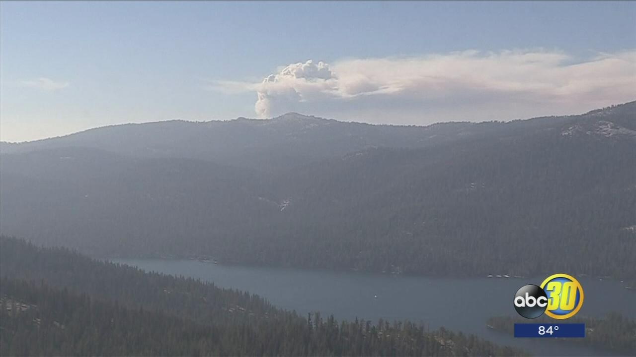
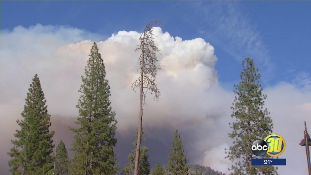
Smoke building over Yosemite as South Fork Fire continues to encroach on Wawona
ABC30 Action News
South Fork Fire firefight, "in a good place," officials say
Wednesday, dozens living in the community of Wawona had the chance to talk face-to-face with their emergency personnel, asking questions about the more than 2,000-acre wildfire burning about a mile east of their homes.
Update On The South Fork Fire Wednesday 6 PM
Posted by: gina clugston August 16, 2017 - 5:48 pm
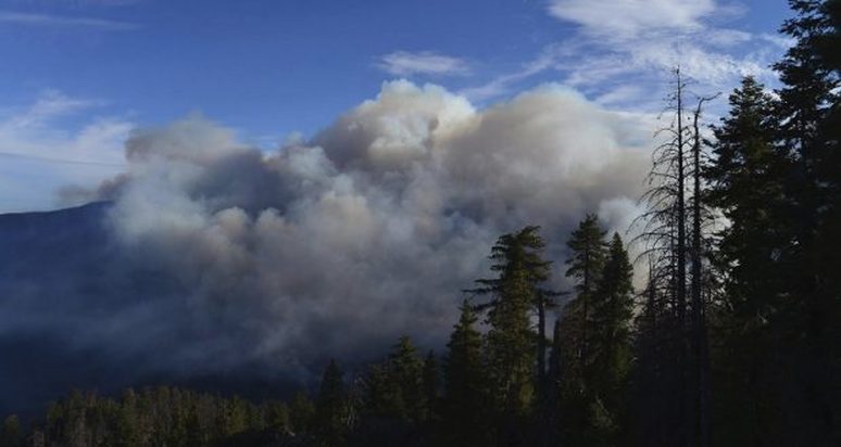
YOSEMITE — For the third straight day, residents and visitors on the southern end of Yosemite National Park woke to a haze from the smoke of the South Fork Fire.
The smoke had lifted by this afternoon in the community of Wawona, where residents are still in a preparation mode for any possible evacuation. However, the fire is not directly threatening the community at this time.
The heavy smoke over the fire itself causes delays in deploying air resources in the morning, but once in the air, they are hitting hard on the west and south flanks of the fire with retardant and water, and tying the firelines into natural barriers.
The fire is still estimated at 2,296 acres with 5 percent containment.
With the danger posed to firefighters by the steep, rugged terrain and the large number of dead trees, there will be no night shift working this fire. Therefore, we will only be updating after the morning briefing, unless major changes occur.
There are currently 350 personnel assigned to the incident.
The fire is burning in an area of heavy tree mortality due to bark beetle infestation and poor forest health. Due to the proximity of the community of Wawona, as well as the challenging terrain, the primary objective is firefighter and public safety.
The fire continues to move north and east from Wawona, and is burning on a south-southwest aspect in steep, rocky, inaccessible terrain.
At this hour, the fireline is holding north of the South Fork of the Merced River, and east of Chilnualna Creek.
The Wawona area continues to be on alert to make appropriate pre-evacuation preparations. If there is an actual need for evacuation, there will be door-to-door notifications by park staff.
In order to maintain the safety of park visitors and allow fire management operations to continue unimpeded, the Superintendent of Yosemite National Park is designating the following area as closed until further notice is given:
The Office of the Superintendent in Yosemite this morning announced these operational changes:
Heavy smoke continues to impact Wawona and the areas surrounding Yosemite, especially overnight and through the morning hours, adding more smoke to what is being produced by the Empire Fire near Bridalveil Campground, which is now estimated at 1,320 acres.
Air quality in Wawona is expected to be extremely smoky and to reach unhealthy/ hazardous conditions. Smoke is expected to fill the canyons west of Wawona to Mariposa, and affect visibility along Highway 140 from El Portal to Mariposa, Wawona Road south to Fish Camp, and roads along Tioga Pass to the Mono Lake area.
The cause of the fire is under investigation.
The estimated date of containment is Sunday, Sept. 3.
For additional information:
https://app.airsis.com/USFS/UnitMap
https://www.nps.gov/yose/learn/nature/aqmonitoring.htm
Click here for a perimeter map.
Click here for interactive map.
YOSEMITE — For the third straight day, residents and visitors on the southern end of Yosemite National Park woke to a haze from the smoke of the South Fork Fire.
The smoke had lifted by this afternoon in the community of Wawona, where residents are still in a preparation mode for any possible evacuation. However, the fire is not directly threatening the community at this time.
The heavy smoke over the fire itself causes delays in deploying air resources in the morning, but once in the air, they are hitting hard on the west and south flanks of the fire with retardant and water, and tying the firelines into natural barriers.
The fire is still estimated at 2,296 acres with 5 percent containment.
With the danger posed to firefighters by the steep, rugged terrain and the large number of dead trees, there will be no night shift working this fire. Therefore, we will only be updating after the morning briefing, unless major changes occur.
There are currently 350 personnel assigned to the incident.
The fire is burning in an area of heavy tree mortality due to bark beetle infestation and poor forest health. Due to the proximity of the community of Wawona, as well as the challenging terrain, the primary objective is firefighter and public safety.
The fire continues to move north and east from Wawona, and is burning on a south-southwest aspect in steep, rocky, inaccessible terrain.
At this hour, the fireline is holding north of the South Fork of the Merced River, and east of Chilnualna Creek.
The Wawona area continues to be on alert to make appropriate pre-evacuation preparations. If there is an actual need for evacuation, there will be door-to-door notifications by park staff.
In order to maintain the safety of park visitors and allow fire management operations to continue unimpeded, the Superintendent of Yosemite National Park is designating the following area as closed until further notice is given:
- The Swinging Bridge Trail on both the north and south sides of the South Fork of the Merced River.
- The Chilnualna Falls Trail from Wawona Trailhead to the top of Chilnualna Falls.
- The two mile connecting trail heading north from the top of Chilnualna Falls to the intersection of the Buena Vista Trail.
- The Chilnualna Creek Trail from the top of Chilnualna Falls east to the intersection of the Buena Vista and Buck Camp trails (Just east of Johnson Lake).
- Off-trail areas in the vicinity are closed (i.e. all areas within the shaded circle on the map below).
- All climbing routes on and around Wawona Dome are closed.
The Office of the Superintendent in Yosemite this morning announced these operational changes:
- Wawona Campground is closed.
- Bridalveil Creek Campground closes on Wednesday morning.
- Wawona trail (mule) rides are not operating.
- Big Trees Golf Course is closed.
- The Badger Pass-Glacier Point shuttle will not operate until further notice as the incident command post is occupying the Yosemite Ski and Snowboard Area facility and parking lot.
- The Glacier Point Road will will remain open to the public however it will close periodically between 10am and 5pm each day when parking at Glacier Point fills to capacity (and will reopen when sufficient space is available). Traffic delays should be expected.
- A voluntary ban on wood fires is in place in Yosemite Valley to reduce smoke. A mandatory ban may be instituted in the days to come.
Heavy smoke continues to impact Wawona and the areas surrounding Yosemite, especially overnight and through the morning hours, adding more smoke to what is being produced by the Empire Fire near Bridalveil Campground, which is now estimated at 1,320 acres.
Air quality in Wawona is expected to be extremely smoky and to reach unhealthy/ hazardous conditions. Smoke is expected to fill the canyons west of Wawona to Mariposa, and affect visibility along Highway 140 from El Portal to Mariposa, Wawona Road south to Fish Camp, and roads along Tioga Pass to the Mono Lake area.
The cause of the fire is under investigation.
The estimated date of containment is Sunday, Sept. 3.
For additional information:
- Rapid Notify is a community alert system for rapid event notifications. Register by visiting www.alert.rapid notify.com
- Nixle is a public-safety notification system. Sign up for emergency alerts by texting 95389 to 888-777 or visit their website at www.nixle.com
- Fire Information: [email protected]
- Yosemite National Park Fire Information website: http://www.nps.gov/yose/blogs/fireinfo.htm
- Facebook, search: Yosemite Fire and Aviation
- Twitter, search @YosemiteFire : http://www.twitter.com/YosemiteFire
https://app.airsis.com/USFS/UnitMap
https://www.nps.gov/yose/learn/nature/aqmonitoring.htm
Click here for a perimeter map.
Click here for interactive map.
South Fork Fire Update August 16th, 2017
Discovered: 8/13/17 2:30 p.m.
Size: 2,296 acres Containment: 5%
Cause: Unknown
Fuels: Ponderosa pine transitioning to White fir
Strategy: Suppression
There will be a community meeting on Wednesday August 16 at 6 pm at the Wawona Community Center.
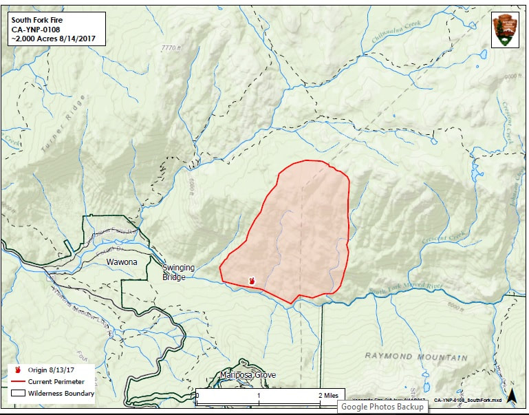
The South Fork fire is burning 1.0 mile east of the community of Wawona upstream of Swinging Bridge in the South Fork of the Merced River drainage. The fireline is holding north of the South Fork and east of Chilnualna Creek. Air resources will continue to assist the firefighting effort in dropping retardant and water on the west and south flanks of the fire.
Smoke is expected to be heavy in the fire area and adjacent communities and is likely to be very dense in Wawona in the evenings and mornings. Community members who are sensitive to smoke may want to close their windows and doors and monitor the air quality links below.
The South Central Sierra Interagency Incident Management Team (Deron Mills IC) assumed command of the fire at 6:00 AM on August 16th.
Current Closures
· Wawona Campground
· Bridalveil Creek Campground
· Big Trees Golf Course
· Wawona mule rides are not operating
· The Badger Pass-Glacier Point shuttle will not operate until further notice as the incident command post is occupying the Yosemite Ski and Snowboard Area facility and parking lot. The Glacier Point Road will remain open to the public, however, it will close periodically between 10am and 5pm each day when parking at Glacier Point fills to capacity (and will reopen when sufficient space is available). Traffic delays should be expected.
For additional information:
· Rapid Notify is a community alert system for rapid event notifications. Register by visiting www.alert.rapidnotify.com· Nixle is a public-safety notification system. Sign up for emergency alerts by texting 95389 to 888-777 or visit their website at www.nixle.com
· Fire Information: [email protected]
· Yosemite National Park Fire Information website: http://www.nps.gov/yose/blogs/fireinfo.htm
· Facebook, search: Yosemite Fire and Aviation
· Twitter, search @YosemiteFire : http://www.twitter.com/YosemiteFire
· Air Quality: https://www.nps.gov/yose/learn/nature/aqmonitoring.htm or https://airnow.gov/index.cfm?action=airnow.local_city&mapcenter=0&cityid=533
South Fork Fire 5% Contained
August 16, by Gina Clugston- Sierra News Online- YOSEMITE — The South Fork Fire, burning inside Yosemite National Park just east of Wawona, has grown by several hundred acres overnight. It is now estimated at 2,296 acres, still with 5 percent containment.
The South Central Sierra Interagency Incident Management Team took over management of the fire yesterday. They will host a community meeting at the Wawona Community Center tonight, Wednesday, Aug. 16, at 6 p.m.
There are currently 253 personnel assigned to the incident including Hot Shots, ground and engine crews, with more resources on order.
There are about 10 aircraft fighting the fire, including helicopters doing bucket work and fixed-wings laying down retardant, mainly on the left flank of the fire closest to Wawona, which is holding at this time.
The Wawona area continues to be on alert to make appropriate pre-evacuation preparations. If there is an actual need for evacuation, there will be door-to-door notifications by park staff.
The Office of the Superintendent in Yosemite this morning announced these operational changes:
- Wawona Campground is closed.
- Bridalveil Creek Campground closes on Wednesday morning.
- Wawona trail (mule) rides are not operating.
- Big Trees Golf Course is closed.
- The Badger Pass-Glacier Point shuttle will not operate until further notice as the incident command post is occupying the Yosemite Ski and Snowboard Area facility and parking lot.
- The Glacier Point Road will will remain open to the public however it will close periodically between 10am and 5pm each day when parking at Glacier Point fills to capacity (and will reopen when sufficient space is available). Traffic delays should be expected.
- A voluntary ban on wood fires is in place in Yosemite Valley to reduce smoke. A mandatory ban may be instituted in the days to come.
Heavy smoke continues to impact Wawona and the areas surrounding Yosemite, especially overnight and through the morning hours, adding more smoke to what is being produced by the Empire Fire near Bridalveil Campground, which is now estimated at 1,320 acres.
Air quality in Wawona is expected to be extremely smoky and to reach unhealthy/ hazardous conditions. Smoke is expected to fill the canyons west of Wawona to Mariposa, and affect visibility along Highway 140 from El Portal to Mariposa, Wawona Road south to Fish Camp, and roads along Tioga Pass to the Mono Lake area.
The cause of the fire is under investigation.
The estimated date of containment is Sunday, Sept. 3.
South Fork Fire In Yosemite Now at 1,700 Acres
Aug. 15, 7:15 PM, YOSEMITE, Gina Clugston, Sierra News— The South Fork Fire, burning inside Yosemite National Park just east of Wawona, is now estimated at 1,700 acres, still with 0 percent containment.
While residents and visitors in Wawona are still in a preparation mode for any possible evacuation, none has been ordered as of this hour.
The South Central Sierra Interagency Incident Management Team took over management of the fire today. They will host a community meeting at the Wawona Community Center tomorrow night, Wednesday, Aug. 16, at 6 p.m.
As of this morning there were 148 personnel assigned to the incident including Hot Shots, ground and engine crews, with many more resources on order. There are also about 10 aircraft fighting the fire, including helicopters doing bucket work and fixed-wings laying down retardant, mainly on the left flank of the fire closest to Wawona.
Crews are working on direct line construction on the west edge of fire with the priority the protection of life and property in Wawona. They are also focused on keeping the fire from crossing to the south side of the Merced River, and protecting the Mariposa Grove of Giant Sequoias.
Fire behavior yesterday consisted of group tree torching, uphill runs and short range spotting in dense mixed conifer forest with heavy tree mortality.
Most of the projected fire growth is expected on the north and northeast flanks of the fire which is burning into the wilderness and away from the community. However, the fire also continues to back down the South Fork drainage.
The Wawona Campground was closed today in order to accommodate firefighters.
The Wawona area continues to be on alert to make appropriate pre-evacuation preparations. If there is an actual need for evacuation, there will be door-to-door notifications by park staff.
The South Fork Fire was reported just after 2 p.m. on Sunday, Aug. 13, and is burning on the South Fork of the Merced River drainage, south of Wawona Dome approximately one mile east of the Swinging Bridge.
Heavy smoke continues to impact Wawona and the areas surrounding Yosemite, especially overnight and through the morning hours, adding more smoke to what is being produced by the Empire Fire near Bridalveil Campground, which is now estimated at 1,320 acres.
Air quality in Wawona is expected to be extremely smoky and to reach unhealthy/ hazardous conditions. Smoke is expected to fill the canyons west of Wawona to Mariposa, and affect visibility along Highway 140 from El Portal to Mariposa, Wawona Road south to Fish Camp, and roads along Tioga Pass to the Mono Lake area.
The cause of the fire is under investigation.
Fire Updates
|
Wawona property owners and residents who would like to receive email fire updates from the park, send your email address to the Fire Information Officer, Shanelle Sanders. She can assist in getting owner email addresses added to the ‘update’ distribution list. This is per Incident Commander Deron Mills. Shanelle's email address is: [email protected] |
Wawona Community Fire Update Meeting Wednesday 6 PM
Community Meeting
Wednesday, August 16
6 p.m.
Wawona Community Center
Wednesday, August 16
6 p.m.
Wawona Community Center
CANCELLED (Due to Fire):
YOSEMITE-WAWONA ELEMENTARY CHARTER SCHOOL
Board of Directors Meeting
Tuesday August 15, 2017 at 6 PM
Wawona Elementary School
7925 Chilnualna Falls Road
Wawona, California
AGENDA
ACTION ITEMS
INFORMATION ITEMS
Tuesday August 15, 2017 at 6 PM
Wawona Elementary School
7925 Chilnualna Falls Road
Wawona, California
AGENDA
- CALL TO ORDER
- ROLL CALL
- CONSENT AGENDA
- Approval of agenda
- Approval of minutes of the regular meeting, June 7, 2017
- Financial reports
- Monthly approval of warrants (Action needed)
- Financial Report
- Payroll Report
- HEARING OF PERSONS WISHING TO ADDRESS THE BOARD
ACTION ITEMS
- Discuss and approve additional payment to educators for drive time to and from school on Mondays-Thursdays in the school's 3 leased vehicles until the bus can be utilized
- Discuss use of school's 3 leased vehicles (3 teaching staff seats available, 21 seats available for students) and need for additional parent volunteer vehicles for field studies until the bus can be utilized
- Discuss pay schedule and hours for Bus Driver/Custodian position. Discuss and approve approximately $3000 for school bus driver training
- Board Member Dale Wohlgemouth term is up. Additional term or nominations.
INFORMATION ITEMS
- BOARD MEMBER COMMENTS
- STAFF REPORTS
- L CAP Update
- NEXT MEETING DATE
- CLOSED SESSION Personnel/Negotiations/Litigation
- Employee Negotiations (Gov. Code 54957.6)
- Personnel (Gov. Code 54957)
- RECOVENE IN OPEN SESSION: ANNOUNCE CLOSED SESSION ACTIONS
- ADJOURNMENT
South Fork Fire Update #3 August 15th, 2017
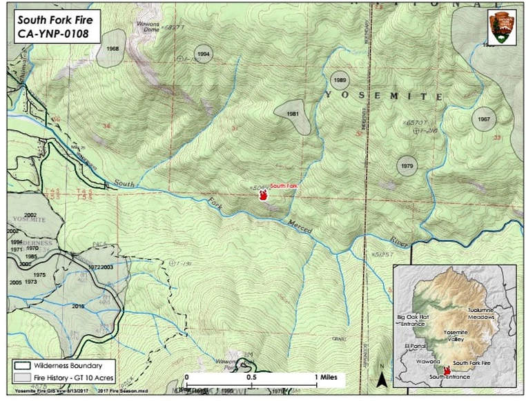
Location: N 37°32 '15" x W 119° 35'54" - approximately 5100' elevation
Discovered: 8/13/17 2:30 p.m.
Size: 1613 acres Containment: 0%
Cause: Unknown
Fuels: Ponderosa pine transitioning to White fir
Strategy: Suppression
County: Mariposa
The South Fork fire is burning 1.0 mile east of the community of Wawona upstream of Swinging Bridge in the South Fork of the Merced River drainage. The fire is burning in the wilderness but is being managed for protection objectives due to its close proximity to the community of Wawona.
The fire was discovered at 2:30 p.m. on August 13, 2017. Tactics in use include helicopter bucket work, retardant drops and tanker drops mainly on the left flank of the fire.
Strategic objectives are containment of the west flank and keeping the fire north of the river for protection of the community of Wawona. Air resources, hand crews and type 3 engines are all being utilized.
The fire is burning in dense mixed conifer forest with areas of heavy tree mortality. Most of the projected fire growth is expected on the north and northeast flanks of the fire which is burning into the wilderness and away from the community. However, the fire also continues to back down the South Fork drainage.
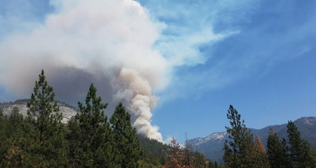
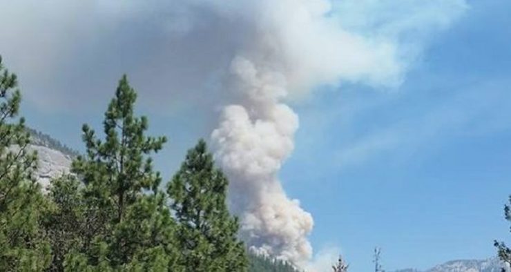
Smoke is expected to be heavy in the fire area and adjacent communities and is likely to be very dense in Wawona in the evenings and mornings. Visibility may be impacted along Wawona Road (Hwy 41 extension) south to Fish Camp, Glacier Point Road, Yosemite Valley, Hwy 140 from El Portal to Mariposa, and Tioga Pass to the Mono Lake area.
Portable and stationary particulate monitors are placed in areas that are most likely to see impacts of smoke during certain hours of the day. The local air quality districts use the data from these monitors to issue air quality alerts and notices. Fire Managers are working with the local Air Quality Districts and will be monitoring smoke impacts to the community of Wawona, park and local communities. Community members who are sensitive to smoke may want to close their windows and doors and monitor the air quality links below.
For additional information:
· Rapid Notify is a community alert system for rapid event notifications. Register by visiting www.alert.rapidnotify.com· Nixle is a public-safety notification system. Sign up for emergency alerts by texting 95389 to 888-777 or visit their website at www.nixle.com
· Fire Information: [email protected]
· Yosemite National Park Fire Information website: http://www.nps.gov/yose/blogs/fireinfo.htm
· Facebook, search: Yosemite Fire and Aviation: http://www. Facebook.com/Yosemite-Fire-and-Aviation-124632964255395
· Twitter, search @YosemiteFire : http://www.twitter.com/YosemiteFire
· Air Quality: http://www.nps.gov/yose/learn/nature/agmonitoring.htm
South Fork Fire Update Aug. 14th, 2 PM
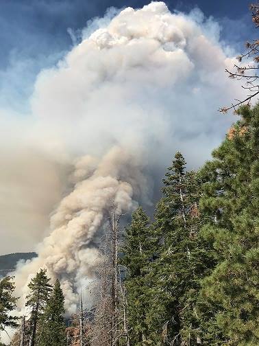
Air recon. of the South Fork Fire this morning has estimated the current size of the fire at 900 acres. The growth was primarily north-northeast with some backing down the South Fork drainage. The retardant line on the west edge of the fires slowed progression but needs to be followed up with hand crews. Crews will work to establish an anchor point and work the fire's western edge to prevent further spread to the west.
The fire is burning in wilderness but is being managed for protection objectives due to it's close proximity to Wawona.
Yosemite is utilizing rapid event notification systems that community members and visitors can self-register for by visiting:
https://alert.rapidnotify.com/lists/38328/self_registrations/new
or
texting 95389 to 888-777
Smoke is expected to be heavy in Wawona and adjacent communities, especially in the morning and evening.
Community members and visitors who are sensitive to smoke should monitor the air quality links below:
www.nps.gov/yose/learn/nature/agmonitoring.htm
www.airnow.gov
South Fork Fire Update #1 August 14th, 2017
Location: N 37°32 '15" x W 119° 35'54" - approximately 5100' elevation
Discovered: 8/13/17 2:30 p.m.
Size: 400 acres Containment: 0%
Cause: Unknown
Fuels: Ponderosa pine transitioning to White fir
Strategy: Suppression
County: Mariposa
The South Fork fire is burning 1.5 mile east of the community of Wawona upstream of Swinging Bridge in the South Fork of the Merced River drainage. The fire is burning in the wilderness but is being managed for protection objectives due to its close proximity to the community of Wawona.
The fire was discovered yesterday at 2:30 p.m. and air resources were quickly on scene. Initial attack was highly effective. Tactics included helicopter bucket work and tanker drops on the left flank of the fire.
Strategic objectives today are containment of the west flank and keeping the fire north of the river for protection of the community of Wawona. Air resources, hand crews and type 3 engines are all being utilized.
The fire is burning in dense mixed conifer forest with areas of heavy tree mortality. Most of the projected fire growth is expected on the north and northeast flanks of the fire which is burning into the wilderness and away from the community.
Smoke is expected to be heavy in the fire area and adjacent communities and is expected to be very dense in Wawona in the evenings and mornings. Visibility may be impacted along Wawona Road (Hwy 41 extension) south to Fish Camp, Glacier Point Road, Yosemite Valley, Hwy 140 from El Portal to Mariposa, and Tioga Pass to the Mono Lake area.
Portable and stationary particulate monitors are placed in areas that are most likely to see impacts of smoke during certain hours of the day. The local air quality districts use the data from these monitors to issue air quality alerts and notices. Fire Managers are working with the local Air Quality Districts and will be monitoring smoke impacts to the community of Wawona, park and local communities. Community members who are sensitive to smoke may want to close their windows and doors and monitor the air quality links below.
For additional information:
· Rapid Notify is a community alert system for rapid event notifications. Register by visiting www.alert.rapidnotify.com
· Nixle is a public-safety notification system. Sign up for emergency alerts by texting 95389 to 888-777 or visit their website at www.nixle.com
· Fire Information: [email protected]
· Yosemite National Park Fire Information website: http://www.nps.gov/yose/blogs/fireinfo.htm
· Facebook, search: Yosemite Fire and Aviation: http://www. Facebook.com/Yosemite-Fire-and-Aviation-124632964255395
· Twitter, search @YosemiteFire : http://www.twitter.com/YosemiteFire
· Air Quality: http://www.nps.gov/yose/learn/nature/agmonitoring.htm
Wawona Residents Warned To Be Prepared To Evacuate
Gina Clugston August 13, 2017 - 7:03 pm
YOSEMITE — A hazard alert message is being issued for the community of Wawona community due to the South Fork Fire, burning just east of the community along the Merced River.
The fire is now estimated at 300 acres with 0 percent containment.
The warning says the threat is of low potential and may require evacuation in 24 hours or more.
“Residents and visitors are encouraged to make appropriate pre-evacuation preparations. Smoke impacts are expected to be heavy starting this evening throughout the entire community.
If there is an actual need for evacuation, there will be door to door notifications by park staff.”
The fire was reported just after 2 p.m., and is burning at the South Fork of the Merced River drainage, south of Wawona Dome approximately one mile upstream from the Swinging Bridge.
The fire is in a rugged wilderness area, and the cause is under investigation.
South Fork Fire Near Wawona
Gina Clugston August 13, 2017 - 4:18 pm
YOSEMITE — The fire burning near the community of Wawona is putting up a lot of smoke, but resources are on scene.
The South Fork Fire is now estimated at 20-30 acres, and moving upslope to the northeast. There is no estimate of containment at this time.
Access to the fire’s location is not possible with engines, but there is a full suppression effort underway, including two Type 1 helicopters, two Type 2’s and at least one Hot Shot crew.
Residents of Wawona are being advised of the fire, but no evacuations are being ordered at this time, and Chilnualna Falls trail has been closed at the bottom.
The fire was reported just after 2 p.m., and is burning at the South Fork of the Merced River drainage, south of Wawona Dome.
According to park officials, the fire is approximately one mile from the Swinging Bridge.
We will update as new information becomes available.
Empire Fire Update #8 August 13th, 2017
Location: N 37° 38' 40" x W 119° 37' 6" at approximately 7300 feet elevation
Discovery Date: July 31st, 2017
Size: 850 acres
Cause: Lightning
The Empire Fire is being managed for both resource and protection objectives. It is approximately 1 mile south of the Bridalveil Campground east of Alder Creek drainage and west of Bridalveil Creek drainage, burning in Red fir. Fire behavior has been actively flanking and backing with some single and group tree torching. The fire is burning in heavy pockets of dead and down timber, reducing fuels buildup which increases forest resiliency. Projected fire growth is expected in the northeast and southeast flanks.
The affected area is in a fire-adapted wilderness. Allowing fires to burn naturally can result in healthier, more diverse ecosystems. Reducing fuels buildup minimizes the potential for future severe fires. Although the current fire may have transient, moderate smoke impacts, more severe fires can cause unhealthy levels of smoke for extended periods, over a much wider area.
Trails are closed from Bridalveil Creek Campground at the second junction with the Ostrander trail and from Westfall Meadow to the Deer Camp junction, along Alder Creek. There are no threats to infrastructure at Bridalveil Campground and the remainder of hiking trails in the area are open at this time. All trails will continue to be assessed by fire crews. Future closures will be decided based on fire behavior. Smoke will be seen in the fire area and may impact the Bridalveil Campground.
The fire will be visible from the high country and may be seen from multiple viewpoints in the immediate area off Glacier Point Road including Sentinel and Washburn Points.
Fire Managers are working with the local Air Quality Districts and will continually be monitoring smoke impacts to the park and local communities. Community members who are sensitive to smoke may want to close their windows and doors and monitor the air quality links below.
For additional Information:
- Fire Information: [email protected]
- Yosemite National Park Fire Information website: http://www.nps.gov/yose/blogs/fireinfo.htm
- Facebook: Search-- Yosemite Fire and Aviation: https://www.facebook.com/Yosemite-Fire-and-Aviation-124632964255395/
- Twitter: Search--@YosemiteFire https://twitter.com/YosemiteFire
- Air Quality: https://www.nps.gov/yose/learn/nature/aqmonitoring.htm
Empire Fire Update #6 August 11th, 2017
Location: N 37° 38' 40" x W 119° 37' 6" at approximately 7300 feet elevation
Discovery Date: July 31st, 2017
Size: 750 acres
Cause: Lightning
The Empire Fire is in the wilderness and is being managed for both resource and protection objectives. It is approximately 1 mile south of the Bridalveil Campground east of Alder Creek drainage and west of Bridalveil Creek drainage burning in red fir. Fire behavior has been actively flanking and backing with some single and group tree torching. The fire has been burning in heavy pockets of dead and down timber reducing fuels build-up which increases forest resiliency. Projected fire growth is expected in the northeast and southeast flanks.
The Empire Fire is in a fire-adapted wilderness area. Allowing fires to burn naturally can result in a healthier, more diverse ecosystem. Reducing fuel buildup minimizes the potential for future catastrophic fires. Although the current fire may have transient, moderate smoke impacts, more severe fires can cause unhealthy levels of smoke for extended periods, over a much wider area.
Trails are closed from Bridalveil Creek Campground to the first junction with the Ostrander trail. Additionally from Westfall Meadow to the Deer Camp junction, along Alder Creek remains closed. There are no threats to infrastructure at Bridalveil Campground and the remainder of hiking trails in the area remain open at this time. All trails will continue to be assessed by fire crews. Future closures will be decided based on fire behavior. The fire will be visible from the high country and may be seen from multiple viewpoints in the immediate area off Glacier Point Road.
Smoke will be seen in the fire area and may impact the Bridalveil Campground. Fire Managers are working with the local Air Quality Districts and will continually be monitoring smoke impacts to the park and local communities. Community members who are sensitive to smoke may want to close their windows and doors and continually monitor the attached air quality links.
For additional Information:
- Fire Information: [email protected]
- Yosemite National Park Fire Information website: http://www.nps.gov/yose/blogs/fireinfo.htm
- Facebook: Search-- Yosemite Fire and Aviation: https://www.facebook.com/Yosemite-Fire-and-Aviation-124632964255395/
- Twitter: Search--@YosemiteFire https://twitter.com/YosemiteFire
- Air Quality: https://www.nps.gov/yose/learn/nature/aqmonitoring.htm
Mountain Lion Stare-Down in Sequoia National Park
SEQUOIA NATIONAL PARK — The California Report
Two hikers walking the High Sierra Trailin Sequoia National Forest encountered a wild mountain lion in their path, videotaping part of a nerve-wracking stare-down with the big cat that lasted nearly half an hour.
The video shows the adult lion scurry down a winding trail out of sight. Moments later the hikers slowly round a turn to see it peering down on them from a rocky perch feet away.
Its ears are perked up and head cocked.
“What are you supposed to do?” one hiker whispers. The other answers: “I don’t know. I don’t think you’re supposed to run.”
At about the 40-second mark, the hikers realize the lion is no longer on the trail, but is above them and only a few feet away.
Rangers at Sequoia National Park on Monday posted a link to the two-minute video captured July 23.
The clip ends with the hikers slowly backing away, but they said the encounter didn’t end there.
Sam Vonderheide, who pressed “record” on his camera, and his hiking companion, Brian McKinney, told The Tribune newspaper in San Luis Obispo that they were on the first day of an 11-day hike through the Central California mountains.
They waited for the cat to leave and tried rousing it from the trail, so they could continue onto the place they wanted to set up camp. The lion didn’t budge.
“For a good 20 to 25 minutes, we tried to scare it, to make noise,” McKinney told the newspaper. “It just looked at us.”
The two hikers then turned back and set up camp for a restless night’s sleep in another area, never seeing it again, they said.
Wildlife biologist Daniel Gammons said the men did the right thing by staying calm. Biologists say you should make yourself appear big by waving your arms overhead and scare off the animal, as the men did.
“The big thing these visitors did right was that they didn’t panic and run,” Gammons said. “Probably the most important message to get out to visitors is not to act like prey if they encounter a mountain lion.”
Empire Fire Update #4 August 8th, 2017
Location: N 37° 38' 40" x W 119° 37' 6" at approximately 7300 feet elevation
Discovery Date: July 31st, 2017
Size: 412 acres
Cause: Lightning
The Empire Fire is in the wilderness and is being managed for both resource and protection objectives. It is approximately 1 mile south of the Bridalveil Campground east of Alder Creek drainage and west of Bridalveil Creek drainage burning in red fir. Fire behavior has been actively flanking and backing with some single and group tree torching. The fire has been burning in heavy pockets of dead and down timber reducing fuels build-up which increases forest resiliency. Projected fire growth is expected in the northeast and southeast flanks.
The Empire Fire is in a fire-adapted wilderness area. Allowing fires to burn naturally can result in a healthier, more diverse ecosystem. Reducing fuel buildup minimizes the potential for future catastrophic fires. Although the current fire may have transient, moderate smoke impacts, more severe fires can cause unhealthy levels of smoke for extended periods, over a much wider area.
Alder Creek trail has been closed at Bridalveil Campground to the junction of Deer Camp trail. Signs will be placed at the affected trails this morning. There are no threats to infrastructure at Bridalveil Campground and the remainder of hiking trails in the area remain open at this time. Alder Creek, Deer Camp and Bridalveil Creek trails will continue to be assessed by fire crews. Future closures will be decided based on fire behavior. The fire will be visible from the high country and may be seen from multiple viewpoints in the immediate area off Glacier Point Road.
Smoke will be seen in the fire area and may impact the Bridalveil Campground. Fire Managers are working with the local Air Quality Districts and will continually be monitoring smoke impacts to the park and local communities. Community members who are sensitive to smoke may want to close their windows and doors and continually monitor the attached air quality links.
For additional Information:
- Fire Information: [email protected]
- Yosemite National Park Fire Information website: http://www.nps.gov/yose/blogs/fireinfo.htm
- Facebook: Search-- Yosemite Fire and Aviation https://goo.gl/orcdws
- Twitter: Search--@YosemiteFire https://twitter.com/YosemiteFire
- Air Quality: https://www.nps.gov/yose/learn/nature/aqmonitoring.htm
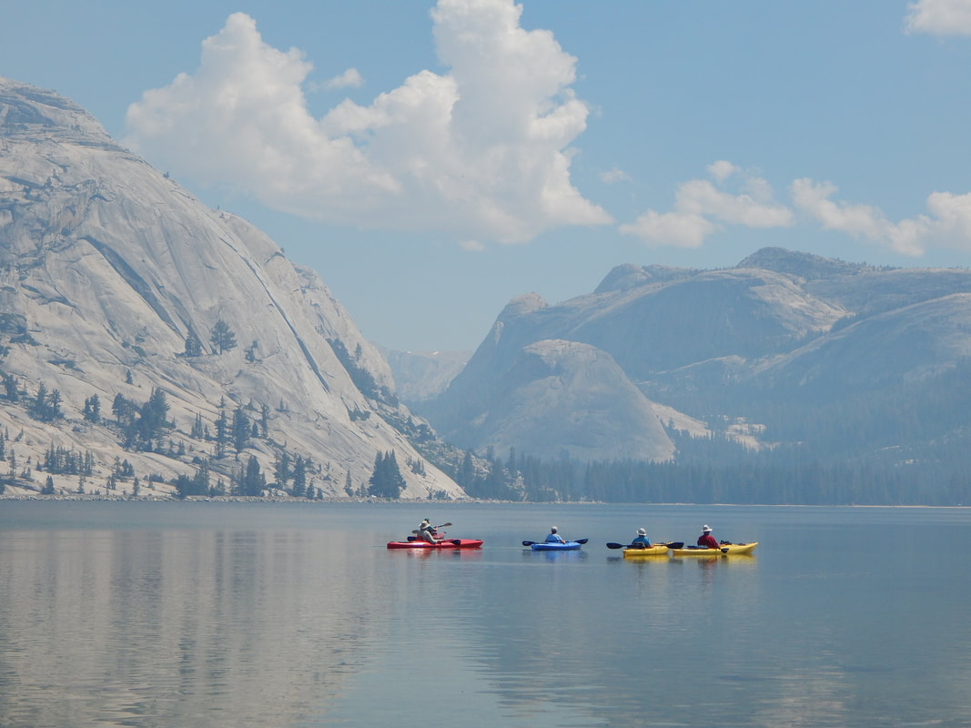
A Smokey Day in Tenaya Lake
Tom Bopp Returns to his Piano
After an approximately 3-week hiatus, Tom Bopp officially returns to his piano at the Big Trees Lodge tomorrow, Tuesday, Aug. 8. (He actually "cheated", and joined Bill, who's been sitting in for him, at the piano last weekend for a few minutes, and sang at the end of the Barn Dance Saturday night.) Tom returned to Wawona on Thursday evening from southern California, where he underwent open-heart surgery.
Tom will resume his usual schedule starting tomorrow: Tues-Sat 5:30-9:30.
Welcome back, Tom!. Wawona can't wait to hear its beloved soundtrack coming form the parlor room at the hotel once again. You are the best.
Tom will resume his usual schedule starting tomorrow: Tues-Sat 5:30-9:30.
Welcome back, Tom!. Wawona can't wait to hear its beloved soundtrack coming form the parlor room at the hotel once again. You are the best.
Take a ride with Yosemite’s ‘Buckshot,’ America’s only stagecoach driver/park ranger
The way Yosemite's Burrel “Buckshot” Rambo Maier tells it, he's living the good life. He's made visitors happy driving them around Yosemite as the the only stagecoach driver/park ranger in the National Park Service. Erica Paul Zamora The Fresno Bee
BY CARMEN GEORGE
[email protected]
AUGUST 06, 2017 8:00 AM
YOSEMITE NATIONAL PARK
Stagecoach driver Burrel “Buckshot” Rambo Maier tells his cargo, a family of three, that it’s his first day on the job and he’s “a little nervous” as a pair of trotting horses pulling the coach embark upon the bumpiest stretch of their journey. The wagon jostles and dust flies, but the horses’ steady gait and the driver’s grizzled beard make the newbie act hard to believe. The family giggles and Maier slips a sly smile.
Maier has been driving stagecoaches in Yosemite for more than 40 years, work he started at age 16. He’s the only stagecoach driver/park ranger in the National Park Service, a title he’s very proud of.
WHEN YOU MEET BURREL, YOU SEE SOMETHING AUTHENTIC AND GET A GLIMPSE OF WHAT PEOPLE WERE LIKE 100 YEARS AGO. HE IS STILL EMBODYING THAT IN A MODERN WAY.
Kansas Carradine of friend Burrel “Buckshot” Rambo Maier
The red-and-yellow stagecoach, “his office,” is the crown jewel of the Pioneer Yosemite History Center. The cluster of cabins is reached by a covered bridge along the south fork of the Merced River in Wawona, a relatively quiet corner of the park away from the bustle of Yosemite Valley. Maier uses the stagecoach as a fast and fun way to share history that he intimately understands.
One of Maier’s young passengers, 10-year-old Alex Varner of Arizona, is so impressed that he says he’d save his money for two years to buy a stagecoach of his own if it cost what it did in the late 1800s – about $350.
“I could ride around on that before I’m 16,” Alex says enthusiastically, “and then you don’t have to buy a $5,000 car. … You can just work a lot of chores, get your wagon, and ride away and have fun!”
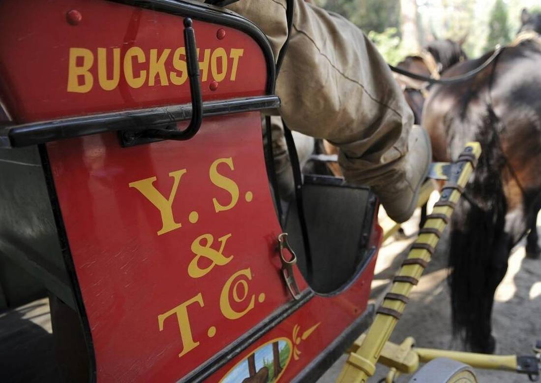
With his nickname on the stagecoach, Burrel “Buckshot” Rambo Maier has been offering rides as Wawona’s stagecoach driver in Yosemite National Park. Photographed Thursday, Aug. 3, 2017
ERIC PAUL ZAMORA [email protected]
During Maier’s stagecoach season, spring through fall, he lives in a bunkhouse by the river in Wawona that was once inhabited by a mountain lion. In winter, he settles into a cabin on a ranch in Exeter in the central San Joaquin Valley, where he looks after the four horses that pull Yosemite’s stage.
He’s befriended pioneers like the late Wawona Washburn Hartwig, whose father owned the historic Wawona Hotel (now called the Big Trees Lodge), and he used to drive a stagecoach that belonged to Galen Clark, the iconic explorer and guardian of Yosemite’s Mariposa Grove of Giant Sequoias.
YOSEMITE IS WORLD FAMOUS FOR THE NATURAL THINGS, BUT WE ALSO HAVE AN INCREDIBLE HISTORY.
Supervisory Park Ranger Dean Shenk
Maier says the most rewarding part of his job is “keeping it going.” The 61-year-old is now the park’s lone steward of a mode of transportation that was instrumental in the protection of Yosemite and eventual creation of the National Park Service. Among the millions who have ventured into Wawona – once the park’s busiest stagecoach stop – was President Theodore Roosevelt during his famous 1903 trip that included camping beneath giant sequoias with conservationist John Muir.
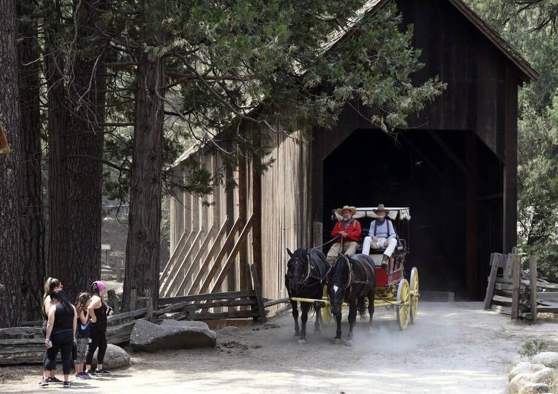
Burrel “Buckshot” Rambo Maier drives the stagecoach with Ron Townsend acting as swamper beside him crosses the wooden bridge to pick up new passengers in Wawona, Yosemite National Park, Thursday, Aug. 3, 2017.
ERIC PAUL ZAMORA [email protected]
Maier reminds visitors of what a trip to Yosemite once required: 36 hours of travel by train and stagecoach from San Francisco to Wawona, then eight hours by stage from Wawona to Yosemite Valley with four stops along the way to change horses. “That’s 16 head (horses) to go 27 miles one way.”
By contrast, a drive from Wawona to Yosemite Valley today takes less than an hour. Alex marvels at the difference and how the invention of the stagecoach led to the automobile.
THE RIDE IS AGELESS.
Burrel “Buckshot” Rambo Maier about driving the Yosemite stagecoach
Maier also passes on his knowledge to schoolchildren through a Park Service Environmental Living Program. He believes that “history is really important because you are carrying on the tradition of life.”
Wild West roots
A ride with Maier is educational, but above all, entertaining. In character as Buckshot the stagecoach driver, he sometimes tells people that he’s searching for a wife. “You got to have all your teeth, be able to cook and sew, I make $40 a month, and I take a bath once a week whether I need it or not.”
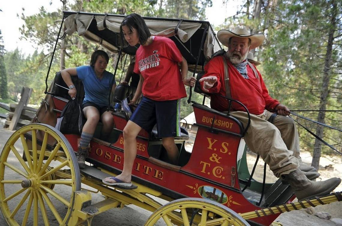
A Girl Scouts of Northern California Backing Interest Group (BIG) exits after a ride with Burrel “Buckshot” Rambo Maier, Wawona’s stagecoach driver in Yosemite National Park on Thursday, Aug. 3, 2017.
ERIC PAUL ZAMORA [email protected]
He follows a strict routine in caring for the horses and cleaning the barn and corral, and he dons a trademark red shirt, suspenders, wide-brimmed cowboy hat, and scarf tied around his neck – always silk. (Cowboys wear silk and farmers wear cotton, he explains, matter-of-factly.)
“It’s really a trip with a character out of the Old West,” says friend David Manchester, “molded by people in his childhood who were in the Old West.”
Some of it’s an act, but overall, “on the job and off the job, it’s pretty much the same guy,” says another friend, C.M. Wilhoit.
HE’S THE REAL DEAL.
Dale Halderman of friend Burrel “Buckshot” Rambo Maier
“He’s always animated,” says friend Kansas Carradine, “but it’s authentic, it’s not fake. He really cares deeply about the American West and history and preserving our heritage.”
This concern, and his flair for performance, was instilled by his father, Tommy Maier, a Hollywood stunt rider and rodeo cowboy with a trick riding and roping show, the Riata Ranch Cowboy Girls, which toured internationally.
As a boy, Burrel Maier performed in a Wild West show at his father’s Riata Ranch horseback riding camp, which operated out of Exeter and Bass Lake, just south of Yosemite. Maier’s nickname of Buckshot was reinforced during the skits, when he was occasionally accidentally shot with a spray of low-intensity pellets while pretending to be a gold-seeking prospector.
His stagecoach training can be traced back to childhood, when he got around by driving a small cart pulled by a donkey. Polio made walking a challenge, but leg braces and surgeries couldn’t keep him from enjoying a fantastical childhood. Exotic animals used in Hollywood movies were often left at the Riata Ranch by a family friend, including a young lion that lazed about the property. Burrel once raced on the back of a baby elephant against his older brother, Clay, perched on an ostrich.
Clay says his brother inherited their father’s creativity and drive to make people happy. “Burrel makes sure when they get on the stagecoach, they get their dollar’s worth.”
Still happy
Maier became Yosemite’s stagecoach driver in the early 1970s, replacing Clay, who he had started working with at age 14. Clay was the first to hold the post at the pioneer history center, driving the stagecoach for a few years before going on to travel as a rodeo cowboy and trainer with a horse show that toured internationally.
“Now I want my job back,” Clay says with a laugh.
Maier has no plans of obliging that request. Stagecoach driving is hard work, but Maier has never seen it as a job. It’s a passion, one he hopes to still be enjoying in old age. He loves everything about being in Wawona, even cleaning up “road apples” – his horses’ manure.
“I’ve dedicated my life to this and it’s paid off wonderfully,” he says. “I’m still happy.”
HE’S A UNIQUE INDIVIDUAL. THEY BROKE THE MOLD AFTER THEY MADE THAT MAN.
Fred Gill of friend Burrel “Buckshot” Rambo Maier
A new stagecoach and horses purchased by the Yosemite Conservancy a couple years ago, along with a corral reconstruction underway, are helping keep the dream alive.
“It’s like a violin,” he says of the stagecoach and horses. “You tune the violin to make it sound good, and right now I’m tuned up pretty good.”
Maier’s passion was on display for millions to see during the 2016 New Year’s Day Rose Parade, where he drove the stagecoach in a procession celebrating the 100th anniversary of the National Park Service.
His long list of extraordinary experiences includes running a traveling donkey basketball program, where children played basketball while riding donkeys; staging a pretend bank robbery as a fundraiser for a local charity; and riding a horse in an Indiana Jones-inspired performance during a 49ers football game halftime show at Candlestick Park. But of all the colorful things he’s done, there’s nothing he loves more than being Yosemite’s stagecoach driver.
Carradine says Maier embodies “the American values that I think we could use a little more of today: Honesty, hard work, integrity, taking care of nature and real friendship, camaraderie.”
Sitting happily in the corral after another day driving the stagecoach, Maier says definitively, “It just don’t get no better than this.”
Carmen George: 559-441-6386, @CarmenGeorge
Fire Update August 4th, 2017
There are expected thunderstorms again over the next couple of days which may produce more lightning and subsequently start more fires.
Knob 91
Discovered: 8/4/17 Location: Location: N 37° 52.185' x W 119° 35.217', 2 miles North East of Lukens Lake on a ridgetop
Size: Less than one quarter acre Cause: Lightning Spread Potential: Low
Fuels: Timber litter Strategy: Monitor
Benson Pass
Discovered: 8/3/17 Location: N 37° 00.925' x W 119° 27.350' at roughly 10,043 feet elevation
Size: less than one quarter acre Cause: Lightning Spread Potential: Low
Fuels: White Bark Strategy: Contained by natural barriers
Yosemite Creek
Discovered: 8/3/17 Location: N 37° 50.414' x W 119° 38.088' at roughly 7,970 feet elevation
Size: less than one quarter acre Cause: Lightning Spread Potential: Moderate
Fuels: Red Fire Strategy: Monitor
Blue
Discovered: 8/2/17 Location: In the Blue Jay Creek drainage at roughly 8,715 feet elevation
Size:less than one quarter acre Cause: Lightning Spread Potential: Low
Fuels: Mountain hemlock/Jeffrey Pine Strategy: Monitor
Jay
Discovered: 8/2/17 Location: In the Blue Jay Creek drainage at roughly 8653 feet elevation
Size: less than one quarter acre Cause: Lightning Spread Potential: Low
Fuels: Mountain Hemlock/Jeffrey Pine Strategy: Monitor
Porcupine
Discovered: 8/2/17 Location: N 37° 49.336' x W 119° 34.720' at roughly 8154 feet elevation just off Tioga road near Yosemite Creek Campground road
Size: less than one quarter acre Cause: Lightning Spread Potential: Low
Fuels: Lodgepole/Red Fire Strategy: Monitor
Indian Canyon
Discovered: 8/2/17 Location: at roughly 7400 feet elevation half a mile from the north Rim Trail
Size: 1/2 acre Cause: Lightning Spread Potential: High
Fuels: Red Fir Strategy: Contained and patrol status
North Dome
Discovered: 8/2/17 Location: N 37° 45.655' x W 119° 33.571' at roughly 7600 feet elevation off the Indian Ridge Trail below the ridge.
Size: 1/4 acre Cause Lightning Spread Potential: High
Fuels: Red Fire Strategy: Contained and patrol status
Starr King
Discovered: 8/2/17 Location: N 37° 42.965' x W 119° 29.588' at roughly 7800 feet elevation
Size: less than one quarter acre Cause: Lightning Spread Potential: Moderate
Fuels: Red Fire/ Lodgepole Strategy: Monitor, no threat to Little Yosemite Valley
Empire
Discovered: 7/31/17 Location: N 37° 38.673' x W 119° 37.096' at roughly 7300 feet elevation
Size: 309 acres
Cause: Lightning
The Empire Fire is in the wilderness and was reported on the night of July 31st. This fire is being managed to meet both protection and resource management objectives as allowed in Yosemite's Fire Management Plan. It is approximately 1 mile south of Bridalveil Campground and between Alder Creek drainage and Bridalveil Creek drainage in red fir.
Fire crews are monitoring growth, fire behavior, and smoke dispersion. Fire growth can range from 50-100 acres due to thunderstorm downdrafts. In sheltered areas with no wind fire will creep and smolder through forest understory. By allowing fires to burn naturally under the right conditions, we can ensure a healthier, more diverse and natural forest. There is no immediate threat to the Bridalveil Campground, Alder Creek trail, and Bridalveil Creek trail. Future closures will be decided based on fire behavior.
For additional Information:
- Fire Information: [email protected]
- Yosemite National Park Fire Information website: http://www.nps.gov/yose/blogs/fireinfo.htm
- Facebook: http://www.facebook.com/pages/Yosemite-Wildland-Fire/124632964255395
- Twitter: https://twitter.com/YosemiteFire
- Air Quality: https://www.nps.gov/yose/learn/nature/aqmonitoring.htm
Gratitude in the wake of a Cabin Fire in Wawona
On June 2, 2017, in the chill of 3 AM, our family cabin burned from the inside out in the little town of Wawona, on the south end of Yosemite Park. We had come up from San Luis Obispo County to work on interior roof repairs, rake pine needles and fell some dead trees before the summer season began. We made great progress the first day and congratulated ourselves with a hot shower and a BBQ dinner on the patio before falling into bed. My partner, Greg and I, slept outside on the patio beneath the stars and my parents occupied their RV parked on the driveway.
At around 3am, I woke to use the bathroom and saw an orange glow in the living room window. I thought I’d left all the lights on by accident, but when I pushed the door open, I was horrified to see the furnace in the back corner completely engulfed in flames and a tower of fire licking up the wall to the ceiling. Having fought wild land fires in New Mexico with the Forest Service, my mind instantly fast-forwarded the scene to a crown fire in the parched pine trees nearby, sweeping through all the cabins in our neighborhood. It was already too hot to enter the room, so I slammed the door shut and screamed “FIRE!” repeatedly. Greg leapt out of bed and I raced to wake my parents and our nearest neighbor who called 911.
I ran from door to door pounding until every cabin occupant in our cul-de-sac was alerted. We moved our vehicles and animals up the road for quick evacuation if necessary. In eleven minutes, our local Wawona fire department arrived in their truck and the crew showering our cabin and nearby trees to keep the fire contained. The fire burned frighteningly fast through our 50-year-old wood cabin and all of its contents. Despite our loss, we were handed the premium gift: our lives and the lives of our neighbors. The other cabins remained safe and all animals and trees were spared.
With recent fires throughout California and Mariposa County in particular, we look towards this experience with deep
gratitude and thankfully receive some key lessons.
GRATITUDE FOR THE LOVE AND CARE OF PEOPLE
As happens in many disasters, we met more of our neighbors. They reached out to us in several ways that touched us deeply. One group offered us their groceries as they were checking out that day. Another local resident lent us bowls and spoons to use for our food. Still another group of renters next door (who ironically hailed from San Luis Obispo where we live) presented us with a portion of their Madonna Inn black forest cake from their own anniversary celebration. “We thought this might help,” they said.
Later after the fire was out, locals Nancy Robbins and Janine Reikhardt walked with me on our lane. I mourned that my brother’s children wouldn’t be able to come out from Colorado as planned as we had no place to put them up that week. Janine turned to me and said, “Well, I work as the Group Booking Agent for the Redwoods (vacation home rental company in Wawona)…let me see what I can do.”
She went on to say that the new General Manager, Christian Mueller, was a deep-hearted person who cared about his community and might be able to contribute. That afternoon, she came by the burned cabin to find us sifting through the ashes. “I’ve got a cabin down the road for you for 3 nights to get some rest and a shower. Would you like that?” With bleary eyes and a numb shock, we gratefully accepted.
As we recovered over the next few days, calling insurance companies, and getting over jumpy nerves, nightmares and weariness, we experienced so much kindness. In Oakhurst, the Wells Fargo banking officer waived check fees and helped begin the process to replace lost ATM cards. The Sierra Tel/Verizon store representative, Brandon Cummins, quickly and expertly helped me purchase and reprogram a new phone so I could get reconnected to family, friends and insurance agents. The lovely lady running the cash register at the Pine Tree Market in Wawona offered us all a cold popsicle on her.
WHAT’S WITH ALL THIS COMPASSION?
Despite catastrophic events all over the world, people continue to exhibit a beautiful capacity to express empathy and compassion. We can still believe in humankind’s ability to lean toward love even as the daily news shows us all the places and times where we err towards harm.
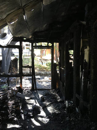
LESSONS LEARNED IN HOME FIRE SAFETY
Our fire began with an old heater, a lit pilot and some boxed games being left in a bad place. We had removed games and books from a bookshelf beneath the ceiling repairs we were doing the day before the fire. A box of games got inadvertently left on the flat surface of the heater during the move. Some time in the night, the temperatures dropped below 40 degrees and the heater kicked on. The game probably smoldered for hours, but because there was no smoke alarm in the cabin, we were not alerted until the fire was well underway. Our extinguisher was not in an accessible place nor would it have helped at that stage.
TIPS WE CAN SHARE TO KEEP YOUR FAMILY AND PROPERTY SAFE
Sincerely,
Sally Lamas, resident of San Luis Obispo, CA
Daughter of John Lamas and neice to Paul Lamas, owners of Margaret Black’s old cabin in Wawona
Our fire began with an old heater, a lit pilot and some boxed games being left in a bad place. We had removed games and books from a bookshelf beneath the ceiling repairs we were doing the day before the fire. A box of games got inadvertently left on the flat surface of the heater during the move. Some time in the night, the temperatures dropped below 40 degrees and the heater kicked on. The game probably smoldered for hours, but because there was no smoke alarm in the cabin, we were not alerted until the fire was well underway. Our extinguisher was not in an accessible place nor would it have helped at that stage.
TIPS WE CAN SHARE TO KEEP YOUR FAMILY AND PROPERTY SAFE
- FIRST DIAL 911! Even if you think you can get the fire out yourself, have someone call 911 so there is backup already on the way if you can’t.
- You can still make a 911 call if your phone can connect to ANY carrier’s cell tower signal. Even if you don’t show cell phone service (ie: “no bars” with your own carrier’s tower), you may be able to connect to another carrier (whose signal or “bars” won’t show up on your phone because they aren’t your carrier.) Make the call and see if you can get through via any carrier’s tower. If I had remembered my cell phone lying next to my bed, I might have been discouraged from trying as I had no service all day with Verizon. Knowing this information might save a life or property in the future.
- Having a landline is great idea for any cabin, rental or residence in the mountains as you are assured a way to call out. At the time of the fire, I thought my cell phone was burning inside the house, so I ran to ask our neighbor to call 911. Coincidentally (or providentially), they had installed a landline just days before in case they needed it for their visiting elderly mother. Thank goodness! This call enabled the fire department to arrive in a speedy 11 minutes and make sure the fire didn’t spread past our cabin.
- Keep a fire extinguisher near the front door or outside the front door where it can be immediately accessed and is seen by all entering the house. Our fire extinguisher was inside the house tucked away near the bathroom hallway and inaccessible during the fire.
- DO NOT PUT ANYTHING ON or CLOSE TO ANY HEATER even for “a few minutes.” Make sure drapes and furniture are at least 2-3 feet away. I’ve talked to so many people who’ve used their wall or floor heaters to dry wet ski socks, rain pants, etc. and then stepped out of the room and came back to find them smoking or in flames. The games that started our fire were set on the flat surface of the heater during the day when it was turned off. We didn’t notice them and forgot to move them that night before we went to bed. NOTHING should ever be put on the heater whether it’s on or off.
- Know your thermostat. Does it have an “on/off “switch or a predetermined low/high setting? Our thermostat was preset to turn on when temperatures dropped below 40 degrees. Because the pilot was lit, it did just that. If you don’t plan to use your heat (especially in warmer summer nights), blow out the pilot and turn gas off to the heater.
- Know how to turn off your butane and leave instructions near the front door so renters can do it. The tower of flames I saw when I first opened the door was so big in part because the butane kept fueling the flame. One family member gratefully remembered to turn off the butane.
- Have family member phone numbers memorized or written in other places outside your residence or rental. Keeping them in your car or at a neighbors’. With the advent of one-touch dialing, many of us don’t know critical phone numbers by heart. If my family had split up in an evacuation, I wouldn’t have been able to contact them as I didn’t know their numbers and had no way to access them away from my home.
- Keep a hide-a-key somewhere on your car or in a hidden box outside your residence. When my keys burned inside the cabin, I could still get in my car and move or evacuate with it. I left my keys in the ignition and the doors unlocked so others could move it without me if necessary.
- Get animals safely secured inside a vehicle (with windows cracked for air). We grabbed my parent’s and my dogs so they wouldn’t be able to run away in the chaos and we would know they were safe and ready to evacuate.
- Keep Xerox copies of the contents of your wallet (driver’s license, credit cards, SS card, emergency financial and personal phone numbers, etc.) somewhere safe outside your home (with neighbors or in a safety deposit box). I had done this for years and it paid off. It made proving my identity a snap so I could easily replace my driver’s license, which I then needed to access emergency money from the bank and get temporary checks to pay my rent.
- Take out insurance on your residence or get renters’ insurance. I was so glad I took out renter’s insurance last year. Even though I was traveling, it covered all my belongings wherever I was. My State Farm Renter’s Insurance covers $43k in personal losses and costs me only $12/mo. The $500 deductible is a small sum considering the $10k in belongings that burned. You may not think you have much to lose, but little things like toiletries and expensive things like laptops add up if you have to replace them all at o, 2017nce.
- Keep purchase receipts of your most important belongings. The receipts I kept for my laptop, bike gear and cell phone made proving my losses easier with my insurance company. They usually pay the depreciated value depending on age and condition, but will reimburse you if you repurchase the item within a specified span of time.
- Take photos of items ruined or burned at the scene. This is another way to prove loss of items for which you may not be able to locate receipts.
- Be kind to yourself and others during the restoration process. Get rest. It may not feel like you are stressed or exhausted, but on many levels, you will be. We got away from the burn site for chunks of time and set limits to how long we would work on fire recovery tasks each following day. We took naps, had a bbq, and watched a silly movie to help ourselves laugh and get our minds off of replaying the events and rehashing the “what ifs”. We gave each other lots of space and understanding if someone was crabby, anxious or extra tired and slow.
- Keep focused on your gratitude. If the losses are high, materially, or if people or animals perish, this is especially important. Gratitude, even for little things that are going well or tragedies that DIDN’T happen, can bring balance to the sadness and shock of great loss. We were grateful for the recent rains that wet the ground; the early time of year that kept the local fire crew in town and not out on other fires; and even the gentle urgings of a full bladder. We especially noted how VERY lucky we were not to lose any people, animals, or neighbors’ cabins. We helped frame our frightening experience by turning towards each other with hourly hugs and verbal statements that honored the contributions we each made during and after the fire. It wasn’t a “tragic loss of an old family cabin” laced with guilt and sorrow, it was an opportunity for us to bond and support each other as a family. The bonding we did in the aftermath made us stronger. In the future, when we experience any new losses together, we’ll already know how to compassionately support each other.
- Share your prevention with others. I’m writing this here now not to preach, but to encourage all of us to be aware and take the extra preventative measures to keep each other safe. I went right home and installed a few more fire alarms in my two-story home in San Luis Obispo and added a carbon monoxide alarm in the bedroom. I’m also getting a fire escape ladder for the deck outside the bedroom. These are things we may be required by law to have in rentals, but have we done them for ourselves, in our own homes? It’s worth the extra time and money. We are all worth it. Keep safe. Be ready to help yourself and others.
Sincerely,
Sally Lamas, resident of San Luis Obispo, CA
Daughter of John Lamas and neice to Paul Lamas, owners of Margaret Black’s old cabin in Wawona
Fire Update August 3rd, 2017
Your browser does not support viewing this document. Click here to download the document.
The thunderstorm activity yesterday afternoon over Yosemite produced a couple hundred lightning strikes in the high country starting numerous fires mostly in the wilderness. There are expected thunderstorms again today and over the next couple of days which may produce more lightning and subsequently start more fires.
Empire Fire: N 37° 38.673' x W 119° 37.096' at approximately 7300 feet elevation
Size: 147 acres
Cause: Lightning
The Empire Fire is in the wilderness and reported on the night of July 31st. This fire is being managed for both protection and resource objectives as allowed in Yosemite's Fire Management Plan. It is approximately 1 mile south of the Bridalveil Campground and between Alder Creek and Bridalveil Creek on a north-northeast aspect with an over story of red fir. Current fire behavior is creeping and smoldering in needle duff, burning in heavy dead and down timber, and backing and flanking on the NW and NE sections of the fire.
Fire crews are on scene today doing an assessment of the fire. There is no immediate threat to the Bridalveil Campground, Alder Creek trail, and Bridalveil Creek trail. Future closures will be decided based on fire behavior.
Starr King Fire: N 37° 42.965' x W 119° 29.588' at approximately 7800 feet elevation
Size: less than one quarter acre
Cause: Lightning Strategy: Monitor, no threat to Little Yosemite Valley
Blue Fire: In the Blue Jay Creek Drainage at approximately 8800 feet elevation
Size: less than one quarter acre
Cause: Lightning Strategy: Monitor
Jay Fire: In the Blue Jay Creek Drainage at approximately 8800 feet elevation
Size: less than one quarter acre
Cause: Lightning Strategy: Monitor
Porcupine Fire: N 37° 49.336' x W 119° 34.720' at approximately 8050 feet elevation just off of Hwy 120 near Yosemite Creek Campground road
Size: less than one quarter acre
Cause: Lightning
Indian Canyon Fire: at approximately 7400 feet elevation half a mile from the north Rim Trail
Size: 1/2 acre
Cause: Lightning Strategy: Initial attack will be suppression
North Dome Canyon Fire: N 37° 45.655' x W 119° 33.571' at approximately 7600 feet elevation off the Indian Ridge Trail below the ridge.
Size: 1/4 acre
Cause: Lightning Strategy: Initial attack will be suppression
For additional Information:
- Fire Information: [email protected]
- Yosemite National Park Fire Information website: http://www.nps.gov/yose/blogs/fireinfo.htm
- Facebook: http://www.facebook.com/pages/Yosemite-Wildland-Fire/124632964255395
- Twitter: https://twitter.com/YosemiteFire
- Air Quality: https://www.nps.gov/yose/learn/nature/aqmonitoring.htm
Yosemite Fire Update- August 2nd, 2017
Empire Fire
Empire Fire: N 37° 38.673' x W 119° 37.096' at approximately 7300 feet elevation
Size: 147 acres
Cause: Lightning
The Empire Fire is in the wilderness and reported on the night of July 31st. This fire is being managed for multiple objectives, for both protection and resources. It is approximately 1 mile south of the Bridalveil Campground and between Alder Creek and Bridalveil Creek on a north-northeast aspect with an over story of red fir, burning in forest ground litter, needle duff, and dead and down red fir. Current fire behavior is creeping and smoldering in needle duff, burning in heavy dead and down timber, and backing and flanking on the NW and NE sections of the fire.
Crews are on scene and will continue to monitor this fire. The wilderness area the Empire Fire is in is a fire adapted forest ecosystem. By allowing fires to burn naturally we can ensure a healthier, more diverse and natural forest. Most importantly, managing fires under the right conditions can reduce fuels and thereafter reduce the intensity of future fires.
There are no threats to the area, Bridalveil Campground, or the hiking trails at this time. Both the Alder creek trail and Bridalveil trail are being assessed by fire crews. The fire will be seen from the high country and may be seen from viewpoints in the immediate area off Glacier Point Road.
Smoke will be seen in the fire area and may impact the Bridalveil Campground. Fire Managers are working with the local Air Quality Districts and will continually be monitoring smoke impacts to the park and local communities. Community members who are sensitive to smoke may want to close their windows and doors and continually monitor the attached air quality links.
For additional Information:
Shanelle Saunders
Fire Education and Information
Yosemite National Park
Office: (209) 375-9515
Cell: (209) 347-6395
[email protected]
Size: 147 acres
Cause: Lightning
The Empire Fire is in the wilderness and reported on the night of July 31st. This fire is being managed for multiple objectives, for both protection and resources. It is approximately 1 mile south of the Bridalveil Campground and between Alder Creek and Bridalveil Creek on a north-northeast aspect with an over story of red fir, burning in forest ground litter, needle duff, and dead and down red fir. Current fire behavior is creeping and smoldering in needle duff, burning in heavy dead and down timber, and backing and flanking on the NW and NE sections of the fire.
Crews are on scene and will continue to monitor this fire. The wilderness area the Empire Fire is in is a fire adapted forest ecosystem. By allowing fires to burn naturally we can ensure a healthier, more diverse and natural forest. Most importantly, managing fires under the right conditions can reduce fuels and thereafter reduce the intensity of future fires.
There are no threats to the area, Bridalveil Campground, or the hiking trails at this time. Both the Alder creek trail and Bridalveil trail are being assessed by fire crews. The fire will be seen from the high country and may be seen from viewpoints in the immediate area off Glacier Point Road.
Smoke will be seen in the fire area and may impact the Bridalveil Campground. Fire Managers are working with the local Air Quality Districts and will continually be monitoring smoke impacts to the park and local communities. Community members who are sensitive to smoke may want to close their windows and doors and continually monitor the attached air quality links.
For additional Information:
- Fire Information: [email protected]
- Yosemite National Park Fire Information website: http://www.nps.gov/yose/blogs/fireinfo.htm
- Facebook: http://www.facebook.com/pages/Yosemite-Wildland-Fire/124632964255395
- Twitter: https://twitter.com/YosemiteFire
- Air Quality: https://www.nps.gov/yose/learn/nature/aqmonitoring.htm
Shanelle Saunders
Fire Education and Information
Yosemite National Park
Office: (209) 375-9515
Cell: (209) 347-6395
[email protected]
Detweiler Fire at 85% Containment
Detwiler Fire (Outside Yosemite National Park) Incident Information:
Last Updated:July 30, 2017 7:18 am
Date/Time Started:July 16, 2017 3:56 pm
Administrative Unit:CAL FIRE Madera-Mariposa-Merced Unit
County:Mariposa County
Location:Detwiler Rd and Hunters Valley Rd, 2 miles east of Lake McClure
Acres Burned - Containment:81,826, acres - 85% contained
Structures Threatened:30
Structures Destroyed:63 residences, 67 minor structures and 1 commercial structure destroyed. 13 residences damages and 8 minor structures damaged
Evacuations:Evacuation Advisories - Mariposa
Dogtown Rd from Texas Hill Rd to Bull Creek Rd Texas Hill Rd Bondurant Mine Rd Bull Creek Rd
Evacuation Shelters
Road Closures:Bull Creek Rd, HWY49-N- Closed 1 mile North of Bear Valley to Crown Lead Rd, Greeley Hill Rd- Closed from Lower Dog Town to Bowers Cave and all roads to the south, Dog Town Rd- Closed and all side roads, Texas Hill Rd- Closed and all side roads, Schilling Rd- Closed and all side roads.
Cause:Under Investigation
Cooperating Agencies:Mariposa County Sheriff’s Office, Mariposa County Fire, CAL OES, CHP, Mariposa Public Works, CALTRANS, Mariposa Public Utility District, BLM, Merced County Fairgrounds, Mariposa County Fairgrounds, California Dept. of Corrections and Rehabilitation, American Red Cross, Mariposa OES ,Mariposa County human Services and Public Health, North Fork Tribal Chair, CDCR CYA Camp, City of San Francisco, TDS Telecom, AT&T, Verizon, Sierra Pacific Industries, PG&E, Tuolumne County Sheriff, Wildland Defense Systems, Sierra Telephone, California State Parks, Salvation Army, United States Forest Service, Federal Team 5, Red Zone Disaster Intelligence, City of Merced, U.S. Senator Feinstein’s Office, California National Guard, John C. Fremont Healthcare District, National Park Service, Sonoma County, Madera Sheriff and Mariposa Health Air Quality, Merced County
Total Fire Personnel:3293
Total Fire Engines:174
Total Fire Crews:76
Total Helicopters:5
Total Dozers:12
Total Water Tenders:33
Incident Management Team:CAL FIRE Incident Management Team 4
Long/Lat:-120.21321/37.61757
Conditions:July 26, 2017 - Detwiler Fire Community Meeting Information
Last night more containment efforts were made. Further repopulation efforts will continue under the repoplulation plan. Sunny and dry weather continue today. The fire is seeing better humidity recoveries at night. We ask the public to exercise caution and remember that, “One Less Spark-One Less Wildfire”.We ask for the public to heed all evacuation orders and warnings. For information about how to prepare for evacuation please visit: www.ReadyForWildfire.org.
Phone Numbers(844) MMU-FIRE (Fire Information Line )
Phone Numbers(562) 619-7467 (Media Line )
Last Updated:July 30, 2017 7:18 am
Date/Time Started:July 16, 2017 3:56 pm
Administrative Unit:CAL FIRE Madera-Mariposa-Merced Unit
County:Mariposa County
Location:Detwiler Rd and Hunters Valley Rd, 2 miles east of Lake McClure
Acres Burned - Containment:81,826, acres - 85% contained
Structures Threatened:30
Structures Destroyed:63 residences, 67 minor structures and 1 commercial structure destroyed. 13 residences damages and 8 minor structures damaged
Evacuations:Evacuation Advisories - Mariposa
Dogtown Rd from Texas Hill Rd to Bull Creek Rd Texas Hill Rd Bondurant Mine Rd Bull Creek Rd
Evacuation Shelters
- Sonora Fair grounds, 220 Southgate, Sonora, CA
- MES Shelter, Red Cross, 5044 Jones St, Mariposa, CASmall animals: Sierra Vista Presbyterian Church at 39616 Hwy 41, Oakhurst, CA.; Cesar Chavez Middle School at 161 Plainsburg Road, Planada, CA. (559)-433-9663; Sonora Fairgrounds at 220 Southgate Rd, Sonora, CA., Oakhurst Community Center, 39800 Fresno Flats Rd, Oakhurst, CA 93644
Large animals: Coarsegold Rodeo Grounds, 44777 Rodeo Grounds Ln, Coarsegold, CA. (559)-994-2794; Horsemen Association, 499 Nevada St, Merced, CA (209)-354-9437
Mariposa County Sheriff's Office Evacation and Road Closure Updates via Nixle
Road Closures:Bull Creek Rd, HWY49-N- Closed 1 mile North of Bear Valley to Crown Lead Rd, Greeley Hill Rd- Closed from Lower Dog Town to Bowers Cave and all roads to the south, Dog Town Rd- Closed and all side roads, Texas Hill Rd- Closed and all side roads, Schilling Rd- Closed and all side roads.
Cause:Under Investigation
Cooperating Agencies:Mariposa County Sheriff’s Office, Mariposa County Fire, CAL OES, CHP, Mariposa Public Works, CALTRANS, Mariposa Public Utility District, BLM, Merced County Fairgrounds, Mariposa County Fairgrounds, California Dept. of Corrections and Rehabilitation, American Red Cross, Mariposa OES ,Mariposa County human Services and Public Health, North Fork Tribal Chair, CDCR CYA Camp, City of San Francisco, TDS Telecom, AT&T, Verizon, Sierra Pacific Industries, PG&E, Tuolumne County Sheriff, Wildland Defense Systems, Sierra Telephone, California State Parks, Salvation Army, United States Forest Service, Federal Team 5, Red Zone Disaster Intelligence, City of Merced, U.S. Senator Feinstein’s Office, California National Guard, John C. Fremont Healthcare District, National Park Service, Sonoma County, Madera Sheriff and Mariposa Health Air Quality, Merced County
Total Fire Personnel:3293
Total Fire Engines:174
Total Fire Crews:76
Total Helicopters:5
Total Dozers:12
Total Water Tenders:33
Incident Management Team:CAL FIRE Incident Management Team 4
Long/Lat:-120.21321/37.61757
Conditions:July 26, 2017 - Detwiler Fire Community Meeting Information
Last night more containment efforts were made. Further repopulation efforts will continue under the repoplulation plan. Sunny and dry weather continue today. The fire is seeing better humidity recoveries at night. We ask the public to exercise caution and remember that, “One Less Spark-One Less Wildfire”.We ask for the public to heed all evacuation orders and warnings. For information about how to prepare for evacuation please visit: www.ReadyForWildfire.org.
Phone Numbers(844) MMU-FIRE (Fire Information Line )
Phone Numbers(562) 619-7467 (Media Line )
Detweiler Fire Now 70% Contained
(This fire is NOT inside Yosemite National Park)
Detwiler Fire Incident Information:
Last Updated:July 25, 2017 6:45 pm
Date/Time Started:July 16, 2017 3:56 pm
Administrative Unit:CAL FIRE Madera-Mariposa-Merced Unit
County:Mariposa County
Location:Detwiler Rd and Hunters Valley Rd, 2 miles east of Lake McClure
Acres Burned - Containment:81,250 , acres - 70% contained
Structures Threatened:1,500
Structures Destroyed:63 residences, 67 minor structures and 1 commercial structure destroyed. 13 residences damages and 8 minor structures damaged
Evacuations:Evacuation Orders - Mariposa
Dogtown Rd. from Wampum Hill to Bowers Cave All of Texas Hill Rd Greeley Hill Rd. from Lower Dogtown Rd. (Coulterville) to Dogtown Rd. near Bowers Cave Bull Creek Rd from Greeley Hill Rd to the Merced River Old Yosemite Rd to the Five Corners intersectionEvacuation Advisories - Mariposa
HWY 49N from Oakridge Rd. to the County Line. All roads north of Greeley Hill Rd. to the Mariposa County line, to include Dexter Rd., Cueno Rd., Smith Station Rd. to HWY 120 and all feeder roads, Buck Meadows Rd. north of Greeley Hill Rd. to HWY 120, Old Yosemite Rd and Bull Creek Rd. The town of Coulterville from Hwy 49N to Lower Dogtown Rd. All of Schilling Rd and all feeder roads. River Rd. from Briceburg to North Fork Falls.
Evacuation Shelters
Road Closures:HWY49-N- Closed 1 mile North of Bear Valley to Crown Lead Rd, Greeley Hill Rd- Closed from Lower Dog Town to Bowers Cave and all roads to the south, Dog Town Rd- Closed and all side roads, Texas Hill Rd- Closed and all side roads, Schilling Rd- Closed and all side roads.
Cause:Under Investigation
Cooperating Agencies:Mariposa County Sheriff’s Office, Mariposa County Fire, CAL OES, CHP, Mariposa Public Works, CALTRANS, Mariposa Public Utility District, BLM, Merced County Fairgrounds, Mariposa County Fairgrounds, California Dept. of Corrections and Rehabilitation, American Red Cross, Mariposa OES ,Mariposa County human Services and Public Health, North Fork Tribal Chair, CDCR CYA Camp, City of San Francisco, TDS Telecom, AT&T, Verizon, Sierra Pacific Industries, PG&E, Tuolumne County Sheriff, Wildland Defense Systems, Sierra Telephone, California State Parks, Salvation Army, United States Forest Service, Federal Team 5, Red Zone Disaster Intelligence, City of Merced, U.S. Senator Feinstein’s Office, California National Guard, John C. Fremont Healthcare District, National Park Service, Sonoma County, Madera Sheriff and Mariposa Health Air Quality, Merced County
Total Fire Personnel:4,914
Total Fire Engines:343
Total Fire Crews:114
Total Helicopters:19
Total Dozers:52
Total Water Tenders:61
Incident Management Team:CAL FIRE Incident Management Team 4
Long/Lat:-120.21321/37.61757
Conditions:July 26, 2017 - Detwiler Fire Community Meeting Information
Last night more containment efforts were made. Further repopulation efforts will continue under the repoplulation plan. Sunny and dry weather continue today. The fire is seeing better humidity recoveries at night. We ask the public to exercise caution and remember that, “One Less Spark-One Less Wildfire”.We ask for the public to heed all evacuation orders and warnings. For information about how to prepare for evacuation please visit: www.ReadyForWildfire.org.
Phone Numbers(844) MMU-FIRE (Fire Information Line )
Phone Numbers(562) 619-7467 (Media Line )
Last Updated:July 25, 2017 6:45 pm
Date/Time Started:July 16, 2017 3:56 pm
Administrative Unit:CAL FIRE Madera-Mariposa-Merced Unit
County:Mariposa County
Location:Detwiler Rd and Hunters Valley Rd, 2 miles east of Lake McClure
Acres Burned - Containment:81,250 , acres - 70% contained
Structures Threatened:1,500
Structures Destroyed:63 residences, 67 minor structures and 1 commercial structure destroyed. 13 residences damages and 8 minor structures damaged
Evacuations:Evacuation Orders - Mariposa
Dogtown Rd. from Wampum Hill to Bowers Cave All of Texas Hill Rd Greeley Hill Rd. from Lower Dogtown Rd. (Coulterville) to Dogtown Rd. near Bowers Cave Bull Creek Rd from Greeley Hill Rd to the Merced River Old Yosemite Rd to the Five Corners intersectionEvacuation Advisories - Mariposa
HWY 49N from Oakridge Rd. to the County Line. All roads north of Greeley Hill Rd. to the Mariposa County line, to include Dexter Rd., Cueno Rd., Smith Station Rd. to HWY 120 and all feeder roads, Buck Meadows Rd. north of Greeley Hill Rd. to HWY 120, Old Yosemite Rd and Bull Creek Rd. The town of Coulterville from Hwy 49N to Lower Dogtown Rd. All of Schilling Rd and all feeder roads. River Rd. from Briceburg to North Fork Falls.
Evacuation Shelters
- Sonora Fair grounds, 220 Southgate, Sonora, CA
- MES Shelter, Red Cross, 5044 Jones St, Mariposa, CASmall animals: Sierra Vista Presbyterian Church at 39616 Hwy 41, Oakhurst, CA.; Cesar Chavez Middle School at 161 Plainsburg Road, Planada, CA. (559)-433-9663; Sonora Fairgrounds at 220 Southgate Rd, Sonora, CA., Oakhurst Community Center, 39800 Fresno Flats Rd, Oakhurst, CA 93644
Large animals: Coarsegold Rodeo Grounds, 44777 Rodeo Grounds Ln, Coarsegold, CA. (559)-994-2794; Horsemen Association, 499 Nevada St, Merced, CA (209)-354-9437
Mariposa County Sheriff's Office Evacation and Road Closure Updates via Nixle
Road Closures:HWY49-N- Closed 1 mile North of Bear Valley to Crown Lead Rd, Greeley Hill Rd- Closed from Lower Dog Town to Bowers Cave and all roads to the south, Dog Town Rd- Closed and all side roads, Texas Hill Rd- Closed and all side roads, Schilling Rd- Closed and all side roads.
Cause:Under Investigation
Cooperating Agencies:Mariposa County Sheriff’s Office, Mariposa County Fire, CAL OES, CHP, Mariposa Public Works, CALTRANS, Mariposa Public Utility District, BLM, Merced County Fairgrounds, Mariposa County Fairgrounds, California Dept. of Corrections and Rehabilitation, American Red Cross, Mariposa OES ,Mariposa County human Services and Public Health, North Fork Tribal Chair, CDCR CYA Camp, City of San Francisco, TDS Telecom, AT&T, Verizon, Sierra Pacific Industries, PG&E, Tuolumne County Sheriff, Wildland Defense Systems, Sierra Telephone, California State Parks, Salvation Army, United States Forest Service, Federal Team 5, Red Zone Disaster Intelligence, City of Merced, U.S. Senator Feinstein’s Office, California National Guard, John C. Fremont Healthcare District, National Park Service, Sonoma County, Madera Sheriff and Mariposa Health Air Quality, Merced County
Total Fire Personnel:4,914
Total Fire Engines:343
Total Fire Crews:114
Total Helicopters:19
Total Dozers:52
Total Water Tenders:61
Incident Management Team:CAL FIRE Incident Management Team 4
Long/Lat:-120.21321/37.61757
Conditions:July 26, 2017 - Detwiler Fire Community Meeting Information
Last night more containment efforts were made. Further repopulation efforts will continue under the repoplulation plan. Sunny and dry weather continue today. The fire is seeing better humidity recoveries at night. We ask the public to exercise caution and remember that, “One Less Spark-One Less Wildfire”.We ask for the public to heed all evacuation orders and warnings. For information about how to prepare for evacuation please visit: www.ReadyForWildfire.org.
Phone Numbers(844) MMU-FIRE (Fire Information Line )
Phone Numbers(562) 619-7467 (Media Line )
Your browser does not support viewing this document. Click here to download the document.
After seven days, Detwiler Fire is now at 40% containment
Sierra Star -
In a 6 p.m. Detwiler Fire update (July 22nd), additional evacuation orders have been lifted for residents only, as firefighters have the fire at 40% containment. The fire has only grown 300 acres from Saturday morning’s update. Total burned acreage is currently at 75,500 acres.
Evacuation orders have been lifted from:
☆ Old Highway from Hwy 49 South to Totokon Rd and all side roads
☆ Old Highway from Guadalupe Fire Rd to Highway 140 (Catheys Valley) - Guadalupe Fire Rd will remain under an evacuation order
☆ Bear Valley Rd
☆ Hunters Valley Rd
☆ Hunters Valley Mt. Access Rd
☆ Detwiler Rd
☆ Cotton Creek Rd
All other evacuation orders remain in effect, with the following roads remaining closed in the above evacuation lifted areas.
☆ All side roads on Highway 140 – Closed with the exception of Elizabeth Lane and Trower Roads
☆ Old Highway - Closed from Totokon to Guadalupe Fire Rd and all side roads in between
☆ Highway 49N - Closed from the top of Bagby Grade to Oakridge Rd (Coulterville)
In a Saturday morning update from Cal Fire, the Detwiler Fire grew overnight by only 200 acres, to 75,200 with 30% containment.
Some 4,645, down from yesterday’s 4,900, personnel are at work to gain complete containment of the fire.
The fire has destroyed 63 homes, damaged 13, and 1,500 structures still remain threatened.
Safety MessageFire officials and the sheriff’s department reminds the public to stay vigilant on current fire conditions, and to continue to adhere to road closures and any evacuation warnings.
If you see electrical wires on the ground, stay clear and contact PG&E immediately. Trees and poles with deep charring, particularly if still smoking, should be considered hazardous.
Drive slowly and yield to emergency personnel in the area.
As you re-enter your property and evaluate damage, be aware that hazardous conditions may exist, particularly if a residence or out-building has burned. Hazards may include asbestos, heavy metals, by-products of plastic combustion and various other chemicals.
The cause of the fire remains under investigation.
DETWILER FIRE Community Meeting
Saturday, July 22, 2017
Community Meeting
DETWILER FIRE
Saturday, July 22, 2017
www.fire.ca.gov
Mariposa:
When:
7:00PM, Saturday, July 22, 2017
Where:
Mariposa County High School Auditorium
5074 Old Hwy N, Mariposa, CA 95338
What:
CAL FIRE Incident Management Team 4, the Mariposa County Sherriff’s Office, and additional cooperating agencies on the Detwiler Fire will be hosting a community meeting in Mariposa. Representatives from the agencies managing the incident will provide an operational briefing and be available for questions. Please arrive early as the meeting will start promptly at 7:00 p.m.
If you have questions about the meeting or the fire, please call the Fire Information Line: (844) 669 - 3473 or (844) MMU-FIRE
Cooperating Agencies: Bureau of Land Management, Mariposa County Sheriff, California Highway Patrol, California Department of Corrections and Rehabilitation, California Conservation Corps, CAL OES, Mariposa County Fire, and the American Red Cross.
###
Detwiler Fire 30% Contained as of Saturday 22nd, 7 AM
Your browser does not support viewing this document. Click here to download the document.
Detwiler Fire Incident Information:
Last Updated:July 22, 2017 7:30 am
Date/Time Started:July 16, 2017 3:56 pm
Administrative Unit:CAL FIRE Madera-Mariposa-Merced Unit
County:Mariposa County
Location:Detwiler Rd and Hunters Valley Rd, 2 miles east of Lake McClure
Acres Burned - Containment:75,200 acres - 30% contained
Structures Threatened:1,500
Structures Destroyed:60 residences, 63 minor structures and 1 commercial structure destroyed. 13 residences damages and 7 minor structures damaged
Evacuations:As of July 21, 2017 at 12:00 PM - Evacuations for the town of Mariposa have been lifted.Evacuation Orders - Mt Bullion Ridge Rd, HWY 140 from Hornitos Rd. to 1 mile west of mariposa town and ALL side roads, Old HWY South from 49 S to School House Rd and all side roads, Buckeye Rd. to Ben Hur Rd. and ALL side roads, HWY 140 from 1 Mile east of Mariposa to East Whitlock Rd. and ALL side roads, East Whitlock Rd from HWY 140 to Colorado Rd and All side roads to the West, West Whitlock from 49-N to East Whitlock at Colorado Rd and ALL side roads, Colorado Rd. from E. Whitlock to Rancheria Creek Rd and ALL side roads,All of Rancheria Creek Rd.ALL of Sherlock Rd, ALL of Telegraph Rd, River Rd from Briceburg to Northfork Falls, French Camp Rd, Mykleoaks Subdivision, Fournier Rd, CYA Camp Rd, Mt. Bullion Cuttoff Rd- From Hwy 140 to 72a, Princeton Rd- From 49N to 72b
Evacuation Orders-North County HWY 49-N from Schilling Rd. to Oakridge Rd. and ALL feeder roads, HWY 132 from HWY 49-N to Windy Point, the town of Coulterville, Dogtown Rd. from Greeley Hill Rd. to Texas Hill Rd., ALL of Texas Hill Rd., Schilling Rd from HWY 49-N to Texas Hill Rd, Greeley Hill Rd. from Dogtown Rd. (Coulterville) to Dogtown Rd. near Bowers Cave. All roads between Greeley Hill Rd, Texas Hill Rd. Bull Creek Rd from Greeley Hill Rd to the Merced River, Old Yosemite Rd to the Five Corners intersection.
Evacuation Advisories NORTH COUNTY: HWY 49N from Oakridge Rd. to the County Line. All roads north of Greeley Hill Rd. to the Mariposa County line, to include Dexter Rd., Cueno Rd., Smith Station Rd. to HWY 120 and ALL feeder roads, Buck Meadows Rd. north of Greeley Hill Rd. to HWY 120, Old Yosemite Rd and Bull Creek Rd.
SOUTH COUNTY: Hwy 49-S from Ben Hur Rd to Indian Peak Rd and ALL feeder roads, Ashworth to Silver Lane and ALL feeder roads, Silver Bar to Ashworth and ALL feeder roads, Indian Peak to Oak Grove Rd and ALL feeder roads, Oak Grove Rd from Miwuk Rd to Oak Grove School Rd and ALL feeder roads, Allred Rd from 49S to Morningstar Lane and ALL feeder roads, Morningstar Lane to Carlton Rd and ALL feeder roads, Carlton Rd to Silva Rd and ALL feeder roads, Silva Rd to Hwy 49 South and ALL feeder roads, Bear Valley Rd- All homes from Exchequer Rd to Hornitos Rd, Hornitos Town Area, HWY 140 from Briceburg to E. Whitlock, Colorado Rd from HWY 140 to Rancheria Creek Rd., Oak Rd and Yosemite Oak Rd and all of Mariposa Town, 49-N from Mariposa to Fremont Fort, Mt Bullion Cuttoff Rd-from 49-N to 72b, School Ln, Rd 72A, Princeton Rd-from 49-N to 72b, Pendola Gardens, Old Toll, Corbett Creek Rd, Mt. Ophir, Hornitos Rd, Mt Gaines, No.9 Rd and Ben Hur Rd from Hwy 49 S. to Buckeye.
Evacuation Advisories - Tuolumne County Smith Station Rd. to HWY 120 and ALL feeder roads.
Evacuation Shelters
Large animals: Coarsegold Rodeo Grounds, 44777 Rodeo Grounds Ln, Coarsegold, CA. (559)-994-2794; Horsemen Association, 499 Nevada St, Merced, CA (209)-354-9437
Mariposa County Sheriff's Office Evacation and Road Closure Updates via Nixle
Road Closures:HWY49-N from Lemee Ln to Oakridge Rd., Bear Valley Rd at Exchequer Rd., Hornitos Rd from Mt Gaines to HWY 140, Mt. Gaines Rd at No.9 Rd., HWY 140 from 49-S to School House Rd, HWY 132 at Horseshoe Bend, Ben Hur at HWY 49S, HWY 140 at Yaqui Gulch Rd., E. Whitlock at HWY 140, Colorado Rd at Rancheria Creek, Greeley at Dogtown Rd to the end of Greeley Hill and Dogtown, Smith Station Rd and Greeley Hill Rd, Lakeview at HWY 140 and Grosgean at HWY 140.
Cause:Under Investigation
Cooperating Agencies:Mariposa County Fire, CAL OES, CHP, Mariposa County Public Works, CALTRANS, Bureau of Land Management, Mariposa County Fairgrounds, California Dept. of Corrections and Rehabilitation, Mariposa County Sheriff’s Office, American Red Cross, Mariposa OES, North Fork Tribal Chair, CDCR CYA Camp, City of San Francisco, TDS Telecom, Sequoia National Forest, AT&T, Verizon, Sierra Pacific Industries, PG&E, Tuolumne County Sheriff’s Office, Wildland Defense Systems, Sierra Telephone, California State Parks, Salvation Army, United States Forest Service, Red Zone Disaster Intelligence, City of Merced, U.S. Senator Feinstein’s Office, California National Guard, John C. Fremont Healthcare District and Yosemite National Park.
Total Fire Personnel:4,489
Total Fire Engines:547
Total Fire Crews:77
Total Airtankers:Yes
Total Helicopters:20
Total Dozers:89
Total Water Tenders:63
Incident Management Team:CAL FIRE Incident Management Team 4
Long/Lat:-120.21321/37.61757
Conditions:Last night firefighters continued to construct and reinforce fire lines. Today conditions will start to heat up. High temperatures are expected to range from 96-102 degrees with minimum humidities from 12-16 percent. Fire activity is expected to be moderate with isolated tree torching. The damage inspection team is now approximately 98 percent complete with their assessment of damaged and destroyed buildings. We ask the public to exercise caution and remember that, “One Less Spark-One Less Wildfire”.We ask for the public to heed all evacuation orders and warnings. For information about how to prepare for evacuation please visit: www.ReadyForWildfire.org.
Phone Numbers(844) MMU-FIRE (Fire Information Line )
Phone Numbers(562) 619-7467 (Media Line )
Last Updated:July 22, 2017 7:30 am
Date/Time Started:July 16, 2017 3:56 pm
Administrative Unit:CAL FIRE Madera-Mariposa-Merced Unit
County:Mariposa County
Location:Detwiler Rd and Hunters Valley Rd, 2 miles east of Lake McClure
Acres Burned - Containment:75,200 acres - 30% contained
Structures Threatened:1,500
Structures Destroyed:60 residences, 63 minor structures and 1 commercial structure destroyed. 13 residences damages and 7 minor structures damaged
Evacuations:As of July 21, 2017 at 12:00 PM - Evacuations for the town of Mariposa have been lifted.Evacuation Orders - Mt Bullion Ridge Rd, HWY 140 from Hornitos Rd. to 1 mile west of mariposa town and ALL side roads, Old HWY South from 49 S to School House Rd and all side roads, Buckeye Rd. to Ben Hur Rd. and ALL side roads, HWY 140 from 1 Mile east of Mariposa to East Whitlock Rd. and ALL side roads, East Whitlock Rd from HWY 140 to Colorado Rd and All side roads to the West, West Whitlock from 49-N to East Whitlock at Colorado Rd and ALL side roads, Colorado Rd. from E. Whitlock to Rancheria Creek Rd and ALL side roads,All of Rancheria Creek Rd.ALL of Sherlock Rd, ALL of Telegraph Rd, River Rd from Briceburg to Northfork Falls, French Camp Rd, Mykleoaks Subdivision, Fournier Rd, CYA Camp Rd, Mt. Bullion Cuttoff Rd- From Hwy 140 to 72a, Princeton Rd- From 49N to 72b
Evacuation Orders-North County HWY 49-N from Schilling Rd. to Oakridge Rd. and ALL feeder roads, HWY 132 from HWY 49-N to Windy Point, the town of Coulterville, Dogtown Rd. from Greeley Hill Rd. to Texas Hill Rd., ALL of Texas Hill Rd., Schilling Rd from HWY 49-N to Texas Hill Rd, Greeley Hill Rd. from Dogtown Rd. (Coulterville) to Dogtown Rd. near Bowers Cave. All roads between Greeley Hill Rd, Texas Hill Rd. Bull Creek Rd from Greeley Hill Rd to the Merced River, Old Yosemite Rd to the Five Corners intersection.
Evacuation Advisories NORTH COUNTY: HWY 49N from Oakridge Rd. to the County Line. All roads north of Greeley Hill Rd. to the Mariposa County line, to include Dexter Rd., Cueno Rd., Smith Station Rd. to HWY 120 and ALL feeder roads, Buck Meadows Rd. north of Greeley Hill Rd. to HWY 120, Old Yosemite Rd and Bull Creek Rd.
SOUTH COUNTY: Hwy 49-S from Ben Hur Rd to Indian Peak Rd and ALL feeder roads, Ashworth to Silver Lane and ALL feeder roads, Silver Bar to Ashworth and ALL feeder roads, Indian Peak to Oak Grove Rd and ALL feeder roads, Oak Grove Rd from Miwuk Rd to Oak Grove School Rd and ALL feeder roads, Allred Rd from 49S to Morningstar Lane and ALL feeder roads, Morningstar Lane to Carlton Rd and ALL feeder roads, Carlton Rd to Silva Rd and ALL feeder roads, Silva Rd to Hwy 49 South and ALL feeder roads, Bear Valley Rd- All homes from Exchequer Rd to Hornitos Rd, Hornitos Town Area, HWY 140 from Briceburg to E. Whitlock, Colorado Rd from HWY 140 to Rancheria Creek Rd., Oak Rd and Yosemite Oak Rd and all of Mariposa Town, 49-N from Mariposa to Fremont Fort, Mt Bullion Cuttoff Rd-from 49-N to 72b, School Ln, Rd 72A, Princeton Rd-from 49-N to 72b, Pendola Gardens, Old Toll, Corbett Creek Rd, Mt. Ophir, Hornitos Rd, Mt Gaines, No.9 Rd and Ben Hur Rd from Hwy 49 S. to Buckeye.
Evacuation Advisories - Tuolumne County Smith Station Rd. to HWY 120 and ALL feeder roads.
Evacuation Shelters
- EV Free Church, 50443 School Rd, Oakhurst, CA
- Sierra Vista Presbyterian, 39696 HWY 41, Oakhurst, CA
- Cesar Chavez Middle School, 161 Plainsburg Rd, Planada, CA
- Mountain Christian Center 40299 HWY 49, Oakhurst , CA
- Sonora Fair grounds, 220 Southgate, Sonora, CA
- North Fork Ranchera Community Center, 56900 Kunigib Rd, North Fork, CA
- Groveland Community Hall, 18720 Main St., HWY 120, Groveland, CA
- MES Shelter, Red Cross, 5044 Jones St, Mariposa, CA
Large animals: Coarsegold Rodeo Grounds, 44777 Rodeo Grounds Ln, Coarsegold, CA. (559)-994-2794; Horsemen Association, 499 Nevada St, Merced, CA (209)-354-9437
Mariposa County Sheriff's Office Evacation and Road Closure Updates via Nixle
Road Closures:HWY49-N from Lemee Ln to Oakridge Rd., Bear Valley Rd at Exchequer Rd., Hornitos Rd from Mt Gaines to HWY 140, Mt. Gaines Rd at No.9 Rd., HWY 140 from 49-S to School House Rd, HWY 132 at Horseshoe Bend, Ben Hur at HWY 49S, HWY 140 at Yaqui Gulch Rd., E. Whitlock at HWY 140, Colorado Rd at Rancheria Creek, Greeley at Dogtown Rd to the end of Greeley Hill and Dogtown, Smith Station Rd and Greeley Hill Rd, Lakeview at HWY 140 and Grosgean at HWY 140.
Cause:Under Investigation
Cooperating Agencies:Mariposa County Fire, CAL OES, CHP, Mariposa County Public Works, CALTRANS, Bureau of Land Management, Mariposa County Fairgrounds, California Dept. of Corrections and Rehabilitation, Mariposa County Sheriff’s Office, American Red Cross, Mariposa OES, North Fork Tribal Chair, CDCR CYA Camp, City of San Francisco, TDS Telecom, Sequoia National Forest, AT&T, Verizon, Sierra Pacific Industries, PG&E, Tuolumne County Sheriff’s Office, Wildland Defense Systems, Sierra Telephone, California State Parks, Salvation Army, United States Forest Service, Red Zone Disaster Intelligence, City of Merced, U.S. Senator Feinstein’s Office, California National Guard, John C. Fremont Healthcare District and Yosemite National Park.
Total Fire Personnel:4,489
Total Fire Engines:547
Total Fire Crews:77
Total Airtankers:Yes
Total Helicopters:20
Total Dozers:89
Total Water Tenders:63
Incident Management Team:CAL FIRE Incident Management Team 4
Long/Lat:-120.21321/37.61757
Conditions:Last night firefighters continued to construct and reinforce fire lines. Today conditions will start to heat up. High temperatures are expected to range from 96-102 degrees with minimum humidities from 12-16 percent. Fire activity is expected to be moderate with isolated tree torching. The damage inspection team is now approximately 98 percent complete with their assessment of damaged and destroyed buildings. We ask the public to exercise caution and remember that, “One Less Spark-One Less Wildfire”.We ask for the public to heed all evacuation orders and warnings. For information about how to prepare for evacuation please visit: www.ReadyForWildfire.org.
Phone Numbers(844) MMU-FIRE (Fire Information Line )
Phone Numbers(562) 619-7467 (Media Line )
Detwiler Fire Map - July 21
Your browser does not support viewing this document. Click here to download the document.
Detwiler Fire Map, dated 7/21. The fire is not within Yosemite National Park. Smoke is affecting air quality in Wawona, especially afternoon and evening hours. Click here for Detwiler Fire incident information.
Be Prepared for Wildfire – A Suggested Wildfire Action Plan
July 20, 2017
Those that live within California wild areas are not new to Wildfire. Knowing the potential for wildfire impacting homes, businesses, lifestyles and visitors it is essential for all users of the Sierra Nevada Mountains to be prepared for a threat from wildfire.
Currently the Detwiler Fire, in Mariposa County, is at over 70 thousand acres, continues to expand in multiple directions and remains a threat to multiple mountain communities. This is an active fire and continues to challenge the approximately 3,000 firefighters and their efforts to suppress this large fire, (as of July 20, 2017).
The current fire incident is a good reminder for each visitor and those living within mountain areas nearby to plan and prepare an emergency checklist for possible evacuation and other impacts from wildfire.
Another reminder – Prepare your property to be successfully defended by firefighters. It is not too late to complete or add to your property defensible space requirements.
Your Emergency Plan Checklist
Create a Family Disaster Plan that includes meeting locations, and communications plans. Rehearse it – “even if you are just visiting.” During an emergency, you must be part of the solution.
Evacuation Planning – Important items
This suggestion pertains to residents and property owners. Often when the order to evacuate is given many people will scramble as to what items should be taken. Even with adequate pre-notice and adequate time to load a vehicle, this part of evacuation can be an anxious/stressful time. This element of planning could be considered before a wildfire begins. During pre-evacuation planning be systematic! What are those items/possessions that cannot be replaced!
So what do you take? A few considerations include:
Detwiler Fire Contacts:
Those that live within California wild areas are not new to Wildfire. Knowing the potential for wildfire impacting homes, businesses, lifestyles and visitors it is essential for all users of the Sierra Nevada Mountains to be prepared for a threat from wildfire.
Currently the Detwiler Fire, in Mariposa County, is at over 70 thousand acres, continues to expand in multiple directions and remains a threat to multiple mountain communities. This is an active fire and continues to challenge the approximately 3,000 firefighters and their efforts to suppress this large fire, (as of July 20, 2017).
The current fire incident is a good reminder for each visitor and those living within mountain areas nearby to plan and prepare an emergency checklist for possible evacuation and other impacts from wildfire.
Another reminder – Prepare your property to be successfully defended by firefighters. It is not too late to complete or add to your property defensible space requirements.
Your Emergency Plan Checklist
Create a Family Disaster Plan that includes meeting locations, and communications plans. Rehearse it – “even if you are just visiting.” During an emergency, you must be part of the solution.
- Ensure your vehicle is fully fueled.
- Carry water in your car – figure 1 gallon /person/day.
- Carry flash lights/headlamps with extra batteries.
- Know community exit roads. If instructed to evacuate please follow the instructions by Yosemite Protection Rangers. They will direct you toward a safety exit.
- Designate and make known to your entire party emergency meeting locations outside of the fire area.
- Assemble an emergency supply kit and “go-bag” – include medicines, passports, airline tickets, and credit cards, cell phones and chargers, special foods and other important “need to take” items.
- As you visit areas within the park for day trips and hikes, take along the “go-bag, as you may not be able to return to your Yosemite/Wawona accommodations.
- Do not forget your pet needs!
- Appoint an out of area point of contact person as a means of communications with family members who may get separated. Fire officials cannot do this function.
- Prepare and always take with you a “Go Bag” – essentials included
Evacuation Planning – Important items
This suggestion pertains to residents and property owners. Often when the order to evacuate is given many people will scramble as to what items should be taken. Even with adequate pre-notice and adequate time to load a vehicle, this part of evacuation can be an anxious/stressful time. This element of planning could be considered before a wildfire begins. During pre-evacuation planning be systematic! What are those items/possessions that cannot be replaced!
So what do you take? A few considerations include:
- “Red Tag” items to take/remove, avoids confusion when the order to evacuate is a reality.
- Important papers: deeds, proof of insurance, medical records, family photo albums, antiques, others;
- Take photos of furnishings, art work, tools, etc.;
- Pre-load containers/tubs with items to remove;
Detwiler Fire Contacts:
- Detwiler Fire Information Number: (844) 668-3473
- Mariposa County NIXLE Emergency Alert System: Text your Mariposa County Area Zip Code to 888777 to opt-in. The text alerts you will receive are current to local area emergency alerts, warning and evacuations as necessary. The NIXLE alert will activate wherever you are located.
- Preparing for Wildfire: ReadyForWildfire.org

