WawonaNews.com - July 2012
Solo Climber Reaches New Heights
By TIM NEVILLE - New York Times
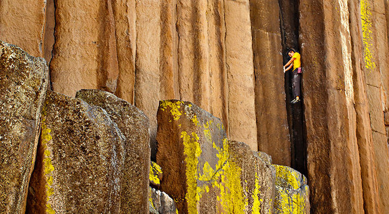
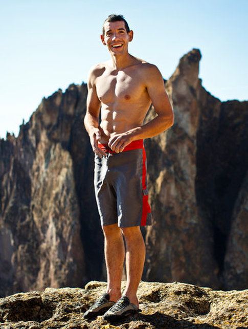
As a professional rock climber who often scales cliffs with nothing to save him should he fall, Alex Honnold has encountered plenty of harrowing moments. But early this month Honnold, a 26-year-old from Sacramento, found himself high on a face in Yosemite National Park in a creepy situation.
Honnold was attempting something no one had done before: climb the three biggest rock faces in the California park in succession, alone, and in less than 24 hours. Dubbed the triple, the task would mean scaling the sheer walls of Mount Watkins, El Capitan and Half Dome for a total of about 7,000 vertical feet of rock. For all but about 500 feet of it, Honnold planned to climb with no ropes or safety equipment at all. One mistake and he could die.
“There is nothing in sports that compares to this,” said John Long, who in 1975 was the first to scale El Capitan in a day with his partners Billy Westbay and Jim Bridwell. (Most people need about five days). “The physical exertion alone is amazing.”
Yet about halfway up the 2,000-foot-high south face of Mount Watkins, the first of the three big walls, Honnold faced another problem. Hordes of wingless insects called silverfish poured down the rock in biblical proportions. There Honnold was, dangling by his fingertips, with inch-long arthropods wiggling into his ears, tickling his neck and probing his mouth with wispy antennae.
“It was heinous,” he said. “At any given point I had dozens of them on me. But what are you going to do?”
The swarm hardly slowed him. By the time Honnold reached safe ground, he had climbed the route in a blistering 2 hours 20 minutes, believed to be a record. Most parties need several days.
The encounter with the silverfish was the latest twist for Honnold, whose feats over the past few years have made him the country’s most renowned rock climber. He has been featured on 60 Minutes, pictured on the cover of National Geographic magazine, and now earns six figures a year from speaking engagements and sponsors like The North Face, La Sportiva and Black Diamond. Honnold has become the closest thing to a celebrity that American rock climbing offers, with fawning fans who rush in to take pictures and get autographs.
Honnold invited me to shadow him for a week in the park. Together with Sender Films, a Boulder, Colo.-based production company that specializes in rock climbing videos, we would have exclusive behind-the-scenes access to what many observers said could be a milestone in the history of climbing in Yosemite, a major epicenter where the elite come to push the bounds of their sport.
The triple is perhaps Yosemite’s most spectacular enchainment, or “link-up” in climber lingo, and only a handful of people in the world — if that many — are capable of doing it in a day. Depending on the routes taken, a climber faces at least 70 pitches (rope-lengths) with some holds so small that human fingers are physically incapable of grasping them. In those cases a climber must place gear onto the rock and then pull on that gear to aid in upward movement — a technique known as aid climbing. Using only your hands and feet to go up (with a rope to guard against a fatal fall) is called free climbing. When the triple was first completed in 2001 by Timmy O’Neill and Dean Potter, the two used a mix of aid- and free-climbing techniques to link the three faces in 23 hours 45 minutes, O’Neill said.
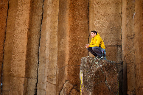
Honnold wanted to improve upon that style by going alone and using no gear or rope for most of it, a dangerous technique known as free-soloing.
To prepare himself, Honnold arrived in Yosemite in May and embarked on a climbing frenzy. He became the first to free solo the west face of El Capitan and the first, along with fellow professional climber Tommy Caldwell, to free climb the triple. They did it in about 21 hours.
“That alone is a huge step up because they are not pulling on any gear at all,” said Peter Croft, who with John Bachar in 1986 was the first to link two Yosemite big walls — Half Dome and El Capitan — in a day.
Honnold kept the blogosphere humming with more accomplishments. On June 1, he climbed the iconic 2,000-foot-high northwest face of Half Dome, alone, with a mix of aid- and free-soloing techniques in a staggering 1:21 — 48 minutes faster than his previous record. On Sunday, Honnold and Hans Florine, a Yosemite speed climber, hope to break another speed record climbing The Nose route up El Capitan. Potter and Sean Leary currently hold that record at 2:35:45.
But the solo triple, if successful, was most likely to go down as one of Honnold’s greatest achievements. After he summited Mount Watkins and the silverfish were gone, he hiked through the highlands to the white Ford van he calls home for much of the year. He whipped it around the curves driving back down into the valley while his girlfriend, Stacey Pearson, a 26-year-old nurse, cooked him dinner on a camping stove in the back. By 9:30 p.m., Pearson, Peter Mortimer of Sender Films, and I stood at the base of El Capitan while Honnold prepared to climb the 2,900-foot-high Nose route through the night. There were dozens of people already on the wall preparing for bed in hanging platforms they had hauled up.
“I feel like I’m forgetting something,” Honnold said.
“Aren’t you going to tie your shoes?” Pearson asked.
“Not until I start rock climbing,” he said, already 30 feet up the cliff.
Back at the van we discovered what Honnold had forgotten: a chalk bag that he would need to keep his hands dry and able to grip the wet slippery rock. The horror of what Honnold was facing gave us all pause and Mortimer quickly called some of his cameramen filming the feat to see if Honnold was in trouble. He was not.
“There’s a guy climbing alone and really fast,” said Colin Delehanty, a lensman who was shooting time-elapsed footage. “That has to be him.”
About 1,000 feet up Honnold borrowed chalk from a group of climbers he encountered, and by 3:30 a.m. he was at the top and bound for Half Dome, which he began climbing at around 8 a.m.
Watching Honnold complete the final pitches up the northwest face was terrifying and impressive. I had hiked to the top in time for sunrise. Around 10:30 a.m. I peered into the dizzying abyss below and Honnold was about 300 feet from the top, without a rope, moving with insectlike mechanicalness. He waved at Pearson, who had come up earlier that morning. It was clear that even now, exhausted as he was, Honnold was climbing far below his ability and that it was unlikely he would fall.
“Oh my god!” shouted a hiker who saw him. “That guy has no rope!”
“Dude, are you serious!” exclaimed another. “I can’t look.”
Honnold reached the summit shortly before 11 a.m., about 19 hours after he started Mount Watkins. He took off his shoes, asked for some Oreos, and was mobbed by dozens of onlookers who wanted to know how he felt.
“Fragile,” he said. “I am going to turn my brain off and stagger downhill now. That was kind of a big deal.”
Yosemite Fires - Update #1 – July 11, 2012
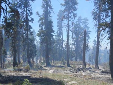
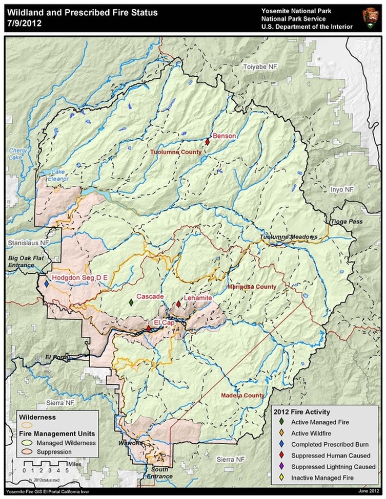
Cascade: (37 46.173 x 119 40.519; 7800’el. Mariposa Co.) This lightning caused fire has been slowly burning for the last month in Yosemite’s high elevation Wilderness. It started during an afternoon thunderstorm on June 15th. The fire is at approximately 33 acres, and is burning in short needle red fir forest between two upper forks of the Cascade Creek. Since June 16, the fire has slowly smoldered through sparse surface fuels of duff, forest litter and occasionally creating enough heat to ignite brush. The northeast perimeter edge is the most active with 6 to 12 inch flame lengths during the hottest part of the day. The fire poses no threat to trails, park service buildings, infrastructure or roads.
The fire could potentially grow to 1000 acres over the next month due to typical warm and dry weather for this time of year. Firefighters have hiked into the fire area to scout and determine the potential in growth and spread direction. Although the immediate fire area has a history of lightning, there is no recorded recent large fire history. Normally fuels too wet during this time of year to support active fire growth. Due to light winter snowpack this year, fuels at this elevation are now able to support fire spread and allow this natural fire to play a vital role in Yosemite Wilderness. The nearest historic fire to the Cascade Fire suggest that fires at this elevation, in this forest type, creep and smolder for weeks and only make runs during dry windy conditions.
Red fir forests burn about every 30 years. Cascade Fire is burning in an area that has not burned in at least 60-90 years. Because there are no resources threatened at this time or in the near term future, allowing this fire to burn in this area, this year promotes healthy, resilient ecosystem function. If resources are threatened, and/or smoke impacts threaten human health, fire managers will reassess the objectives of this fire.
Though California is hot and dry, which is typical for this time of year and there are few fires burning in our region. Other fires nationally are starting to wind down due to cooler weather and monsoonal flow patterns assisting firefighters in suppression efforts. Resources are available to assist with managing the Cascade Fire. The Cascade Fire meets the park fire management objectives of minimal risk to firefighter and public safety, federal and public property, air quality and Wilderness character.
Light smoke has been visible mainly in the morning hours near Cascade Falls and the community of Foresta. Smoke may become more visible at high locations within the park. Fire managers are working closely with state and local air pollution regulators concerning potential adverse air quality impacts to nearby smoke sensitive areas. Yosemite’s Division of Resources Management and Sciences personnel have installed air quality monitoring equipment within the communities of Lee Vining, Hodgdon Meadow, El Portal and Yosemite Valley. The park’s webcam located at Crane Flat Helibase will capture fire images, which can be viewed at: http://ssgic.cr.usgs.gov/dashboards/WebCam.htm?
For additional Information:
Ø Fire Information Officer Gary Wuchner at: [email protected] (209) 372-0480 or 375-9574.
Ø Yosemite National Park Web page: http://www.nps.gov/yose/parkmgmt/current_fire.htm.
Ø Yosemite Air Quality Web page: http://www.nps.gov/yose/naturescience/aqmonitoring.htm
Ø Yosemite Fire Twitter: http://twitter.com#!/YosemiteFire
Ø Yosemite Fire Facebook: http://www.facebook.com/pages/Yosemite-Wildland-Fire/124632964255395
Historic Yosemite bridges face removal under rive restoration plan
By Tracie Cone ASSOCIATED PRESS
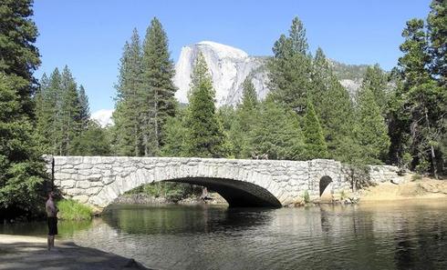
YOSEMITE NATIONAL PARK, Calif. — Perhaps no river crossing in Yosemite Valley has been more photographed than the historic Stoneman Bridge: a single, arching span faced with rough-hewn granite that provides a dramatic foreground to Half Dome, the park's most iconic natural marvel.
Yet the 205-foot bridge is slated for possible removal under proposed plans for restoring the natural flow of the Merced River. As a federally designated "Wild and Scenic River," some say its course should be shaped only by nature as it meanders through the valley — and bridge abutments alter that course.
The future of the roughly 80-year-old Stoneman and two other spandrel arch bridges has pitted environmentalists, who want the river to flow freely, against historic preservationists who say these early examples of the rustic park architectural style are too culturally important to destroy.
"We're talking about nationally significant resources in arguably the best-known national park in the world. What happens in Yosemite has echoes throughout the National Park System," said Anthony Veerkamp of the National Trust for Historic Preservation.
It's why last month the trust placed the Stoneman and two other Yosemite Valley stone-arch bridges threatened with removal — the Ahwahnee Bridge and the Sugar Pine Bridge — on its 2012 most endangered historic places list.
Four other Yosemite Valley bridges cross the Merced, but only these three are built into the river, said park spokesman Scott Gediman.
"Yosemite is known throughout the world for its beauty, but in addition to natural beauty, the cultural beauty is significant," Gediman said. "We take it very seriously. These are not decisions we're taking lightly."
Yosemite is remarkable among the nation's national parks with a combination of stunning beauty, inspiring hikes and proximity to metropolitan areas. Despite the park's 1,200 square miles of wilderness, 95 percent of the 4 million visitors each year stay in the one-by-eight-mile valley, where senses are overwhelmed by the Half Dome and El Capitan walls of granite, stands of pines and waterfalls.
"It seems quite beautiful," said Christa Danielson of Eugene, Ore., as she sat on a log photographing the Ahwahnee Bridge. "It's amazing, but everything here is. It would be sad to see it go."
Park officials stress that none of the plans are final, and they could be altered to spare all or some of the bridges.
Michael J. Ybarra dies at 45; chronicler of extreme sports
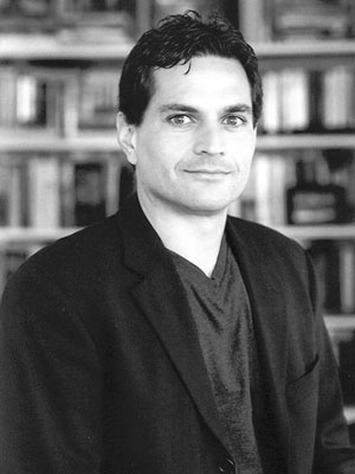
The veteran mountaineer, a writer for the Wall Street Journal and former Los Angeles Times reporter, falls to his death in the Eastern Sierra.
By Valerie J. Nelson, Los Angeles Times July 6, 2012
Michael J. Ybarra, a former Times reporter who had recently chronicled his extreme-sports adventures for the Wall Street Journal, was killed in a mountain-climbing fall over the weekend on the edge of Yosemite National Park. He was 45.
A veteran mountaineer, he had set out alone to cross the craggy Sawtooth Ridge in the Eastern Sierra and summited the 12,280-foot Matterhorn Peak before he fell about 200 feet to his death, said his sister, Suzanne Ybarra.
His family reported him missing Sunday, and a rescue crew spotted his body Tuesday in a rugged area difficult to reach on foot, according to Kari Cobb, a park ranger. His body was found on the side of a mountain, his sister said.
"He died doing what he loved most," she wrote on her Facebook page.
In a statement, the Wall Street Journal called Ybarra "an extraordinary journalist. In the best traditions of his profession he enlightened and engaged readers on a wide array of topics in clear, vivid prose."
Although his outdoor pursuits were often inherently dangerous, he frequently joked about his fears and sometimes addressed them in his writing. A piece he wrote in May of last year for the Journal about white-water kayaking carried the headline: "When Death Is Merely a Paddle Stroke Away."
The same month, Ybarra wrote about how he had "straddled the knife edge between caution and confidence" before falling during an icy mountain climb near Bozeman, Mont.
"Climbing in the mountains is serious business," he wrote in the Journal. "Mistakes carry consequences — for yourself and for your partner. At night I lay awake wondering if I should just go back to gym climbing or find a more sensible sport, such as table tennis."
About five years ago, Ybarra essentially decided to live on the road and out of his car to pursue his passion for adventure, said Bret Israel, Sunday Calendar editor of The Times, who met the writer when Ybarra interned in the Metro department in the late 1980s.
Ybarra was also the author of a noted biography, "Washington Gone Crazy," that grew out of his reporting for The Times. The book tells the story of Pat McCarran, a former U.S. senator from Nevada who wielded power during the anti-Communist hysteria of the 1950s.
When The Times named it one of the best books of 2004, the reviewer pronounced it "magisterial" and said Ybarra "meticulously traces McCarran's rise to power" in creating "an indispensable … nuanced assessment" of a contested period of recent history.
The biography was also a finalist for the 2005 Times Book Prize.
Michael Jay Ybarra was born Sept. 28, 1966, in Los Angeles to Eugene Ybarra, a Los Angeles Unified School District administrator, and his wife Lillie, a social worker.
During his senior year at UCLA, the political science major began a yearlong Times internship in 1988 that included a stint in the Washington Bureau.
After earning a master's degree in political science from UC Berkeley in the early 1990s, Ybarra held several internships and spent four years working for the Wall Street Journal but bridled at the constraints of a full-time job in a large organization.
As a freelance writer, Ybarra contributed to many publications, including The Times, where he wrote about the outdoors and art in the West for more than two decades. One of his final articles for The Times, about a gallery show in Venice of photos from the Eastern Sierra, will be published Sunday.
He was working on a biography of Patagonia founder Yvon Chouinard and continued traveling the world to climb and kayak.
"At a time when many of his peers want to get rich, to climb the ladder of success and to be friended and Tweeted to every minute," Israel said, "he marched to his own strong internal drum far from fashion or fad."
Ybarra is survived by his parents, Lillie, of Woodland Hills, and Eugene, of Encino; his brother, Gary, of Woodland Hills; and his sister, Suzanne, of Los Angeles.
Services are pending.
[email protected]
July 4th Activities at the Pioneer History Village
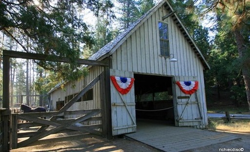
The Pioneer History Village has a number of activities planned to celebrate Independence Day . The cabins will be open from 10:00 AM to noon and staffed with volunteers to share information about the history of the cabins. At 2:00 PM we will have the the "parade", songs and speeches next to the Gray Barn. At 2:30 there will be old fashioned games at the History Center. At 3:30 visitors can enjoy "Music on the porch", a short informal concert of old-time music. Of course, there is also the barn dance at 8:00 PM in the Gray Barn.
Water Levels on the South Fork Merced River Dropping Quickly
Dear Wawona Community:
This winter and spring have been exceptionally mild with regard to rain and
snowfall. To date, 2012 is set to go down as one of the 10 driest years on
record for Yosemite National Park. Because of this, water levels measured
in the rivers and streams are exceptionally low for June. In fact, current
data shows that water levels on the South Fork Merced River, for example,
are dropping quickly and there is no significant precipitation forecasted
in the near future.
Without significant precipitation in the upcoming days and weeks, the
Tuolumne and South Fork Merced Rivers will drop to levels where it will be
necessary to implement water conservation plans for the residents and
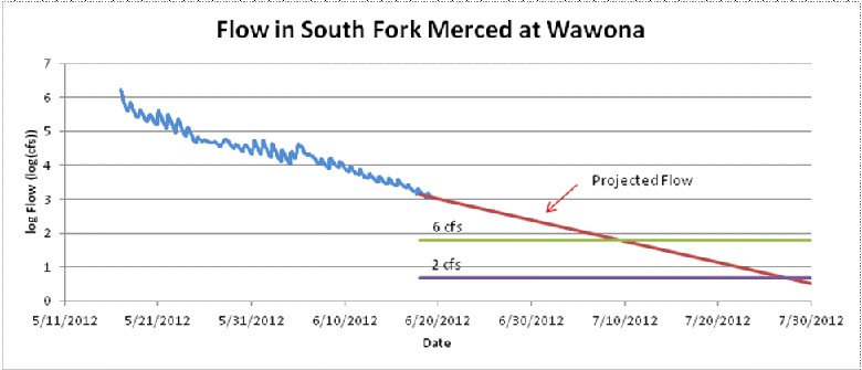
visitors to Tuolumne Meadows and Wawona. Water conservation measures are mandatory when flow rates drop below 6 cubic feet per second (CFS).
As of June 22, the South Fork Merced River was measured at 17 CFS, and as th chart above shows, hydrologic modeling indicates that Wawona will need to implement conservation procedures in early July. Further, without
significant rainfall, these levels will continue to drop and each river
will likely reach critical levels by late July. Critical levels are reached
when demand for water exceeds the supply which is at 2 CFS.
In order for Yosemite National Park to meet the domestic water needs of
Wawona and Tuolumne Meadows, water from Yosemite Valley and the park’s South Entrance will need to be transported to the Wawona Water Treatment Plant daily. In Tuolumne Meadows, the water supply is augmented by drawing water from the main stem of the Tuolumne River. Historically, we have not had to implement water conservation efforts in Tuolumne Meadows, so we will all learn how successful our conservation measures actually work. What is important is that the amount of water to be transported and diverted will depend upon the success of the conservation efforts in each community.
Attentive conservation measures, therefore, are our best opportunity to ensure that water is available where needed for safety and health purposes, as well as protection of park resources. We ask that you consider your water consumption in the coming days and look for ways to conserve it. In the coming days and weeks, we will continue to share more information about the water levels and conservation practices.
We thank you for attention and support as we all address this important community and preservation issue. Through our combined efforts, we can work to maintain adequate domestic water while still preserving the ecosystems of Yosemite National Park.
Don Neubacher, Superintendent
_______________________________
Don Neubacher
Superintendent
Yosemite National Park
9039 Village Drive
PO Box 577
Yosemite, CA 95389
209-372-0201 (Phone)
209-372-0220 (fax)
Yosemite Superintendent Office
(209) 372-0286
[email protected]
UC Merced’s Sierra Nevada Research Institute
Cordially Invites You to the 2012
Yosemite Field Station OPEN HOUSE
The Sierra Nevada Research Institute Annual Open House is a great chance to meet the people leading the collaborative research projects and educational programs affiliated with the University of California Merced’s first field facility located in Yosemite National Park.
The 2012 Open House will feature presentations by high school and university students participating in unique educational programs in Yosemite, presentations by UC Merced Researchers working in the Sierra and updates on the National Parks Institute programs at UC Merced.
Friday July 6, 2012
12:00 p.m. – 5:00 p.m.
UC Merced’s Yosemite Field Station (YFS) programs represent an extraordinary partnership among UC Merced, Yosemite National Park, Delaware North Companies, and the Yosemite Conservancy. The 2012 Open House will feature the Research activities and the youth leadership programs made possible by these partnerships.
Agenda
12:00 p.m. Lunch at the Wawona Hotel, suggested donation of $20/person.
RSVP (209-375-9917) required by Wednesday June 27th
1:30 p.m. Research and Education Program Presentations – OPEN TO THE PUBLIC!
Wawona Hotel Sunroom (above the Golf Shop)
Welcome & Introduction - Becca Fenwick, Director SNRI/
Welcome - Roger Bales, Don Neubacher, Mike Tollefson
Summary overview of the partnerships at work in Yosemite
Yosemite Leadership Program, Adventure Risk Challange, Research and the National Park Institute
Research in Yosemite
UC Research Projects in Yosemite and the National Parks Institute: Steve Shackelton
2:30 – 2:45 p.m. Break - Coffee & refreshments
2:45 p.m. Adventure Risk Challenge (ARC) Jen Gurecki and students
Yosemite Leadership Program (YLP) Shauna Potocky and students
3:45 p.m. Close – Becca Fenwick
4:00 p.m. Reception & student poster viewing
Additional Information:
Becca Fenwick
Yosemite Field Station Director
[email protected]
209-375-9917
Curry Village Closes More Cabins, Campsites, Due to Danger From Falling Rocks
By Miguel Llanos, msnbc.com
Yosemite National Park is shuttering cabins, campsites and other structures in areas found to be at greatest risk of boulders crashing down. |
Visit msnbc.com for breaking news, world news, and news about the economy |
In a statement released Thursday, the park said it made the decision after a new study for the first time delineated "a rockfall hazard line" in the Yosemite Valley.
Eighteen more cabins will be off limits in Curry Village, where in 2008 the equivalent of 570 dump trucks of boulders from the 3,000-foot-tall Glacier Point hit 18 cabins and sent visitors fleeing for their lives. The park closed 233 of the 600 cabins in the village after the scare, and later relocated 125. The 18 closed Thursday will be relocated to safer areas as well.
Advertise | AdChoices Other areas impacted include:
Park spokesman Kari Cobb emphasized to msnbc.com that the park is "fighting against" erroneous news reports suggesting that park areas are being closed off to hikers. It's the structures and campsites, not the recreational areas, being impacted, she said.
The greatest rockfall dangers are within 180 feet of the base of the cliffs, the study concluded, while adding that there is also a 10 percent chance a potentially deadly boulder will fall outside of the zone every 50 years.
The Yosemite Lodge and the Ahwahnee Hotel are not located in the danger zone.
Laser mapping was used to create the first detailed look at the valley's towering cliffs, which ultimately could lead to identifying which ones are most vulnerable to rockfalls.
After the 2008 fall, the Associated Press reported that while Yosemite officials were aware of earlier studies showing Glacier Point was susceptible to rock falls they did not warn vRockfalls in and around Curry Village have killed two people and injured two dozen since 1996, the AP stated. Since officials began keeping track in 1857, 15 people have died throughout the valley and 85 have been injured from falling rocks.
More than 900 rockfalls have been documented at Yosemite, the park stated.
The Associated Press contributed to this report.
isitors and repaired and reused rock-battered cabins.
Cobb noted that damaged cabins had been repaired since the park's early years and that since 2006, when Yosemite's first geologist was hired, "we have never intentionally left open cabins or other high visitor use areas that we know to be susceptible to higher probability of rockfall."
"It is impractical to put signs at every location that may pose a risk to visitors," she added. "We are surrounded by 3,000 foot granite cliffs that actively experience rockfall about once per week at different locations. The most we can do is educate visitors and provide them safe accommodations while they are staying here."
Eighteen more cabins will be off limits in Curry Village, where in 2008 the equivalent of 570 dump trucks of boulders from the 3,000-foot-tall Glacier Point hit 18 cabins and sent visitors fleeing for their lives. The park closed 233 of the 600 cabins in the village after the scare, and later relocated 125. The 18 closed Thursday will be relocated to safer areas as well.
Advertise | AdChoices Other areas impacted include:
- Two employee dorms and parts of three others will close, forcing the park to move 30 staff and worsening a critical housing shortage;
- Eight campsites at Camp 4, a $5-a-night bargain near El Capitan used mainly by climbers, will be relocated nearby;
- The LeConte Memorial, which includes a library and educational site, as well as the Curry Village Amphitheater will host fewer programs.
Park spokesman Kari Cobb emphasized to msnbc.com that the park is "fighting against" erroneous news reports suggesting that park areas are being closed off to hikers. It's the structures and campsites, not the recreational areas, being impacted, she said.
The greatest rockfall dangers are within 180 feet of the base of the cliffs, the study concluded, while adding that there is also a 10 percent chance a potentially deadly boulder will fall outside of the zone every 50 years.
The Yosemite Lodge and the Ahwahnee Hotel are not located in the danger zone.
Laser mapping was used to create the first detailed look at the valley's towering cliffs, which ultimately could lead to identifying which ones are most vulnerable to rockfalls.
After the 2008 fall, the Associated Press reported that while Yosemite officials were aware of earlier studies showing Glacier Point was susceptible to rock falls they did not warn vRockfalls in and around Curry Village have killed two people and injured two dozen since 1996, the AP stated. Since officials began keeping track in 1857, 15 people have died throughout the valley and 85 have been injured from falling rocks.
More than 900 rockfalls have been documented at Yosemite, the park stated.
The Associated Press contributed to this report.
isitors and repaired and reused rock-battered cabins.
Cobb noted that damaged cabins had been repaired since the park's early years and that since 2006, when Yosemite's first geologist was hired, "we have never intentionally left open cabins or other high visitor use areas that we know to be susceptible to higher probability of rockfall."
"It is impractical to put signs at every location that may pose a risk to visitors," she added. "We are surrounded by 3,000 foot granite cliffs that actively experience rockfall about once per week at different locations. The most we can do is educate visitors and provide them safe accommodations while they are staying here."
Wawona-Area Road Pavement Preservation (June-September)
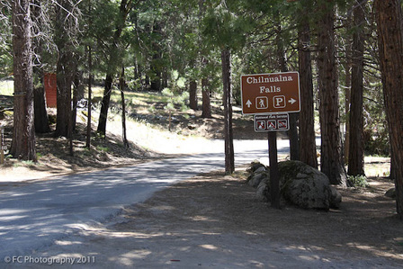
Starting Tuesday, June 19th crews will begin pavement preservation work on the Wawona Road and secondary Roads (Chilnualna Falls Road--Forest Drive) in the Wawona Area. The road preservation work includes, crack seals, chip seals, microseals, and thin overlays, along with preparatory patching work. Crews will be working both day and night with traffic control and up to 15 minute delays with a pilot car operations. Crews will be working all day Monday thru Friday and nights Sunday thru Thursday 8:00 PM to 6:00 AM. This work will continue over the next 3-months. (M. Pieper)
Hodgdon Proposed Prescribed Fire
June 19, 2012
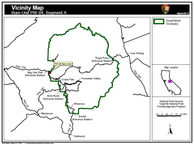
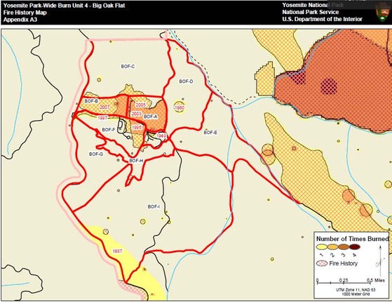
Segments D and E of Hodgdon (PW-04) area burn unit are being prepared for a prescribed fire to begin on Tuesday June 19, 2012.
The units have dried sufficiently to conduct the proposed 220 acre project. Fuel moistures and other fire factors, within the burn unit, are reaching optimal levels to successfully complete the project. The project area is near the Big Oak Flat entrance station, campground and community of Hodgdon Meadows.
The two units have had minimal fire history between 1930 and 1990, although natural fire history is evident with fire scars on several mature trees. Since 1990, a hazardous fuel reduction program has been implemented to protect private and public structures around the Hodgdon Wildland Urban Interface (WUI). The most recent projects were last summer with over 500 acres being treated. A mixture of fuel reduction techniques have been used including mechanical thinning, pile and prescribed burning. These WUI treatments have created defensible space for the Hodgdon residential area. This project will not only extend the defensible space, but also facilitate the reintroduction of fire into the ecosystem and restore the forest area. Combined with other burns near Crane Flat, and Rockefeller Grove areas, and with the fuel reduction projects conducted by the Stanislaus National Forest along Evergreen Road, this project will further reduce the likelihood of catastrophic fire originating at lower elevations, either inside or outside of the park affecting communities in mixed confer pine forest.
A Resource Advisor will be assigned to the project to advise on cultural and natural resources.
Smoke, affecting health, is always a factor in the decision making process. A smoke management plan has been submitted to the Tuolumne County Air Pollution Control District, and a burn permit has been issued. Smoke monitors will be deployed in smoke sensitive areas determined by Yosemite’s air quality manager, and Tuolumne County APCD.
More updates will be published through the duration of the prescribed fire project. It is anticipated active ignition will take three days. The fire area will then be mopped–up and monitored.
For Additional Information please contact:
Ø Fire Information Officer Gary Wuchner at: [email protected]/ (209) 372-0480 or 375-9574.
Ø Yosemite National Park Web page: http://www.nps.gov/yose/parkmgmt/current_fire.htm.
Ø Yosemite Air Quality Web page: http://www.nps.gov/yose/naturescience/aqmonitoring.htm
Ø Yosemite Fire Twitter: http://twitter.com#!/YosemiteFire
Yosemite Fire Facebook: http://www.facebook.com/pages/Yosemite-Wildland-Fire/124632964255395
Yosemite Redevelopment May Eliminate Icons

MARK GROSSI/THE FRESNO BEE
A raging flood wiped out more than half the 495 cabins and rooms at Yosemite Lodge 15 years ago, and the National Park Service has been trying to rebuild ever since. Now that effort might be abandoned.
The venerable lodge could be gone under a new scenario for the long-delayed Merced River plan in Yosemite Valley. Such attractions as Curry Village stables and ice rink could close. The ideas shock area tourism leaders and business owners, who fear the Yosemite visitor flow would slow down.
But Yosemite National Park brass are determined to consider all ideas in making this plan as immune as possible to environmental legal challenges. Lawsuits and two failed planning efforts already have cost more than a decade of delay on $100 million of projects.
The new ideas are not yet part of any official plan. They are just on a list of what park officials are contemplating.
Among the eye-openers are permits for day visits to control the head count in the valley, and elimination of a river bridge. Shutting down bicycle and raft rentals is on the list, too. In addition, outside Yosemite Valley on the south fork of the Merced River, suggestions include removing Wawona Golf Course.
To some, it sounds like Yosemite could become less visitor-friendly. Communities such as Oakhurst, Fish Camp and Mariposa could take an economic hit if changes lead to a visitor slowdown, business owners say.
"I don't even know why these ideas are being considered," said Max Stauffer, owner of the Yosemite Mountain Sugar Pine Railroad in Fish Camp. "These are the kinds of things that will be bad for visitors and the business community."
The ideas are among five broad approaches posted online for the public to see. The approaches have been centerstage at a barrage of public meetings this year. More than 400 comments have been posted on Yosemite's web page.
Planners in September are scheduled to release a preferred alternative in draft environmental documents. The public will have 90 days to comment.
There will be an outcry if Yosemite Lodge or any other established amenities are on the chopping block, but that is a familiar reaction in the land of Half Dome, Yosemite Falls and El Capitan. More than a decade ago, the outcry from environmentalists and other activists led to federal court.
Activists did not like the fixes for the vast damage to roads and buildings from the January 1997 flood, fearing there would be too much pavement and too much development.
Activists still say Yosemite Lodge could be closed, allowing motels around the outside of the park to pick up business.
"To a great extent, that has already happened in surrounding communities," said Greg Adair of the Friends of Yosemite Valley, which led the legal action.
The key legal argument that stopped the previous two river plans centered on the lack of a visitor limit. Activists said the plans needed to specify a limit, and federal judges agreed.
The park service two years ago withdrew $100 million of valley projects and again started the Merced River plan from scratch. According to a settlement agreement, a new plan must be finished by June 2013.
This time, there will be limits on the number of visitors in the valley. The park's five approaches include limits ranging from 14,200 to 24,000 people.
Three consultants have been hired to help, including Bo Shelby, a social science professor from Oregon State University, who has done this kind of work in the Grand Canyon.
"It's challenging, but it makes perfect sense to do," he said. "There are already limits on the number of motel rooms, campgrounds and parking spaces."
Along with the five approaches, the park's web- site has an extensive archive that traces the history of the planning. The web- site invites public comment over and over.
"We're seeking the public's involvement, and we're going to use it," said park spokesman Scott Gediman. "People should not be surprised by what we say in September."
Tourism leaders say they're surprised, though. They say they are rallying people to push back against some of the suggestions.
A website has been started to encourage people around the globe to post concerns. More than 375 people have done so.
Dan Cunning, chief executive officer of the Yosemite Sierra Visitors Bureau in Oakhurst, said he's not opposed to protecting the park's pristine resources. But surrounding businesses need the traffic created by the 4 million Yosemite visitors each year.
"We need to think about the impact on the gateway communities," he said. "We need to say something about some of these ideas now, or we wouldn't be protecting our county."
Read more here: http://www.fresnobee.com/2012/06/09/2867841/merced-river-plan-scenarios-offer.html#storylink=cpy
Hodgdon Proposed Prescribed Fire
Mid-June, 2012
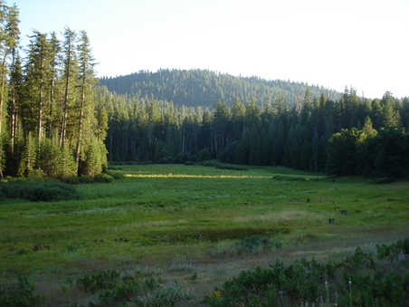
Segments D and E of Hodgdon (PW-04) area burn unit are being prepared for a prescribed fire to begin mid-June, dates to be announced. The units have dried sufficiently to conduct the proposed 200 acre project. Fuel moistures and other fire factors, within the burn unit, are reaching optimal levels to successfully complete the project. The project area is near the Big Oak Flat entrance station, campground and community of Hodgdon Meadows.
The two units have had minimal fire history between 1930 and 1990, although natural fire history is evident with fire scars on several mature trees. Since 1990, a hazardous fuel reduction program has been implemented to protect private and public structures around the Hodgdon Wildland Urban Interface (WUI). The most recent projects were last summer with over 500 acres being treated. A mixture of fuel reduction techniques have been used including mechanical thinning, pile and prescribed burning. These WUI treatments have created defensible space for the Hodgdon residential area. This project will not only extend the defensible space, but also facilitate the reintroduction of fire into the ecosystem and restore the forest area. Combined with other burns near Crane Flat, and Rockefeller Grove areas, and with the fuel reduction projects conducted by the Stanislaus National Forest along Evergreen Road, this project will further reduce the likelihood of catastrophic fire originating at lower elevations, either inside or outside of the park affecting communities in mixed confer pine forest.
In accordance with the Wilderness Act of 1964, all phases including; unit preparation, ignition, holding, mop-up and rehabilitation will be implemented with the intention to preserve wilderness integrity. Minimum Impact Management Techniques will be employed to preserve the wilderness area. By joining with the Stanislaus National Forest no fire line is needed due to roads surrounding the project area. A Resource Advisor will be assigned to the project to advise on cultural and natural resources.
Smoke, affecting health, is always a factor in the decision making process. A smoke management plan has been submitted to the Tuolumne County Air Pollution Control District, and a burn permit has been issued. Smoke monitors will be deployed in smoke sensitive areas determined by Yosemite’s air quality manager, and Tuolumne County APCD.
More updates will be published through the duration of the prescribed fire project. It is anticipated active ignition will take three days. The fire area will then be mopped–up and monitored.
For Additional Information please contact:
Ø Fire Information Officer Gary Wuchner at: [email protected]/ (209) 372-0480 or 375-9574.
Ø Yosemite National Park Web page: http://www.nps.gov/yose/parkmgmt/current_fire.htm.
Ø Yosemite Air Quality Web page: http://www.nps.gov/yose/naturescience/aqmonitoring.htm
Ø Yosemite Fire Twitter: http://twitter.com#!/YosemiteFire
Ø Yosemite Fire Facebook: http://www.facebook.com/pages/Yosemite-Wildland-Fire/124632964255395
Wawona Pine Needle Pile Pick Up: June 4 – 8, 2012
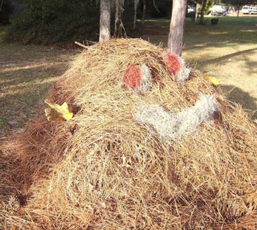
Thanks to our District 5 Supervisor Jim Allen and Mariposa County Public Works, Mariposa County will again pick up our piles of pine needles. Your pile must be ready by Monday, June 4. If it is not ready by the time the equipment are in your area, they will not go back and pick up late piles. Remember, one pile per property along the road in front of your property, in an unobstructed area where the equipment can easily access your needle pile. Tree limbs and branches must be cut to a maximum of 3 feet in length to be picked up.
Only vegetation material will be picked up. No construction materials or large branches, please.
Yosemite National Park, DNC & UC Merced properties not included in pick-up.
If your address is on an out-of-the-way street, you can call or e-mail GregOllivier , Solid Waste Manager 209-966-5165; [email protected] That way your pile won’t be missed.
May 30, 2012, Open House and Webinar featuring the Mariposa Grove
Restoration Project and South Entrance Station Kiosks Replacement
Join us for our monthly open house on Wednesday May 30, 2012,
from 1 to 4 pm in the Valley Visitor Center Auditorium. Presentations will
begin at 2 pm. Park Entrance fees are waived for attendees.
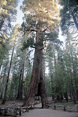
The open house will feature an update on the Restoration of
the Mariposa Grove of Giant Sequoias project. The goal of the project is to
restore the ecological health of the Grove and improve the visitor experience
at the South Entrance and Grove. Since public scoping closed on February 3,
2012, an interdisciplinary planning team has been developing site design
concepts and draft alternatives.
With input from public scoping, and through a series of
design workshops, park staff/subject matter experts, and the design team have
been working together to formulate basic site design concepts. Project managers
provided an update on the status of the project at the April 25 open house. A
copy of the April 25 presentation is available at the plan website at
http://www.nps.gov/yose/parkmgmt/mgrove_documents.htm. This month we will review the latest versions of the site design concepts and draft alternatives.
For those unable to attend the open house in person, the presentation will also be available online via a webinar at yose.webex.com.
Yosemite National Park Soliciting Comment on South Entrance Station
Kiosks Replacement
The goal of this project is to design and construct safe, secure, accessible, and high performance entrance station kiosks at the South Entrance of the park on Highway 41 (Wawona Road). The safety of park staff at the South Entrance Station is compromised with over 30 vehicle collisions each year. Narrow lanes and the “T” intersection create a difficult turning radius
for larger vehicles.
The objectives of the project are to:
1) Address the overall kiosk placement and road layout configuration to reduce congestion, improve safety, and improve visitor service through wayfinding and lighting
2) Replace and update fire and security monitoring, alarm systems, and communication infrastructure
3) Replace or remodel kiosks and office with architecturally appropriate structures using the new Big Oak Flat Entrance Station Kiosk design as the baseline for the architectural design
4) Provide a climate control system and an overall kiosk design that is environmentally safe, comfortable, and energy efficient
Specifically, two of the existing kiosks would be removed and the third historic kiosk would remain in the existing location and used as an office. Three new kiosks would be relocated along the Wawona Road approximately 350-ft. south of the existing kiosks location. It would include an easterly widening of the Wawona Road to accommodate the kiosks relocation.
Public scoping period for this project will open on May 30, 2012 and will extend through June 29, 2012. Park staff will be at the May 30 open house to answer any questions. Again, park admission fees will be waived for those attending the open house.
The public is encouraged to submit comments through the Planning, Environment, and Public Comment (PEPC) system at
http://parkplanning.nps.gov/SEntrKiosk. Comments also may be submitted by mail (postmarked no later than June 29, 2012):
Mail:
Superintendent
Attn: South Entrance Station Kiosks Replacement
P.O. Box 577
Yosemite, CA 95389
Yosemite National Park Announces Beginning of 2012
Fire Season
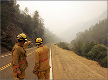
Yosemite fire managers have announced the 2012 Fire Season began yesterday, Monday, May 21, 2012. Fire season officially begins when seasonal firefighting equipment and personnel are in place, prepared and ready to respond. Additionally, grasses and other vegetation at the lower elevations have begun to dry out. This year, vegetation is drying out faster than average due to the low snowpack the park received over the winter.
Firefighters will spend the week conducting their annual readiness reviews that demonstrate skills and proficiency for fighting fire. In addition, daily weather patterns, temperatures, and moisture levels are closely monitored, which aids in determining if vegetation is within prescription for burning.
In preparation for the fire season, the park has begun defensible space inspections throughout Yosemite’s communities, including Aspen Valley, Hodgdon Meadows, Foresta, El Portal, Yosemite Valley, and Wawona. Residents and homeowners are urged to clear a defensible space around homes and other structures in an effort to reduce the risk of fire hazards.
Yosemite National Park officials are committed to ensuring sufficient fire crews will be onsite during all prescribed burn activity
throughout the fire season. These resources will monitor fire behavior and weather, as well as support burnout and holding operations to ensure firefighter safety, public safety, and to prevent prescribed fire escape. With the official declaration of fire season, pile burning will be discontinued until further notice.
For more information about fire in Yosemite National Park, please visit
http://www.nps.gov/yose/parkmgmt/firemanagement.htm.
