WawonaNews.com - July 2021
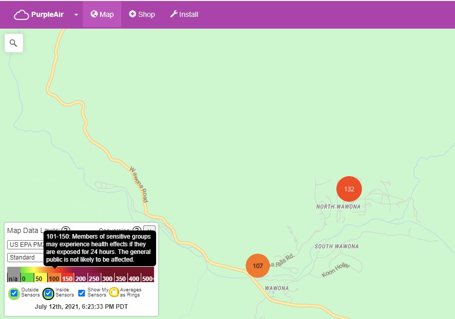
Air Quality In Wawona
River Fire in Madera, Mariposa counties at 8,000 acres, 10% contained, residents ordered to evacuate
FRESNO, Calif. (KFSN) -- CAL FIRE crews are battling a wildfire in Madera and Mariposa counties that is spreading quickly and threatening lives and property.
The River Fire was sparked off Oak Grove Road and Oak Grove School Road in Mariposa County.
Driven by wind, the fast-moving blaze jumped from 50 to 800 to 4,000 acres in a matter of hours on Sunday.
CAL FIRE announced that the flames grew to 8,000 acres on Monday. Containment also grew from 5% to 10%.
More than 200 firefighters are battling the fast-moving flames. Officials said fire crews worked through the night aggressively attacking the flames.
Crews are facing challenges in the firefight due to hot and dry weather conditions and winds.
Madera County residents are urged to sign up for alerts on evacuation orders and warnings here.
Mariposa County residents are urged to sign up for alerts here.
You can also call 1-844-668-3473 to receive information.
Evacuation Orders
Madera and Mariposa County authorities have issued an evacuation order for the following areas:
- Indian Peak and Road 800
- Leland Gulch to Road 600
- Road 800 between Road 613 and Road 812
- Intersection of Road 800/Road 810 to Road 600
- Road 812 to Road 600
- Road 600 to Road 812 to Blazing Saddle trl
- Road 600 between Road 810 and Apache Ranch Road
- Road 600 north of Apache Ranch Road to CA-49
- Road 600 south of road 810 to road 612
- Road 600 between Apache Ranch Road and Blazing Saddle Trail including the spur road JWP Ranch Road
Residents should use Usona Rd or Indian Peak Rd to Hwy 49 to exit the area.
Click here for a map of the evacuated areas.
They say there is an immediate threat to residents' life and they must leave immediately.
Evacuation Warnings
An evacuation warning has been issued for the following area: - 1 mile east of Rd 600, 1 mile north of Rd 600
- A temporary evacuation point has been established at New Life Christian Fellowship at 5089 Cole Road, Mariposa, CA 95338. If residents in the area have questions, they can call CAL FIRE at 844-668-3473.
Madera County residents are urged to sign up for alerts on evacuation orders and warnings here.
Mariposa County residents are urged to sign up for alerts here.
The American Red Cross has prepared for several dozen people who have been impacted. They've set up cots and will be passing out water bottles and food.
A neighbor alerted John Hanson Sunday afternoon that he was in a life-threatening area and needed to leave.
"Put some clothes in a bag...and... got my shoes.. found (my dog's) bed... and took off, and I hope everything is still there when I get back," said John Hanson.
Video taken from PG&E's Deadwood Peak webcam shows huge thick grey clouds of smoke blowing up above the hills in the area.
The company has shut down power for about 350 customers in the area as a preventative measure.
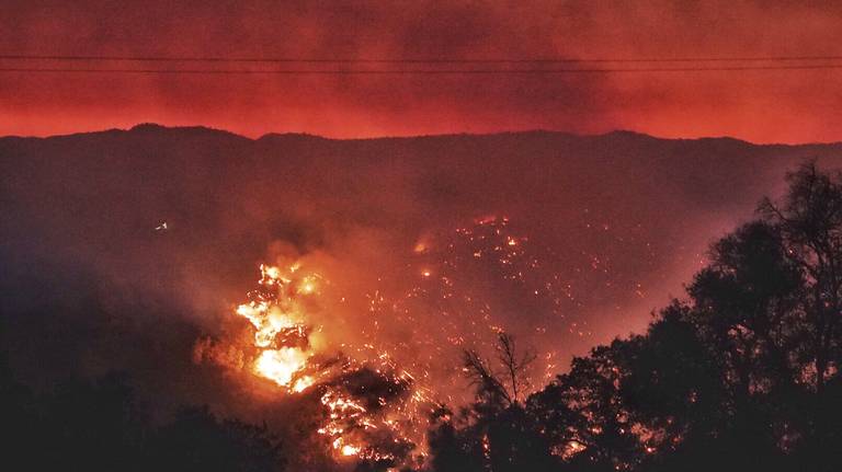
River Fire Currently 16 Miles From Wawona
7/12 - 8:02 AM
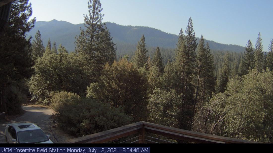
Wawona Smoke Cam - 7/12, 8:04 AM
River Fire Now At 4,000 Acres. Here Are Areas Under Evacuation
Fresno Bee - 10:15 PM, July 11
The fire broke out in the area near Oak Grove Road and Oak Grove School Road. A wildfire continues to spread west of Yosemite National Park, prompting multiple evacuations.
Dubbed the “River Fire,” the wildfire is burning along the Mariposa and Madera county border in the area near Oak Grove Road and Oak Grove School Road, according to Cal Fire.
Cal Fire spokesperson Jamie Williams said the fire was being wind-driven and at a critical rate of spread.
FIRST SIGN OF CONTAINMENT
Roughly six hours after the River Fire started, firefighters managed to contain some of the wildfire.
At around 10 p.m., Cal Fire reported the River Fire had grown to 4,000 acres but firefighters also established 5% containment.
Firefighters are continuing to make an aggressive attack on the fire, while dealing with hot, dry and windy conditions, according to Cal Fire.
The fire is burning in oak/grass woodland, Cal Fire added. The agency had not reported any structures destroyed and any injuries from the fire.
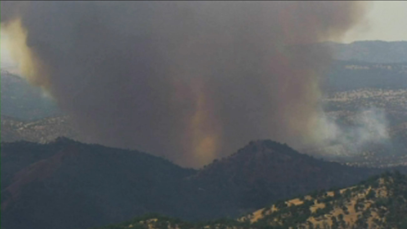
River Fire near Oakhurst explodes to 200 acres, residents ordered to evacuate immediately
The wildfire jumped from 50 to 100 to 200 acres in less than an hour.
FRESNO, Calif. (KFSN) -- CAL FIRE crews are battling a wildfire near Oakhurst that is spreading quickly and threatening lives and property.
The River Fire is burning off Oak Grove Road and Oak Grove School Road in Mariposa County.
Driven by wind, the fast-moving blaze jumped from 50 to 100 to 200 acres in less than an hour.
Authorities have issued an evacuation order for the following areas:
They say there is an immediate threat to residents' life and they must leave immediately.
A temporary evacuation point has been established at New Life Christian Fellowship on Cole Road.
If residents have questions in the area, they can call CAL FIRE at 844-668-3473.
The area is being closed to public access.
The wildfire jumped from 50 to 100 to 200 acres in less than an hour.
FRESNO, Calif. (KFSN) -- CAL FIRE crews are battling a wildfire near Oakhurst that is spreading quickly and threatening lives and property.
The River Fire is burning off Oak Grove Road and Oak Grove School Road in Mariposa County.
Driven by wind, the fast-moving blaze jumped from 50 to 100 to 200 acres in less than an hour.
Authorities have issued an evacuation order for the following areas:
- Indian Peak and Road 800
- Leland Gulch to Road 600
- Road 800 between Road 613 and Road 812
- Intersection of Road 800/Road 810 to Road 600
- Road 812 to Road 600
- Road 600 to Road 812 to Blazing Saddle trl
They say there is an immediate threat to residents' life and they must leave immediately.
A temporary evacuation point has been established at New Life Christian Fellowship on Cole Road.
If residents have questions in the area, they can call CAL FIRE at 844-668-3473.
The area is being closed to public access.
- Residents should use Usona Rd or Indian Peak Rd to Hwy 49 to exit the area.

Fire Update July 10, 2021
On Monday, June 28, 2021, through July 2, thunderstorms developed over Yosemite National Park, creating lightning that ignited 19 fires. Fire managers have been assessing all fires for an appropriate response. Due to the risk of visitor safety and park values, the King Fire has been suppressed in the Illilouette Creek drainage, and five fires, Harden, Pothole, Ridge, Coyote and Kerrick are out. The Fork Fire east of Mt. Starr King, has been contained at 12 acres. Remaining fires are burning in high elevation areas located in wilderness ranging from 7,000 to 9,700 feet. One additional fire, North, was reported on July 8 and is an escaped campfire; this fire has been suppressed. The weather is forecast to be hot and dry through this weekend, with record temperatures potential scattered thunderstorms.
Yosemite National Park is a fire-adapted ecosystem. The overall strategy for managing all wildland fires is to provide for the safety of employees and the public and protect and enhance natural and cultural resources.
King
Location: South of Nevada Falls, north of Mount Starr King. 7220 elevation.
Discovery Date: June 29, 2021 Size: 10 acres
Containment: 100% Strategy: Suppression
Cause: Lightning
Quartzite
Location: West of Quartzsite Peak. 8781 elevation.
Discovery Date: June 29, 2021 Size: .5 acre
Containment: 0% Strategy: Monitor
Cause: Lightning
Harden
Location: North of Harden Lake, south of Hetch Hetchy. 6665 feet elevation.
Discovery Date: July 1, 2021 Size: .25 acre
Containment: Out 7/4/2021 Strategy: Suppression
Cause: Lightning
Stubblefield
Location: Northern end of Yosemite NP, near Stubblefield and Kerrick canyons. 8000 elevation.
Discovery Date: June 28, 2021 Size: .1 acre
Containment: 0% Strategy: Monitor
Cause: Lightning
Porcupine
Location: Northeast of Porcupine Campground, and Tioga Road. 8210 elevation.
Discovery Date: June 28, 2021 Size: 1. acres
Containment: 0% Strategy: Monitor
Cause: Lightning
Coyote
Location: Coyote Rocks, north of Tioga Road. 9742 elevation.
Discovery Date: June 28, 2021 Size: .1 acre
Containment: Natural Out. Strategy: Monitor
Cause: Lightning
Hidden
Location: Northwest of Olmsted Point, Tioga Road. 9017 elevation.
Discovery Date: June 28, 2021 Size: .1 acre
Containment: 0% Strategy: Monitor
Cause: Lightning
County Line
Location: Near Yosemite Creek Campground Road. 8361 elevation.
Discovery Date: June 28, 2021 Size: .6 acres
Containment: 0% Strategy: Monitor
Cause: Lightning
Lukens
Location: West of Lukens Lake, North of Tioga Road. 8243 elevation.
Discovery Date: June 28, 2021 Size: 1.4 acre
Containment: 0% Strategy: Monitor
Cause: Lightning
Wegner
Location: East of Yosemite Creek Picnic Area and east of Tioga Road. 8256 elevation.
Discovery Date: June 28, 2021 Size: .25 acre
Containment: 0% Strategy: Monitor
Cause: Lightning
Half Moon
Location: West of Ten Lakes near Half Moon Meadow. 8256 elevation.
Discovery Date: June 28, 2021 Size: .1 acre
Containment: 0% Strategy: Monitor
Cause: Lightning
Pothole
Location: South of Glacier Point Road. 7885 elevation.
Discovery Date: June 28, 2021 Size: .1 acre
Containment: Out Strategy: Suppressed
Cause: Lightning
Fork
Location: 1 mile southeast of Mt. Starr King. 8500 elevation.
Discovery Date: June 28, 2021 Size: 12 acres
Containment: 100% Strategy: Confine and Contain
Cause: Lightning
Ridge
Location: South of Glacier Point Road, across from Sentinel Parking area. 8000 elevation.
Discovery Date: July 3, 2021 Size: .10 acre
Containment: Out 7/4/2021 Strategy: Confine and Contain
Cause: Lightning
Lake
Location: West slope of Mt Hoffman. 9000 elevation.
Discovery Date: July 3, 2021 Size: .10 acre
Containment: Natural Out. Strategy: Confine and Contain
Cause: Lightning
Lost
Location: Northeast Starr King Meadow. 8700 elevation.
Discovery Date: July 6, 2021 Size: .25 acre
Containment: 100% Strategy: Suppression
Cause: Lightning
North
Location: North side of North Dome.
Discovery Date: July 8, 2021 Size: .10 acre
Containment: 100% Strategy: Suppression
Cause: Escaped campfire
For the most up-to-date fire information follow Inciweb: https://inciweb.nwcg.gov/
Yosemite Fire 7.10.2021 Updates Printable PDF
Yosemite Fire Map 7.10.2021 Printable PDF
-NPS-
- Air Quality: Yosemite Air Quality Page or airnow.gov or airnow.gov/fires
- Trail Closures: https://www.nps.gov/yose/planyourvisit/conditions.htm
- Fire Restrictions: https://www.nps.gov/yose/planyourvisit/firerestrictions.htm
- National Weather Service Yosemite area forecast: www.weather.gov/hanford
- Sign-up for Alerts: go.nps.gov/alert
- Yosemite National Park Fire Information webpage: go.nps.gov/yosefire
- Facebook: @YosemiteFire
- Twitter: @YosemiteFire

Fire Update July 6, 2021
On Monday June 28, 2021 through July 2, thunderstorms developed over Yosemite National Park creating lightning that ignited 16 fires. Fire managers have been assessing all fires for an appropriate response. Due to the risk of visitor safety and park values the King Fire is being suppressed in the Illilouette Creek drainage and is being controlled by hand crews and helicopters. Four fires, Harden, Pothole and Ridge are out, the remaining fires are burning in high elevation areas located in wilderness ranging from 7,000 to 9,700 feet. The weather is forecasted to be hot and dry through next week with record temperatures throughout the region.
Yosemite National Park is a fire adapted ecosystem. The overall strategy for managing all wildland fires is to provide for the safety of employees and public, as well as protect and enhance natural and cultural resources.
King
Location: South of Nevada Falls, north of Mount Starr King. 7220 elevation.
Discovery Date: June 29, 2021 Size: 10 acres
Containment: 50% Strategy: Suppression
Cause: Lightning
Quartzite
Location: West of Quartzsite Peak. 8781 elevation.
Discovery Date: June 29, 2021 Size: .30 acre
Containment: 0% Strategy: Monitor
Cause: Lightning
Harden
Location: North of Harden Lake, south of Hetch Hetchy. 6665 feet elevation.
Discovery Date: July 1, 2021 Size: .25 acre
Containment: Out 7/4/2021 Strategy: Suppression
Cause: Lightning
Stubblefield
Location: Northern end of Yosemite NP, near Stubblefield and Kerrick canyons. 8000 elevation.
Discovery Date: June 28, 2021 Size: .1 acre
Containment: 0% Strategy: Monitor
Cause: Lightning
Porcupine
Location: Northeast of Porcupine Campground, and Tioga Road. 8210 elevation.
Discovery Date: June 28, 2021 Size: .10 acres
Containment: 0% Strategy: Monitor
Cause: Lightning
Coyote
Location: Coyote Rocks, north of Tioga Road. 9742 elevation.
Discovery Date: June 28, 2021 Size: .1 acre
Containment: 0% Strategy: Monitor
Cause: Lightning
Hidden
Location: Northwest of Olmsted Point, Tioga Road. 9017 elevation.
Discovery Date: June 28, 2021 Size: .1 acre
Containment: 0% Strategy: Monitor
Cause: Lightning
County Line
Location: Near Yosemite Creek Campground Road. 8361 elevation.
Discovery Date: June 28, 2021 Size: .6 acres
Containment: 0% Strategy: Confine and Contain
Cause: Lightning
Lukens
Location: West of Lukens Lake, North of Tioga Road. 8243 elevation.
Discovery Date: June 28, 2021 Size: .2 acre
Containment: 0% Strategy: Confine and Contain
Cause: Lightning
Wegner
Location: East of Yosemite Creek Picnic Area and east of Tioga Road. 8256 elevation.
Discovery Date: June 28, 2021 Size: .25 acre
Containment: 0% Strategy: Monitor
Cause: Lightning
Half Moon
Location: West of Ten Lakes near Half Moon Meadow. 8256 elevation.
Discovery Date: June 28, 2021 Size: .1 acre
Containment: 0% Strategy: Monitor
Cause: Lightning
Pothole
Location: South of Glacier Point Road. 7885 elevation.
Discovery Date: June 28, 2021 Size: .1 acre
Containment: Out 7/4/2021 Strategy: Suppressed
Cause: Lightning
Fork
Location: 1 mile southeast of Mt. Starr King. 8500 elevation.
Discovery Date: June 28, 2021 Size: .3 acres
Containment: 0% Strategy: Confine and Contain
Cause: Lightning
Ridge
Location: South of Glacier Point Road, across from Sentinel Parking area. 8000 elevation.
Discovery Date: July 3, 2021 Size: .10 acre
Containment: Out 7/4/2021 Strategy: Confine and Contain
Cause: Lightning
Lake
Location: West slope of Mt Hoffman. 9000 elevation.
Discovery Date: July 3, 2021 Size: .10 acre
Containment: 0% Strategy: Confine and Contain
Cause: Lightning
For the most up-to-date fire information follow Inciweb: KING: https://inciweb.nwcg.gov/incident/7593/
Yosemite Fires Map PDF
7.6.2021 Yosemite Fires Update PDF
-NPS-
- Air Quality: Yosemite Air Quality Page or airnow.gov or airnow.gov/fires
- Trail Closures: https://www.nps.gov/yose/planyourvisit/conditions.htm
- Fire Restrictions: https://www.nps.gov/yose/planyourvisit/firerestrictions.htm
- National Weather Service Yosemite area forecast: www.weather.gov/hanford
- Sign-up for Alerts: go.nps.gov/alert
- Yosemite National Park Fire Information webpage: go.nps.gov/yosefire
- Facebook: @YosemiteFire
- Twitter: @YosemiteFire
Wawona 4th of July Parade
Photos courtesy of Wendy Marshall and Kathie Heringer.
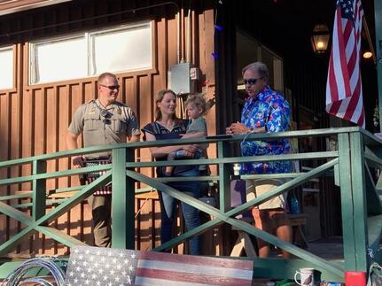
by Jennifer Wuchner - Wawona Community enjoyed a great 4th of July potluck hosted by the Pine Tree Market. In addition to hulu hoops, bubbles, reunions with friends after long Covid separations, and great food, we celebrated Yuliya Rippetoe becoming our newest naturalized citizen.
Yuliya came to the United States in 2010 from Ukraine. She was impressed by the patriotism she observed and the pride people had of our country. In 2015, she attended a naturalization ceremony at Glacier Point. She was struck by the profound patriotism and emotions the event evoked.
Yuliya decided to embark on the citizenship journey. The process involves 5 years continual residency, interviews, endless forms, background checks, expenses and arduous oral and written testing.
Yuliya passed all with highest scores and quietly took her Oath of Allegiance in early 2021.
Covid denied Yuliya the public Naturalization Ceremony, so the Wawona Community gathered together to honor her. Flag waving, loud cheers, and tears were all a part of Yuliya’s 4th of July public ceremony. The ceremonial tradition of apple pie with ice cream was served to honor Yuliya’s citizenship.
Yuliya lives in Wawona with her husband and 2 year old son.

Fire Update July 4, 2021
On Monday July 28, 2021 through July 2, thunderstorms developed over Yosemite National Park creating lightning that ignited 14 fires. Fire managers have been assessing all fires for an appropriate response. Due to the risk of visitor safety and park values three fires are being immediately suppressed. The King Fire in the Illilouette Creek drainage is being controlled by hand crews and helicopters. The Pothole and Harden fires are being extinguished by hand crews with support from a helicopter. The Kerrick Fire adjacent to the Pacific Crest Trail in the north end of the park has burned itself out in sparse fuels. The remaining fires are burning in high elevation areas located in wilderness ranging from 7,000 to 9,700 feet. Isolated afternoon showers and thunderstorms are possible through the 4th of July weekend then the weather is forecasted to be hot and dry into next week.
Yosemite National Park is a fire adapted ecosystem. The overall strategy for managing all wildland fires is to provide for the safety of employees and public, as well as protect and enhance natural and cultural resources.
Smoke maybe visible from areas along Tioga Road, Glacier Point Road and Yosemite Valley.
King
Location: South of Nevada Falls, north of Mount Starr King. 7220 elevation.
Discovery Date: June 29, 2021 Size: 8 acres
Containment: 5% Strategy: Suppression
Cause: Lightning
Quartzite
Location: West of Quartzsite Peak. 8781 elevation.
Discovery Date: June 29, 2021 Size: .30 acre
Containment: 0% Strategy: Monitor
Cause: Lightning
Harden
Location: North of Harden Lake, south of Hetch Hetchy. 6665 feet elevation.
Discovery Date: July 1, 2021 Size: .25 acre
Containment: 0% Strategy: Suppression
Cause: Lightning
Stubblefield
Location: Northern end of Yosemite NP, near Stubblefield and Kerrick canyons. 8000 elevation.
Discovery Date: June 28, 2021 Size: .1 acre
Containment: 0% Strategy: Monitor
Cause: Lightning
Porcupine
Location: Northeast of Porcupine Campground, and Tioga Road. 8210 elevation.
Discovery Date: June 28, 2021 Size: .10 acre
Containment: 0% Strategy: Monitor
Cause: Lightning
Coyote
Location: Coyote Rocks, north of Tioga Road. 9742 elevation.
Discovery Date: June 28, 2021 Size: .1 acre
Containment: 0% Strategy: Monitor
Cause: Lightning
Hidden
Location: Northwest of Olmsted Point, Tioga Road. 9017 elevation.
Discovery Date: June 28, 2021 Size: .1 acre
Containment: 0% Strategy: Monitor
Cause: Lightning
County Line
Location: Near Yosemite Creek Campground Road. 8361 elevation.
Discovery Date: June 28, 2021 Size: .1 acre
Containment: 0% Strategy: Confine and Contain
Cause: Lightning
Lukens
Location: West of Lukens Lake, North of Tioga Road. 8243 elevation.
Discovery Date: June 28, 2021 Size: .2 acre
Containment: 0% Strategy: Confine and Contain
Cause: Lightning
Wegner
Location: East of Yosemite Creek Picnic Area and east of Tioga Road. 8256 elevation.
Discovery Date: June 28, 2021 Size: .25 acre
Containment: 0% Strategy: Monitor
Cause: Lightning
Half Moon
Location: West of Ten Lakes near Half Moon Meadow. 8256 elevation.
Discovery Date: June 28, 2021 Size: .1 acre
Containment: 0% Strategy: Monitor
Cause: Lightning
Pothole
Location: South of Glacier Point Road. 7885 elevation.
Discovery Date: June 28, 2021 Size: .1 acre
Containment: 0% Strategy: Suppressed
Cause: Lightning
Fork
Location: 1 mile south of Ostrander Lake along Horse Ridge. 8500 elevation.
Discovery Date: June 28, 2021 Size: .3 acres
Containment: 0% Strategy: Confine and Contain
Cause: Lightning
Ridge
Location: South of Glacier Point Road, across from Sentinel Parking area. 8000 elevation.
Discovery Date: July 3, 2021 Size: .10 acre
Containment: 0% Strategy: Confine and Contain
Cause: Lightning
Lake
Location: West slope of Mt Hoffman. 9000 elevation.
Discovery Date: July 3, 2021 Size: .10 acre
Containment: 0% Strategy: Confine and Contain
Cause: Lightning
For the most up-to-date fire information follow Inciweb: KING: https://inciweb.nwcg.gov/incident/7593/
HARDEN: https://inciweb.nwcg.gov/incident/7594/
-NPS-
- Air Quality: Yosemite Air Quality Page or airnow.gov or airnow.gov/fires
- Trail Closures: https://www.nps.gov/yose/planyourvisit/conditions.htm
- Fire Restrictions: https://www.nps.gov/yose/planyourvisit/firerestrictions.htm
- National Weather Service Yosemite area forecast: www.weather.gov/hanford
- Sign-up for Alerts: go.nps.gov/alert
- Yosemite National Park Fire Information webpage: go.nps.gov/yosefire
- Facebook: @YosemiteFire
- Twitter: @YosemiteFire
Fire Update July 1, 2021
Location: Yosemite National Park
Size: 0.1 to 15 acres
Containment: 0%
Strategy: Suppression, Confine/Contain, Monitor
Cause: Lightning
Yosemite National Park experienced multiple lightning strikes igniting wildfires June 29-30, 2021. Park management is still determining the total number and location of fires to prioritize fire management actions. At this time thirteen fires have been detected.
Yosemite National Park is a fire adapted ecosystem. The strategy for all fires is to provide for the safety of employees and public, as well as protect natural and cultural resources. Currently there are no threats to infrastructure.
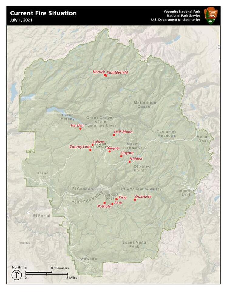
Yosemite Current Fire Situation Map
Fires will be visible from numerous vantage points throughout the park, including Tioga Road, Glacier Point, and other high-country viewpoints.
Park Managers are working with the local Air Quality Districts and will be monitoring smoke impacts to the park and local communities.
Look for future updates coming soon at the InciWeb Incident Information System. https://inciweb.nwcg.gov/
-NPS-
Location: Yosemite National Park
Size: 0.1 to 15 acres
Containment: 0%
Strategy: Suppression, Confine/Contain, Monitor
Cause: Lightning
Yosemite National Park experienced multiple lightning strikes igniting wildfires June 29-30, 2021. Park management is still determining the total number and location of fires to prioritize fire management actions. At this time thirteen fires have been detected.
Yosemite National Park is a fire adapted ecosystem. The strategy for all fires is to provide for the safety of employees and public, as well as protect natural and cultural resources. Currently there are no threats to infrastructure.
- Three fires posing threats to public safety and park resources are being suppressed: King (8 acres); Pothole (.1 acre) and Harden (.1 acre). Two segments of trails from Illilouette Creek to Nevada Falls are currently closed due to King Fire.
- Two fires will be confined and contained: County Line (.1 acre) and Lukens (.1 acre). These are near last year’s Wolf and Blue Jay fires, in the area around White Wolf, and will be contained using last year’s fire footprints and natural barriers such as granite and bare ground.
- The remaining nine fires have been placed in monitor status due to their remote location and low potential for fire spread. This minimizes suppression impacts in the wilderness while providing for the healthy ecological effects of natural fire. Firefighters will routinely monitor fire behavior and take suppression actions as warranted.
Yosemite Current Fire Situation Map
Fires will be visible from numerous vantage points throughout the park, including Tioga Road, Glacier Point, and other high-country viewpoints.
Park Managers are working with the local Air Quality Districts and will be monitoring smoke impacts to the park and local communities.
Look for future updates coming soon at the InciWeb Incident Information System. https://inciweb.nwcg.gov/
-NPS-
- Air Quality: Yosemite Air Quality Page or airnow.gov or airnow.gov/fires
- Trail Closures: https://www.nps.gov/yose/planyourvisit/conditions.htm
- Fire Restrictions: https://www.nps.gov/yose/planyourvisit/firerestrictions.htm
- National Weather Service Yosemite area forecast: www.weather.gov/hanford
- Sign-up for Alerts: go.nps.gov/alert
- Yosemite National Park Fire Information webpage: go.nps.gov/yosefire
- Facebook: @YosemiteFire
- Twitter: @YosemiteFire

COVID VACCINATIONS
Vaccine Clinics in Fish Camp & Wawona July 6
Mariposa County Public Health will be hosting two vaccine clinics on Tuesday July 6 in Fish Camp and Wawona. These two events will be with the Johnson and Johnson vaccine.
Fish Camp Fire Station #33
7731 Summit Road
Fish Camp, CA 93623
Tuesday July 6 from 1:30pm to 2:30pm
Wawona Library
7971 Chilnualna Falls Rd
Wawona, CA 95389
Tuesday July 6 from 3:30pm to 4:30pm
Appointments can be made online at myturn.ca.gov or by calling 833-422-4255. Walk-ins are welcome during these clinics. 18 years old and up only. (A. Carter)

YOSEMITE-WAWONA ELEMENTARY CHARTER SCHOOL
Board of Directors Regular Meeting
Tuesday, June 29, 2019
5:30 P.M.
Wawona Elementary School
7925 Chilnualna Falls Road
Wawona, CA
MONTHLY ITEMS AND FINANCIAL REPORTS
3.1- Approval of Agenda
3.2– Approval of Minutes of the regular meeting of June 15
3.3 - Approve Warrants/Payroll
3.4 – Accept Donations to YWECS
ACTION ITEMS
INFORMATION ITEMS
Board of Directors Regular Meeting
Tuesday, June 29, 2019
5:30 P.M.
Wawona Elementary School
7925 Chilnualna Falls Road
Wawona, CA
- CALL TO ORDER
- ROLL CALL
MONTHLY ITEMS AND FINANCIAL REPORTS
- CONSENT AGENDA
3.1- Approval of Agenda
3.2– Approval of Minutes of the regular meeting of June 15
3.3 - Approve Warrants/Payroll
3.4 – Accept Donations to YWECS
- HEARING OF PERSONS WISHING TO ADDRESS THE BOARD
ACTION ITEMS
- APPROVAL OF THE 2021-22 LCAP AND 2019-20 ANNUAL UPDATE FOR YOSEMITE-WAWONA ELEMENTARY CHARTER SCHOOL
- APPROVAL OF THE 2021-22 BUDGET FOR YOSEMITE-WAWONA ELEMENTARY CHARTER SCHOOL
- APPROVAL OF THE STUDENT/PARENT HANDBOOK FOR 2021-22
INFORMATION ITEMS
- BOARD MEMBER COMMENTS
- FUTURE AGENDA ITEMS
- NEXT BOARD MEETING
- ADJOURNMENT

STATE ROUTE 41 STRIPING AND DELINEATOR INSTALLATION PROJECT TO BEGIN NEXT WEEK IN OAKHURST
The California Department of Transportation (Caltrans), along with Granite Construction, announces the scheduled project to add striping and delineators along a portion of State Route 41, in Oakhurst, in Madera County.
The following will occur:
Closures may continue for longer periods of time if necessary, due to delays caused by weather or uncontrollable events that may occur.
Caltrans reminds you to drive with extra care and allow additional time while travelling near construction zones. Please be alert for construction personnel and remember to “Slow for the Cone Zone.”
The California Department of Transportation (Caltrans), along with Granite Construction, announces the scheduled project to add striping and delineators along a portion of State Route 41, in Oakhurst, in Madera County.
The following will occur:
- The project, roughly ¼ of a mile long, is scheduled to begin Monday, June 28th and last through October 2021.
- The project will take place, in both directions of State Route 41, between Golden Oak Loop and Hodges Hill Drive.
- Work will typically be from 7:00 a.m. to 4:00 p.m., each week, Monday through Thursday.
- A one-way reverse traffic control pattern will be in place during striping/delineator placement on Monday, June 28th. Two-way traffic, with no shoulders, will be in place for the duration of the project.
- Motorists can expect a speed limit reduction in the construction zone.
Closures may continue for longer periods of time if necessary, due to delays caused by weather or uncontrollable events that may occur.
Caltrans reminds you to drive with extra care and allow additional time while travelling near construction zones. Please be alert for construction personnel and remember to “Slow for the Cone Zone.”
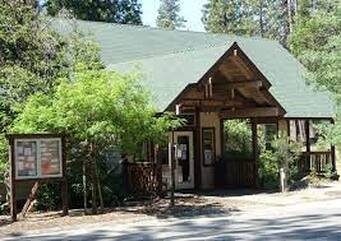
Library Limited Reopening
Wawona Bassett Memorial Library will be closed for the Federal Holiday, Juneteenth, on Friday, June 18 and Saturday, June 19.
Also, PGE power outage scheduled for June 18.
Beginning June 20, 2021, you’ll be able to browse the shelves, pickup holds, check out circulation material, or use our public computers at the Wawona Bassett Memorial Library. WiFi is available in the library parking lot.
Per State and County guidelines, we will require face coverings and social distancing, and we ask everyone to limit visits to 30 minutes. 6 library patrons will be allowed in the library at one time.
Initially, we will be open to the public for Friday and Saturday hours with additional days added as appropriate.
Tuesday: Curbside pickup only
Friday: 12 Noon—5 p.m.
Saturday: 10 a.m.—3 p.m.
YOSEMITE-WAWONA ELEMENTARY CHARTER SCHOOL
Board of Directors Regular Meeting
June 15, 2021
5:30 P.M.
Wawona Elementary School
7925 Chilnualana Falls Road
Wawona, CA
MONTHLY ITEMS AND FINANCIAL REPORTS
3.1- Approval of Agenda
3.2– Approval of Minutes of the regular meeting of May 11, 2021
3.3–Approve Payroll
3.4- Approve Warrants
3.5 -Accept Donations to YWECS
ACTION ITEMS
INFORMATION ITEMS
Board of Directors Regular Meeting
June 15, 2021
5:30 P.M.
Wawona Elementary School
7925 Chilnualana Falls Road
Wawona, CA
- CALL TO ORDER
- ROLL CALL
MONTHLY ITEMS AND FINANCIAL REPORTS
- CONSENT AGENDA
3.1- Approval of Agenda
3.2– Approval of Minutes of the regular meeting of May 11, 2021
3.3–Approve Payroll
3.4- Approve Warrants
3.5 -Accept Donations to YWECS
- HEARING OF PERSONS WISHING TO ADDRESS THE BOARD
ACTION ITEMS
- PUBLIC HEARING OF THE 2021-22 LOCAL CONTROL ACCOUNTABILITY PLAN (LCAP)
- PUBLIC HEARING OF THE 2021-22 SCHOOL BUDGET
- STUDENT ENROLLMENT CAP FOR 2021-22
- STUDENT HANDBOOK REVISION UPDATE
- APPROVAL OF EMPLOYEE CONTRACTS FOR THE 2021-22 SCHOOL YEAR
INFORMATION ITEMS
- STAFF REPORTS
- BOARD MEMBER COMMENTS
- FUTURE AGENDA ITEMS
- NEXT BOARD MEETING
- CLOSED SESSION: Personnel/Negotiations/Litigation
- Student Discipline or other confidential Student matters (Ed. Code sections 35146, 48900 et seq., 48912(b) and 49060 et seq., and 20 U.S.C. section 1232g)
- RECONVENE IN OPEN SESSION: Announce Closed Session Actions
- ADJOURNMENT
Mom Takes Little Ones Out For a Walk
Pictures From Today's WAPPOA Meeting
A special thank you to Eric Scott for all his work these years in Wawona. Eric, we will miss you! Best wishes in your retirement. (Photos courtesy of Annette Stephens)

Fire Season Declared
Yosemite National Park has declared fire season due to hotter and drier weather conditions. Fire season is officially enacted when the fire danger rating for the park shows moderate for three consecutive days. As such, the Superintendent has initiated Stage 1 fire restrictions in accordance with and under authority of Title 36, Code of Federal Regulations, Section 2.13(c):
• No building, maintaining, attending, or using a fire (including campfire, cooking fire, and charcoal fires) within Yosemite National Park below 6,000 feet in elevation except as noted below. Portable stoves using pressurized gas, liquid fuel or propane are permitted, as are alcohol stoves, including tablet/cube stoves. Twig stoves are not permitted.
• No smoking below 6,000 feet except within an enclosed vehicle, a campground or picnic area where wood and charcoal fires are allowed or in a designated smoking area. All public buildings, public areas of Concession buildings (including restrooms), other areas as posted, and within 25 feet of any non-single-family residential building to remain closed to smoking at all times.
• Campfires and cooking fires may still be used in designated campgrounds and picnic areas in developed portions of the park in accordance with park regulations.
• Campfires and cooking fires may still be used in residential areas in developed portions of the park in accordance with park regulation.
When recreating, be sure to follow all fire rules and regulations. Help prevent human caused wildfires by ensuring your campfire is out cold using the “drown, stir, and feel method.”
New House For Sale in Wawona
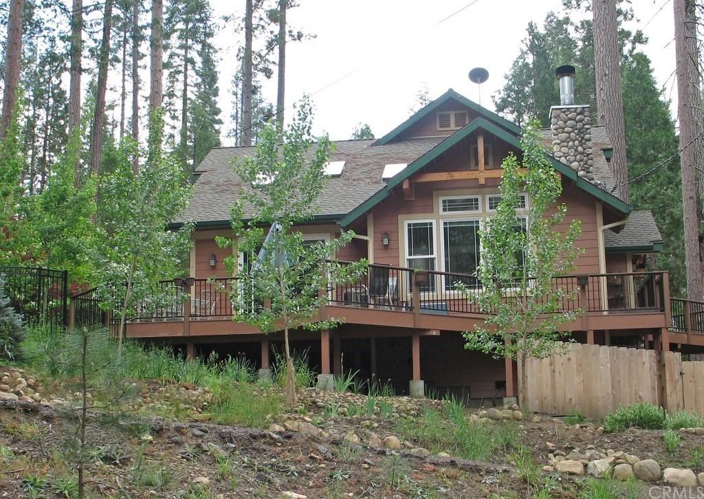
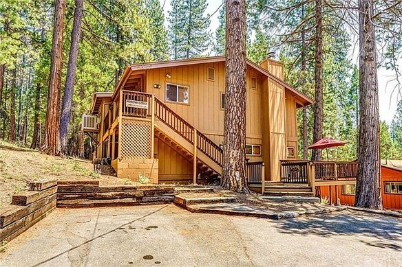
7937 Wawona Way, Wawona, CA, 95389 - 3bed, 2.5bath, 1,672sqft, 0.36acre lot, $1,150,000 Click here for more info.
