WawonaNews.com - May 2014
Save a Yosemite Meadow
Save A Yosemite Meadow from Zeus Leyva on Vimeo.
Sign the petition to SAVE FISH CAMP
goo.gl/mdTnGJ
A small village, just south of the gate to Yosemite on highway 41 is fighting to save a beautiful meadow from development of a large hotel. Beyond the obvious environmental concerns, like much of California, Fish Camp is suffering from a severe drought and its water supply is dangerously low. Building a large hotel takes about 10,000 gallons of water a day during construction and so much more after completion, leaving Fish Camp with a deficient supply of water for fire suppression and a degraded supply of water for this small community's daily use.
Several years ago an Environmental Impact Report ("EIR") was approved by Mariposa County's Planning Commission and Board of Supervisors. The developer did not build and the project was foreclosed. In 2012 the old EIR was extended until June 2014 on the condition that it would be the last extension. But now on the eve of the old EIR expiring the owners who bought the meadow out of foreclosure are requesting the EIR be extended again. The County is motivated to approve the additional extension by the additional TOT, or so-called "bed tax", it will reap if the hotel gets built. Due to its location near the park, Fish Camp already has a large hotel and many other small establishments that serve the tourists visiting Yosemite and already generates substantial bed tax for Mariposa County.
Now Fish Camp is being asked to sacrifice its very existence for another large hotel and its bed tax. Fish Camp can't provide its residents with clean water or protect them from wildfire if it does not have sufficient water. The result of extending the outdated Environmental Impact Report -- now well over a decade old - could be catastrophic for Fish Camp. A jewel of California's varied landscape, Fish Camp serves as a water shed for the National Forest, with the Giant Sequoias, wild flowers, and hundreds of species of wild life depending on its water. We can't let a bed tax driven by the greed of a few remote politicians sacrifice our meadow and all it means to our entire community. The irony is that if the Fish Camp water supply is diminished and degraded by allowing a poorly thought through development to proceed under an ancient and outdated EIR, the very beds the County is trying to add will be unprotected from wildfire, jeopardizing not only the revenue from any additional bed taxes but also the revenue the County is currently receiving from the already existing hotels. What's the rush? The bottom line is if another hotel in Fish Camp is a good idea then another EIR based on current conditions is a good idea.
Sign the petition to SAVE FISH CAMP
goo.gl/mdTnGJ
goo.gl/mdTnGJ
A small village, just south of the gate to Yosemite on highway 41 is fighting to save a beautiful meadow from development of a large hotel. Beyond the obvious environmental concerns, like much of California, Fish Camp is suffering from a severe drought and its water supply is dangerously low. Building a large hotel takes about 10,000 gallons of water a day during construction and so much more after completion, leaving Fish Camp with a deficient supply of water for fire suppression and a degraded supply of water for this small community's daily use.
Several years ago an Environmental Impact Report ("EIR") was approved by Mariposa County's Planning Commission and Board of Supervisors. The developer did not build and the project was foreclosed. In 2012 the old EIR was extended until June 2014 on the condition that it would be the last extension. But now on the eve of the old EIR expiring the owners who bought the meadow out of foreclosure are requesting the EIR be extended again. The County is motivated to approve the additional extension by the additional TOT, or so-called "bed tax", it will reap if the hotel gets built. Due to its location near the park, Fish Camp already has a large hotel and many other small establishments that serve the tourists visiting Yosemite and already generates substantial bed tax for Mariposa County.
Now Fish Camp is being asked to sacrifice its very existence for another large hotel and its bed tax. Fish Camp can't provide its residents with clean water or protect them from wildfire if it does not have sufficient water. The result of extending the outdated Environmental Impact Report -- now well over a decade old - could be catastrophic for Fish Camp. A jewel of California's varied landscape, Fish Camp serves as a water shed for the National Forest, with the Giant Sequoias, wild flowers, and hundreds of species of wild life depending on its water. We can't let a bed tax driven by the greed of a few remote politicians sacrifice our meadow and all it means to our entire community. The irony is that if the Fish Camp water supply is diminished and degraded by allowing a poorly thought through development to proceed under an ancient and outdated EIR, the very beds the County is trying to add will be unprotected from wildfire, jeopardizing not only the revenue from any additional bed taxes but also the revenue the County is currently receiving from the already existing hotels. What's the rush? The bottom line is if another hotel in Fish Camp is a good idea then another EIR based on current conditions is a good idea.
Sign the petition to SAVE FISH CAMP
goo.gl/mdTnGJ
Bishop Creek Prescribed Fire Canceled
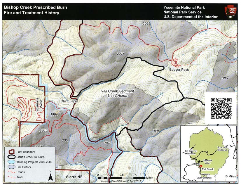
The proposed 1,447 acre Bishop Creek Prescribed Fire has been cancelled for the spring. It was necessary to cancel the project due to deteriorating air quality and the time needed to complete this project before the Memorial Day holiday week. The primary objective of the prescribed fire was to reduce hazardous vegetation adjacent to the Wildand Interface community of Yosemite West.
150th Anniversary of the Yosemite Grant
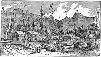
June 30th marks the 150th anniversary of the Mariposa Grove of Giant Sequoias and Yosemite Valley as America's First Public Lands. There will be several events that day for park staff and visitors to celebrate this special anniversary. Mark the day on your calendar and stay tuned for more details. (J. Wuchner)
The Sad Consequences of Feeding Bears
SOUTH LAKE TAHOE, Calif. (MyNews4.com & KRNV) – Heavenly, the bear, was named so after he was found skirting through the Heavenly Ski lift in early March. The Lake Tahoe Wildlife Care Center nursed Heavenly back to health, and Secretary Tom Millham, dreamed of a happy ending for him.
"Our expectation for all bears that are released back into the wild are that they would go back into the wild and perform their natural things that they do," said Millham.
Unfortunately, that's not how the story is unfolding. Last week, Heavenly was released into the wild 25 miles south of Lake Tahoe, but he quickly returned and was captured overnight after reports of him approaching people. Heavenly has been deemed too domesticated for wild life and will be given to a sanctuary.
"Basically it came back to where it learned how to eat," said Chris Healy from the Nevada Department of Wildlife. "Unfortunately, it learned how to eat amongst the garbage from homes in of Lake Tahoe."
Heavenly is currently staying at the Lake Tahoe Wildlife Care Center where his fate hangs in the balance. Returning to the wild is not an option.
"This is a wild animal it will no longer be able to be wild because it has become acclimated to humans as a source of food," Healy said.
Healy and Millham believe Heavenly may have been illegally fed by humans.
"Don't feed the wildlife," said Millham. "They know enough to get their own food."
By doing so, authorities have to consider the danger Heavenly could pose to humans when he grows bigger.
"We have taken what should be a magnificent wild animal and turned it into an almost domestic pet, and now it’s going to have to live out its life in a sanctuary," said Healy. "It’s a horrible outcome for this fine animal."
However, Heavenly's fate does not include euthanization.
"We really only have two alternatives: one is to put him down, or the other would be to place him," said Millham. "So yeah, placing him would be the lesser of two evils."
Millham said there has been a lot of interest for heavenly from different sanctuaries across the country thanks to his story, and "Tahoe", another bear cub at the wildlife center that made national headlines.
South Entrance Station Project Delays
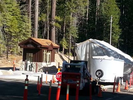
The South Entrance Station Project has scheduled to complete the final paving starting this coming Thursday (May 8th) and will be working thru next week (Friday May 16th) with placement asphalt, shoulder backing and striping. All of this work will occur with 15 minute delays The following is the proposed traffic control scheduled over the next week:
Thursday, May 8th--Flaggers will be in-place with alternating one-way traffic control.
Monday, May 12th--Flaggers will be in-place with alternating one-way traffic control.
Tuesday, May 13th--Flaggers and Pilot Car Operations will be in place with alternating one-way traffic control. This will be a long paving day with many trucks traveling in this area and crews will be working from 5AM to 8PM. So please be patient and slow down as there will be many trucks and crews working next to moving traffic.
Wednesday, May 14th--Flaggers will be in-place with alternating one-way traffic control.
Thursday, May 15th--Flaggers will be in-place with alternating one-way traffic control.
Please expect up to 15 minute delays when you are traveling in this area over the next week (No weekend work is scheduled). (M. Pieper)
New Yosemite Nature Notes Video
Wawona Pine Needle Pick Up - June 9-13

1. Place materials adjacent to roadways so they can be accessed easily with front loaders.
2. Material must be in place PRIOR to event week.
3. Only vegetation material will be picked up. No household garbage, construction materials or large/longer than 3 feet branches, please.
4. Only one pile per property, and it should be placed away from trees or other obstructions
so that the loader can pick up the material. If your needle pile is between or against trees/rocks, it will necessitate hand loading the material into the loader or dump truck, slowing down the process and unnecessarily delaying the pickup of needle piles for the total community of Wawona.
5. We have the County services for one week only.
6. Wawona property owners pay for the service. Yosemite National Park, DNC & UC Merced properties are not included in the pick-up.
7. If your address is on an out-of-the-way street or you have any questions, you can call or e-mail
Greg Ollivier, Solid Waste Manager, 209-966-5165 or his cell 209-742-3263,
[email protected]. That way your pile won’t be missed. This helps the County staff serve as many as possible during the time allotted.
Yosemite-Wawona Elementary Charter School to open in August
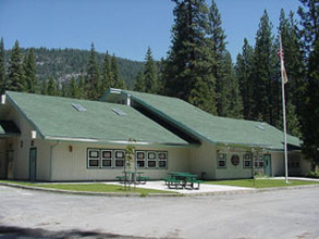
The Yosemite-Wawona Educational Foundation is meeting at the school every Monday evening at 7 PM to complete all the tasks needed to be ready for the doors of the Yosemite-Wawona Elementary Charter School to open in August. All are welcome - we would appreciate your input!
We would like to give a HUGE thanks to Chad Andrews for all of the time he has spent creating the website for our charter school. Thanks, Chad!
Yosemite Wawona Elementary Charter School: (YWECS) http://www.yosemitewawonacharter.org/
We would like to give a HUGE thanks to Chad Andrews for all of the time he has spent creating the website for our charter school. Thanks, Chad!
Yosemite Wawona Elementary Charter School: (YWECS) http://www.yosemitewawonacharter.org/
Tioga Road to open tomorrow, Friday, May 2 at Noon
- News Release Visitors urged to take safety precautions while traveling on road
Scott Gediman 209-372-0248Kari Cobb 209-372-0529
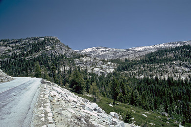
The Tioga Road in Yosemite National Park will open for the season tomorrow, Friday, May 2, 2014, at noon for all vehicular traffic. The Tioga Road, bounded on both sides by State Highway 120, is the popular east-west crossing of the Sierra Nevada. Vault toilets are available in several locations along the road. Limited visitor services will be available over the next several weeks. Due to a light snowpack this past winter (approximately 30% of normal), the Tioga Road was cleared of snow early into the season. Snow and icy conditions may still exist on hiking trails at the higher elevations. Visitors are urged to be prepared for snowy conditions and possible treacherous stream crossings while hiking the backcountry in the early season. All campgrounds along the Tioga Road are closed. All commercial services, including the gas station, store, and village grill, are also closed. There are no anticipated opening dates for any of these facilities. (K. Cobb)
Bishop Creek Prescribed Fire Postponed in Yosemite National Park
Prescribed Burn Rescheduled for Early May
Scott Gediman 209-372-0248
Kari Cobb 209-372-0529
Yosemite National Park Fire Managers have rescheduled a prescribed fire in the Bishop Creek area for early May. The prescribed fire, originally scheduled for the end of April, is postponed because of forecasted rain in the area. Yosemite is expecting up to one inch of rain throughout the park. Ignition of the prescribed fire is dependent on weather and moisture levels.
The prescribed fire is located near the community of Yosemite West in the Bishop Creek area. The total prescribed fire area will include 1,447 acres. The prescribed fire is designed to protect Yosemite West from potential wildfires. Additionally, the prescribed fire is designed to reduce surface fuels and ladder fuels. Heavy understory ladder fuels allow surface fires to spread from the ground to tree canopies creating undesirable crown fires, which are fires in the tops of trees.
Ignition will take approximately five days with active burning, and about two weeks to monitor burn down activity. The Wawona Road will remain open during the prescribed fire, however, traffic control may be instituted if conditions require. Firefighters, fire equipment, and smoke may be present on and around the roadway.
The park has submitted a smoke management plan to the Mariposa County Air Pollution Control District (APCD), and will obtain a burn permit prior to burning. Smoke monitors will be deployed in smoke sensitive communities to monitor air quality. The California Air Resources Board, Tuolumne, San Joaquin, and Great Basin APCDs have been notified of the prescribed fire. (K. Cobb)
Yosemite Climber's Rescue Caught on Camera
CBS NewsApril 23, 2014, 8:56 AM
A California man is recovering from a serious rock climbing accident. He broke his back after falling as far as 30 feet at Yosemite National Park on Sunday.
Blake Parkinson, 26, says he doesn't remember what went wrong. Luckily, the recreational climber was wearing a helmet when he fell on the most challenging section of his climb. When rescuers spotted Parkinson, he had fallen onto the narrow ledge of this remote cliff.
"I was climbing into the most difficult part of the second pitch," he said. "And [I] went to pull a move and I didn't make it and I fell."
Parkinson and his friend, Ben Tomsky, were climbing up Higher Cathedral Spire, a 600-foot tall peak located in the heart of California's Yosemite National Park.
Parkinson - an experienced climber -- broke his back in the fall.
"He was in pretty bad shape," said Tomsky. "There wasn't a lot of relief. I mean, I was happy to see he was alive. But he was clearly very, very badly injured."
Tomsky called 911 and a California Highway Patrol helicopter rushed to the scene and carefully lowered a Yosemite Search and Rescue team on to the ledge.
With its chopper blades dangerously close to the rock face, pilots steadied the helicopter and hoisted Parkinson to safety.
"Yosemite Search and Rescue is the best in the world at what they do," said Parkinson. "I have the utmost respect for their skills and their training and I'm just extremely grateful to have them help me out."
More than 100 climbing accidents occur in Yosemite each year. Just last week, rescuers evacuated a woman who injured her back while hiking.
Parkinson suffered a fractured spine, but he can move his arms and legs so paralysis isn't an issue.
He has weeks of intensive therapy ahead of him.
Prescribed Fire Scheduled in the Yosemite West Area
Date: April 16, 2014 Burn proposed for the week of April 28th near Bishop Creek
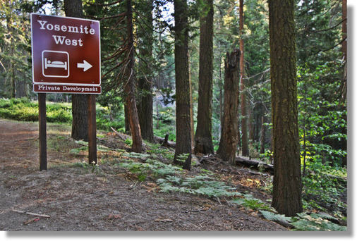
Yosemite National Park is planning a 1,447 acre prescribed fire in the southwestern portion of the park near Yosemite West. The burn is projected to start the week of April 28, depending upon weather conditions. Ignition will take approximately five days with active burning, and about two weeks to monitor burn down activity. The Wawona Road will remain open during the burn, however, traffic control may be instituted if conditions require. Firefighters, fire equipment, smoke and debris may be present on the roadway.
The primary objective of this prescribed fire is to treat hazardous vegetation and fuels (brush and other flammable material) adjacent to the Wildland Urban Interface community of Yosemite West. The burn area is east of the Wawona Road along Highway 41. This burn would protect the area from wildfires that start above the community of Yosemite West. Conducting this prescribed fire would also allow the area to function as a fire hardened buffer for future wildfires, and to anchor additional prescribed fires surrounding the community. This prescribed fire is designed to reduce surface fuels and ladder fuels. Heavy understory ladder fuels allow surface fires to spread from the ground to tree canopies creating undesirable crown fires, which are fires in the tops of trees. Once the area is treated and maintained, this area will offer a fuel break for firefighters to safely protect the area east of Yosemite West from future wildfires.
Conducting this prescribed burn in April will allow the park to protect the community of Yosemite West during this dry year. Typically, fuels in this area would be too wet to burn in April, but the drought makes this month an ideal time for prescribed fire. Taking advantage of this early dry season will allow the park to clear fuels that may pose a threat if left untreated.
The park has submitted a smoke management plan to the Mariposa County Air Pollution Control District (APCD), and will obtain a burn permit prior to burning. The prescribed fire window will be determined in collaboration with surrounding air pollution control districts to find the best opportunity for smoke to disperse from populated areas. Smoke monitors will be deployed in smoke sensitive communities to monitor air quality. The California Air Resources Board, Tuolumne, San Joaquin, and Great Basin APCDs have been notified of the burn.
Fifty lightning ignitions have been suppressed in this area since 1930. This historical fire suppression effort has put the community of Yosemite West at risk for larger wildfires. Prescribed fire mimics the effects of wildfire (reducing surface and ladder fuels) under environmental conditions the fire managers prescribe to meet life and property protection objectives and to reduce safety risks.
AT&T Representatives at WAPOA meeting
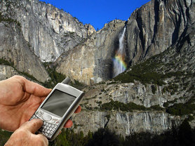
AT&T representatives will attend the April 12th WAPOA meeting to discuss plans for enhanced service in Yosemite National Park including Wawona and Yosemite West.
