WawonaNews.com - October 2018
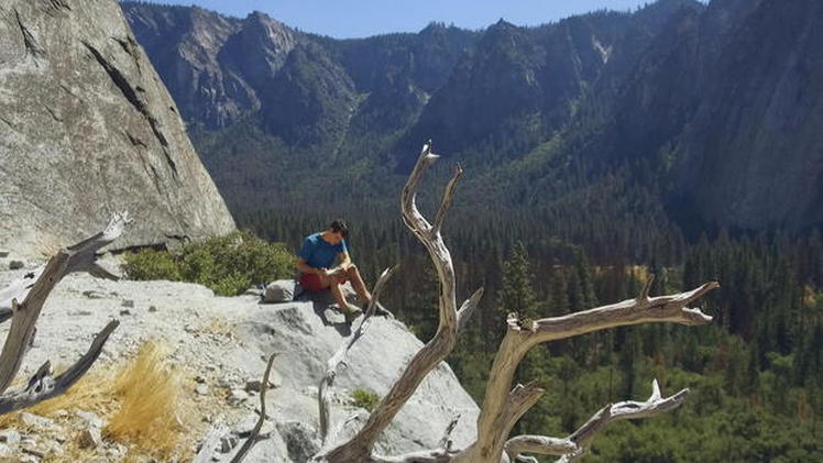
Climber Alex Honnold reflects on what it took to scale a 3,000-foot rock wall with no ropes
Thirty-three-year-old Alex Honnold is one of the biggest names in rock climbing. Last summer, he became the first and only person so far to climb Yosemite's El Capitan without any ropes or safety gear. The famed 3,000-foot rock wall is higher than the tallest building in the world, the Burj Khalifa in Dubai. His climb is the subject of a new documentary called "Free Solo." Honnold returned to the site of his record-breaking triumph to write a note to his teenage self about what lies ahead.
Dear Alex,
Right now, you're an 18-year-old loner, lost in a sea of uncaring faces at UC Berkeley. You'll spend most of your freshman year, not at class, but at a local boulder, traversing the rock face back and forth with headphones in. You prefer it to the climbing gym because you don't have to talk to anyone. Surprisingly, this is the beginning of a path. You will leave school, move into a van, and devote yourself to climbing.
Your lack of social skills will be one part of why you take up free soloing, climbing by yourself without a rope. But don't worry – you'll eventually find yourself right at home in the climbing community, surrounded by close friends and lifelong partners.
You've always loved the physical movement of climbing. There's a certain joy in swinging around, propelling yourself upward, the fluidity of movement. Whether it's climbing trees or buildings as a kid or climbing Half Dome in Yosemite National Park as an adult, you'll come to appreciate the strain in your arms and the burning of your muscles. You'll experience this joy climbing throughout your life; no matter how many routes you climb, it will always be at the core of your drive.
The idea of free soloing El Capitan, the iconic 3,000-foot wall in Yosemite, will become an all-encompassing dream for much of your climbing life. For the first five or six years, you'll be too afraid to try – too afraid to even put any effort toward a potential solo. Right now, you're afraid of so many things: strangers, girls, vegetables, falling to your death. That's fine; fear is a perfectly natural part of life. You will always feel fear. But over time you will realize that the only way to truly manage your fears is to broaden your comfort zone. It's a long, slow process that requires constantly pushing yourself, but eventually you'll feel pretty darn good, and you'll climb big walls just like this.
You'll have near misses and frequently think about death. It will change your perspective and little annoyances will melt away. There will always be people calling you crazy or assuming that you have a death wish – that's fine. They don't see the amount of time and effort that goes into preparation or your drive to do something difficult, especially if it's never been done before.
But you will always find purpose in exploring your own limits. Don't let anyone else's opinion rein you in. It doesn't matter what anyone else thinks: live your life in the way that you find most fulfilling.
For many years, climbing will be the most important thing in your life. You will put climbing before everything else. But keep an open mind. Eventually you will have a wonderful girlfriend and a charitable foundation.
In the end, it all comes back to El Capitan. It will give your life direction for almost a decade. It will be your muse, the reason you get up early to train and stay out for long days in the mountains. The day that you finally free solo El Cap will be one of the most satisfying of your life. It will also serve as an important reminder that no summit is more important than the long process of getting there.
Climbing is a lifelong journey; use it to learn and grow. And Alex, don't forget to enjoy the view.
CBS NEWS October 9, 2018
YOSEMITE-WAWONA ELEMENTARY CHARTER SCHOOL Board of Directors Regular Meeting
Wednesday, October 10, 2018 Wawona Elementary School 7925 Chilnualana Falls Road Wawona, CA
1. CALL TO ORDER
2. ROLL CALL MONTHLY ITEMS AND FINANCIAL REPORTS
3. CONSENT AGENDA NOTE: The Board will be asked to approve all of the following items by a single vote, unless any member of the Board or of the public asks that an item be removed from the consent agenda and considered and discussed separately.
3.1- Approval of Agenda
3.2– Approval of Minutes of the regular meeting of September 12 and September 25
3.3–Approve Payroll 3.4- Approve Warrants
4. HEARING OF PERSONS WISHING TO ADDRESS THE BOARD The public may address the Board on any matter pertaining to the school that is not ion the agenda. There will be no Board discussion and no action will be taken unless listed on a subsequent agenda. ACTION ITEMS
5. STATUS OF THE LEASED SCHOOL BUS Consideration and action on a decision about what to do with the school bus being leased by the Charter during the 2018-19 school year.
6. RETURN OF YOSEMITE CONSERVANCY GRANT FUNDS Consideration and action on the return of Yosemite Conservancy Grant funds due to the fact that the school cannot meet the requirements of the Grant.
7. EMPLOYMENT STATUS OF CURRENT EMPLOYEES Consideration and action on the employment status of current employees INFORMATION ITEMS
8. REPORT ON THE STATUS OF CHARTER FUNDING STREAMS
9. BUDGET COMMITTEE REPORT
10. REPORT ON PROGRESS TOWARDS THE COMPLETION OF THE CHARTER RENEWAL PETITION
11. DISCUSSION ON THE RENEWAL OF A SPECIAL USE PERMIT WITH YOSEMITE NATIONAL PARK
12. STAFF REPORTS
13. BOARD MEMBER COMMENTS
14. FUTURE AGENDA ITEMS Request that various items be placed on the next agenda for discussion and/or action.
15. NEXT BOARD MEETING Unless otherwise announced, the next regular meeting of the Board of Directors will be scheduled for Wednesday, November 14, 2018 at 5:30 p.m. at the Wawona School.
16. CLOSED SESSION: Personnel/Negotiations/Litigation Note: The Board will consider and may act upon any of the following items in closed session. Any action taken will be reported publically at the end of closed session as required by law.
16.1 Personnel (Gov. Code 54957)
17. RECONVENE IN OPEN SESSION: Announce Closed Session Actions
18. ADJOURNMENT

Large Item Pickup, October 13
The Mariposa County Public Works will pick up large items from property owners in Wawona on Saturday, October 13, 2018 – the same date as the WAPOA meeting. TheCounty will have a trailer/dumpster in the Wawona Maintenance Yard between 9 a.m. and 3 p.m. Large household furnishings, appliances, deck furniture, etc. will be accepted. No hazardous waste or electronics will be accepted. This is one of the benefits from our property owner combination garbage pick-up, needle pick-up, and large item pick-up special service district billing.
The Mariposa County Public Works will pick up large items from property owners in Wawona on Saturday, October 13, 2018 – the same date as the WAPOA meeting. TheCounty will have a trailer/dumpster in the Wawona Maintenance Yard between 9 a.m. and 3 p.m. Large household furnishings, appliances, deck furniture, etc. will be accepted. No hazardous waste or electronics will be accepted. This is one of the benefits from our property owner combination garbage pick-up, needle pick-up, and large item pick-up special service district billing.
Wawona Roads Delays Postponed
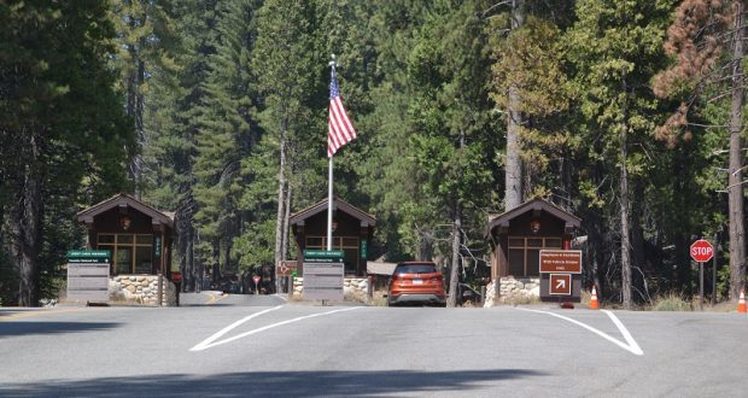
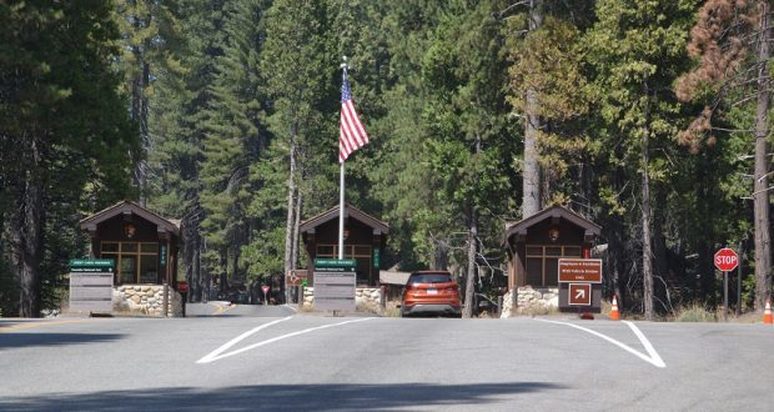
Due to expected rain, the Wawona/Mariposa Grove Roads (South Entrance) delays will take place next Tuesday (10/9) and Wednesday(10/10).
A Contractor will be completing asphalt repairs on Wawona Road and Mariposa Grove Road near the South Entrance roundabout Tuesday (10/9) and Wednesday (10/10) with single lane traffic control, so please be patient and schedule additional time when traveling thru this area.
Anticipated delays Tuesday October 9th and 10th, 7am to 7pm – Traffic delays up to 15 minutes. (M. Pieper)
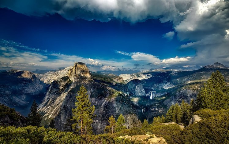
America's National Parks Are Warming And Drying Up Faster Than The Rest Of The Country, Says A New Study
(CNN) — National parks are important. They're home to irreplaceable ecosystems, cultural sites and extraordinary wildlife.
But according to a new study, things are not looking good for them.
The study revealed that temperatures across the country's 417 protected areas have increased by 1.8 degrees Fahrenheit, double the amount compared to the rest of the country. While both temperatures and aridity went up, precipitation rates have drastically gone down.
Why this is happeningPatrick Gonzalez, a climate change scientist at the University of California Berkeley and one of the study's authors, says the reason why the national parks are adversely affected is usually because of their locations. A lot of national parks are in the Arctic, at high elevations or in dry weather ares in the southwestern United States.
The high temperatures, according to the study, often occur because a large portion of national parks are at high elevations, "where warming occurs more quickly due to a thinner atmosphere."
More than half of the country's parks -- 63% -- are in Alaska and have seen the worst temperature increase.
"The permafrost is melting," Gonzalez told CNN. "The ground there is frozen because of the cold climate through most of the year, so once you heat it up, the ground melts." When the snow melts, Gonzalez said, the land's color turns darker, with the snow gone.
"And we all know that darker colors absorb more sunlight and get hotter."
That puts not only glaciers at risk, but polar bears as well, who depend on the sea ice.
The study found precipitation was also down by 12% across the country's national parks, while it had only decreased by 3% in the US as a whole.
What this means for parksBetween 1948 and 2000, Muir Glacier in the Glacier Bay National Park in Alaska has shed over 2,099 feet; forests in the Noatak National Preserve and Yosemite National Park have thinned and shifted.
Vast areas of forests are dying in Yellowstone National Park from droughts and bark beetles, which have thrived due to climate change are attacking the trees.
And in areas like Yosemite National Park and preserves in Alaska, trees are growing in meadows and tundra.
It could get much worse, scientists say.
Yellowstone National Park -- the world's first national park -- could see up to 10 times more areas burned by wildfires by 2100, while Joshua Tree National Park could see its famous Joshua trees die out.
Temperatures in the country's national parks could increase six times faster in the 21st century than they did in the 20th century. Alaska's national parks alone could see up to a 16 degrees Fahrenheit temperature increase.
What can be done about itThere's a way back, Gonzalez said. The temperature increases can be attributed to human-caused climate change.
"Carbon dioxide has risen to its highest level in 800,000 years, well beyond the natural range of variation," Gonzalez said. Plus, the carbon that scientists have found in the atmosphere has a unique chemical signature, different from the carbon that comes from volcanoes or plants.
"We have quantified the carbon pollution to cars, power plants and deforestation. We have found that human activities pump nine billion tons of carbon into the atmosphere every year but growing forests and ocean waters only absorb five billions tons a year."
Reducing greenhouse gas emissions, according to the study, could reduce projected temperature increases by at least a half and possibly up to two-thirds.
Go car-free, he suggests. "Walk, bike, take public transit," Gonzales said. "Cutting carbon pollution from human sources can save parks from the most extreme heat."
Wawona Road (South Entrance) Delays Next Tuesday (10/2) and Wednesday(10/3)
A Contractor will be completing asphalt repairs on Wawona Road and Mariposa Grove Road near the South Entrance roundabout next Tuesday and Wednesday with single lane traffic control, so please be patient and schedule additional time when traveling through this area.
Tuesday October 2nd and 3rd (Next Tuesday and Wednesday)
7am to 7pm – Traffic delays up to 15 minutes (M. Pieper)
************************************************************************************************
Traffic Data Equipment Installation Date Changes
New Traffic Data Recording Equipment is Currently Being Installed to Replace All of the Existing Traffic Counters in the Park
On September 11, contractors began to replace or rehabilitate all existing traffic counters in Yosemite. The scope of work includes installation of loop vehicle detectors in each lane, trenching and placing wiring in underground conduit along the shoulder of the road, and connections to Automatic Traffic Data Recorders.
Flagging operations and lane closures may be required. Lanes may be closed for up to three hours. Please watch for flaggers and traffic cones in work zones.
Short traffic delays may be anticipated as work crews proceed with excavation and construction on the shoulder of the road and in the roadway. Motorists can expect day work along Tioga Road, Big Oak Flat Road, Wawona and Glacier Point Roads, Southside Drive near the Chapel, and Northside Drive near Camp 4. Night work will take place at the South Entrance, Arch Rock, and Big Oak Flat Entrance. Work will not be conducted on the weekends, from Friday night to Sunday afternoon.
South Entrance 10/17-10/21 8:00 pm-5:00 am Flagger (one-lane road)
Fire Update September 27th, 2018
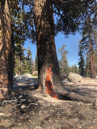
There are multiple fires burning in Yosemite National Park's wilderness. Wildfires when caused by lightning are a natural phenomenon on the landscape. Fire managers work to restore healthy forests and reduce the threat of extensive, severe fire by allowing some lightning-ignited wildfires to burn. While hiking trails and sitting at vistas you may see smoke in some of these areas.
Stage 2 Fire Restrictions are currently in place inside Yosemite National Park. Please review the details for Stage 2 Fire Restrictions, which will remain in place until further notice. https://www.nps.gov/yose/planyourvisit/firerestrictions.htm
Fire Name: Indian Date: 9/27/18
Discovery Date: 9/4/18 Location: Near Porcupine Camp Ground, in Yosemite's Wilderness
Size: 102 acres Status: Active
Strategy: Monitor Cause: Lightning
Predominate growth is on the north and west flanks of the fire, fire behavior is creeping and smoldering with pockets of condensed heat in heavy dead and down fuels. This fire is surrounded by many natural barriers and rock bands. Fire crews are monitoring daily with easy access off the Tioga road.
Fire crews will be working along Tioga road as the fire backs down towards the road. There may be smoke impacts to Porcupine Campground and Yosemite Valley at night and in the morning when smoke settles in low areas. There will also be smoke impacts to Tioga road, we urge motorists to follow all posted signs and use caution when driving in the area.
Fire Name: Rancheria Date: 9/27/18
Discovery Date: 9/8/18 Location: North end of Rancheria Mountain, in Yosemite's Wilderness
Size: 41 acres Status: Active
Strategy: Monitor. Cause: Lightning
The fire is creeping though dead and down ground fuels in red fir. The spread is mostly north and southwest following vegetation pockets. There are some natural barriers including very green vegetation, rock out cropping's, and changes in vegetation. Smoke production has been very light with some overnight accumulation in the Tuolumne river canyon. Fire crews will continue to assess impacts to trails.
Fire Name: Unicorn Date: 9/27/18
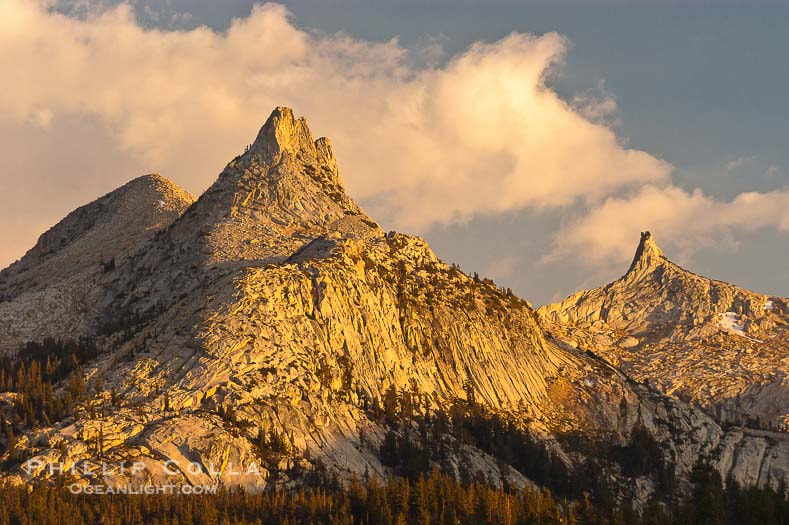
Discovery Date: 7/28/18 Location: Unicorn Peak Area, in Yosemite's Wilderness
Size: 2.6 acres Status: Active
Strategy: Occasional patrol with very low spread. Cause: Lightning
The Fire is at 9500 feet in elevation. Smoke may be visible from Tuolumne meadows.
Fire Name: Pinnacles Date: 9/27/18
Discovery Date: 9/8/18 Location: Near Clouds Rest, Yosemite's Wilderness
Size: 1/10th acre Status: Active
Strategy: Monitor Cause: Lightning
This is a high elevation fire with low spread potential, burning near areas of granite and rock outcroppings.
Fire Name: Rafferty Date: 9/27/18
Discovery Date: 9/21/18 Location: Near Ireland Lake, in Yosemite's Wilderness
Size: 1/10th acre Status: Active
Strategy: Monitor Cause: Lightning
This is a high elevation fire with low spread potential, burning near areas of granite and rock outcroppings
Crews Gain The Upper Hand On The Oak Fire
Posted by: gina clugston September 25, 2018 - 8:35 am
AHWAHNEE – The Oak Fire is now 55 percent contained as crews continue to strengthen containment lines and do mop-up in the interior.
With more accurate mapping, the estimated size has been adjusted to 360 acres.
The fire started on Saturday, Sept. 22 at 3:44 p.m. off Lonesome Oak Road north of Road 620.
At 2 p.m. yesterday, evacuation orders were lifted for the communities of Cedarbrook and Timberloft. The areas remain under advisory evacuation notice and are open to residents only.
All mandatory evacuation orders on Road 620 were reduced to pre-evacuation advisory status as of 8 p.m. on Sunday.
The following areas are still under mandatory evacuation:
Lone Sequoia Campground
Miami Motorcycle Trails closed to all traffic
Road Closures:
Road 620 from Miami Creek to just west of Lonesome Oak Lane (open to residents only)
Miami Motorcycle Trails (closed to all traffic)
Pre-Evacuation Advisories:
Lonesome Oak Lane (open to residents only)
Buckeye Gap Trail (open to residents only)
North side of Road 620 between Lonesome Oak Lane and Badger Hollow Trail
Road 620 (north side) between Road 628 and Mojo Lane
Road 620 (north side) between Buckeye Gap Trail and Old Yosemite Road
Old Yosemite Road
Sunshine Mountain Road
Cedarbrook (open to residents only)
Timberloft (open to residents only)
Fire personnel are still active in the area. Please reduce speeds and drive with caution.
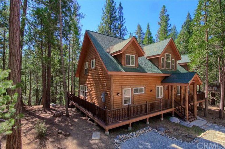
New Wawona Real Estate Listing
- 5beds
- 3baths
- 3,012sq ft
- 2,178sqft lot
Click here for more info.
Firefighters Hold The Oak Fire At 390 Acres, Increase Containment
Posted by: gina clugston September 24, 2018 - 7:55 am
AHWAHNEE – The huge column of smoke over the Oakhurst area the past few days has been reduced to a light haze as firefighters on the Oak Fire continue to hold it at 390 acres. It is now 45 percent contained.
Crews have mopped up about 60 feet inside the line on the western and northern perimeters and will be working toward increasing that to 200 feet today.
On the eastern flank where air resources focused their efforts yesterday, there is dozer line three blades wide along much of that line.
Crews were pulled off the line in some areas overnight as hazard trees continue to drop. Fallers are working today to remove those hazards.
The Incident Command Post is at Station 12 in Oakhurst and Cal Fire is now in Unified Command with the U.S. Forest Service. The fire is burning in Madera and Mariposa Counties, and on the Sierra National Forest.
Federal resources are being housed at Batterson Work Station north of Oakhurst, and motorists should be aware of large equipment moving in and out of that station.
All mandatory evacuation orders on Road 620 have been reduced to pre-evacuation advisory status as of 8 p.m., Sunday, Sept. 23. Road 620 openedn to residents only last night.
Road Closures:
– Road 620 from Miami Creek to just west of Lonesome Oak Lane (Open to Residents Only)
– Miami Motorcycle Trails (Closed to All Traffic)
Mandatory Evacuation Orders:
– Community of Cedarbrook on Forest Service Road 5S12
– Community of Timberloft on Forest Service Road 6S09 and 6S14B
– Lone Sequoia Campground
Pre-Evacuation Advisories:
– Lonesome Oak Lane
– Buckeye Gap Trail
– North side of Road 620 between Lonesome Oak Lane and Badger Hollow Trail
– Road 620 (north side) between Road 628 and Mojo Lane
– Road 620 (north side) between Buckeye Gap Trail and Old Yosemite Road
– Old Yosemite Road
– Sunshine Mountain Road
Fire personnel are still active in the area. Please reduce speeds and drive with caution. Access will be limited to residents only in areas indicated and no other public access will be granted at this time.
The cancellation of additional evacuation orders is being evaluated based on a variety of factors including potential fire behavior and the re- establishment of crucial infrastructure.
A Red Cross Evacuation Center had been established at the Oakhurst Community Center located at 39800 Road 425B. However, with no one in need of their services, they have gone on standby. Please call 559-515-3974 if you require assistance. The Center will be reopened if needed.
The cause of the fire is under investigation.
Good Progress On The Oak Fire
Now 35 Percent Contained
Posted by: gina clugston September 23,
AHWAHNEE – Firefighters made excellent progress today on the Oak Fire, burning northeast of Ahwahnee above Road 620.
The fire was estimated at 390 acres at 1:30 p.m. today, and is holding at that acreage. The fire is 35 percent contained.
The mission for the day was to hit the east flank hard with water drops and retardant between Road 620 and Forest Road 6S17.
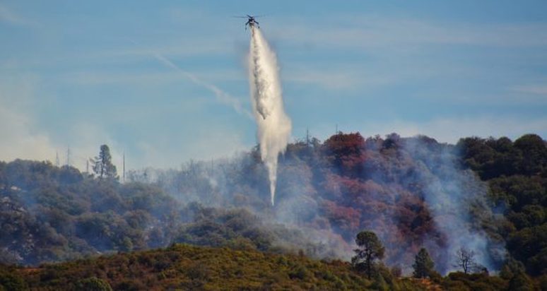
Air resources were over the fire at about 9 a.m. and continued to drop and reload, painting the ridge north of Lonesome Oak Lane where the fire started, and allowing crews on the ground to cut and hold their line.
There is now line around the entire perimeter and crews are working on mop-up and strengthening those lines. The new section of line completed today on the southeast portion has hose lay in place.
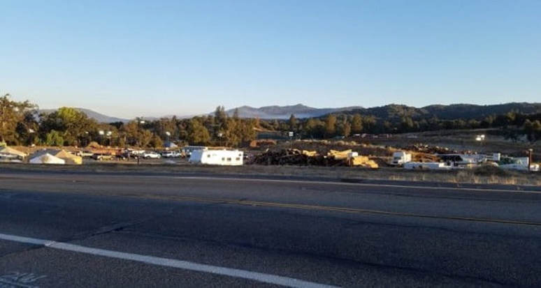
Oak Fire from Road 620 and 628 at noon – photo Gina Clugston
There are currently 318 personnel assigned to the incident.
We will update in more detail after tomorrow’s morning briefing, including new maps.
All mandatory evacuation orders on Road 620 have been reduced to pre-evacuation advisory status as of 8 p.m., Sunday, Sept. 23. Road 620 will open to residents only at 8 p.m.
Road Closures:
– Road 620 @ Miami Creek (Open to Residents Only)
– Road 620 Just West of Lonesome Oak Lane (Open to Residents Only)
– Miami Motorcycle Trails (Closed to All Traffic)
Mandatory Evacuation Orders:
– Miami Motorcycle Trails
– Community of Cedarbrook on Forest Service Road 5S12
– Community of Timberloft on Forest Service Road 6S09 and 6S14B
– Lone Sequoia Campground
Pre-Evacuation Advisories:
– Lonesome Oak Lane
– Buckeye Gap Trail
– North side of Road 620 between Lonesome Oak Lane and Badger Hollow Trail
– Road 620 (North side) between Road 628 to Mojo Lane
– Road 620 (North side) between Buckeye Gap Trail and Old Yosemite Road
– Old Yosemite Road
– Sunshine Mountain Road
Fire personnel are still active in the area. Please reduce speeds and drive with caution. Access will be limited to residents only in areas indicated and no other public access will be granted at this time.
The cancellation of additional evacuation orders is being evaluated based on a variety of factors including potential fire behavior and the re- establishment of crucial infrastructure.
A Red Cross Evacuation Center had been established at the Oakhurst Community Center located at 39800 Road 425B. However, with no one in need of their services, they have gone on standby. Please call 559-515-3974 if you require assistance. The Center will be reopened if needed.
The cause of the fire is under investigation.
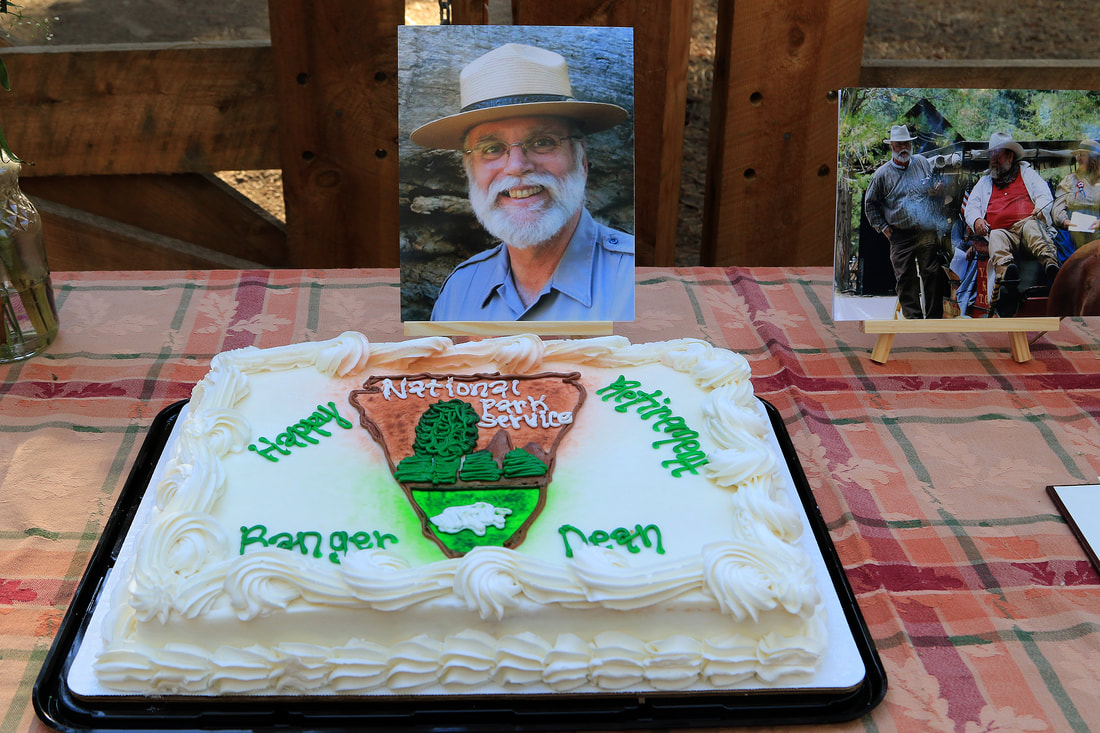
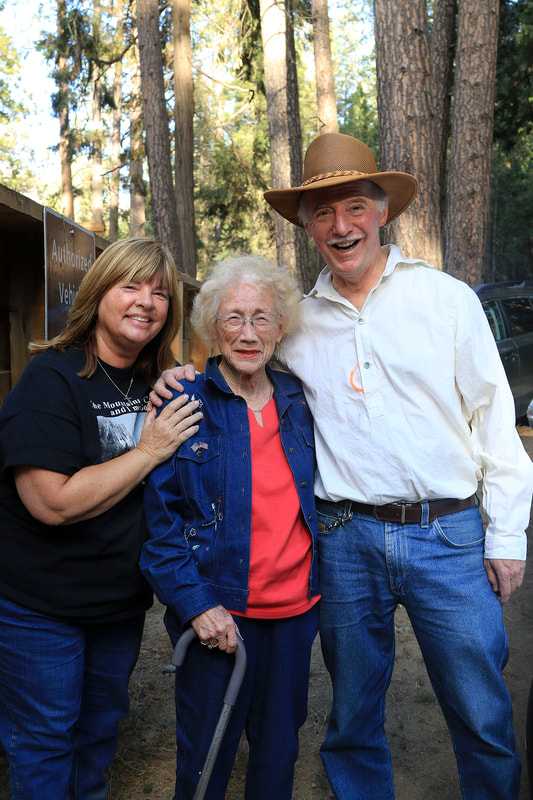
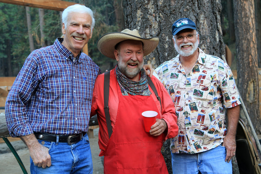
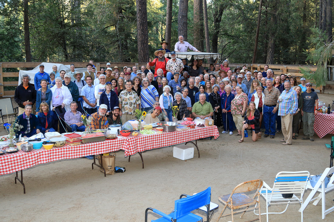
Photos From Dean Shenk's Retirement Party
How Firefighters Saved Yosemite West, What They’re Doing Now
Posted by: gina clugston September 21, 2018
YOSEMITE – Though the firefight has ended on the nearly 97,000-acre Ferguson Fire and only a few smokes remain throughout the interior, the work of repair and restoration continues.
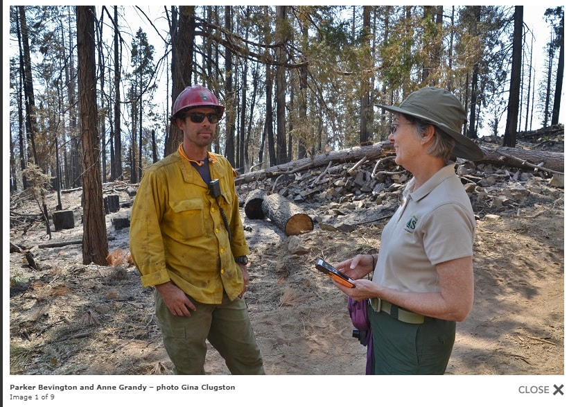
On a recent trip to Yosemite West, I was escorted by Anne Grandy, retired from the Bass Lake Ranger District and now serving as a PIO on the South Central Sierra Interagency Incident Management Team, which served two stints managing the Ferguson Fire.
We were shown first-hand where firefighters made their stand to save the community, the massive amount of work that went into that effort, and the equally daunting process in which they are now engaged to repair the damage done during suppression efforts.
Parker Bevington, Engine Captain at the Wawona Fire Station in Yosemite National Park, was the Division Boss in Division H on the fire – the area on the northeast corner where firefighters stopped the forward progress before the fire reached Yosemite Valley, and kept it from destroying Yosemite West and the ski area at Badger Pass.
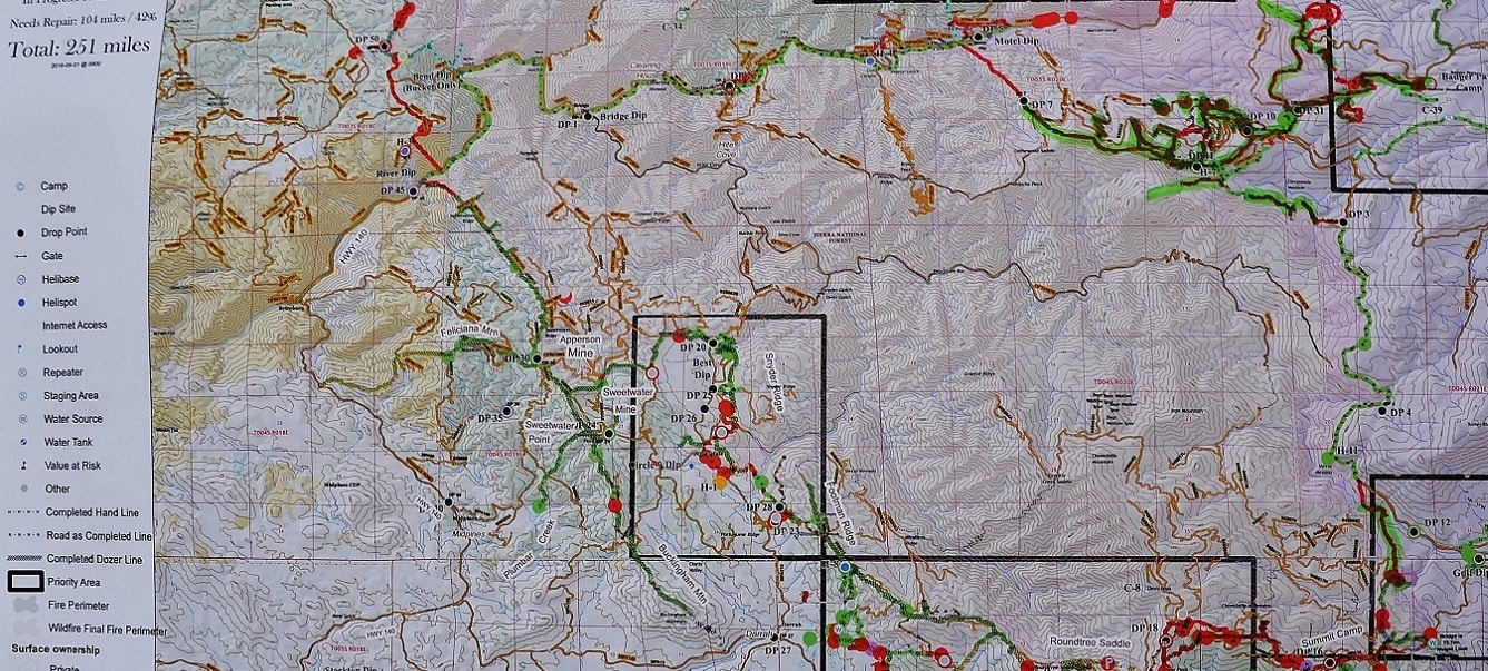
Bevington is now the Division Supervisor for the Yosemite Group, which is working to repair suppression damage all across the fireline from Wawona to El Portal and Foresta. This is his section of the 251 miles of fireline that will be repaired in the coming months.
On the day of our visit, about 25 people were hard at work on the southeast corner of Yosemite West near the site of an old logging camp. While there were about 300 people defending this section of line during the firefight, that number has been reduced to less than 10 percent doing the massive job of repair work.
On the day of our visit, about 25 people were hard at work on the southeast corner of Yosemite West near the site of an old logging camp. While there were about 300 people defending this section of line during the firefight, that number has been reduced to less than 10 percent doing the massive job of repair work.
Back in July when it was clear that the Ferguson Fire was headed toward the community across steep, inaccessible terrain, heavy with beetle-kill trees and dense fuel loads, firefighters prepared to defend around Yosemite West and along Highway 41. The heavy inversion layer in the days before the fire arrived gave crews time to construct several contingency lines ahead of the leading edge.
“That nasty inversion we had for about a week was a miracle,” said Bevington. “We were blessed to have it. If we hadn’t, it could have been just like the Rim Fire with those 50,000 foot columns, and it would have all been gone. Though the inversion kept the aircraft from flying, it also kept a lid on our jar. When you get into this decadent timber that’s overloaded with millions upon millions of dead trees, you can drop retardant on it all day and it’s not going to stop it.”
“That nasty inversion we had for about a week was a miracle,” said Bevington. “We were blessed to have it. If we hadn’t, it could have been just like the Rim Fire with those 50,000 foot columns, and it would have all been gone. Though the inversion kept the aircraft from flying, it also kept a lid on our jar. When you get into this decadent timber that’s overloaded with millions upon millions of dead trees, you can drop retardant on it all day and it’s not going to stop it.”
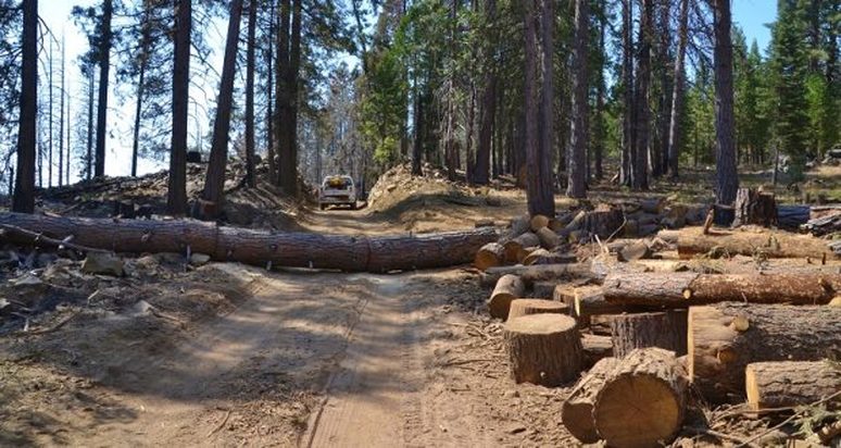
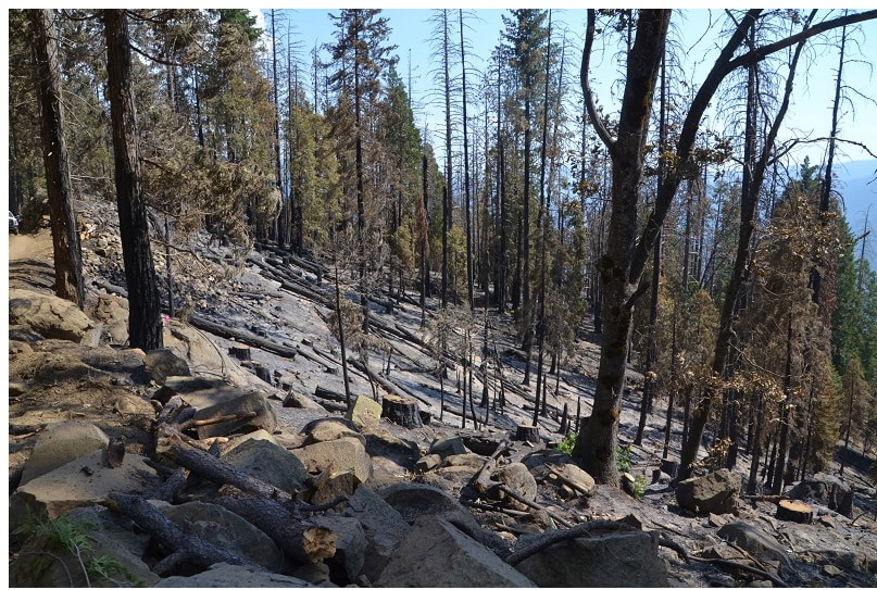
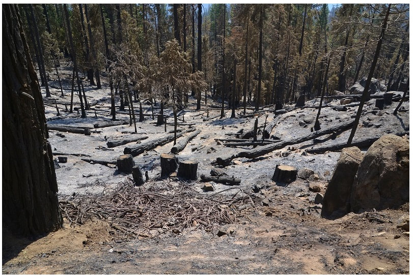
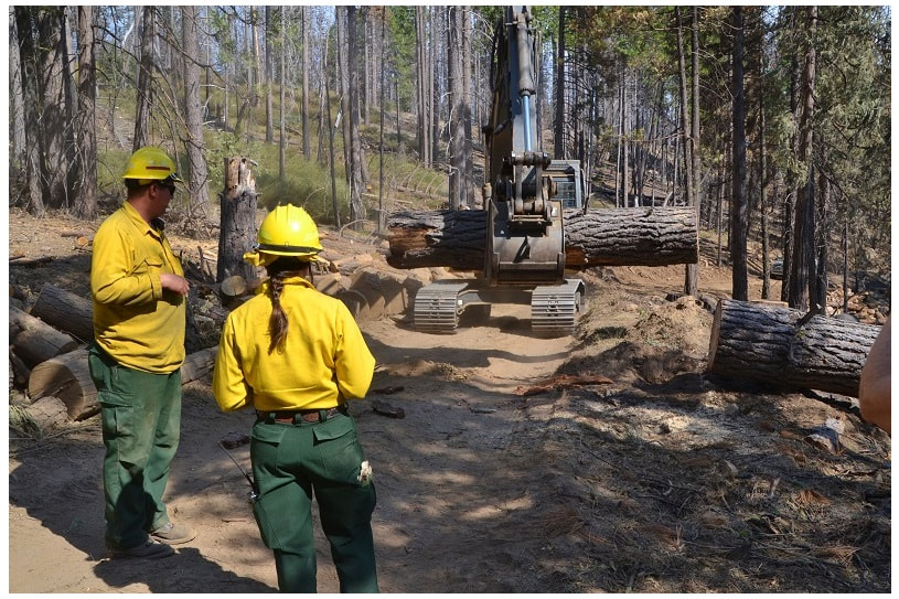
Firefighters used that time to remove the fuel inside their line. They dropped about 80 percent of the trees within one chain (66 feet) of the road on the “black” side, all of which were dead.
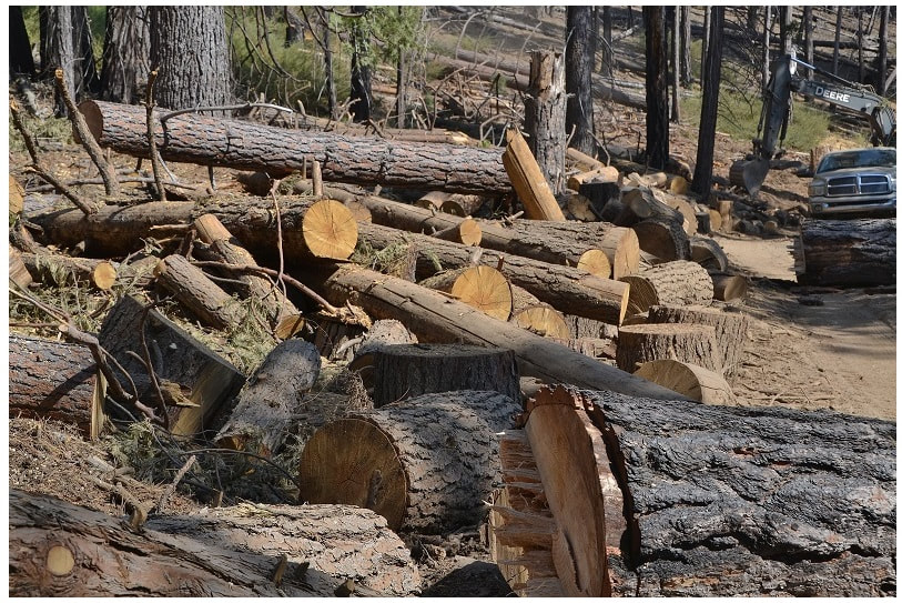
They then cut them into thousands of huge rounds and with no processors or skidders available, firefighters rolled them – uphill mind you – into the “green” and fired off that section of line so that when the leading edge of the fire arrived, there was no fuel left to burn.
They then cut them into thousands of huge rounds and with no processors or skidders available, firefighters rolled them – uphill mind you – into the “green” and fired off that section of line so that when the leading edge of the fire arrived, there was no fuel left to burn.
The firefight around Yosemite West, and in fact across any fire of size, was planned and executed not only to save lives and property, but also to preserve natural, cultural and other resources across the landscape.
Resource Advisors, or READs, are an integral and largely unrecognized part of suppression activity and the repair process after the fire is contained. They are brought in right from the beginning to identify areas that need to be protected. Each division on the fire has at least one READ assigned.
Resource Advisors, or READs, are an integral and largely unrecognized part of suppression activity and the repair process after the fire is contained. They are brought in right from the beginning to identify areas that need to be protected. Each division on the fire has at least one READ assigned.
All READs who work on the fireline are called REAFs (Resource Advisor – Fireline) and receive the same Basic 40 training as all other firefighters. They come from a wide range of experience levels, professional backgrounds and agencies.
While firefighters are focused on stopping the fire, they also don’t want to run a dozer line through an ancient burial ground or destroy the nesting ground of an endangered species. READs identify those areas so that fire managers can avoid them. They assist with planning suppression actions such as scouting lines, digging handline, putting out spot fires, placing hoselays and repairing damaged areas.
On the Ferguson Fire, there are READs with decades of experience and a variety of other fireline qualifications:
- Tribal members
- Engine crews
- Task force leaders
- Crew bosses
- Firefighter Types 1 and 2
- Helicopter crew members
- Heavy equipment operators and bosses
- Suppression repair specialists
- Cultural specialists
- Specialists in Geographic Information Systems (GIS) mapping technology
- Timber fallers
- Wilderness specialists
- Emergency medical technicians
- Low-angle rope rescue technicians
READs write a suppression repair plan with input from various agency administrators and fire personnel, collaborate with Task Force Leaders, Heavy Equipment Bosses, and Heavy Equipment Operators, and collaborate with local tribal governments and provide escort missions for tribal personnel who want to visit sensitive areas, as long as it is safe to do so.
Some of their notable efforts on the Ferguson Fire included protecting historic structures such as Henness Ridge and Trumbull Peak Lookouts, and the Merced Grove Cabin; helping rangeland permitees track down lost animals; protecting owl nests, pacific fisher nests, fish and amphibian habitat; protecting bears and other animals by making sure proper food storage containers were in place; repairing areas used by fire personnel for camps; informing air operations about good places to access water, where to place heliwells and retardant plants, where to avoid dropping retardant; helping private landowners file claims if they have property that was saved by suppression efforts, but also damaged by suppression activities; identification of previously undiscovered archeological sites; and avoiding or minimizing the spread of noxious weeds.
On the day of our visit to Yosemite West, an old logging camp from the Sugar Pine Lumber Company had been flagged for protection by one of the Yosemite Group’s READs. The crews were moving the heavy rounds that had been cut inside the fireline, and piling them outside the flagged area.
This time, they had heavy equipment assisting in their efforts. They were stacking burn piles and covering them with wax-covered paper to keep them dry. Then, when winter weather arrives and there is about a foot of snow on the ground, they will burn the piles when there is no chance of the fire creeping.
This is the third time some of these huge rounds have been moved. First they were rolled up the hill to create the wide fireline, then they were piled for burning. But with the identification of the logging camp site, some have to be moved again so as to avoid damage to the site.
As fall arrives across the fire’s footprint, crews will continue to repair the firelines – both hand and dozer lines – by smoothing them out and using buck brush, branches and limbs to minimize erosion. The branches act as a screen so that as water starts to develop a flow it gets trapped and pools rather than rushing downhill.
They are also removing hazard trees from along the roadway. With most of the trees in this area having succumbed to the beetle attack or the ravages of the fire, that is a huge job. They must be taken down, bucked into chunks and piled for burning.
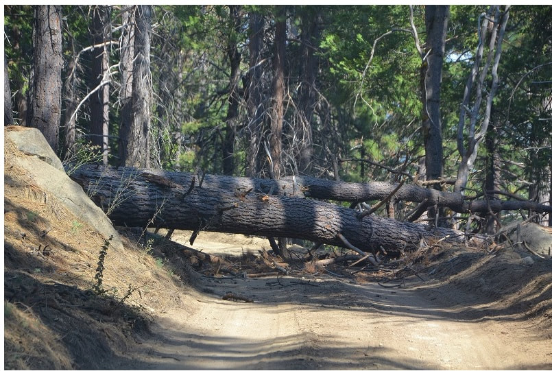
Just to put a fine point on the ever-present danger of all these dead trees, our way back out from the site was blocked by a tree that had fallen across the road just minutes before.
Our hosts got to work to cut it up and clear the road, but we were thankful we hadn’t left a few minutes earlier and been in the wrong place at just the wrong moment.
As we drove down the mountain from Yosemite West, we marveled at the skill and dogged determination of these firefighters who stopped the Ferguson Fire just feet from what would have been a monumental disaster. The fire burned around all sides of the community but not one of the nearly 200 structures was damaged or destroyed.
“It’s really easy to measure failure,” said Bevington. “You didn’t do your job and now it’s all destroyed. But it’s really difficult to measure success. You can’t possibly forecast the scope of success or the breadth of what might have been lost – how many lives, how many homes, how many firefighters didn’t get injured.”
Fire Update September 20th, 2018
There are multiple fires burning in Yosemite National Park's wilderness. Wildfires when caused by lightning are a natural phenomenon on the landscape. While hiking trails and sitting at vistas you may see smoke in some of these areas.
Stage 2 Fire Restrictions are currently in place inside Yosemite National Park. Please review the details for Stage 2 Fire Restrictions, which will remain in place until further notice.
Fire Name: Rancheria Date: 9/19/18
Discovery Date: 9/8/18 Location: North end of Rancheria Mountain, in Yosemite's Wilderness
Size: 18.2 acres Status: Active
Strategy: Early planning phase, planned action to insert crew for detailed assessment.
Comments: Lightning caused. The fire is creeping though dead and down ground fuels in red fir. The spread is mostly north and southwest following vegetation pockets. There are some natural barriers including very green vegetation, rock out cropping's, and changes in vegetation. Smoke production has been very light with some overnight accumulation in the Tuolumne river canyon. Fire crews are on scene assessing fuels and spread potential as well as impacts to trails in the area.
Fire Name: Indian Date: 9/19/18
Discovery Date: 9/4/18 Location: Near Porcupine Camp Ground, in Yosemite's Wilderness
Size: 10.6 acres Status: Active
Strategy: Monitor
Comments: Lightning caused. Growth continues to be slow to the south and backing down hill and along rocky ridges. Fire behavior is smoldering and creeping in red fir. This fire is surrounded by many natural barriers and rock bands. Fire crews are monitoring daily with easy access off the Tioga road. Smoke may occasional be seen from Porcupine Campground and and view points above Yosemite Creek
Fire Name: Unicorn Date: 9/19/18
Discovery Date: 7/28/18 Location: Unicorn Peak Area, in Yosemite's Wilderness
Size: 2.6 acres Status: Active
Strategy: Occasional patrol with very low spread.
Comments: Lightning strike start at 9500 feet in elevation. Smoke may be visible from Tuolumne meadows.
Fire Name: Chain Lakes Date: 9/19/18
Discovery Date: 9/9/18 Location: Near Chain Lakes, in Yosemite's Wilderness
Size: .10 acres Status: Active
Strategy: Suppression tactics, crews will continue to mop up and monitor
Comments: Human caused.
For more information go to https://www.nps.gov/yose/blogs/fireinfo.htm. (S. Saunders)
