WawonaNews.com - September 2015
Tenaya Fire
September 08, 2015 Posted by: Yosemite Fire Information
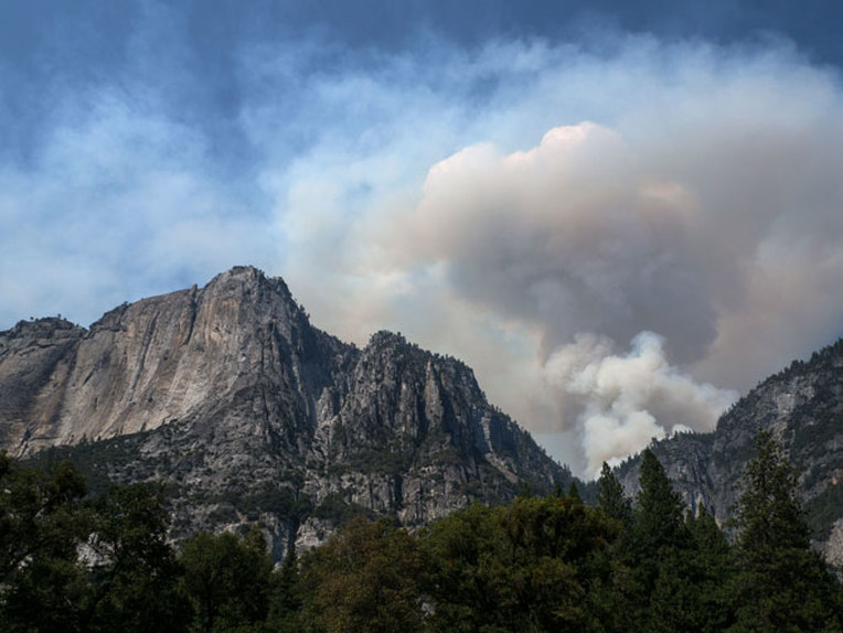
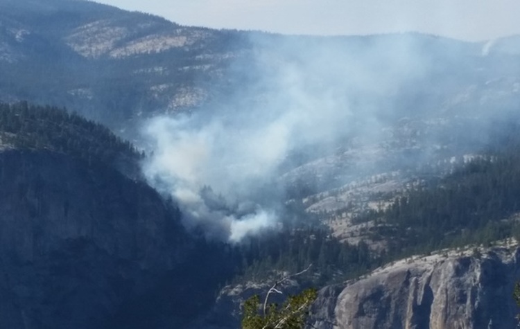
The smoke visible in the Yosemite Valley is coming from the Tenaya Fire, which is located in Indian Canyon above the north rim of the Valley on both sides of the Lehamite trail, between the Valley and Tioga Road. The fire was discovered last night and is currently estimated at 100 acres. The fire is spotting among dead trees creating much of the large smoke plume we are seeing in Yosemite Valley.Full suppression efforts are underway. Two 20-person Type-1 hand crews are on scene. Four air tankers and two helicopters are also assisting. Temperatures are expected to drop tonight which should help firefighting efforts. The cause of the fire is under investigation. Smoky conditions are likely to persist over the next few days.
Trails on the north rim of Yosemite Valley south of the Tioga Road and east of Yosemite Creek, to near Olmsted Point, are closed.
Your browser does not support viewing this document. Click here to download the document.
Your browser does not support viewing this document. Click here to download the document.
YOSEMITE-WAWONA ELEMENTARY CHARTER SCHOOL BOARD MEETING, SEPTEMBER 2

Board of Directors Meeting
Wednesday, September 2, 2015, 8:30 AM
Wawona Elementary School
7925 Chilnualna Falls Road
Wawona, California
AGENDA
1. CALL TO ORDER
2. ROLL CALL
MONTHLY ITEMS AND FINANCIAL REPORTS
3. CONSENT AGENDA
NOTE: The Board will be asked to approve all of the following items by a single vote, unless any member of the Board or of the public asks that an item be removed from the consent agenda and considered and discussed separately.
3.1. Approval of agenda
3.2. Approval of minutes of the regular meeting, ****
4. Financial reports
4.1. Monthly approval of warrants (Action needed)
4.2. Financial Report
4.3. Salary Report
5. HEARING OF PERSONS WISHING TO ADDRESS THE BOARD
The public may address the Board on any matter pertaining to the school that is not on the agenda. Unless otherwise determined by the Board, each person is limited to five (5) minutes. There will be no Board discussion and no action will be taken unless listed on a subsequent agenda.
ACTION ITEMS
6. Discuss adding a budget item for Wordly Wise or other similar work books, a science budget and a kiln.
7. Field trips; funding vs no funding, daily rate for staff, parent participation, student age, substitute teachers, use of personal vehicles and gas reimbursement.
INFORMATION ITEMS
8. BOARD MEMBER COMMENTS
9. STAFF REPORTS
9.1. L CAP Update
9.2. Internet: Uverse vs DSL
10. NEXT MEETING DATE
11. CLOSED SESSION Personnel/Negotiations/Litigation
NOTE: The Board will consider and may act upon any of the following items in closed session. Any action taken will be reported publicly at the end of the closed session as required by law.
11.1.Employee Negotiations (Gov. Code 54957.6)
11.2.Personnel (Gov. Code 54957)
12. RECOVENE IN OPEN SESSION: ANNOUNCE CLOSED SESSION ACTIONS
13. ADJOURNMENT
Yosemite Fire Update #14, August 29, 2015
Yosemite has been experiencing periodical air quality changes due to regional fires. Numerous large fires are burning along the entire western part of the United States and transport winds are carrying smoke across a very
large region. This pattern may continue for the next few days. We urge everyone to consider air quality when planning outdoor activities.
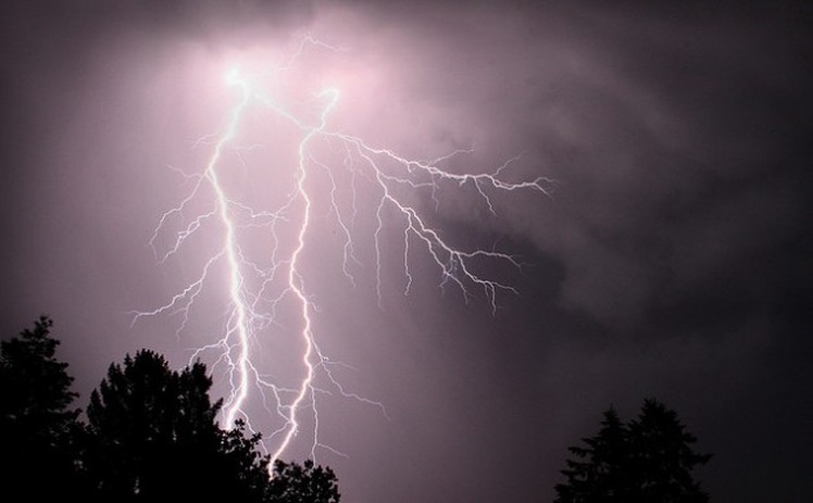
Lightning caused fires being monitored and managed for multiple objectives:
Cathedral (37 51.078 x 119 25.120 – Tuolumne Co., 9400’El., 8/2). This is near the John Muir Trail to Cathedral Lakes. The perimeter is actively smoldering and creeping through lodgepole pine needles and logs and has good potential to grow until it hits natural barriers. The fire is 29 acres in size and is being monitored.
Middle (37 51.538 x 119 41.194 - Tuolumne Co., 8043’El., 7/27). It is west of White Wolf and south of the Middle Tuolumne River. It is at 24 acres, and smoke may be visible from Tioga Road. It continues to smolder and creep through down logs, pine needles and other vegetation. It is in a red fir and lodgepole pine forest.
Dark (37 50.575 x 119 37.153 – Mariposa Co.,8200’ el., 7/ 9). This fire is along the Yosemite Creek Campground Road and smoke is periodically visible from both the campground and Tioga roads. Fire crews secured the edges of the fire by burning along the most active perimeter. That operation is complete. It is at 40 acres, and continues to creep and smolder through red fir duff and needles within the interior of the fire. The Lukens trail is now re-opened.
White Cascade (37 54.926 x 119 23.780 - Tuolumne Co, at 9000’ el., 7/3). This remote fire is east of Glen Aulin High Sierra camp, east of Conness Creek, and west of Tuolumne Meadows, and is at 23 acres. This high elevation fire, in a lodge pole pine forest. The fire is not near any trails. Smoke may be visible in Tuolumne Meadows.
Quartzite (37 43.871 x 119 25.200 - Mariposa Co., 8387’ el., 7/27). It is approximately 0.5 miles south of Merced Lake, mid-slope and on a north aspect. It is smoldering in mountain hemlock, western white pine and lodgepole pine. This fire is contained to natural barriers. It was declared out August 28.
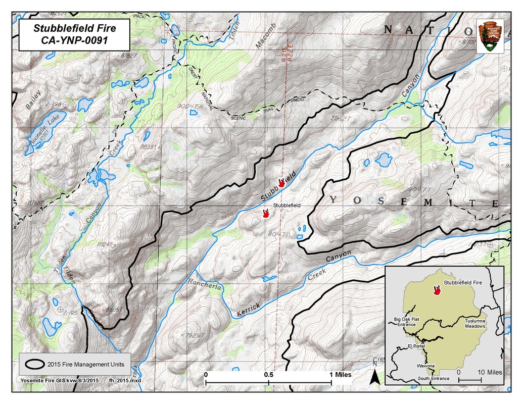
Stubblefield (38 02.743 x 119 36.625 – Tuolumne Co., 7659’ el., 8/3). This fire is in Stubblefield Canyon and west of the Pacific Crest Trail and at the northeast section of the Park; it is very remote. It is most likely a lightning strike holdover. Currently, it is 2 acres in size, in a red fir and Jeffrey Pine forested area, with other sparse vegetation.
Currently no roads are closed within the park.
All visitors are urged to be diligent in any use of fire, including smoking. And be sure all fires are out!
As with all fires, staff and visitor safety is of paramount importance. Each fire, regardless of size, is assessed for the appropriate course of action.
For More Information
- Fire information: [email protected], (209) 372-0480
- Yosemite Web: http://www.nps.gov/yose/blogs/fireinfo.htm.
- Air Quality Sites: http://www.californiasmokeinfo.blogspot.com/ & http://airnow.gov/index.cfm?action=airnow.main & www.mariposacounty.org/aqi
- Yosemite Wildland Fire Facebook: https://www.facebook.com/pages/Yosemite-Fire-and-Aviation/124632964255395
- Twitter: @yosemitefire
- Nixle - Emergency Alerts and Updates– www.nixle.com
Farewell to Frank Hutchinson, Director of Operations at The Redwoods in Yosemite
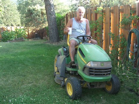
You are invited to attend an appreciation reception for Frank on August 28th from 4—6 pm on the Fireside Deck at The Redwoods In Yosemite Event Center.
Refreshments will be served.
Message From Superintendent Neubacher Regarding Wawona Water Level
Dear Wawona community and friends:
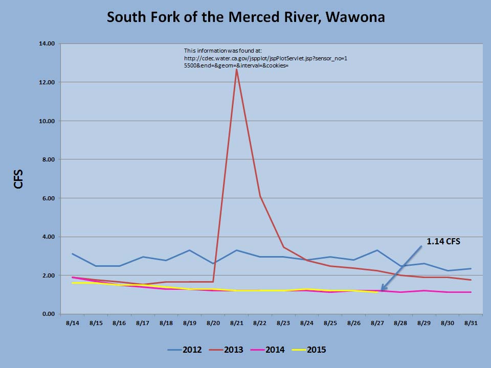
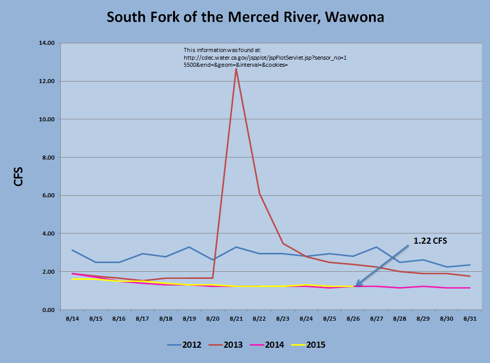
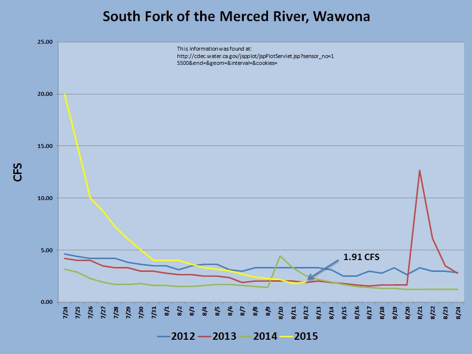
Although we continue to have very dry summer conditions, the south fork of the Merced River is staying above the critical 1.0 cfs mark. During the last few days it has been hovering a little below1.5 cfs (see Graph 1 below). It fluctuates during the day from about 1.2 cfs to about 1.46 cfs.
The Wawona community has been doing an excellent job at implementing water conservation measures, which is critical to maintaining domestic supplies, the health of the river, and the species that depend on it. As you can see in the Graph 2 (below), usage in the area has dropped significantly over the years and it is even lower this year than last. Please keep up the efforts and continue to exercise all possible water conservation measures.
We have not needed to use water held in storage tanks or use trucks to haul water to Wawona thus far, but we are prepared to do so if it should become necessary.
We thank you for your attention and support as we all address this important issue. Through our combined efforts, we can work to maintain adequate domestic water use while still preserving the ecosystems of Yosemite National Park.
Links for additional, useful information are below.
Water Conservation Plan: http://www.nps.gov/yose/parkmgmt/op_plans.htm
Yosemite hydrology: http://www.nps.gov/yose/naturescience/hydrology.htm
Water gauge at Wawona: http://cdec.water.ca.gov/cgi-progs/queryFx?s=smw
Sincerely,
Don L. Neubacher, on behalf of the Executive Leadership Team
Basketball Court: Community Help Requested
|
By Chad Andrews
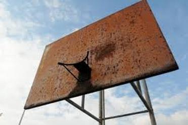
Yosemite-Wawona Elementary Charter School Board Secretary For many years the Wawona School has continued the upkeep of the basketball court. Nearly every year, this has involved replacing one or both of the backboards and hoops as a result of unintentional damage by unknown persons. This year was the worst. As the equipment is least used by the school kids we are asking for the community's help. We are in the process of replacing the posts, backboards and hoops with new equipment that will withstand the arduous use by students, community members and visitors. These cost approximately $3000 to replace, so we would be happy to accept any contributions to help us with the cost.
If you would like to contribute, please make a check payable to Yosemite-WawonaElementary Charter School and mail to: |
Basketball Court Yosemite-WawonaElementary Charter School P.O. Box 2068 7925 Chilnualna Falls Road Yosemite National Park, CA 95389 |
Thank you, in advance, for your generosity!
School Board Meeting, August 24th

Board of Directors Meeting
Monday, August 24, 2014, 6:30 PM
Wawona Elementary School
7925 Chilnualna Falls Road
Wawona, California
AGENDA
1. CALL TO ORDER
2. ROLL CALL
MONTHLY ITEMS AND FINANCIAL REPORTS
3. CONSENT AGENDA
NOTE: The Board will be asked to approve all of the following items by a single vote, unless any member of the Board or of the public asks that an item be removed from the consent agenda and considered and discussed separately.
3.1. Approval of agenda
3.2. Approval of minutes of the regular meeting, August 6, 2015
4. Financial reports
4.1. Monthly approval of warrants (Action needed)
4.1.1. Reimbursement for school supplies
4.1.1.1. 7th Grade teaching materials, apps and teaching aids
4.1.2. Approve additional monthly supplies funds
4.1.3. Approve $25 for payroll report the CMRA
4.1.4. Approve fire extinguisher inspection and replacement
4.1.5. Approve emergence go bag as discussed in “School Safety Plan”
4.1.6. Reimburse Michelle Stauffer $131.28 for golf tournament expense
4.1.7. Reimburse Jess Stanphill $8 for required fingerprinting
4.2. Financial Report
4.3. Salary Report
5. HEARING OF PERSONS WISHING TO ADDRESS THE BOARD
The public may address the Board on any matter pertaining to the school that is not on the agenda. Unless otherwise determined by the Board, each person is limited to five (5) minutes. There will be no Board discussion and no action will be taken unless listed on a subsequent agenda.
ACTION ITEMS
6. Discussion and action on grant proposal to the NPS
7. Discuss and approve any action on organizing the resource office
8. Discuss Board of Director’s vacancies
INFORMATION ITEMS
9. BOARD MEMBER COMMENTS
10. STAFF REPORTS
10.1.L CAP Update
10.2.Schedule work day for school grounds and basketball court construction
10.3. YARTS update
11. NEXT MEETING DATE
12. CLOSED SESSION Personnel/Negotiations/Litigation
NOTE: The Board will consider and may act upon any of the following items in closed session. Any action taken will be reported publicly at the end of the closed session as required by law.
12.1.Employee Negotiations (Gov. Code 54957.6)
12.2.Personnel (Gov. Code 54957)
13. RECOVENE IN OPEN SESSION: ANNOUNCE CLOSED SESSION ACTIONS
14. ADJOURNMENT
Yosemite Fire Update #13, August 21, 2015
Upper (37 45.534 x 119 35.983 – Mariposa Co., August 10). This fire was discovered by hikers at approximately 3:30PM, August 10. It is now out and in patrol status. Quick action by the Yosemite Helitack, with supporting water bucket drops, and fire crews held the fire to 3.85 acres. The fire was determined to be human caused and is under investigation. Smoke from the fire may continue to affect air quality in the morning hours. All park trail closures associated with the Upper Falls fire were lifted at 6:00 PM 8/13.
Badger (37 40.697 x 119 39.316 – Mariposa Co., August 10). This fire was discovered by Helicopter 551 in the area of Summit Meadows near Glacier Point Road. Wawona Engine 32 responded and suppressed the 0.01acre fire. It is in patrol status.
Lightning caused fires being monitored and managed for multiple objectives:
Cathedral (37 51.078 x 119 25.120 – Tuolumne Co., 9400’El., 8/2). This is near the John Muir Trail to Cathedral Lakes. The perimeter is actively smoldering and creeping through lodgepole pine needles and logs and has good potential to grow until it hits natural barriers. The fire is 16 acres in size and is being monitored.
Middle (37 51.538 x 119 41.194 - Tuolumne Co., 8043’El., 7/27). It is west of White Wolf and south of the Middle Tuolumne River. It is at 14.1 acres, and smoke may be visible from Tioga Road. It continues to smolder and creep through down logs, pine needles and other vegetation. It is in a red fir and lodgepole pine forest.
Dark (37 50.575 x 119 37.153 – Mariposa Co.,8200’ el., 7/ 9). This fire is along the Yosemite Creek Campground Road and smoke is periodically visible from both the campground and Tioga roads. Fire crews secured the edges of the fire by burning along the most active perimeter. That operation is complete. It is at 40 acres, and continues to creep and smolder through red fir duff and needles within the interior of the fire. The Lukens trail is now re-opened. Fire crews will be parked and working Yosemite Creek Campground Road. For firefighter and visitor safety, drivers are urged to use caution while driving in the area of parked fire equipment.
White Cascade (37 54.926 x 119 23.780 - Tuolumne Co, at 9000’ el., 7/3). This remote fire is east of Glen Aulin High Sierra camp, east of Conness Creek, and west of Tuolumne Meadows, and is at 8 acres. This high elevation fire, in a lodge pole pine forest, has a low spread potential. The fire is not near any trails. Smoke may be visible in Tuolumne Meadows.
Quartzite (37 43.871 x 119 25.200 - Mariposa Co., 8387’ el., 7/27). It is approximately 0.5 miles south of Merced Lake, mid-slope and on a north aspect. It is smoldering in mountain hemlock, western white pine and lodgepole pine. This fire is contained to natural barriers.
Stubblefield (38 02.743 x 119 36.625 – Tuolumne Co., 7659’ el., 8/3). This fire is in Stubblefield Canyon and west of the Pacific Crest Trail and at the northeast section of the Park; it is very remote. It is most likely a lightning strike holdover. Currently, it is 2 acres in size, in a red fir and Jeffrey Pine forested area, with other sparse vegetation.
Air Quality in the park is being affected by numerous fires throughout California. For more information refer to the web sites listed below. Currently no roads are closed within the park.
All visitors are urged to be diligent in any use of fire, including smoking. And be sure all fires are out!
As with all fires, staff and visitor safety is of paramount importance. Each fire, regardless of size, is assessed for the appropriate course of action.
For More Information
- Fire information: [email protected], (209) 372-0480
- Yosemite Web: http://www.nps.gov/yose/blogs/fireinfo.htm.
- Air Quality Sites: http://www.californiasmokeinfo.blogspot.com/ & http://airnow.gov/index.cfm?action=airnow.main & www.mariposacounty.org/aqi
- Yosemite Wildland Fire Facebook: https://www.facebook.com/pages/Yosemite-Fire-and-Aviation/124632964255395
- Twitter: @yosemitefire
- Nixle - Emergency Alerts and Updates– www.nixle.com
Tree Limb Kills Two Young Campers at Upper Pines
LA Times- Aug. 14
Two young people were killed early Friday after a limb from an oak tree fell on their tent as they slept at a popular campground in Yosemite National Park.
The names and ages of the minors were not released, and their deaths remain under investigation, according to park spokesman Scott Gediman. Tuolumne County sheriff’s officials said they will not release the young people’s identities.
"Our thoughts are with the families as they grieve this tragedy," park Supt. Don Neubacher said in a statement.
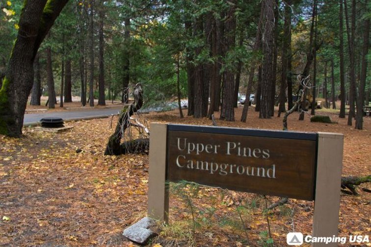
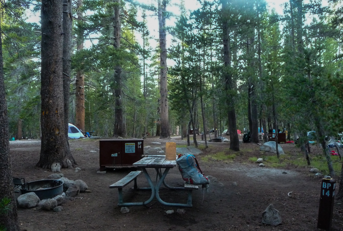
The youngsters were sleeping in their tent at the popular family Upper Pines Campground in Yosemite Valley. Then at about 5 a.m., a limb from a black oak collapsed on them, Gediman said.
The park’s dispatchers received numerous 911 calls for medical assistance. When they arrived to the campground, the youngsters were dead.
It is unclear why the tree limb fell, but officials said it wasn’t windy that morning, Gediman said.
“Fallen branches like this one are a common occurrence across the park,” he said.
Situated at 4,000 feet in the Yosemite Valley near Curry Village, the campground with views of the park’s most iconic rock formation Half Dome is the chosen destination for families site.
The youngsters’ deaths add to what appears to be a long history of tree-related fatalities at the park.
Two tourists were killed and nine were injured in 1985 when a 25-foot oak branch fell 15 feet onto an open-air tram carrying 50 passengers.
The same series of events happened in 1992, when a branch from an oak tree fell onto another touring bus, injuring seven people. The visitors were stopped on a main road near the Merced River to observe Yosemite Falls. The large branch came crashing as the tour guide spoke.
Then in 2012, a concession worker was killed when a tree limb crashed onto his tent cabin during a windstorm. The employee, Ryan Hiller, 27, of Chapel Hill, N.C., was the last person to be killed by fallen tree limb at Yosemite.
In 2013, a counselor at the Jewish summer Camp Towango, a few miles away from Yosemite National Park, was crushed by a tree that crashed onto a campfire.
It is unclear why the tree’s branch fell in Friday's deaths, but recently the U.S. Forest Service said more than 12 million trees have died off due to the drought.
Years of dry conditions have taken a toll on California forest lands. The weakened and dehydrated trees are susceptible to bark beetle infestations. The tiny brown beetles chew away at pines and make them brittle.
In Friday’s incident, drought may have played a role but it’s too early to say, Gediman said. Bark beetles steer away from oak, so he said that likely didn’t cause the limb to fall.
Last month, an 85-foot pine toppled and injured children in a Pasadena park.
Officials said the prolonged drought, a lack of strong roots and a burst of heavy rain were factors.
The massive, city-owned Italian stone pine came crashing down on young day campers outside the Kidspace Museum at Brookside Park on July 28. Firefighters, police officers and bystanders worked feverishly to free the 33 children caught beneath its branches.
Two of the children were critically injured but were recovering, authorities said.
The thirsty tree may have absorbed too much water in a short period, concluded arborist Ted Lubeshkoff, hired by the city to investigate why the tree fell.
“California is currently in its fourth year of drought, where it is receiving abnormally low rainfall amounts. This probably resulted in the Italian stone pine not receiving adequate amounts of water,” he wrote.
According to a Los Angeles parks department survey ending in April, as many as 14,000 trees in L.A. parks -- about 4% of the total -- may have died during the last year of drought. The year before that, officials said only about 1% of trees were found dead. In a normal year, the tally would be even less.
Tuolumne Meadows Campground Closed Due to Plague
YOSEMITE NATIONAL PARK, Calif. -- Officials at Yosemite National Park said Friday they will temporarily close a popular campsite after two squirrels died of plague in the area.Tuolumne Meadows Campground will close from noon Monday through noon Friday so authorities can treat the area with a flea-killing insecticide. Campers had their reservations canceled at the 304-site campground so the insecticide can be sprayed into rodent "burrow holes," the California Department of Health said Friday.
Plague is carried by rodents and is spread by fleas, but transmission between people is rare.
"Although this is a rare disease, and the current risk to humans is low, eliminating the fleas is the best way to protect the public from the disease," said Dr. Karen Smith, director of the state Health Department. "By eliminating the fleas, we reduce the risk of human exposure and break the cycle of plague in rodents at the sites."
An unidentified child fell ill with the plague after camping with his family at Yosemite's Crane Flat Campground in mid-July. The park reopened Crane Flat on Friday after treating that campground for four days with an insecticide.
The child has been recovering in a hospital. No other family members became sick.
Plague's symptoms can include fever, chills, weakness, abdominal pain, and sometimes shortness of breath and swollen lymph nodes. It can be treated and cured when antibiotics are given soon after infection, but it's deadly when treatment is delayed.
The last three cases of human plague in the state occurred in 2005 and 2006, the Health Department said. All three of those patients survived.
Since 1970, 42 people in California have contracted plague, resulting in nine deaths. Health officials find plague-infected animals every year, mostly in the state's mountains and foothill regions.
Last year, plague was found in the counties of El Dorado, Mariposa, Modoc, Plumas, San Diego, Santa Barbara, and Sierra.
CBS News - YOSEMITE NATIONAL PARK, Calif. -- Officials say an oak tree limb fell on a tent in the heart of Yosemite National Park killing two young campers.
Park spokesman Scott Gediman on Friday morning declined to release the ages or any details about the two, describing them only as under age 18.
Gediman says the limb fell from a black oak tree at about 5 a.m. Friday in the popular Upper Pines Campground in Yosemite Valley. The juveniles were sleeping in their tent when an oak tree limb fell and hit them, reports CBS Sacramento.
The incident happened in the Upper Pines Campground, according to Yosemite National Park. Park rangers, who soon showed up at the scene found that the children had died, reports CBS Sacramento.
Gediman said the campground is one of the most popular with a view of Half Dome. The incident remains under investigation
In 2012, a parks concession employee died when his tent cabin was hit by a falling limb.
Health Talk With Janet Lee, August 16th, 6:30 PM

Janet Lee (from the alternative cancer clinic in Mesa, AZ) is visiting again - she was here in January and gave a wonderful health talk. We will be at the Wawona School on Sunday evening, August 16th at 6:30 PM to "continue the informal discussion on health.” We will also demo a few easy summer treats that you can enjoy! Hope to see you there!!
Michelle Stauffer
Michelle Stauffer
Yosemite Fire Update #12, August 13, 2015
Upper (37 45.534 x 119 35.983 – Mariposa Co., August 10). This fire was discovered by hikers at approximately 3:30PM, August 10. It is now out and in patrol status. Quick action by the Yosemite Helitack, with supporting water bucket drops, and fire crews held the fire to 3.85 acres. The fire was determined to be human caused and is under investigation. Smoke from the fire may continue to affect air quality in the morning hours. All park trail closures associated with the Upper Falls fire were lifted at 6:00 PM 8/13.
Badger (37 40.697 x 119 39.316 – Mariposa Co., August 10). This fire was discovered by Helicopter 551 in the area of Summit Meadows near Glacier Point Road. Wawona Engine 32 responded and suppressed the 0.01acre fire. It is in patrol status.
Lightning caused fires being monitored and managed for multiple objectives:
Cathedral (37 51.078 x 119 25.120 – Tuolumne Co., 9400’El., 8/2). This is near the John Muir Trail to Cathedral Lakes. The perimeter is actively smoldering and creeping through lodgepole pine needles and logs and has good potential to grow until it hits natural barriers. The fire is 6.0 acres in size and is being monitored.
Middle (37 51.538 x 119 41.194 - Tuolumne Co., 8043’El., 7/27). It is west of White Wolf and south of the Middle Tuolumne River. It is at 2.5 acres, and smoke may be visible from Tioga Road. It continues to smolder and creep through down logs, pine needles and other vegetation. It is in a red fir and lodgepole pine forest.
Dark (37 50.575 x 119 37.153 – Mariposa Co.,8200’ el., 7/ 9). This fire is along the Yosemite Creek Campground Road and smoke is periodically visible from both the campground and Tioga roads. Fire crews secured the edges of the fire by burning along the most active perimeter. That operation is complete. It is at 41.5 acres, and continues to creep and smolder through red fir duff and needles within the interior of the fire. The Lukens trail is now re-opened. Fire crews will be parked and working Yosemite Creek Campground Road. For firefighter and visitor safety, drivers are urged to use caution while driving in the area of parked fire equipment.
White Cascade (37 54.926 x 119 23.780 - Tuolumne Co, at 9000’ el., 7/3). This remote fire is east of Glen Aulin High Sierra camp, east of Conness Creek, and west of Tuolumne Meadows, and is at 0.68 acres. This high elevation fire, in a lodge pole pine forest, has a low spread potential. The fire is not near any trails. Smoke may be visible in Tuolumne Meadows.
Quartzite (37 43.871 x 119 25.200 - Mariposa Co., 8387’ el., 7/27). It is approximately 0.5 miles south of Merced Lake, mid-slope and on a north aspect. It is smoldering in mountain hemlock, western white pine and lodgepole pine. This fire is contained to natural barriers.
Stubblefield (38 02.743 x 119 36.625 – Tuolumne Co., 7659’ el., 8/3). This fire is in Stubblefield Canyon and west of the Pacific Crest Trail and at the northeast section of the Park; it is very remote. It is most likely a lightning strike holdover. Currently, it is 2-3 acres in size, in a red fir and Jeffrey Pine forested area, with other sparse vegetation.
Air Quality in the park is being affected by numerous fires throughout California. For more information refer to the web sites listed below. Currently no roads are closed within the park.
All visitors are urged to be diligent in any use of fire, including smoking. And be sure all fires are out!
As with all fires, staff and visitor safety is of paramount importance. Each fire, regardless of size, is assessed for the appropriate course of action.
For More Information
· Fire information: [email protected], (209) 372-0480
· Yosemite Web: http://www.nps.gov/yose/blogs/fireinfo.htm.
· Air Quality Sites: http://www.californiasmokeinfo.blogspot.com/ & http://viewer.smoke.airfire.org/run/standard/CANSAC-2km/2015062200/ and http://airnow.gov/index.cfm?action=airnow.main and www.mariposacounty.org/aqi
· Yosemite Wildland Fire Facebook: https://www.facebook.com/pages/Yosemite-Fire-and-Aviation/124632964255395
· Twitter: @yosemitefire
· Nixle - Emergency Alerts and Updates– www.nixle.com
Man fights off bear in Midpines, drives himself to hospital
Los Angeles Times -
A 67-year-old man fought off a bear that attacked him on his front porch as it scavenged for food on the outskirts of Yosemite National Park.
The man survived the attack but suffered numerous cuts to his arms, legs and body, as well as defensive wounds to his hands, said Lt. Chris Stoots of the California Department of Fish and Wildlife.
Wardens with the agency and the U.S. Department of Agriculture were searching Wednesday for the California black bear, which will be euthanized when caught, he said. The severity of the man’s injuries and the extent of the attack left wildlife officials with no other option, he said.
“Bear attacks on humans are very uncommon,” he said.
The attack occurred about 4 a.m. when the man walked onto his porch and was ambushed by the bear in Midpines, a community on the edge of Yosemite National Park.
The bear was feeding on a bag of trash left 20 feet from the man’s front door, Stoots said. The bear tackled the man and attacked him. But the man fought back, using his legs and arms, and eventually escaped back into his house.
Injured and bloodied, the man drove to the hospital, where he was in stable condition Thursday, Stoots said.
The bear disappeared before authorities arrived.
Drought has wiped out food sources usually found in the wilderness, driving bears into foothill communities in search of their next meals. The drought, Stoots said, will push bears to go to “great lengths to find food and water.”
Stoots said people should not leave food or water unattended near a home, and they should always keep trash away from their property.
But then again, he said, “this is bear country.”
Yosemite Fire Update #11, August 11, 2015
New Fires:
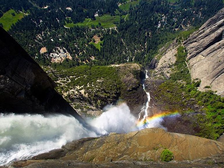
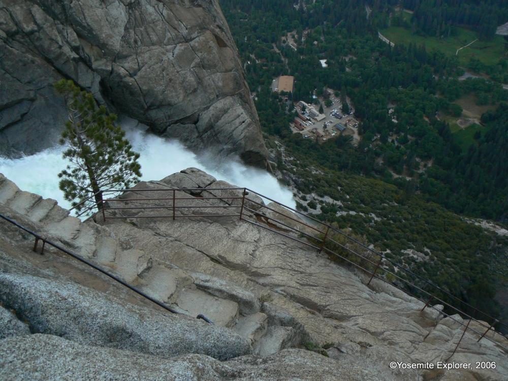
Upper (37 45.534 x 119 35.983 – Mariposa Co., August 10). This fire was discovered by hikers at approximately 3:30PM, August 10. It is at the top of the Yosemite Falls trail above the switchbacks. Quick action by the Yosemite Helitack, with supporting water bucket drops, and fire crews held the fire to 3 acres as of 10PM August 10. Hikers were escorted out of the fire area by fire crews and Yosemite search and rescue members. Suppression efforts will continue today. Resources include 2 helicopters for bucket drops, and 14 fire personnel. All trails to Yosemite Falls are temporarily closed. The fire was determined to be human caused and is under investigation. Smoke from the fire may affect air quality in the morning hours. There have been no injuries. All visitors are urged to be diligent in any use of fire, including smoking. And be sure all fires are out!
Badger (37 40.697 x 119 39.316 – Mariposa Co., August 10). This fire was discovered by Helicopter 551 in the area of Summit Meadows near Glacier Point Road. Wawona Engine 32 responded and suppressed the 0.01acre fire. It is in patrol status.
Lightning caused fires being monitored and managed for multiple objectives:
Cathedral (37 51.078 x 119 25.120 – Tuolumne Co., 9400’El., 8/2). This is 0.20 of a mile off the John Muir Trail to Cathedral Lakes. The perimeter is actively smoldering and creeping through lodgepole pine needles and logs and has good potential to grow until it hits natural barriers. The fire is 0.20 acres in size and is being monitored.
Middle (37 51.538 x 119 41.194 - Tuolumne Co., 8043’El., 7/27). It is west of White Wolf and south of the Middle Tuolumne River. It is at 1.5 acres, and may be visible from Tioga Road. It continues to smolder and creep through down logs, pine needles and other vegetation. It is in a red fir and lodgepole pine forest.
Dark (37 50.575 x 119 37.153 – Mariposa Co.,8200’ el., 7/ 9). This fire is along the Yosemite Creek Campground Road and smoke is periodically visible from both the campground and Tioga roads. Fire crews secured the edges of the fire by burning along the most active perimeter. That operation is complete. It is at 38.8 acres, and continues to creep and smolder through red fir duff and needles within the interior of the fire. The Lukens trail is temporarily closed. Fire crews will be parked and working Yosemite Creek Campground Road. For firefighter and visitor safety, drivers are urged to use caution while driving in the area of parked fire equipment.
White Cascade (37 54.926 x 119 23.780 - Tuolumne Co, at 9000’ el., 7/3). This remote fire is east of Glen Aulin High Sierra camp, east of Conness Creek, and west of Tuolumne Meadows, and is at 0.68 acres. This high elevation fire, in a lodge pole pine forest, poses no threat to trails and has a low spread potential. Smoke may be visible in Tuolumne Meadows.
Quartzite (37 43.871 x 119 25.200 - Mariposa Co., 8387’ el., 7/27). It is approximately 0.5 miles south of Merced Lake, mid-slope and on a north aspect. It is smoldering in mountain hemlock, western white pine and lodgepole pine. This fire is contained to natural barriers.
Stubblefield (38 02.743 x 119 36.625 – Tuolumne Co., 7659’ el., 8/3). This fire is in Stubblefield Canyon and west of the Pacific Crest Trail and at the northeast section of the park; it is very remote. It is most likely a lightning strike holdover. Currently, it is 2-3 acres in size, in a red fir and Jeffrey Pine forested area, with other sparse vegetation.
In addition, Indian Canyon was suppressed and is in patrol status.
Air Quality in the park is being affected by numerous fires throughout California. For more information refer to the web sites listed below. Currently no roads are closed within the park. The Lukens cut-off trail, south of the Tioga Road, is temporarily closed.
As with all fires, staff and visitor safety is of paramount importance. Each fire, regardless of size, is assessed for the appropriate course of action.
For More Information
· Fire information: [email protected], (209) 372-0480
· Yosemite Web: http://www.nps.gov/yose/blogs/fireinfo.htm.
· Air Quality Sites: http://www.californiasmokeinfo.blogspot.com/ & http://viewer.smoke.airfire.org/run/standard/CANSAC-2km/2015062200/ and http://airnow.gov/index.cfm?action=airnow.main and www.mariposacounty.org/aqi
· Yosemite Wildland Fire Facebook: https://www.facebook.com/pages/Yosemite-Fire-and-Aviation/124632964255395
· Twitter: @yosemitefire
· Nixle - Emergency Alerts and Updates– www.nixle.com
Your browser does not support viewing this document. Click here to download the document.
Yosemite Fire Update #10, August 7, 2015
Lightning caused fires being monitored and managed for multiple objectives:
Periodic thunderstorms have continued and over the month of July and early August there are now 5 lightning caused fires being monitored for multiple objectives. Lightning caused fires can take days or weeks to detect because vegetation has to dry out enough to create smoke or visible flames after the storm passes over. Additional fires may be discovered, as temperatures rise and fuels dry out. Most of these fires are small; single tree strikes that amount to less than a tenth of an acre. These fires are in the wilderness and are being monitored by either fire crews hiking into the fire areas or via air reconnaissance due to location, sparse fuels, and low growth potential. Thunderstorms, lightning and fire have been part of the ecosystem for thousands of years and are necessary for natural processes and the long term health of forests. Yosemite engines and crews, 2 Bureau of Land Management engines, Whiskeytown Fire Module, and overhead personnel from Point Reyes are monitoring these fires.
Current fires being monitored:
Cathedral (37 51.078 x 119 25.120 – Tuolumne Co., 9400’El., 8/2). This is 0.20 of a mile off the John Muir Trail to Cathedral Lakes. The perimeter is actively smoldering and creeping through lodgepole pine needles and logs and has good potential to grow until it hits natural barriers. The fire is 0.20 acres in size and is being monitored.
Middle (37 51.538 x 119 41.194 - Tuolumne Co., 8043’El., 7/27). It is west of White Wolf and south of the Middle Tuolumne River. It is at 0.90 acres, and may be visible from Tioga Road. It continues to smolder and creep through down logs, pine needles and other vegetation. It is in a red fir and lodgepole pine forest.
Dark (37 50.575 x 119 37.153 – Mariposa Co., 8200’ el., 7/ 9). This fire is along the Yosemite Creek Campground Road and smoke is periodically visible from both the campground and Tioga roads. It is at 10.5 acres, and continues to creep and smolder through red fir duff and needles. The most active perimeter is to the east and near the Lukens cut-off trail – the trail is temporarily closed. Fire crews will be parked and working along Yosemite Creek Campground Road. For firefighter and visitor safety, drivers are urged to use caution while driving in the area of parked fire equipment. Fire crews are securing the edges of the fire by burning along the most active perimeter.
White Cascade (37 54.926 x 119 23.780 - Tuolumne Co, at 9000’ el., 7/3). This remote fire is east of Glen Aulin High Sierra camp, east of Conness Creek, and west of Tuolumne Meadows, and is at 0.68 acres. This high elevation fire, in a lodge pole pine forest, poses no threat to trails and has a low spread potential. Smoke may be visible in Tuolumne Meadows.
Quartzite (37 43.871 x 119 25.200 - Mariposa Co., 8387’ el., 7/27). It is approximately 0.5 miles south of Merced Lake, mid-slope and on a north aspect. It is smoldering in mountain hemlock, western white pine and lodgepole pine. This fire is contained to natural barriers.
Stubblefield (38 02.743 x 119 36.625 – Tuolumne Co., 7659’ el., 8/3). This fire is in Stubblefield Canyon and west of the Pacific Crest Trail and at the northeast section of the park; it is very remote. It is most likely a lightning strike holdover. Currently, it is 2-3 acres in size, in a red fir and Jeffrey Pine forested area, with other sparse vegetation.
New fires that were found and were suppressed: Rancheria, Fireplace, Ribbon were found August 3 and were put out. In addition, Indian Canyon and the Creek have been suppressed August 6, 2015.
Air Quality in the park is being affected by numerous fires throughout California. For more information refer to the web sites listed below. Currently no roads are closed within the park. The Lukens cut-off trail, south of the Tioga Road, is temporarily closed.
As with all fires, staff and visitor safety is of paramount importance. Each fire, regardless of size, is assessed for the appropriate course of action.
For More Information
· Fire information: [email protected], (209) 372-0480
· Yosemite Web: http://www.nps.gov/yose/blogs/fireinfo.htm.
· Air Quality Sites: http://www.californiasmokeinfo.blogspot.com/ & http://viewer.smoke.airfire.org/run/standard/CANSAC-2km/2015062200/ and http://airnow.gov/index.cfm?action=airnow.main and www.mariposacounty.org/aqi
· Yosemite Wildland Fire Facebook: https://www.facebook.com/pages/Yosemite-Fire-and-Aviation/124632964255395
· Twitter: @yosemitefire
· Nixle - Emergency Alerts and Updates– www.nixle.com
Your browser does not support viewing this document. Click here to download the document.
