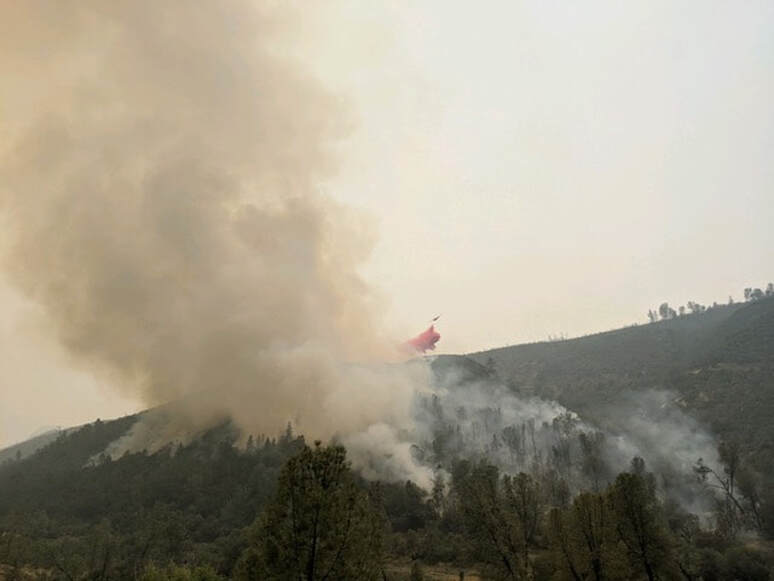
WawonaNews.com - September 2020
Creek Fire: 220,025 Acres Burned With 16% Containment,
By ABC30.Com Staff
CAL FIRE officials say the Creek Fire grew to 220,025 acres overnight while containment remained at 16%.
In total, approximately 555 structures have been destroyed and 47 were damaged by the flames since the wildfire broke out. Damage assessment was 46% complete as of Tuesday morning.
Officials say their firefighting efforts are being hampered due to the thick smoke. It's keeping airplanes and helicopters grounded and unable to help by dropping water and fire retardant on the flames.
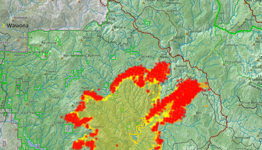
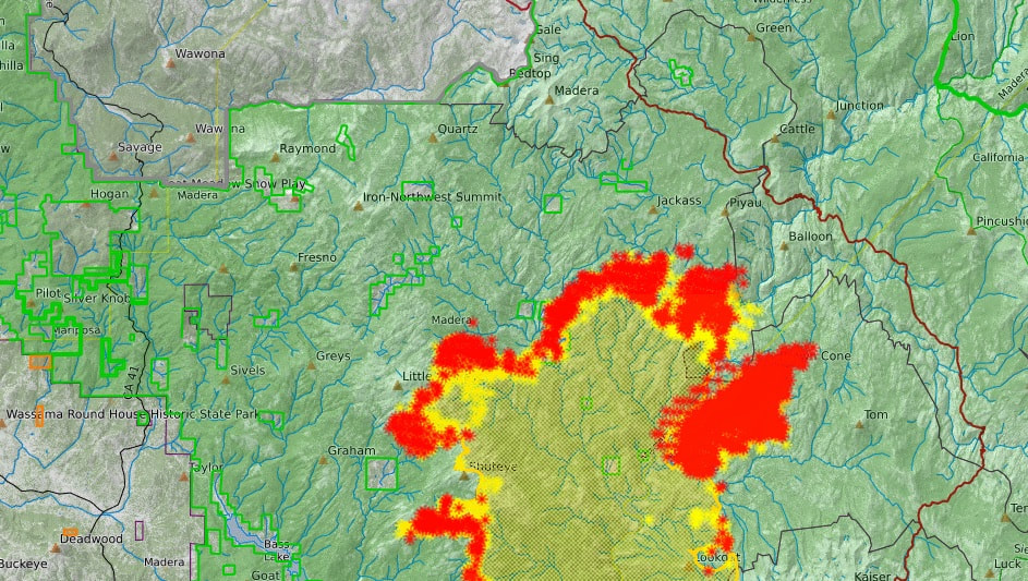
Creek Fire Perimeter Map as of 7:30 AM, Sept. 15
Creek Fire Briefing Video, September 14
16% Containment, 212,744 Acres Burned, 243 Miles of Fire Lines Constructed
Creek Fire North Zone Operational Briefing, Sept. 14
Creek Fire: 212,744 acres burned with 10% containment, latest evacuations issued for Fresno, Madera, Mariposa counties
FRESNO, Calif. (KFSN) -- The Creek Fire grew overnight to 212,744 acres and is 10% contained, CAL FIRE said on Monday morning.
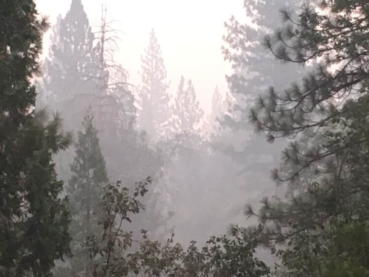
Firefighters say heavy smoke from the Castle Fire, part of the SQF Complex Fire, in Tulare County drifted north over the Creek Fire on Sunday. The smoke settled into lower elevations on Sunday night and many woke up to a thick haze on Monday morning.
Crews say winds are expected to be moving the Creek Fire flames into the deep canyons.
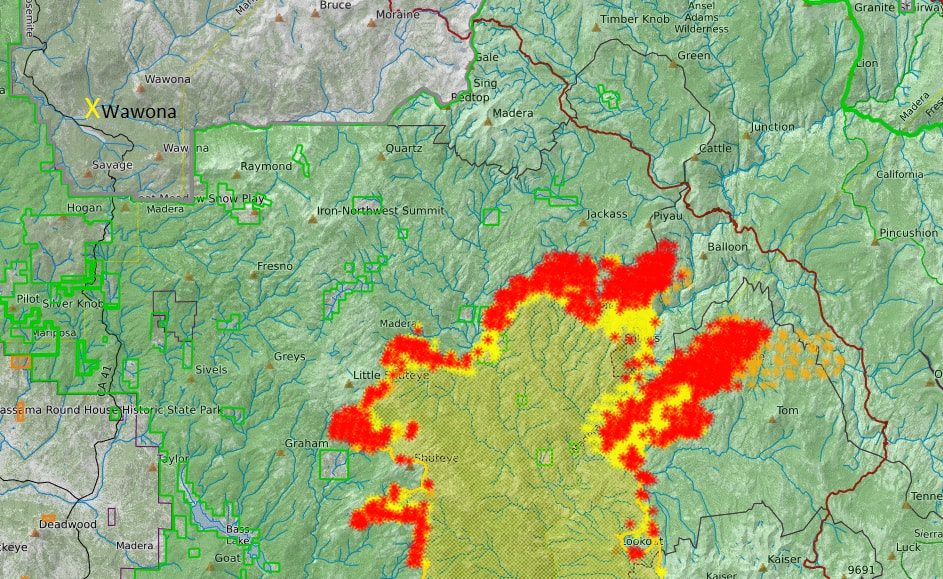
Creek Fire Perimeter Map as of 8:00 AM, Sept. 14
Fireline Activity with ASL Interpretation
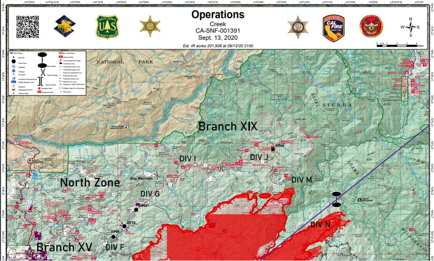
North Zone Operations Briefing Video for September 13, 2020

Evacuation Warning Areas Lifted in Zones M58-M87
Madera County Sheriff's Office
Evacuation Warning Areas Lifted in Zones M58-M87. These zones include the general Hwy 41 corridor between road 200 and Bass Lake Rd (Rd 222). Please see the Evacuation Map for specific details, you will see those zones now in Green. All other Madera County Mandatory Evacuations and Evacuation Warnings remain in effect. To view a map of the affected areas please visit http://bit.ly/creekfireevacmap
Please remember a large amount of traffic related to the fire may still be in the area. Please drive carefully and watch for fire suppression equipment work in the area.
Mandatory Evacuation Re-Population Process: Once the Madera County Sheriff’s Office as well as the Fire Incident Management teams and Cooperators determine a current evacuation area safe for residents to return home. Those living in Madera County will be notified they can go home by using the Sheriff’s Office MCALERT system, Facebook and the Madera County website. A press release will also be issued by the Fire Incident Management teams to local media. These Alerts will contain instructions on when and how you can return home, as well as safety messages and special instructions for returning to an area that may have burned.
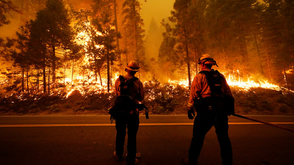
Creek Fire: 200,000 Acres Burned; Will Winds Rise As Crews Hit 8% Containment?
BY ROBERT KUWADA- Fresno Bee
SEPTEMBER 13, 2020 09:16 AM
The Creek Fire continued to burn through the Sierra National Forest and foothill communities and has burned more than 200,000 acres with 8% containment Sunday morning.
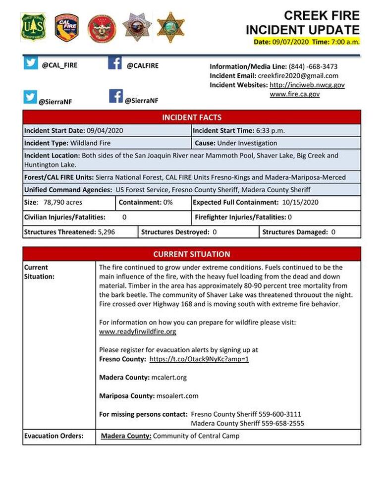
Full containment is not expected until mid-October, and the cause of the fire remains under investigation.
According to a report from Cal Fire, stronger winds over the fire will allow for better mixing and less smoke, and winds over the highest peaks in the area could hit 35 mph.
The change in conditions is expected to lead to more active fire behavior, putting the focus on structure defense, tactical patrol around structures in burned areas and perimeter control. Containment lines are being constructed and strengthened in several areas including China Peak, Cherry Valley, Blue Canyon, Auberry, Shaver Lake and Huntington Lake.
The winds will clear the layer of smoke over portions of the fire, allowing for the use of helicopters and air tankers.
Click on Image Below For Full Perimeter Map
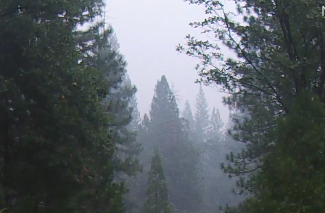
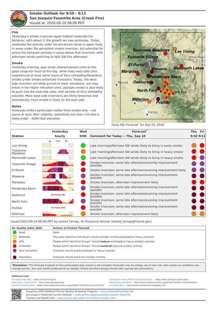
Smoke Conditions This Morning - September 13
Creek Fire Perimeter Map as of 7:00 AM, Sept. 13
Creek Fire Briefing Video September 12
196,667 Total Acres Burned, 8% Containment, "Definitely Some Success in The North", Some Setbacks in North West Area Near Bass Lake, Fire Forward Progression in Direction of North East
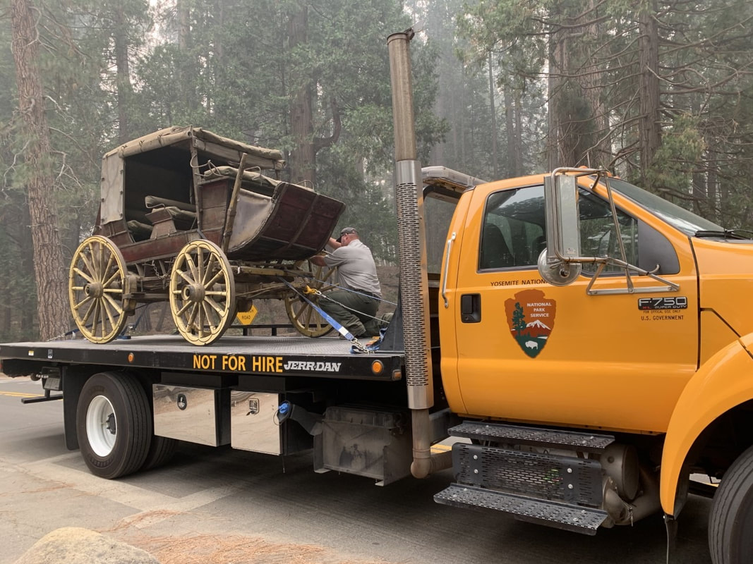
Stagecoach Moved To Yosemite Valley As a Precaution
(Yosemite Fire and Aviation)
NPS employees are working hard to protect historical artifacts and structures in the Pioneer Yosemite History Center. The Buckshot Stagecoach and others were taken to Yosemite Valley as a precaution in case of wildfire spread. (Yosemite Fire and Aviation)
(Yosemite Fire and Aviation)
NPS employees are working hard to protect historical artifacts and structures in the Pioneer Yosemite History Center. The Buckshot Stagecoach and others were taken to Yosemite Valley as a precaution in case of wildfire spread. (Yosemite Fire and Aviation)
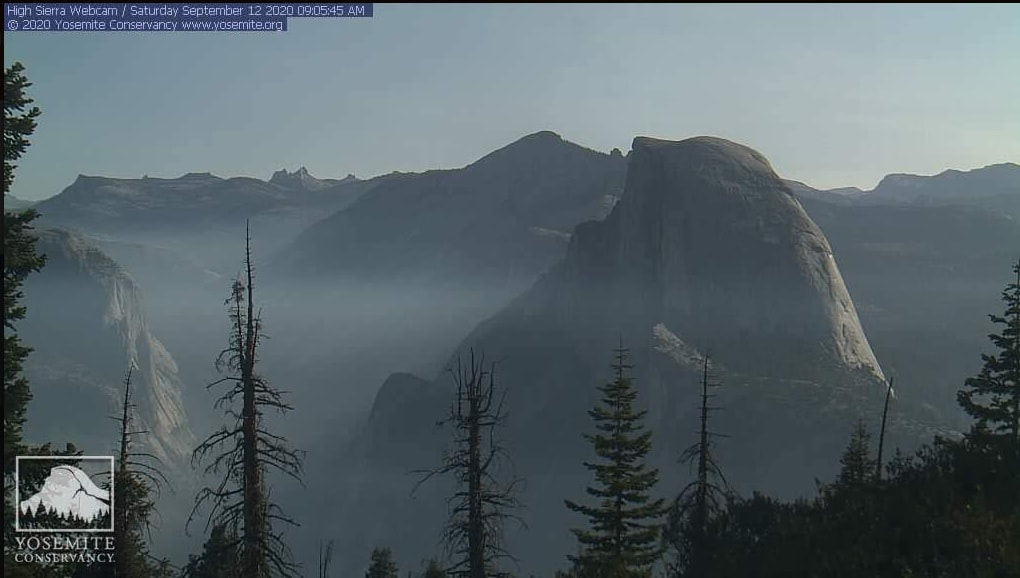
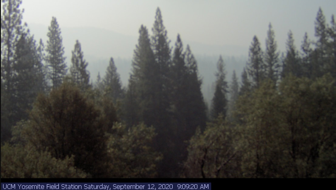
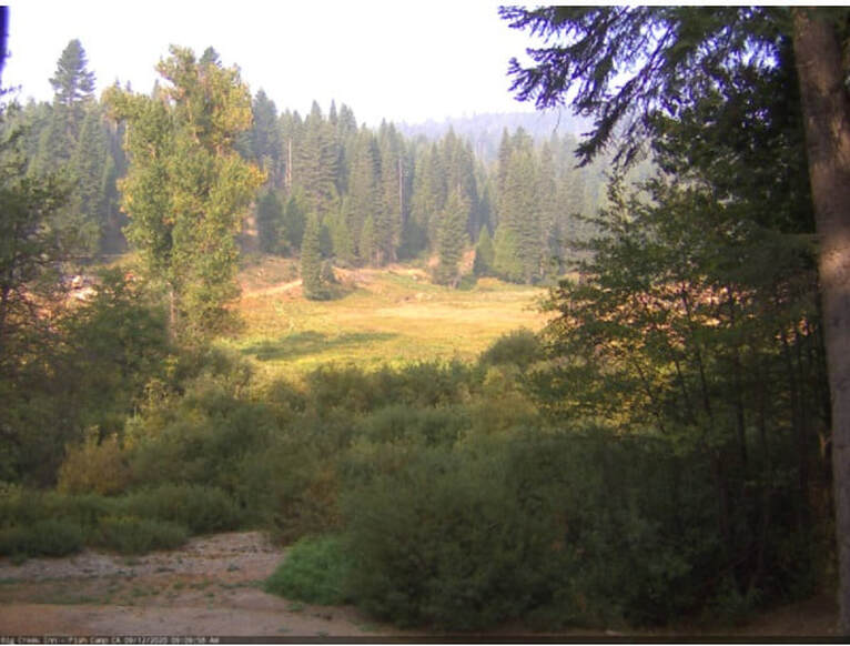
Smoke Conditions This Morning - September 12
Creek Fire at 196,667 Acres, Still 6% Containment
Fresno Bee - Sept. 12
The fire swelled overnight to 196,667 acres but containment remained unchanged Saturday morning at 6% due to the blaze’s steady and stubborn growth.
Firefighters said the flames continue to slow as cooler temperatures and climbing humidity aid the effort.
The fire swelled overnight to 196,667 acres but containment remained unchanged Saturday morning at 6% due to the blaze’s steady and stubborn growth.
Firefighters said the flames continue to slow as cooler temperatures and climbing humidity aid the effort.
Creek Fire Perimeter Map as of 7:00 AM, Sept. 12
Creek Fire Briefing Video September 11
182,000 Total Acres Burned, Still 6% Containment, But For The First Time Fire Consumed Fewer Than 10,000 Acres in One Day, Northern Flank: "Things going well"
Creek Fire Perimeter Map as of 8:00 AM, Sept. 11
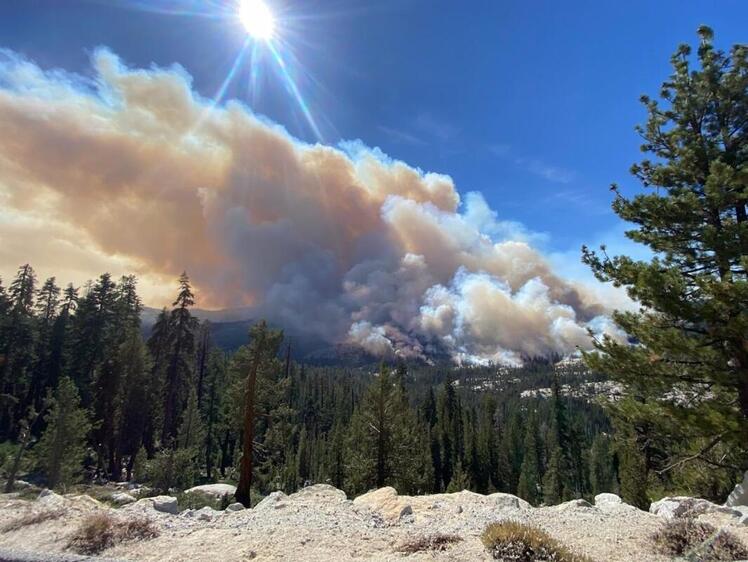
The "Other" Fires in Yosemite, September 11, 2020
There are multiple fires burning in Yosemite National Park Wilderness. Each fire is burning in a fire adapted ecosystem. There are trail closures for the Lukens Lake-Yosemite Creek and Yosemite Creek Campground trails from Tioga road to the north rim of Yosemite Valley. All fires may be visible from Tioga Road, Glacier Point, and high country vistas. Smoke from each fire is settling locally at night and in the morning, then rising and dispersing to the north and northeast in the early afternoon. Park managers are working with the local Air Quality Districts and will be monitoring smoke impacts to the park and local communities. Heavy smoke from the Creek Fire is reducing visibility and shading out the area which has moderated fire behavior.
Blue Jay Fire
Location: 4 miles south of White Wolf campground and 1 mile west of Lukens Lake trail at approximately 9,000 feet elevation.
Discovery Date: July 24, 2020
Size: 3,132 acres
Containment: 20%
Strategy: Confine and Contain
Cause: Lightning
The fire has a 70% active perimeter burning in pockets of accumulated dead and down logs and is creeping and backing with isolated single tree torching along the active perimeter. When conditions are favorable, firing operations are occurring to help bring the fire’s edge to natural containment lines. Fire crews are utilizing unmanned aircraft systems for aerial reconnaissance and mapping, infrared detection (IR), and aerial ignition. This type of aerial ignition aids fire personnel by gaining depth along natural containment lines in areas otherwise too dangerous for firefighters to hike.
inciweb.nwcg.gov/incident/6888/
Wolf Fire
Location: 1 mile north of White Wolf campground and 2 miles east of Lukens Lake trail at 9,000 feet elevation.
Discovery Date: August 11, 2020
Size: 792 acres
Containment: 0%
Strategy: Confine and Contain
Cause: Lightning
The fire has a 60% active perimeter primarily on the north and northwest edge. The fire is burning in dense pockets of vegetation and accumulated dead and down logs and is creeping along the forest floor with some isolated single tree torching and short range spotting along the active perimeter.
inciweb.nwcg.gov/incident/7134/
North Whiz Dome Fire
Location: 4/10 mile south of Cathedral Creek and 1 mile northwest of Tioga Road at 8,400 feet elevation.
Discovery Date: August 27, 2020
Size: 19 acres
Containment: 0%
Strategy: Monitor
Cause: Lightning
The fire has an 80% active perimeter burning in heavy fuels through ground litter on the forest floor and burning in pockets of accumulated dead and down logs with some isolated single tree torching. Fire personnel will continue to monitor fire behavior and growth. inciweb.nwcg.gov/incident/7135/
Horse Fire
Location: 1 mile south of Ostrander Lake along Horse Ridge at 9,500 feet elevation.
Discovery Date: August 24, 2020
Size: 15 acres
Containment: 0%
Strategy: Confine and Contain
Cause: Lightning
The fire is creeping and smoldering through sparse vegetation in a very rocky area. It is not currently burning along any trails and has shown moderate activity.
For the most up-to-date fire information follow Inciweb: inciweb.nwcg.gov
These updates will happen once week unless significant activity occurs. For the most up-to-date fire information go to : Inciweb
Yosemite Fires Web Map
Fire Update Printable PDF
Yosemite Fires Map Printable PDF
-NPS-
- Air Quality: Yosemite Air Quality Page or airnow.gov or airnow.gov/fires
- Sign-up for Alerts: go.nps.gov/alert
Creek Fire Briefing Video September 10
Containment Now at 6%, More Personnel Sent to Northern Flank, Daily Fire Growth Decreasing Significantly, Firefighting Tactic Shifting From Defense to Offense
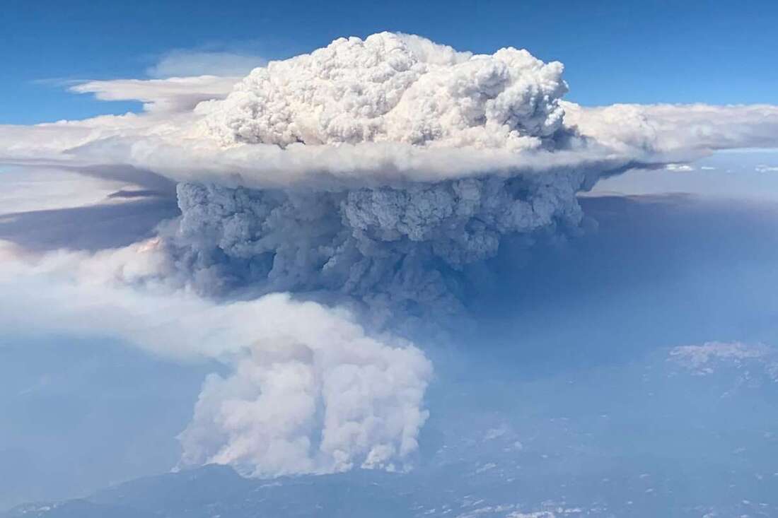 A pyrocumulonimbus cloud from the Creek Fire in the the Sierra National Forest. Passenger Thalia Dockery took the photo on a Southwest Airlines flight from San Jose to Las Vegas.Photo: Thalia Dockery - SF Chronicle
‘Fire-Breathing Dragon Of Clouds’: Formation Over Creek Fire Said To Be Biggest In US History
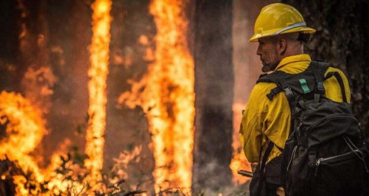
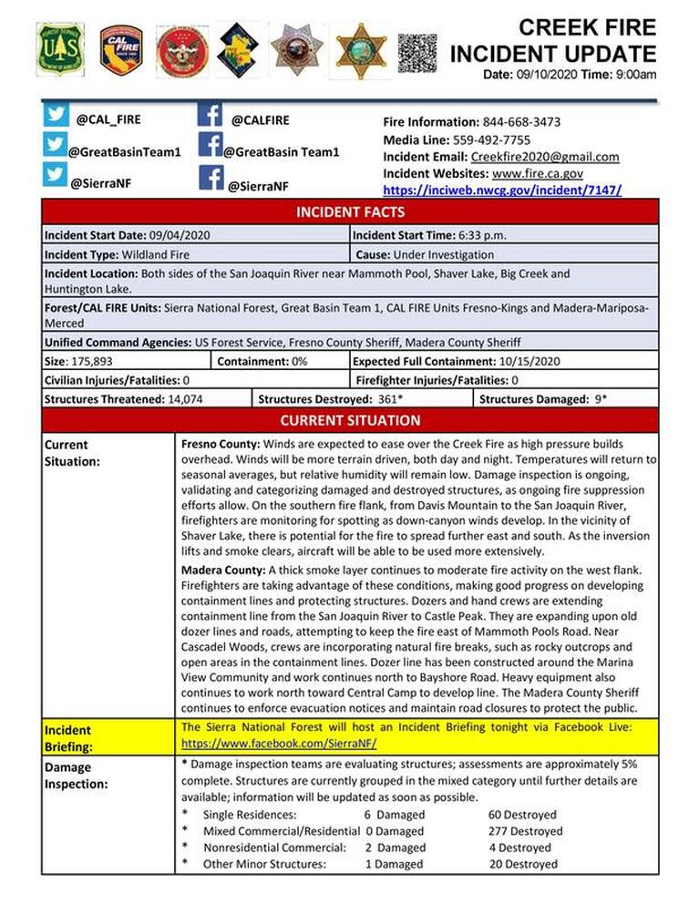
Creek Fire has Burned 175,893 Acres
Posted by: SNO Staff September 10, 2020
NORTH FORK – Sept, 10, 2020 – More favorable conditions and a thick smoke layer continue to moderate fire activity on the west flank which is closest to the communities of North Fork and Bass Lake. Firefighters are taking advantage of these conditions making good progress on developing containment lines and protecting structures.
Dozers and hand crews are extending containment lines from the San Joaquin River north to Castle Peak. They are expanding upon old dozer lines and roads attempting to keep the fire east of Mammoth Pools Road.
Near Cascadel Woods crews are incorporating natural fire breaks such as rocky outcrops and open areas into containment lines. A dozer line has been created around the Marina View Community and is continuing north to Central Camp and Beasore Road.
The Sierra National Forest will host an incident briefing tonight on Facebook Live at 7 pm. Facebook Sierra National Forest
The Madera County Sheriff continues to enforce all evacuation notices and maintain road closures to protect the public.
Incident Website
Wawona Prayer (during the Creek Fire) - by Tom Bopp
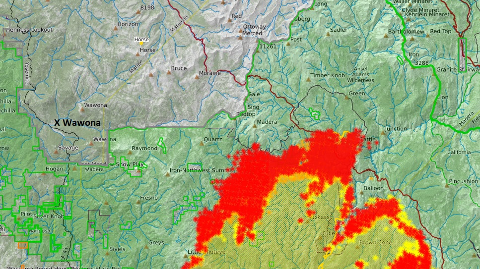
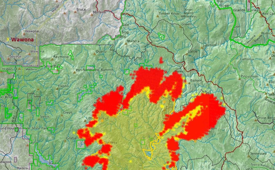
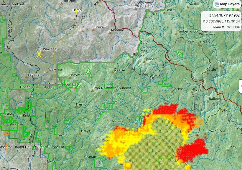 As of 7:30 AM, September 10, the Creek Fire is approximately 12 miles South East of Wawona, remains at 0% containment, and has grown to 166,000 acres
Creek Fire Perimeter Map as of 7:30 AM, September 10

Creek Fire Update and Evacuation Centers
Posted by: SNO Staff September 9, 2020
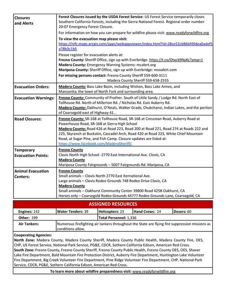
Wednesday Sept. 9, 2020 – 10 am – The Red Cross temporary evacuation point at the Oakhurst Community Center has been closed. If you are in need of an evacuation center please go to the Mariposa County Fairgrounds, 5007 Fairgrounds Rd. Mariposa, CA. 95338 or Clovis North High School, 2770 E. International Ave. Fresno, CA. 93730.
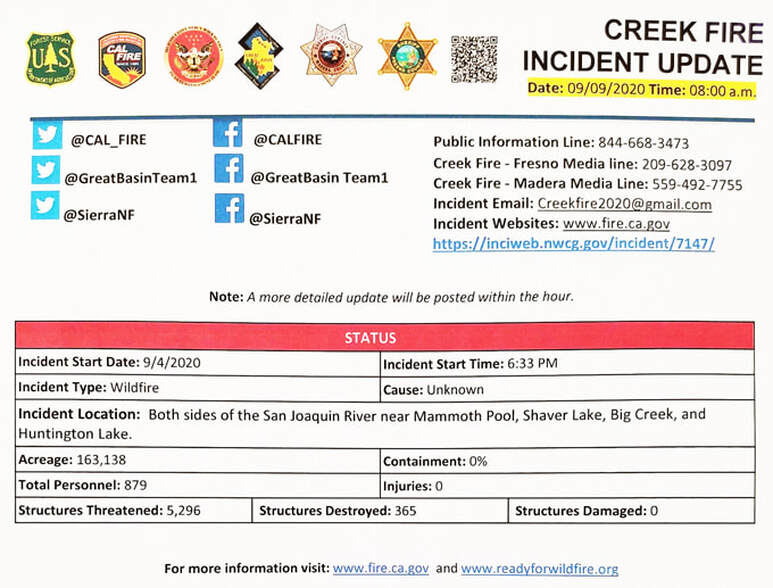
The Creek Fire continues to rage out of control with the aid of strong winds, extreme weather and rugged terrain. The unpredictable fire behavior has now blazed more than 163,000 acres with 0% containment and an expected full containment date of Oct. 15th, 2020.
All evacuation orders remain in full effect.
Creek Fire Update - September 9
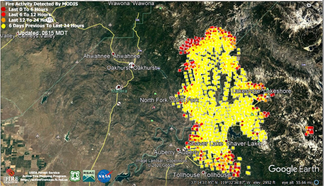
Update: 5:55 A.M. Sierra National Forest Creek Fire Operations Briefing Map for Wednesday, September 9, 2020
September 9, 2020 - Overnight infrared mapping has the Creek Fire at 163,138 Interpreted Acres.
Comments and notes on flight:
The fire progression has slowed but it still has grown considerably to the south and east as the interior is beginning to cool. Intense heat is still present around most of the perimeter, however the main areas of activity are in the southern tip (Divisions W and V) and the northern portion (Divisions F, G, and I), as well as some to the east as well (Division R).
Wawona - September 9, 8 AM
Wawona Creek Fire Meeting Video
Sierra National Forest Creek Fire Meeting Video
Creek Fire Grows to 162,833 Acres, With 365 Structures Damaged or Destroyed
The Creek Fire has grown to 162,833 acres but remained at 0% containment Tuesday night, even as Cal Fire and other agencies announced some positive developments in the blaze afflicting Fresno and Madera county mountain towns.
Here are some of the highlights from a 7 p.m. news conference, the second of what are scheduled to be daily updates. It was again held virtually at Sierra High in Tollhouse, but some questions posted by Facebook users were addressed.
▪ Fresno County Sheriff’s Office Lt. Brandon Pursell said 30,000 people in Fresno County have been evacuated.
▪ Some 365 structures, which include homes, businesses and minor buildings are damaged or destroyed, though a full damage assessment has not been completed, said Marty Adell, Deputy Incident Commander of Great Basin National Incident Management Team 1.
▪ The cause of the fire is still under investigation, according to the U.S. Forest Service.
Purcell said the Edison Campground at Shaver Lake “is in the area that has fire.”
“That area has received some damage,” he said.
Purcell indicated Lake Edison, however, “is in great shape” and continues to be used as a refuge for those caught in the backcountry until evacuations can be arranged.
Though the fire continued to grow Tuesday, the rate of growth did slow despite warnings of potentially significant wind.
Wawona Community Meeting Regarding Creek Fire
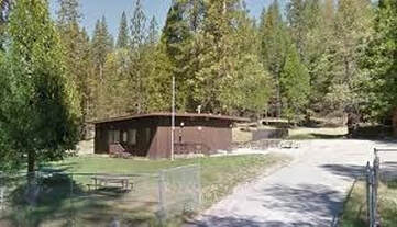
The National Park Service will host a community meeting on Tuesday, September 8, at 6:00 pm, at the Wawona Community Center. This will be an informational meeting to discuss the park's planning and response efforts in relation to the Creek Fire, to include community protection and potential evacuation. In consideration of COVID-19 protocols, the meeting will take place outdoors and attendees are asked to wear a face covering. Wawona is under a fire advisory and residents are reminded that they should be making preparations for a potential evacuation. Updated fire information is available at https://inciweb.nwcg.gov/incident/7147/.
The National Park Service will host a community meeting on Tuesday, September 8, at 6:00 pm, at the Wawona Community Center. This will be an informational meeting to discuss the park's planning and response efforts in relation to the Creek Fire, to include community protection and potential evacuation. In consideration of COVID-19 protocols, the meeting will take place outdoors and attendees are asked to wear a face covering. Wawona is under a fire advisory and residents are reminded that they should be making preparations for a potential evacuation. Updated fire information is available at https://inciweb.nwcg.gov/incident/7147/.
A Message from WAPPOA - September 8
We are sorry to inform you that we have decided to cancel our October 10 meeting and picnic. We hope that you are all well and are staying safe during this COVID pandemic. We miss seeing everyone and appreciate your support this year.
Our 2021 meetings are scheduled for April 10, June 5, and October 9 or 16 (TBD) and we hope you can join us in Wawona. As you know, the April meeting is the same weekend as the Redwoods owners’ meetings and the Wawona School picnic and fund-raising auction, so it’s a fun weekend!
The WAPPOA Board has still been at work through Zoom meetings and emails and calls. Some of the areas we’ve been involved in include:
A Donation to Wawona School for new flooring
A Donation to the Wildland Firefighters Foundation
Email blasts and mailings to all owners concerning the Park closing and re-opening, and fire updates and safety messages
Researching and supporting the “Save Wawona Golf Course” committee, including a “walk the course” meeting with Acting Superintendent Cicely Muldoon
We continue to support Wawona School, and they will be submitting a new request soon for school needs. They are open for in-person classes for Wawona residents now, and hope to open soon to the other students coming from the Oakhurst area. WAPPOA has also reached out to the Yosemite Conservancy to see if it’s possible to apply to a grant from them to help the school.
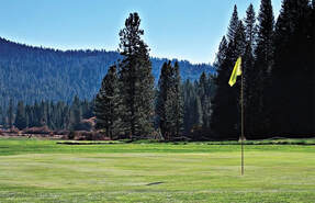
The Wawona Golf Course has fallen into serious disrepair for two reasons.
The NPS is currently constructing a new wastewater treatment plant in Wawona, which will include new sprinklers for the spray field, as well as improvements for a leech field along the 7th fairway. The golf course closed in October 2019 and is expected to reopen in April 2021, when the construction is done.
The Wawona Hotel closed for the 2020 season for major repairs to the electrical system and hopes to reopen in the spring of 2021. The primary responsibility for maintenance and operation of the golf course (including greens and fairways) is with Yosemite Hospitality (Aramark) pursuant to their contract with the NPS. Unfortunately, Aramark furloughed all the golf course maintenance staff along with the Hotel employees, and there has not been any course maintenance since March. Between October and March, when the golf course is not available for play, the NPS assumes management of the course, with continued attention to the maintenance of the fairways and greens.
WAPPOA sent a letter to Acting Supervisor Cicely Muldoon on June 15, 2020, asking her to review the situation and to meet with members of the Board and of the committee to save the course, with the hope of getting a promise to help. Superintendent Muldoon walked the course with them on July 23rd, and sent a letter to WAPPOA on August 7, 2020 stating “Yosemite National Park recognizes the value of this historic golf course and is committed to its maintenance during the Wawona Wastewater Treatment Plant construction project. Upon completion of this critical infrastructure project, the course will be returned to a playable condition. Collaborative upkeep efforts between the National Park Service, park concessioner Yosemite Hospitality,LLC, and private contractors will ensure reopening of the Sierra Nevada’s first regulation golf course following construction. The Park looks forward to providing the same rewarding golf experience it has since 1918.”
The Board also wants to thank John Klein and Liv Escola for their years of service on the Board. They have both decided to retire from the Board this October. We will be welcoming two new Board members, Joe Iaccino and Katy Jacobson, in October, and look forward to working with them!
Please remember to read the Wawona News online at wawonanews.com. It has all the latest news about the Park, the Wawona School, fire updates, etc. There’s an interesting story this month about the new owners at the Pine Tree Market, and several “journals” from Tom Bopp, including music and walks in the area. There’s an area for YNP News releases, Yosemite Area webcams and weather forecasts, and road conditions. Look under “archives’ for past posts.
Stay safe and healthy, and we hope to see you in 2021!

Free Covid-19 Testing Relocated to Yosemite Valley, September 9
Free COVID-19 tests are available in the park every Wednesday. Appointments are required. To schedule your appointment please visit http://projectbaseline.com/covid. Must be at least 18 years old to get tested, please remember to bring your Drivers License or other government-issued ID.
It is recommended for anyone working closely with the public or anyone who has been exposed to a lot of people outside of your household bubble to get tested every 14-days.
The Verily testing site originally scheduled for Wawona on September 9th, has been moved to Yosemite Valley.
Both drive-up and walk-up or bike-up testing will be available. Must be at least 18 years old to get tested, please remember to bring your Drivers License or other government-issued ID.
Appointments are required. To schedule your appointment please visit: http://projectbaseline.com/covid
Creek Fire Grows to 135,000 Acres, Remains 0% Contained
,
Sheyanne N RomeroDavid Rodriguez
Visalia Times-Delta
Updated 7:29 AM, Tuesday, Sept. 8
The Creek Fire grew to 135,523 acres and claimed at least one life Monday night. The massive wildfire remains 0% contained.
Fire officials haven't even begun to assess the structures lost to the wildfire, but know it's extensive, they said.
"This fire has already hit us hard. We know there's been structure loss. I know on the forest staff, personally, there's been loss of homes," said Dean Gould, Sierra National Forest supervisor on Monday night. "This one has hit harder and more emotionally than perhaps all those others."
Creek Fire Survivor:'It felt like you were sitting in an oven'
While Gould spoke on the emotional firefighting efforts underway, a helicopter crew unsuccessfully attempted to rescue roughly 60 of hikers and campers trapped at Lake Edison and China Peak.Fresno Fire Department reported that one person had died. However, the man's death is not connected to the Creek Fire.
"Sunday evening, an older gentleman arrived at Vermillion Store, located on Edison Road in Mono Hot Springs," said Tony Botti, spokesman for Fresno County Sheriff's Department. "The man collapsed due to a medical episode. Life-saving measures were taken, but he ended up passing away."
Paramedics weren't able to respond to the location immediately and plans are underway to fly the body out.
By Tuesday morning, 24 people were rescued by the Calfornia National Guard. Rescue efforts continue for the Creek Fire.
More than 1,000 fighters are at the incident and there are now two Type 1 incident command teams, a rarity. Cal Fire and Great Basin Incident Command Team 1 will be working together to manage the incident.
"That should be a message to all of you, just how seriously both federal leadership and state leadership are taking this incident," Gould said. "Do know that they understand the challenges. They understand the needs."
The fire was ignited Friday night near the San Joaquin River and the communities of Big Creek and Huntington Lake. Fresno and Madera counties issued a slew of mandatory evacuation orders, which will remain in effect for the time being.
On Monday night, volunteer firefighter Brian Fowlie worked alongside his crew to protect homes in North Fork.
Fowlie lives in the community and had been on duty for 48 hours.
"We're here because we want to be," he said. "It's tough, physically. You're breathing the smoke. Your feet hurt. Your knees hurt... But we're not going home until we're done."
Although he was unsure what the night would bring, he and the crew were ready.
"We're first responders. This is what we do," he said. "These houses, these are all part of our community."
He described the feeling of being able to protect his community as "pretty exhilarating."
The town was evacuated on Monday and at least one home had already been destroyed, but crews managed to save the rest.
"We have sustained pretty heavy structure loss," said Nick Truax, an incident commander with Cal Fire. "Normally, we try to get our damage inspections started in the first couple of days in an incident like this. It's going to take a little bit longer."
Crews are still in a "massive firefight" in areas where structural damage has occurred. Fallen trees and debris have also made it difficult for crews to assess structure loss.
Timber has roughly 80 to 90% tree mortality from the bark beetle, according to Cal Fire.
Additionally, much of the firefighting efforts have been focused on saving lives and getting people to safety.
What we know: More evacuations ordered as fire continues to grow
"I know everyone wants to know the status of their structures," Truax said. "You're going to have to give us just a little bit of time. We are definitely working on it and it is a priority of ours."
The fire continues to grow in most areas and crews have been asked to focus on saving life and property.
Creek Fire Evacuation Orders:
- Bass Lake Basin
- The town of North Fork and surrounding areas - Rd. 221, Rd. 222, Rd. 226, and Rd. 200 and all tributary roads are included.
- Shaver Lake down to Cressman Road, including Cressman Road
- Big Creek
- Huntington Lake
- Camp Sierra
- High Sierra areas, which include: Florence Lake, Ward Lake, Portal Forebay, Edison Lake, Mono Hot Springs, Kaiser and all campgrounds.
- The area west of Tollhouse, along Auberry Road west to Powerhouse Road.
- Alder Springs, Mile High, Meadow Lakes, Big Sandy, Mono Wind Casino, Jose Basin and Italian Bar.
- Dinkey Creek, Wishon & Courtright Reservoirs.
- Tollhouse Road at Peterson Road down to Lodge Road
- Beal Fire Road
- Powerhouse Road to the San Joaquin River
- Entire town of Auberry, which extends from the San Joaquin River on Powerhouse Road to Auberry Road in both directions out to Hwy. 168. This includes the points next to Prather and next to Cressman's General Store.
- Cascadel Road (and all off-shoots), Peckinpah Rd., Mission Rd., Douglas Rd., South Fork, Tu Nobi, Rd. 225 from Cascadel to Italian Bar.
- Evacuation warnings:
- Areas east of Highway 41 in Oakhurst, Coarsegold, O’Neals
- Two evacuation centers have been established by the American Red Cross at Oakhurst Community Center, 39800 Fresno Flats Rd., and Clovis North High School, 2770 E. International Ave., Fresno.
Red Cross has established a hotline for shelter information at 571-595-7401. Text your zip code to 888-777 for text alerts.
Creek Fire Grows to 135,523 Acres With 0% Containment
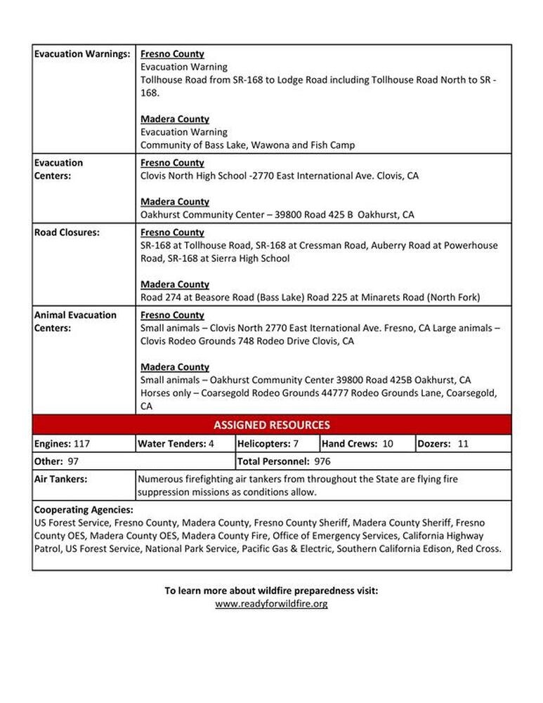
FRESNO, Calif. (KFSN) -- The Creek Fire was first sparked on Friday evening and quickly exploded to 135,523 acres - doubling in size again within a day - with 0% containment. There's no official word yet on the number of structures that may be damaged or destroyed, but nearly 5,300 are still threatened.
The fire is located near the communities of Shaver Lake, Big Creek and Huntington Lake. The flames have also spread towards the San Joaquin River and jumped into Madera County on the other side of the river. Approximately, 976 firefighters were battling the wildfire on Monday morning, CAL FIRE said
During a press conference on Monday, fire officials urged people to be prepared and proactive when it comes to evacuation orders.
They also said that there are two separate incident command teams working the Creek Fire: one is a federal team that is handling the north side of the blaze and another is working the south side of the fire into Fresno County.
The fast-moving wildfire trapped more than 200 people near the Mammoth Pool Reservoir in Madera County. National Guard helicopters were called in to airlift them to safety.
The fire also forced evacuations in numerous Fresno and Madera County mountain communities. Deputies said they are going door to door to alert residents in some areas.
On Sunday evening, California Governor Gavin Newsom declared a state of emergency in Fresno, Madera and Mariposa counties due to the fire. The declaration will help the state deploy additional resources to tackle it.
RELATED: Here's how you can help people impacted by the Creek Fire
FRESNO COUNTY
Here are all the areas under mandatory evacuation orders in Fresno County:
- Shaver Lake
- Huntington Lake
- Camp Sierra
- Big Creek
- High Sierra areas, which include: Florence Lake, Ward Lake, Portal Forebay, Edison Lake Mono Hot Springs, Kaiser and all campgrounds.
- Alder Springs
- Mile High
- Meadow Lakes
- Big Sandy
- Jose Basin
- Italian Bar
- Dinkey Creek
- Wishon & Courtright Reservoirs
- Area west of Tollhouse, along Auberry Road west to Powerhouse Road.
- Tollhouse Road and Peterson Road down to Lodge Road
- Beal Fire Road on both sides of Highway 168
- Powerhouse and Auberry Roads to the San Joaquin River
- An Evacuation Order means there is immediate threat to life. This is a lawful order to leave now. The area is lawfully closed to public access.
Fresno County has set up an an evacuation center for people and small animals at Clovis North High School, 2770 E International Ave.
Here are all the areas under an evacuation warning in Fresno County: - Cressman Road
- Auberry Road from the top of the four lanes to Powerhouse to the San Joaquin River
- Jose Basin
- Alder Spring
- Mono Wind Casino
- Meadow Lakes
- Mile High
- Tollhouse Road at Peterson Road down to Lodge Road
- Beal Fire Road
- Powerhouse Road to the San Joaquin River
- An evacuation warning means there is a potential threat to life or property. Those who require additional time to evacuate and those with pets/livestock should leave now.
RELATED: Where to bring large animals, livestock displaced by Creek Fire
MADERA COUNTY
Here are all the areas under mandatory evacuation orders in Madera County: - Cascadel Woods
- Kinsman Flat Subdivision
- Italian Bar Rd. from Road 225 to Reddinger Lake
- Mammoth Pool
- Whiskey Falls
- Clover Meadow
- Arnold Meadows
- Minarets
- All campgrounds off Minarets Road
- All campgrounds off Beasore Road north of Grizzley Road
- Mammoth Pool Trailer Park to Road 233
- Central Camp
- Road 225 east of Road 274 and all spur roads, such as Douglas Ranger Station Road, Cascadel Road, Peckinpah Road, Mission Road, Tu-Nobi Way, Rainbow Drive, Lark Lane, Boulder Creek Drive, Tera Tera Ranch Road, and Italian Bar Road, Road 235 between Road 222 and Italian Bar Road
- North Fork
- Road 221 between Road 200 and Road 226 and all spur roads such as Kowana Lane, Pahuma Way, Nielsen Road, Quail Flats Drive, Sunridge Drive and Klette's Pride Way
- Road 226 between Road 221 and Road 222 and all spur roads such as Bishop Park Place, Deer Springs Lane, Walker Ranch Road, and Keller Road
- Road 224 between Road 226 and Road 200 and all spur roads such as Horn Road, Mountain Springs Road, Priest Road, Wilcox Drive, Wild Plum Lane, and Quail Hollow Court
- Road 225 between Road 222 and Road 274 and all spur roads such as Amber Lane, Willow Creek Drive, and Road 228
- Road 222 between Road 226 and Road 200 and all spur roads such as Wah Up Way, Weatherly Lane and Buckhorn Court
- Road 200 on the northside of road between Road 221 and Road 222 and all spur road such as Wild Plum Lane, Tahoot Drive, Maranatha Drive, Golden Acorn Court, Ellis Way, Rocky Road, Cougar Springs Trail
- Bass Lake
- Eastside of Highway 41 between Road 222 and Road 200
- Road 223 from Road 426 to Road 221
- Road 222 between Road 274 and Road 226
- An Evacuation Order means there is immediate threat to life. This is a lawful order to leave now. The area is lawfully closed to public access.
Here are all the areas under an evacuation warning in Madera County: - Mammoth Pool trailer park to Road 233, down Road 225
- Sierra Sky Ranch (Road 632) and surrounding area
- North Fork
- Southside of Road 200 between Road 221 and Road 222 and all spur roads, such as Oak Junction Lane Wyle Ranch Road, Lumburg Road and Fast Lane
- Road 222 between Road 200
- Fresno/Madera County Line and all spur roads, such as Carmen Ranch Road, Ciatana Creek Road, Corrine Lake Road, Box Canyon Road, Tunoi Place and Smalley Cove Campground
- An evacuation warning means there is a potential threat to life or property. Those who require additional time to evacuate and those with pets/livestock should leave now.

YOSEMITE-WAWONA ELEMENTARY CHARTER SCHOOL
Board of Directors Regular Meeting
Tuesday, September 15, 2020
5:30 P.M.
Wawona Elementary School
7925 Chilnualana Falls Road
Wawona, CA
CALL TO ORDER
ROLL CALL
MONTHLY ITEMS AND FINANCIAL REPORTS
CONSENT AGENDA
NOTE: The Board will be asked to approve all of the following items by a single vote, unless any member of the Board or of the public asks that an item be removed from the consent agenda and considered and discussed separately.
3.1- Approval of Agenda
3.2– Approval of Minutes of the regular meeting of August 11, 2020
3.3- Accept the resignation of Ping Luo from the Board of Directors
3.3–Approve Payroll
3.4- Approve Warrants
3.5 -Accept Donations to YWECS
HEARING OF PERSONS WISHING TO ADDRESS THE BOARD
The public may address the Board on any matter pertaining to the school that is not on the agenda. There will be no Board discussion and no action will be taken unless listed on a subsequent agenda. Speakers will be limited to 3 minutes.
ACTION ITEMS
APROVAL OF 2019-20 UNAUDITED ACTUALS
Consideration and action on the adoption of the Unaudited Actuals report for 2019-20 prepared by Esme McCarthy
APPROVAL OF EMPLOYEE AND CONSULTANT AGREEMENTS
Consideration and action on the approval of employee contracts for Stacy Boydstun, Sylvia Loza and Esme McCarthy.
ACTION ON A COMMUNITY MEMBER’S REQUEST FOR A RECALL OF A BOARD OF DIRECTORS MEMBER
Consideration and action on a request by a community member to recall a sitting board member.
INFORMATION ITEMS
PUBLIC HEARING ON THE LEARNING CONTINUITY AND ATTENDANCE PLAN FOR 2020-21
STAFF REPORTS
Update on School Reopening
Enrollment and attendance requirements for students
BOARD MEMBER COMMENTS
FUTURE AGENDA ITEMS
Request that various items be placed on the next agenda for discussion and/or action.
NEXT BOARD MEETING
Unless otherwise announced, the next regular meeting of the Board of Directors will be scheduled for Tuesday, October 13, 2020, at 5:30 p.m. at the Wawona School.
An additional special meeting of the Board of Directors will be required in September to approve the Learning Continuity and Attendance Plan
CLOSED SESSION: Personnel/Negotiations/Litigation
Note: The Board will consider and may act upon any of the following items in closed session. Any action taken will be reported publically at the end of closed session as required by law.
Personnel (Gov. Code 54957)
RECONVENE IN OPEN SESSION: Announce Closed Session Actions
ADJOURNMENT
Fire Advisory for Wawona
Posted by: SNO Staff September 6,
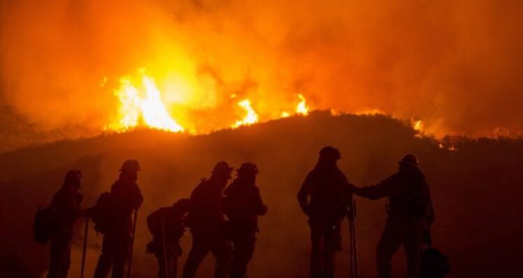
YOSEMITE – FIRE ADVISORY: Wawona residents and visitors should GET SET and prepare their home and family for the possibility of having to evacuate due to the Creek Fire burning on the Sierra National Forest. This incident may require evacuation in 24 hours or more if the threat increases.
An evacuation warning means there is a potential threat to life and / or property. Those who require additional time to evacuate and those with pets / livestock should leave now.
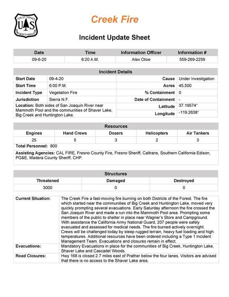
The fast moving Creek Fire has now consumed over 45,000 acres with 0% containment and more than 3000 structures threatened. The fire which started near the communities of Big Creek and Huntington Lake, moved very quickly prompting evacuations in Big Creek, Huntington Lake, Camp Edison and Shaver Lake areas.
Early Saturday afternoon the fire moving north crossed the San Joaquin River into Madera County forcing evacuations for Kinsman Flat, Cascadel Woods, Fish Creek, Rock Creek and Mammoth Pool. Many campers near Wagner’s Store and Mammoth Pool Campground were forced to shelter in place and advised to take shelter in the lake if necessary. With assistance from the California Office of Emergency Services and the California Army National Guard, 207 people were safely evacuated and assessed for medical needs.
As the fire quickly moved north more and more evacuations were ordered including Clover Meadow, surrounding campgrounds, Arnold Meadow, Minarets Work Center, Chiquito Campground, Beasore and Beasore Rd north to Clover Meadow.
The Red Cross has set up temporary evacuation shelters at the Oakhurst Community Center 39800 Fresno Flats Rd, Oakhurst, CA 93644 and Foothill Elementary School 29147 Auberry Rd, Prather, CA 93651. The North Fork Elementary evacuation shelter is still pending. We will update as more temporary shelters are set up.
The Central CA Animal Disaster Team is aiding in animal evacuations in coordination with the Madera County Sheriff’s Office, Animal Services and Red Cross. Here is information on the evacuation and sheltering of animals:
Small Companion Animal Sheltering: Oakhurst Community Center, 39800 Fresno Flats Rd, Oakhurst, CA 93644 . They are following COVID-19 protocols, please wear a mask when entering the shelter and maintain social-distancing.
Large Animals: Coarsegold Rodeo Grounds. Please contact CCADT at 559-433-9663 prior to taking your animals there so rodeo ground management can be notified to meet you.
All evacuations and closures remain in effect with no estimated time frame.
The fire burned actively overnight with a crew of more than 800 and they will continue to be challenged today by steep rugged terrain, heavy fuel loading and high temperatures.
For ongoing information click on Creek Fire Update
Click here for a topo map of the burn area
For the safety of fire crews, and the public who are leaving the area weekend visitors are asked to make alternate plans. Shaver Lake is closed.
More information will be provided when obtained as this is an active initial attack and resources are committed to a full suppression engagement of the Creek Fire
Creek Fire - Fire Advisement for Fish Camp
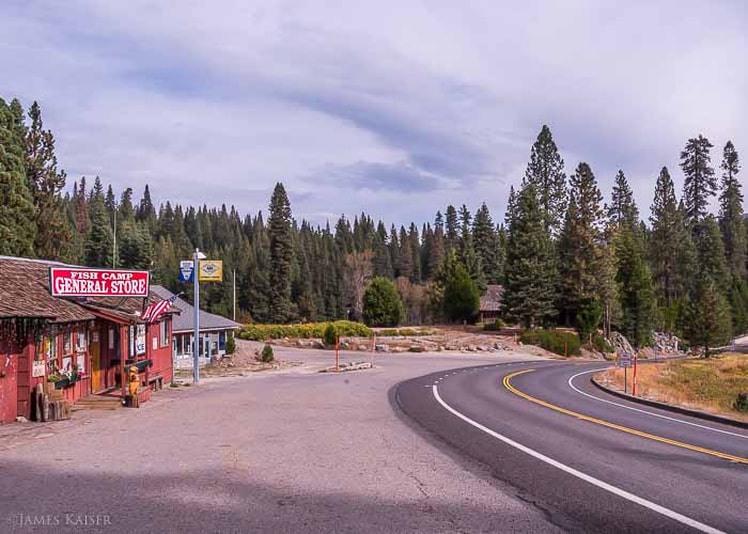
A Fire Advisement has been issued for the following areas:
Fish Camp - This includes all areas of Fish Camp from the Mariposa County Line to the Yosemite National Park Boundaries. For areas of Fish Camp in Madera County please refer to Madera County Sheriff's Office.
This is NOT a Mandatory Evacuation, this is an advisement only of fire in the area, allowing you to prepare for a potential Evacuation Order should conditions change. Fire conditions can change at any moment so please start to prepare.
Don’t wait for an evacuation order to leave if you feel threatened. If you feel unsafe please leave the area.
For a map of the current Fire Advisement areas click here- https://arcg.is/14je1K0
A Temporary Evacuation Point has been established at the Oakhurst Community Center located at 39800 425B (Fresno Flats Rd) Oakhurst, CA. please stay in your car and wear a mask when contacting Red Cross.
Dark Afternoon Sky in Wawona
Picture of dark sky in Wawona taken at 4:30 PM. The smoke has blocked the sun and is making everything quite dark. But, surprisingly, it is not hard to breathe, so far, and while it was 106 degrees in Fresno at 3 PM, it was 73 degrees in Wawona. The high heavy layer of smoke has blocked the sun and made the air cool.
What we know about the Creek Fire: Where it started, latest evacuations in California
BY ROBERT KUWADA - Fresno Bee
SEPTEMBER 06, 2020 11:17 AM , UPDATED 5 PM
The Creek Fire has been burning since sparking Friday evening in Fresno County, and on Saturday crossed the San Joaquin River to the east and made a run into the Mammoth Pool area in Madera County. It is burning on both sides of the San Joaquin River in steep, rugged terrain.
The Creek Fire as of Sunday morning was 45,500 acres (more than 70 square miles), after starting around 600. It is 0% contained, according to Cal Fire officials.
WHERE DID THE CREEK FIRE START?
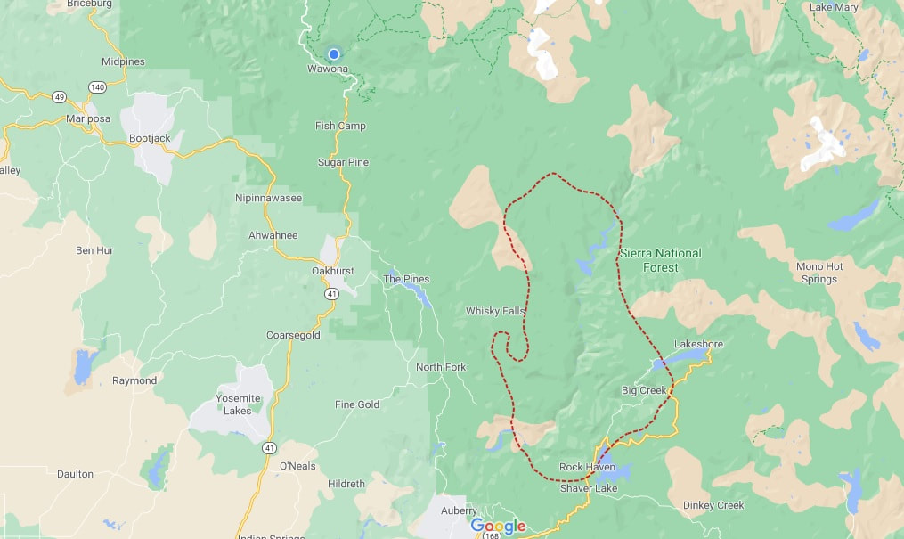
The Creek Fire started near Big Creek and Huntington Lake in Fresno County (see the map below).
At a news briefing Sunday afternoon near Shaver Lake, Fresno County Supervisor Nathan Magsig, who represents areas in the eastern part of the county including Big Creek, Shaver Lake and Huntington Lake, said the fire was nearly controlled before it exploded.
“When it was first discovered it was only 3 acres,” Magsig said. “Aircraft were deployed to knock the fire down. They thought they had it pretty well handled. It was knocked down to less than an acre. But within a matter of really just a handful of minutes the fire exploded and was up to 300 acres.”
WHERE IS THE WILDFIRE SPREADING?
The Madera County Sheriff’s Office said Sunday that an evacuation warning is likely for the town of North Fork, meaning an evacuation order is imminent.
It also is possible that Bass Lake will go under an evacuation warning in the next few days.
At the Sunday afternoon news conference, Fresno County Supervisor Magsig said there were 450 firefighters on scene but more were needed “just because of how quickly the fire is moving.”
He continued, “Because the wind conditions up here are strong with just the huge temperatures on the Valley floor the winds pick up very quickly throughout the day here and so the fire will move in different directions.
“It will move north and east, but then it will quickly move south and west. It has been very difficult to contain this fire.”
LATEST EVACUATION ORDERS, WARNINGSThe Madera County Sheriff’s Office issued an evacuation warning for the Bass Lake Basin at 4:15 p.m. Sunday due to the Creek Fire and the potential threat to life and property.
The warning includes areas west of Tollhouse, along Auberry Road west to Powerhouse Road. Also, Alder Springs, Mile High, Meadow Lakes, Big Sandy, Jose Basin, Italian Bar, Dinkey Creek, and Wishon and Courtright reservoirs.
Residents are asked to monitor the situation and be prepared to take action immediately. Those that require additional time to evacuate, and those with pets and livestock, should leave now rather than waiting for the mandatory order.
EVACUATIONS
Mandatory evacuation orders have been issued for these areas:
There are evacuation warnings in effect in these spots:
The Fresno-Madera Red Cross has established two temporary evacuation points: at Foothill Elementary School in Prather in Fresno County and at North Fork Elementary School in the Madera County town of North Fork.
Highway 168 is closed 2.7 miles east of Prather below the four-lane. The public is advised there is no access to the Shaver Lake area.
Update at 11:30 a.m.: The Red Cross opened an additional temporary evacuation point at Clovis North High to assist families who have been evacuated due to the Creek Fire. The Fresno Convention Center is being used as a reunification point for those rescued who didn’t require medical attention, and it also has an evacuation point at the Oakhurst Community Center in Oakhurst.
At the Sunday afternoon news briefing, Fresno County Supervisor Magsig said, “A lot of people are calling my office wanting to know if they can come up to get things out of their cabins, but 168 is closed so at this point, please, just stay away from this area.”
WHAT HAPPENED AT MAMMOTH POOL?
The Madera County Sheriff’s Office and California Governor’s Office of Emergency Services coordinated a rescue of more than 200 people sheltering-in-place at Mammoth Pool, trapped when the fast-moving Creek Fire crossed the north side of the San Joaquin River.
The operation was completed Sunday morning with 20 transported to area hospitals with injuries including broken bones and burns. Two chose to stay behind, refusing evacuation, according to the sheriff’s office.
The majority of the victims were flown to Fresno Yosemite International Airport, where a triage center was set up. Units from the Fresno and Clovis fire departments then were standing by to help transfer patients to local hospitals.
HOW DID THE FIRE START?
The cause of the fire remains under investigation.
FIGHTING THE WILDFIRE
There are 800 fire and other personnel battling the wildfire from the U.S. Forest Service, Cal Fire, Fresno County Fire, Fresno County Sheriff’s Office, Madera County Sheriff’s Office, California Highway Patrol, Caltrans, Southern California Edison and PG&E.
Fire crews, working in steep, rugged terrain, also were contending with temperatures on Sunday expected to hit 110 degrees in the afternoon. Thunder and lightning, which could trigger more flames, were in the air in the Shaver Lake area.
There are 25 engines, three air tankers and two helicopters fighting the blaze.
PROPERTY AT RISK
There are 3,000 structures threatened by the Creek Fire.
SEPTEMBER 06, 2020 11:17 AM , UPDATED 5 PM
The Creek Fire has been burning since sparking Friday evening in Fresno County, and on Saturday crossed the San Joaquin River to the east and made a run into the Mammoth Pool area in Madera County. It is burning on both sides of the San Joaquin River in steep, rugged terrain.
The Creek Fire as of Sunday morning was 45,500 acres (more than 70 square miles), after starting around 600. It is 0% contained, according to Cal Fire officials.
WHERE DID THE CREEK FIRE START?
The Creek Fire started near Big Creek and Huntington Lake in Fresno County (see the map below).
At a news briefing Sunday afternoon near Shaver Lake, Fresno County Supervisor Nathan Magsig, who represents areas in the eastern part of the county including Big Creek, Shaver Lake and Huntington Lake, said the fire was nearly controlled before it exploded.
“When it was first discovered it was only 3 acres,” Magsig said. “Aircraft were deployed to knock the fire down. They thought they had it pretty well handled. It was knocked down to less than an acre. But within a matter of really just a handful of minutes the fire exploded and was up to 300 acres.”
WHERE IS THE WILDFIRE SPREADING?
The Madera County Sheriff’s Office said Sunday that an evacuation warning is likely for the town of North Fork, meaning an evacuation order is imminent.
It also is possible that Bass Lake will go under an evacuation warning in the next few days.
At the Sunday afternoon news conference, Fresno County Supervisor Magsig said there were 450 firefighters on scene but more were needed “just because of how quickly the fire is moving.”
He continued, “Because the wind conditions up here are strong with just the huge temperatures on the Valley floor the winds pick up very quickly throughout the day here and so the fire will move in different directions.
“It will move north and east, but then it will quickly move south and west. It has been very difficult to contain this fire.”
LATEST EVACUATION ORDERS, WARNINGSThe Madera County Sheriff’s Office issued an evacuation warning for the Bass Lake Basin at 4:15 p.m. Sunday due to the Creek Fire and the potential threat to life and property.
The warning includes areas west of Tollhouse, along Auberry Road west to Powerhouse Road. Also, Alder Springs, Mile High, Meadow Lakes, Big Sandy, Jose Basin, Italian Bar, Dinkey Creek, and Wishon and Courtright reservoirs.
Residents are asked to monitor the situation and be prepared to take action immediately. Those that require additional time to evacuate, and those with pets and livestock, should leave now rather than waiting for the mandatory order.
EVACUATIONS
Mandatory evacuation orders have been issued for these areas:
- Shaver Lake down to Cressman
- Big Creek
- Huntington Lake
- Camp Sierra
- Italian Bar Road from Road 225 to Reddinger Lake
- High Sierra areas, which include: Florence Lake, Ward Lake, Portal Forebay, Edison Lake, Mono Hot Springs, Kaiser and all campgrounds
There are evacuation warnings in effect in these spots:
- Cressman Road
- Auberry Road from the top of the four-lane to Powerhouse to the San Joaquin River
- Jose Basin, Alder Spring, Mono Wind Casino, Meadow Lakes and Mile High
The Fresno-Madera Red Cross has established two temporary evacuation points: at Foothill Elementary School in Prather in Fresno County and at North Fork Elementary School in the Madera County town of North Fork.
Highway 168 is closed 2.7 miles east of Prather below the four-lane. The public is advised there is no access to the Shaver Lake area.
Update at 11:30 a.m.: The Red Cross opened an additional temporary evacuation point at Clovis North High to assist families who have been evacuated due to the Creek Fire. The Fresno Convention Center is being used as a reunification point for those rescued who didn’t require medical attention, and it also has an evacuation point at the Oakhurst Community Center in Oakhurst.
At the Sunday afternoon news briefing, Fresno County Supervisor Magsig said, “A lot of people are calling my office wanting to know if they can come up to get things out of their cabins, but 168 is closed so at this point, please, just stay away from this area.”
WHAT HAPPENED AT MAMMOTH POOL?
The Madera County Sheriff’s Office and California Governor’s Office of Emergency Services coordinated a rescue of more than 200 people sheltering-in-place at Mammoth Pool, trapped when the fast-moving Creek Fire crossed the north side of the San Joaquin River.
The operation was completed Sunday morning with 20 transported to area hospitals with injuries including broken bones and burns. Two chose to stay behind, refusing evacuation, according to the sheriff’s office.
The majority of the victims were flown to Fresno Yosemite International Airport, where a triage center was set up. Units from the Fresno and Clovis fire departments then were standing by to help transfer patients to local hospitals.
HOW DID THE FIRE START?
The cause of the fire remains under investigation.
FIGHTING THE WILDFIRE
There are 800 fire and other personnel battling the wildfire from the U.S. Forest Service, Cal Fire, Fresno County Fire, Fresno County Sheriff’s Office, Madera County Sheriff’s Office, California Highway Patrol, Caltrans, Southern California Edison and PG&E.
Fire crews, working in steep, rugged terrain, also were contending with temperatures on Sunday expected to hit 110 degrees in the afternoon. Thunder and lightning, which could trigger more flames, were in the air in the Shaver Lake area.
There are 25 engines, three air tankers and two helicopters fighting the blaze.
PROPERTY AT RISK
There are 3,000 structures threatened by the Creek Fire.
Creek Fire Perimeter - September 6, 6 PM
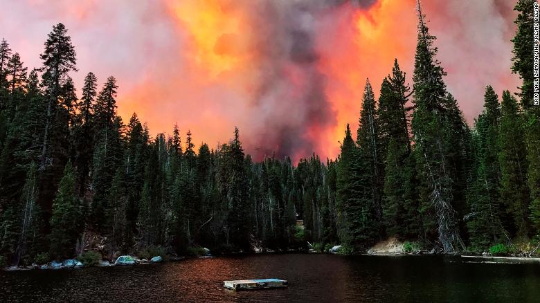
Creek Fire Moving Into Madera County Mountain Communities: Further Evacuations
Posted by: SNO Staff September 5, 2020
MADERA COUNTY MOUNTAIN COMMUNITIES – The Creek Fire that started nearly twenty four hours ago has quickly moved into Madera County. It has burned more than 2000 acres and is growing rapidly due to dry weather conditions and rugged terrain.
The Madera County Sheriff’s Office has issued mandatory evacuation orders for Kinsman Flat in North Fork and for the camping areas of Rock Creek and Fish Creek. In addition to the mandatory evacuation orders an evacuation warning has been issued for Cascadel Woods. Monitor the situation and be prepared to take action immediately. Do not wait for an evacuation order to leave if you feel threatened. Those who require additional time to evacuate, and those with pets and livestock should leave now.
*Update – The Cascadel Woods evacuation warning is due to a spot fire created from embers jumping 5 miles ahead of the Creek Fire creating the Peckinpah fire. In addition to Cascadel Woods there is a mandatory evacuation order for the Whiskey Falls area. The area is being closed to public access. The Mammoth Pool area is also under evacuation orders.
The Creek Fire was spotted on Friday Sept. 4 around 6:30 pm near Camp Sierra Road and Reddin Road between Shaver Lake and Big Creek. Cause of fire has not been determined at this time.
Mandatory evacuation orders were issued earlier today for the Shaver Lake, Big Creek and Huntington Lake areas.
We will continue to monitor the fire and report updates as they become available.
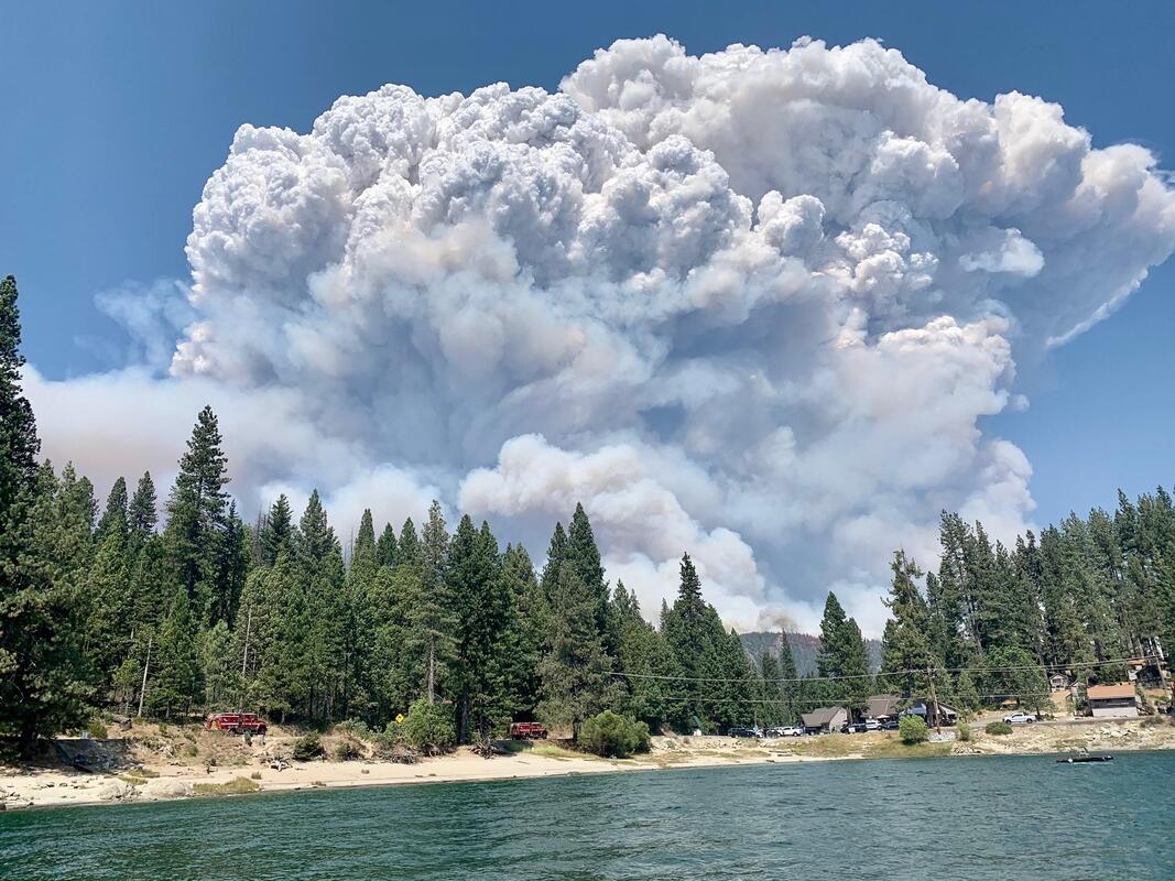
Creek Fire Update
On Friday September 4, 2020 at about 6:44 PM the Fire started. This fire is burning in the Big Creek drainage between Shaver Lake, Big Creek and Huntington Lake, cause of this fire is under investigation.
Acres: Approximately 36,000
Vegetation: Timber, Brush and Understory Litter.
Evacuations: Sierra Camp, Big Creek, Huntington Lake, and Cacadel.
Closures: Hwy 168 closed at Huntington Lake Road and at the top of the four lane Cressman's. These are hard closures CHP road block in place.
For the safety of fire crews, and the public who are leaving the area weekend visitors are asked to make alternate plans. Shaver Lake is closed.
More information will be provided when obtained as this is an active initial attack and resources are committed to a full suppression engagement of the Creek Fire.

YOSEMITE-WAWONA ELEMENTARY CHARTER SCHOOL
Board of Directors Regular Meeting
Tuesday, September 8, 2020
5:30 P.M.
Wawona Elementary School
7925 Chilnualana Falls Road
Wawona, CA
CALL TO ORDER
ROLL CALL
MONTHLY ITEMS AND FINANCIAL REPORTS
CONSENT AGENDA
NOTE: The Board will be asked to approve all of the following items by a single vote, unless any member of the Board or of the public asks that an item be removed from the consent agenda and considered and discussed separately.
3.1- Approval of Agenda
3.2– Approval of Minutes of the regular meeting of August 11, 2020
3.3–Approve Payroll
3.4- Approve Warrants
3.5 -Accept Donations to YWECS
HEARING OF PERSONS WISHING TO ADDRESS THE BOARD
The public may address the Board on any matter pertaining to the school that is not on the agenda. There will be no Board discussion and no action will be taken unless listed on a subsequent agenda. Speakers will be limited to 3 minutes.
ACTION ITEMS
APROVAL OF 2019-20 UNAUDITED ACTUALS
Consideration and action on the adoption of the Unaudited Actuals report for 2019-20 prepared by Esme McCarthy
APPROVAL OF EMPLOYEE AND CONSULTANT AGREEMENTS
Consideration and action on the approval of employee contracts for Stacy Boydstun, Sylvia Loza and Esme McCarthy.
INFORMATION ITEMS
PUBLIC HEARING ON THE LEARNING CONTINUITY AND ATTENDANCE PLAN FOR 2020-21
STAFF REPORTS
Update on School Reopening
Enrollment and attendance requirements for students
BOARD MEMBER COMMENTS
FUTURE AGENDA ITEMS
Request that various items be placed on the next agenda for discussion and/or action.
NEXT BOARD MEETING
Unless otherwise announced, the next regular meeting of the Board of Directors will be scheduled for Tuesday, October 13, 2020, at 5:30 p.m. at the Wawona School.
An additional special meeting of the Board of Directors will be required in September to approve the Learning Continuity and Attendance Plan
CLOSED SESSION: Personnel/Negotiations/Litigation
Note: The Board will consider and may act upon any of the following items in closed session. Any action taken will be reported publicly at the end of closed session as required by law.
Personnel (Gov. Code 54957)
RECONVENE IN OPEN SESSION: Announce Closed Session Actions
ADJOURNMENT
Medley of George M. Cohan songs - by Tom Bopp
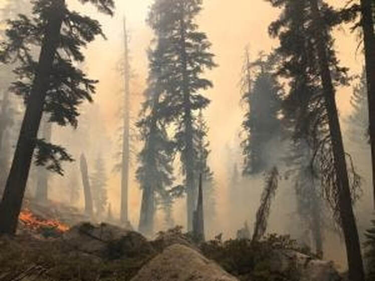 Below , NPS Photo Blue Jay Fire September 2, 2020
Fire Update September 4, 2020
There are multiple fires burning in Yosemite National Park Wilderness. Each fire is burning in a fire adapted ecosystem. There are currently no threats to infrastructure and all trails remain open. All fires may be visible from Tioga Road, Glacier Point, and from high country vistas. Smoke from each fire is settling locally at night and in the morning, then rising and dispersing to the north and northeast in the early afternoon. Park managers are working with the local Air Quality Districts and will be monitoring smoke impacts to the park and local communities. Smoke from regional wildfires in California is impacting the area reducing visibility.
Blue Jay Fire
Location: 4 miles south of White Wolf campground and 1 mile west of Lukens Lake trail at approximately 9,000 feet elevation.
Discovery Date: July 24, 2020
Size: 508
Containment: 15%
Strategy: Confine and Contain
Cause: Lightning
The fire has a 40% active perimeter burning in pockets of accumulated dead and down logs and is creeping and backing with some isolated single tree torching along the active perimeter. When conditions are favorable fire personnel are conducting firing operations to help bring the fire’s edge to natural containment lines.
inciweb.nwcg.gov/incident/6888/
Wolf Fire
Location: 1 mile north of White Wolf campground and 2 miles east of Lukens Lake trail at 9,000 feet elevation.
Discovery Date: August 11, 2020
Size: 494 acres
Containment: 0%
Strategy: Confine and Contain
Cause: Lightning
The fire has an 80% active perimeter primarily on the north and northwest edge. The fire is burning in dense pockets of vegetation and accumulated dead and down logs and is creeping along the forest floor with some isolated single tree torching and short range spotting along the active perimeter.
inciweb.nwcg.gov/incident/7134/
North Whiz Dome Fire
Location: 4/10 mile south of Cathedral Creek and 1 mile northwest of Tioga Road at 8,400 feet elevation.
Discovery Date: August 27, 2020
Size: 2-3 acres
Containment: 0%
Strategy: Monitor
Cause: Lightning
The North Whiz Dome Fire is not currently burning along any trails. The strategy for this fire is to monitor and utilize natural barriers for the fire to burn into, such as granite and bare ground. Fire behavior is actively burning in heavy fuels through ground litter on the forest floor and burning in pockets of accumulated dead and down logs with isolated single tree torching along the active perimeter.
Horse Fire
Location: 1 mile south of Ostrander Lake along Horse Ridge at 9,500 feet elevation.
Discovery Date: August 24, 2020
Size: 2-3 acres
Containment: 0%
Strategy: Confine and Contain
Cause: Lightning
The Horse Fire was ignited by lightning on Aug 24th.Fire is slightly active with low fire behavior. It is not currently burning along any trails and has shown little activity. This will be the last report unless conditions change.
These updates will happen once week unless significant activity occurs. For the most up-to-date fire information go to : Inciweb
Yosemite Fires Web Map
Yosemite Fire Update September 4, 2020 pdf
Yosemite Fire Map 2020 pdf
-NPS-
- Air Quality: Yosemite Air Quality Page or airnow.gov or airnow.gov/fires
- Sign-up for Alerts: go.nps.gov/alert
Cottage - by Tom Bopp
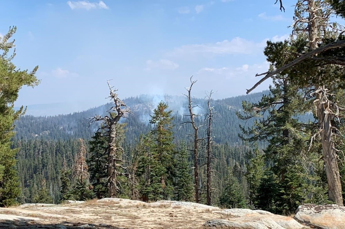 NPS Photo of the Wolf Fire August 25th, 2020
Blue Jay and Wolf Fire Update August 28, 2020
Blue Jay Fire
Location: In the wilderness 4 miles south of White Wolf campground and 1 mile west of Lukens Lake trail at approximately 9,000 feet elevation.
Discovery Date: July 24, 2020 Size: 275 acres
Containment: 15% Strategy: Confine and Contain
Cause: Lightning
Wolf Fire
Location: In the wilderness 1 miles north of White Wolf campground and 2 miles east of Lukens Lake trail at approximately 9,000 feet elevation.
Discovery Date: August 11, 2020 Size: 289 acres
Containment: 0% Strategy: Confine and Contain
Cause: Lightning
The strategy for both fires is to confine and contain to a specific area, utilizing natural barriers for the fires to burn into, such as granite and bare ground. This minimizes fire suppression impacts in the wilderness and reduces exposure to firefighters in a remote area of the park where there are no trails or campgrounds. National Park Service and Forest Service resources are committed to both fires and will continue to monitor fire weather behavior and growth.
The Blue Jay Fire has a 30% active perimeter and the Wolf Fire has a 40% active perimeter. The fires are burning in an area with an overstory of lodgepole and red fir. Fire behavior for both fires is creeping and smoldering through ground litter on the forest floor and burning in pockets of accumulated dead and down logs with some isolated single tree torching along the active perimeter. Smoke from both fires is settling locally at night and in the morning then rising and dispersing to the north northeast in the early afternoon.
The environment both fires are burning is a fire adapted ecosystem. There are currently no threats to infrastructure and all trails remain open. Both fires may be visible from Tioga Road, Glacier Point, and from high country vistas.
Park Managers are working with the local Air Quality Districts and will be monitoring smoke impacts to the park and local communities. Heavy smoke from regional wildfires in California may impact the area reducing visibility.
These updates will happen once week unless significant activity occurs. For the most up-to-date fire information go to : Inciweb
Blue Jay and Wolf Web Map
Blue Jay and Wolf Fire Update 8.28.2020 Printable PDF
-NPS-
- Air Quality: Yosemite Air Quality Page or airnow.gov or airnow.gov/fires
- Sign-up for Alerts: go.nps.gov/alert
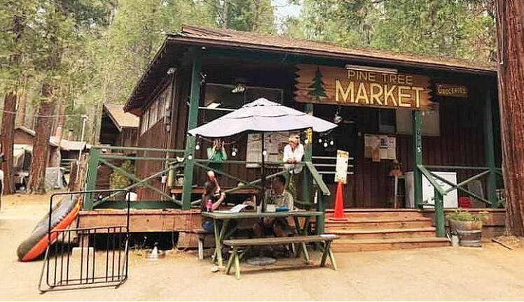 More than just a grocery store, the Pine Tree Market is a community hub. Photo by Kellie Flanagan
Pine Tree Market: It’s Where Everybody Knows Your Name
Fabled store in Wawona has new owners, same ambiance
| August 27, 2020
By KELLIE FLANAGAN
Mariposa Gazette staff writer
One regular customer said it perfectly: If the Pine Tree Market in Yosemite was a bar, its name would be Cheers. The small grocery store on Chilnualna Falls Road in Wawona is a place where everybody knows your name.
For some 30 years, the Pine Tree Market was a family operation owned by Paul and Kathy DeSantis, who cultivated a mountain tradition that continues uninterrupted with new owners Michael and Katie Henderson. Together with their three children, the Hendersons have taken up residence in the neighborhood, surely as Pine Tree Market has taken up space in the Hendersons’ hearts.
“It’s more than just selling groceries,” said Michael Henderson.
In some cases, he said, people have saved up to visit and experience Yosemite, and it’s part of his responsibility — and his pleasure — to help them with just about whatever they need during one of “the most exciting times of their lives.”
One tradition of the Pine Tree Market is to “have it all.”
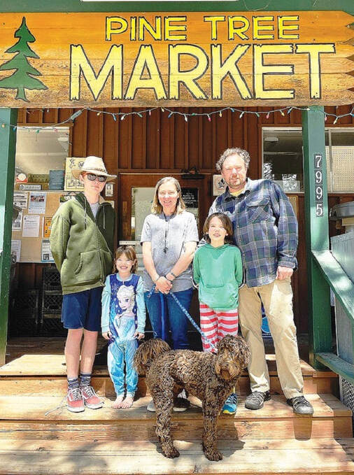 Meet the Hendersons, new owners of the Pine Tree Market in Wawona. From left are Lochlann, Brighid, mom Katie, Darrah and Michael. Submitted photo
The second most common phrase they hear is, “Gosh, you have everything.”
“Sometimes it’s not about making money on a product but having it,” to maintain that reputation.
Henderson is also there for recommendations on hikes or directions to the best swimming hole. The purveyor has a lot of answers, having been part of the scene since his folks bought a Wawona vacation home in 1987. Michael even worked at the Pine Tree Market in the summer of his 13th year; he spent his pay on sandwiches.
In the beginning…
The story of Michael and Katie dates back pretty far, too. They first met as kids in South Pasadena, where Michael’s mom led the first grade communion class that Katie attended at their local parish. Years later, they reconnected; Michael’s dad was a dean at the University of Southern California and hired Katie for a research project. Michael was in research, too.
The couple married in 2003. Coincidentally, Pine Tree Market owners Paul and Kathy DeSantis attended the wedding, once being part of the same parish in southern California.
Before long, the young Hendersons were living a busy life with three kids: Lochlann, now 14, Darrah, 10, and Brighid, 6. Mom Katie has a PhD in epidemiology and public health. Dad Michael was busy working his way up the ladder at the YMCA, where he started as a trainer and grew into a top executive position.
 Despite its remote locale, Henderson does what he can to keep fresh and colorful produce on the shelves. Photo by Kellie Flanagan
“When I was in grad school, we had a nanny,” Katie said.
She was doing post-doctoral work at City of Hope when the complicated world of academia and research funding bumped up against a recession and growing demands of parenting — the results were not ideal. Seeing the writing on the wall, Katie left the position in 2012 and began work for her brother in their family’s produce-box business — prompting her return to school for a Master of Business Administration (MBA) degree.
After five years as an associate director at the YMCA, Michael took an executive director position with the Antelope Valley and Santa Clarita organizations — two branches with about 170 staff, all together.
The family moved to Leona Valley on the edge of the Angeles National Forest in pursuit of a more rural lifestyle both Michael and Katie were attracted to. Katie had grown up around horses and the couple wound up with a 10-acre farm complete with menagerie: chickens, pigs, horse and goat — the works.
Still, the Hendersons had a dream and they weren’t quite there… yet.
“I always wanted to live in Wawona,” Katie said, after having stayed in the family’s home during vacations over the years. “We have been fans of the community for so long.”
Michael is into backpacking and he’s always loved the Sierra and Yosemite.
 Photographer Nancy Robbins said if the market was a bar it would be called Cheers because everybody knows your name. Photo by Kellie Flanagan
One day, he said, “I was reading a book on Wawona and seeing how people wanted to live here but they had to figure out how to make it work in order to stay.” That got into his head.
A dream realized
The Hendersons knew the importance of the Pine Tree Market as a source of supplies and as a central hub where the tightly-knit community could gather. They wanted to foster that.
So last year, when the Hendersons heard the DeSantis family was selling the beloved establishment, they were immediately interested. With their extended family in support of the idea, negotiations began and this spring, Paul and Kathy DeSantis retired to be grandparents while Michael and Katie Henderson became the new owners — and stewards — of the little institution, Pine Tree Market.
 Longtime friend Stephanie Yuen-Perales volunteered to help out at Pine Tree temporarily during her “covid-vacation.” Photo by Kellie Flanagan
“It’s satisfying,” said Katie. “After having worked our whole careers for others, the appeal of working for ourselves is enormous.”
After they bought the place, the shopkeepers said, so many people, from vendors to visitors, have told them, “We were thinking about buying it!”
“It’s a dream realized,” Michael added. And the accountability of “cleaning up your own mistakes,” as compared with those of others, he said, “is the best.” Of course, it’s his hope to limit the errors and they’ve always got their loyal customers to keep them on the right track.
One thing no one counted on: the novel coronavirus.
“Covid derailed plans,” Michael said. “There was no bustling tourism, travel was on hold.”
The first week of March, the Hendersons closed escrow on the Pine Tree Market, including the family home behind it. They intended on a family trip to Ireland before assuming their new lives in Wawona. Not to be: In the second week of March, Antelope Valley schools closed due to Covid-19 and, in the third week of March, California Gov. Gavin Newsom told residents to shelter in place to slow the spread of the virus.
Michael traveled ahead to Yosemite and his family stayed behind at the farm, getting ready to sell. At first, he said, Wawona was very quiet. Yosemite was closed and it was just the regulars, including park rangers, furloughed hospitality employees, law enforcement and a handful of year-round residents, all living in the “Wawona bubble.”
Stymied by the pandemic’s effect on travel and tourism while wondering how they would survive as new owners of a small store with few customers, Michael was intending to take a little time to officially open up the market.
Until, “rangers said ‘we need the store open, it’s an essential business,’” Michael recounted. “That’s when I thought, ‘we will be okay: we are needed.’”
Getting to know you
Locals pitched in, helping to get the Pine Tree Market open, and giving Michael an opportunity to get to know a core group of people in a way he may not have, without Covid-19 decimating what would have been a busy season. He dove right in, putting fresh and brightly colored produce on the shelf, trying to serve people, and making friends.
“You cannot be on the fringe of the community when you’re doing what we’re doing.”
Finally on April 1, the Pine Tree Market officially reopened under the new ownership and, once the rest of his family joined him in Wawona, things began humming along — as much as anything does during the pandemic.
“It’s been a weird time.”
When Yosemite reopened, “it was like a switch flipped.” Suddenly it was souvenirs, water shoes, everything visitors want — the need level “went from little to big.”
Now, things are settling down a bit. The youngest kids are in school down the street where Katie is on the school board: Wawona Elementary School is now a Montessori program. The simple act of walking to school has always been part of the family’s vision.
“It’s a busy time right now,” Katie said. “School is awesome.”
Their oldest son is a freshman at Yosemite and, while Lochlann had been looking forward to riding a bus to the Badger campus, that’s not happening for now. Lochlann did get a “proper birthday kidnapping” when some local teens stopped by and dragged him out with them in just the nick of time — “saving” him from a family-only 14th birthday party.
That’s the kind of neighborly response that you’d expect in Wawona, the Mayberry of Yosemite.
Every day now, the store is open 8 a.m. to 8 p.m., except sometimes when it’s closed for a family swim in the river — a needed break “to remind us where we are,” Michael said.
“I love having the family so close.”
With her public health background, Katie understates that the pandemic is “hard to watch,” and laughingly rejoices in a conveniently sharpened new skill set: Katie recently cut Michael’s hair — and word of her talent is getting around.
A new business model
People stream in and out of the store all day long – not as many as in a “normal” year, but it’s a sure-stop for many. Covid rules apply: the market steps are flanked by jumbo bottles of hand sanitizer and, when there are five customers in the store, a red light goes on outside to let people know to stay out. Sometimes, they serve regular customers from the porch. The Hendersons want to keep that “Wawona bubble” safe.
Outside, there’s a little lending library and bulletin boards where people can share community news and updates about fires and road conditions. Moms and dads ride their bikes or walk over for ice cream and to get what they need for dinner. In front, people congregate at safe distances, sipping soda at the picnic table. Rangers wave when they drive by and Wawona is as beautiful as ever.
Inside, there’s the usual fresh produce, meat and milk, and a well-stocked souvenir section highlighting local artists, with everything from stunning prints and handmade knives to bath salts and lavender. Michael and some friends designed a new logo now displayed on T-shirts, ball caps and bucket hats. Pine Tree now sells some fancy cheeses, a nice range of wines and when it’s available, fresh swordfish or salmon. When it comes to knowing what to put on the shelves, “our vendors helped us know what to do,” Michael said, while “locals give us constructive criticism.”
For now, Michael and Katie have their longtime friend Stephanie Yuen-Perales, a YMCA associate executive director, who’s volunteered to help them out temporarily during her “covid-vacation.”
The Hendersons have taken advantage of their new locale and, for instance, drove to Taft Point to see the comet recently. After one sunrise trip to the valley, Michael even saw a mountain lion.
Right now, he said, “the hardest part is the uncertainty,” of not knowing when business will pick up or what will happen in the near future.
On the other hand, he points out, “there’s a rocking chair on the porch.” Sometimes he sits in it and thinks, “I’m in Wawona,” a place where “some people spend their lives planning to come and this is the pinnacle.”
Most of all, the Hendersons said, they “appreciate the way the community has supported and embraced us,” and all of the help they’ve received.
“It’s so nice to be part of the story of Wawona.”
Tioga Afternoon - by Tom Bopp
Moc Fire Continues To Force Evacuations
By B.J. Hansen Published Aug 21, 2020 05:52 am Updated Aug 21, 2020 07:02 am
Update at 6:40am: CAL Fire spokesperson Melinda Shoff reports that the Moc Fire is up to 2,500 acres and there is still no containment. More details about the fire can be found below.
Original story posted at 5:52am: Mocassin, CA — The Moc Fire burning in Tuolumne County continues to threaten homes and businesses.
The Tuolumne County Sheriff’s Office reports that Groveland and Pine Mountain Lake are still under a mandatory evacuation order due to the fire. It includes up Highway 120 to Big Creek Shaft Road. Mandatory evacs are also in place for those along Hwy 120 to Boneyard, Second Garrote, and Incense Cedar Trail, and everything West of Second Garrote, Cherokee Trail, and Yosemite Springs. The Mariposa County Sheriff’s Office has also issued a mandatory evacuation order for much of the Greeley Hill area, as the fire has been moving southeast. Evacuation shelters are open at the Mother Lode Fairgrounds and at the Mariposa County Fairgrounds.
For a map view of the evacuation zone, click here.
Westbound Highway 120 is open for people to evacuate. Smith Station Road to Highway 132 is another route. The Yosemite National Park gate is also open for evacuees needing to exit.
We’ll keep you updated as more information comes into the newsroom. CAL Fire will also release an update later this morning on progress made overnight by crews trying to build containment lines. The Moc Fire ignited on Thursday afternoon near Moccasin and the cause is under investigation. For a recap of events from yesterday, click here.
Written by BJ Hansen.
Report breaking news, traffic or weather to our News Hotline 532-6397. Send Mother Lode News Story photos to [email protected]. Sign up for our FREE myMotherLode.com Daily Newsletters by clicking here.
Fire information is located under the “Community” tab or keyword: fire
Local Burn Day information is here. If you see breaking news send us a photo at [email protected].
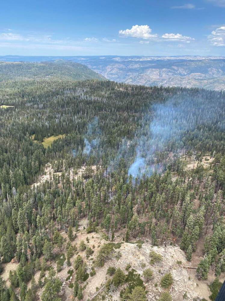 NPS Photo of the Wolf Fire August 19th , 2020
Combined Fire Update August 21, 2020
Blue Jay Fire
Location: In the wilderness 4 miles south of White Wolf campground and 1 mile west of Lukens Lake trail at approximately 9,000 feet elevation.
Discovery Date: July 24, 2020 Size: 185 acres
Containment: 0% Strategy: Confine and Contain
Cause: Lightning
White Wolf
Location: In the wilderness 1 miles north of White Wolf campground and 2 miles east of Lukens Lake trail at approximately 9,000 feet elevation.
Discovery Date: August 11, 2020 Size: 53 acre
Containment: 0% Strategy: Confine and Contain
Cause: Lightning
The strategy for both fires is to confine and contain to a specific area, utilizing natural barriers for the fires to burn into, such as granite and bare ground. This minimizes fire suppression impacts in the wilderness and reduces exposure to firefighters in a remote area of the park where there are no trails or campgrounds.
National Park Service and Forest Service resources are committed to both fires and will continue to monitor fire weather behavior and growth.
The Blue Jay Fire has an 40% active perimeter and the Wolf Fire has a 45% active perimeter. Both fires are creeping and smoldering through ground litter on the forest floor with an overstory of lodgepole and red fir and burning in pockets of accumulated dead and down logs with some isolated single tree torching along the active perimeter. Smoke has been lifting and rising 300 feet above tree line and dispersing out to the north and northeast.
The environment both fires are burning is a fire adapted ecosystem. There are currently no threats to infrastructure and all trails remain open. Both fires may be visible from Tioga Road, Glacier Point, and from high country vistas.
Park Managers are working with the local Air Quality Districts and will be monitoring smoke impacts to the park and local communities. Heavy smoke from regional wildfires in California is impacting the area further reducing visibility.
These updates will happen once week unless significant activity occurs. For the most up-to-date fire information go to : Inciweb
PDF Printable Fire Update
Blue Jay and Wolf Web Map
-NPS-
- Air Quality: www.nps.gov/yose/learn/nature/aqmonitoring or www.airnow.gov
- Sign-up for Alerts: go.nps.gov/alert
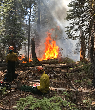
Combined Fire Update August 17, 2020
Blue Jay Fire
Location: In the wilderness 4 miles south of White Wolf campground and 1 mile west of Lukens Lake trail at approximately 9,000 feet elevation.
Discovery Date: July 24, 2020
Size: 117 acres
Containment: 0%
Strategy: Confine and Contain
Cause: Lightning
White Wolf
Location: In the wilderness 1 miles south of White Wolf campground and 2 miles west of Lukens Lake trail at approximately 9,000 feet elevation.
Discovery Date: August 11, 2020
Size: 2 acre
Containment: 0%
Strategy: Confine and Contain
Cause: Lightning
The Blue Jay Fire was ignited by lightning on July 24th. The Wolf Fire was ignited by lightning on August 11th
The Blue Jay Fie is not burning along trails, the Wolf Fire is burning 150-200 yards from the Lukens Lake Trail. The strategy for both fires is to confine and contain to a specific area, utilizing natural barriers for the fires to burn into, such as granite and bare ground. This minimizes fire suppression impacts in the wilderness and reduces exposure to firefighters in a remote area of the park where there are no trails or campgrounds. Firefighters will continue to monitor fire behavior. One Yosemite Wildfire Module (WFM) is committed to the Blue Jay Fire and various YNP Fire resources are committed to the Wolf Fire.
Both fires are creeping and smoldering through ground litter on the forest floor and burning in pockets of accumulated dead and down logs with some isolated single tree torching along the active perimeter. Smoke production has been light to moderate depending on fuels. Smoke has been lifting and rising 300 feet above tree line and dispersing out to the east. The fires are expected to continue creeping and smoldering as each burn through timber litter with an overstory of lodgepole and red fir.
The environment both fires are burning is a fire adapted ecosystem. There are currently no threats to infrastructure or access on maintained trails. Both fires may be visible from Tioga Road, Glacier Point, and from high country viewpoints.
Park Managers are working with the local Air Quality Districts and will be monitoring smoke impacts to the park and local communities.
For the most up-to-date fire information: Inciweb
8.17.2020 Combined Yosemite Fire Update
-NPS-
- Air Quality: www.nps.gov/yose/learn/nature/aqmonitoring or www.airnow.gov
- Sign-up for Alerts: go.nps.gov/alert
Elmer - by Tom Bopp
Combined Fire Update August 14, 2020
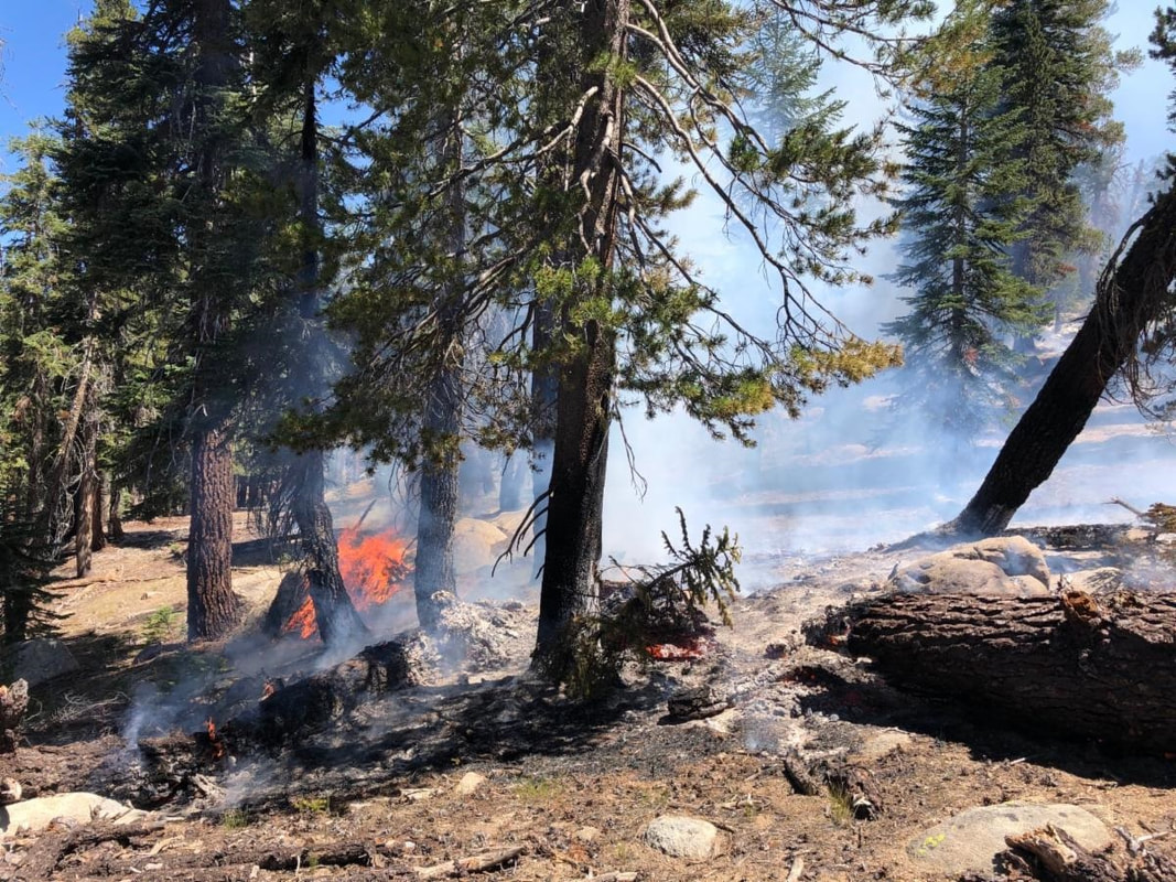
Blue Jay Fire
Location: In the wilderness 4 miles south of White Wolf campground and 1 mile west of Lukens Lake trail at approximately 9,000 feet elevation.
Discovery Date: July 24, 2020 Size: 80 acres
Containment: 0% Strategy: Confine and Contain
Cause: Lightning
White Wolf
Location: In the wilderness 1 miles south of White Wolf campground and 2 miles west of Lukens Lake trail at approximately 9,000 feet elevation.
Discovery Date: August 11, 2020 Size: 1 acre
Containment: 0% Strategy: Confine and Contain
Cause: Lightning
The Blue Jay Fire was ignited by lightning on July 24th. The Wolf Fire was ignited by lightning on August 11th
The Blue Jay Fie is not burning along trails, the Wolf Fire is burning 150-200 yards from the Lukens Lake Trail. The strategy for both fires is to confine and contain to a specific area, utilizing natural barriers for the fires to burn into, such as granite and bare ground. This minimizes fire suppression impacts in the wilderness and reduces exposure to firefighters in a remote area of the park where there are no trails or campgrounds. Firefighters will continue to monitor fire behavior. One Yosemite Wildfire Module (WFM) is committed to the Blue Jay Fire and various YNP Fire resources are committed to the Wolf Fire.
Both fires are creeping and smoldering through ground litter on the forest floor and burning in pockets of accumulated dead and down logs with some isolated single tree torching along the active perimeter. Smoke production has been light to moderate depending on fuels. Smoke has been lifting and rising 300 feet above tree line and dispersing out to the east. The fires are expected to continue creeping and smoldering as each burn through timber litter with an overstory of lodgepole and red fir.
The environment both fires are burning is a fire adapted ecosystem. There are currently no threats to infrastructure or access on maintained trails. Both fires may be visible from Tioga Road, Glacier Point, and from high country viewpoints.
Park Managers are working with the local Air Quality Districts and will be monitoring smoke impacts to the park and local communities.
For the most up-to-date fire information: Inciweb
Combined Yosemite Fire Update 8.14.2020
-NPS-
- Air Quality: www.nps.gov/yose/learn/nature/aqmonitoring or www.airnow.gov
- Sign-up for Alerts: go.nps.gov/alert
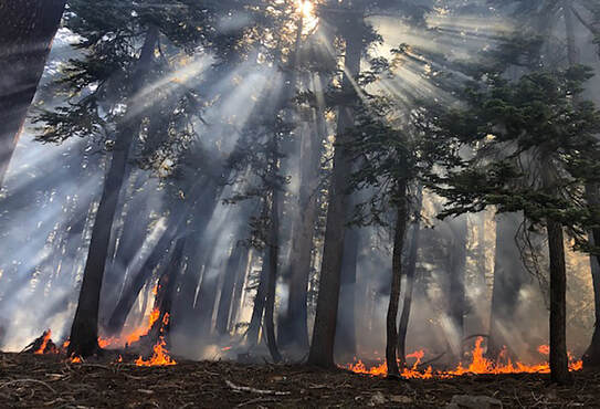
Blue Jay Fire Update August 12, 2020
Location: In the wilderness 4 miles south of White Wolf campground and 1 mile west of Lukens Lake trail at approximately 9,000 feet elevation.
Discovery Date: July 24, 2020 Size: 65 acres
Containment: 0% Strategy: Confine and contain
Cause: Lightning
The Blue Jay Fire was ignited by lightning on July 24th. It is not currently burning on or along any trails.The strategy for this fire is to confine and contain it to a specific area, utilizing natural barriers for the fire to burn into, such as granite and bare ground. This minimizes fire suppression impacts in the wilderness and reduce exposure to firefighters in a remote area of the park where there are no trails or campgrounds. Firefighters are on scene and will continue to monitor fire behavior. One Yosemite Wildfire Module (WFM) is committed to the incident.
The fire is creeping and smoldering through ground litter on the forest floor and burning in pockets of accumulated dead and down logs with some isolated single tree torching along its active perimeter. Smoke production has been light to moderate depending on fuels. Smoke has been lifting and rising 300 feet above tree tops and dispersing to the east.The fire is expected to continue creeping and smoldering as it burns through timber litter with an overstory of lodgepole and red fir.
The area the fire is burning in is a fire adapted ecosystem. There are currently no threats to infrastructure or access on maintained trails. The fire will be visible from Tioga Road, Glacier Point, and from high country viewpoints.
Park Managers are working with the local Air Quality Districts and will be monitoring smoke impacts to the park and local communities.
For the most up-to-date fire information: Inciweb
Blue Jay fire update 8.12.2020
Tourism Officials Renew the Call to Roam Responsibly
Posted by: SNO Staff
OAKHURST – Visit Yosemite | Madera County supports the Responsible Travel Code launched by Visit California, which asks visitors to travel with RESPECT by committing to seven best practices when exploring the southern Yosemite region:
“The tenets of our Responsible Travel Code speak to both preserving California and the safety of our communities and visitors,” said Caroline Beteta, president and CEO of Visit California. “We hope this code can serve as a quick resource for travelers on how to stay safe and be respectful of others and the environment when visiting the state.”
The code is part of the Responsible Travel Hub, found at visitcalifornia.com/respect. This resource demonstrates ways visitors can travel safely and responsibly and shares what businesses and communities across the state are doing to ensure the safety of their employees and guests. Content includes tips and strategies for those ready to travel and covers what travelers need to know about experiencing the golden state this year.
Visitors have always loved picnicking in the Sierra National Forest and around Bass Lake. Now ordering takeout for those picnics is easier than ever. Local wineries and breweries have also embraced the to-go spirit, making dining al fresco — bellissimo! However, preserving California means packing up every container, every paper napkin and ensuring even the smallest scraps of food are removed and disposed of securely.
“Due to COVID-19, trash removal services are reduced in remote areas. Litter and overflowing bins are not only an eyesore, but these conditions are unhealthy for the environment and wild animals as well. ‘Leave No Trace’ means leaving the outdoors pristine, as good, or cleaner than you found it.” said Brooke Smith, spokesperson for Visit Yosemite | Madera County. “Foxes, Bears, Raccoons and Bald Eagles live in Madera County, if garbage doesn’t fit securely into a trash receptacle, please take it home or the local critters will have a midnight snack scattering litter everywhere in these beautiful places, creating a dangerous situation for the health of the animals and the people.”
“Visitors should plan ahead by checking with the destinations they intend to visit to learn what activities are allowed, prohibited or limited, and prepare accordingly,” Beteta said. “They should plan to take several new precautions, but they should also be excited to experience travel again — spending time with loved ones, creating new memories, and enjoying the communities and great experiences that California has to offer.”
Posted by: SNO Staff
OAKHURST – Visit Yosemite | Madera County supports the Responsible Travel Code launched by Visit California, which asks visitors to travel with RESPECT by committing to seven best practices when exploring the southern Yosemite region:
- Roam Responsibly
- Educate Myself
- Safety First
- Preserve California
- Embrace Community
- Celebrate Culture
- Teach Others
“The tenets of our Responsible Travel Code speak to both preserving California and the safety of our communities and visitors,” said Caroline Beteta, president and CEO of Visit California. “We hope this code can serve as a quick resource for travelers on how to stay safe and be respectful of others and the environment when visiting the state.”
The code is part of the Responsible Travel Hub, found at visitcalifornia.com/respect. This resource demonstrates ways visitors can travel safely and responsibly and shares what businesses and communities across the state are doing to ensure the safety of their employees and guests. Content includes tips and strategies for those ready to travel and covers what travelers need to know about experiencing the golden state this year.
Visitors have always loved picnicking in the Sierra National Forest and around Bass Lake. Now ordering takeout for those picnics is easier than ever. Local wineries and breweries have also embraced the to-go spirit, making dining al fresco — bellissimo! However, preserving California means packing up every container, every paper napkin and ensuring even the smallest scraps of food are removed and disposed of securely.
“Due to COVID-19, trash removal services are reduced in remote areas. Litter and overflowing bins are not only an eyesore, but these conditions are unhealthy for the environment and wild animals as well. ‘Leave No Trace’ means leaving the outdoors pristine, as good, or cleaner than you found it.” said Brooke Smith, spokesperson for Visit Yosemite | Madera County. “Foxes, Bears, Raccoons and Bald Eagles live in Madera County, if garbage doesn’t fit securely into a trash receptacle, please take it home or the local critters will have a midnight snack scattering litter everywhere in these beautiful places, creating a dangerous situation for the health of the animals and the people.”
“Visitors should plan ahead by checking with the destinations they intend to visit to learn what activities are allowed, prohibited or limited, and prepare accordingly,” Beteta said. “They should plan to take several new precautions, but they should also be excited to experience travel again — spending time with loved ones, creating new memories, and enjoying the communities and great experiences that California has to offer.”
Free COVID-19 Testing In Wawona August 12
The Verily COVID-19 testing site will move on Wednesday, August 12 from Yosemite Valley to Wawona. Free COVID-19 tests will be available by reservation at the Wawona Community Center from 10:00 am to 4:00 pm. Both drive-up and walk-up or bike-up testing will be available. Must be at least 18 years old to get tested. Please remember to bring your driver's license or other government-issued ID.
Appointments are required. To schedule your appointment please visit: http://projectbaseline.com/covid
It is recommended for anyone working closely with the public or anyone who has been exposed to a lot of people outside of your household bubble to get tested every 14 days. The Verily testing site will be located in Wawona on the 2nd Wednesday of the month moving forward, and in Yosemite Valley in front of the Emergency Services Complex (near the Valley fuel pumps) on the 1st, 3rd, and 4th Wednesday of the month.
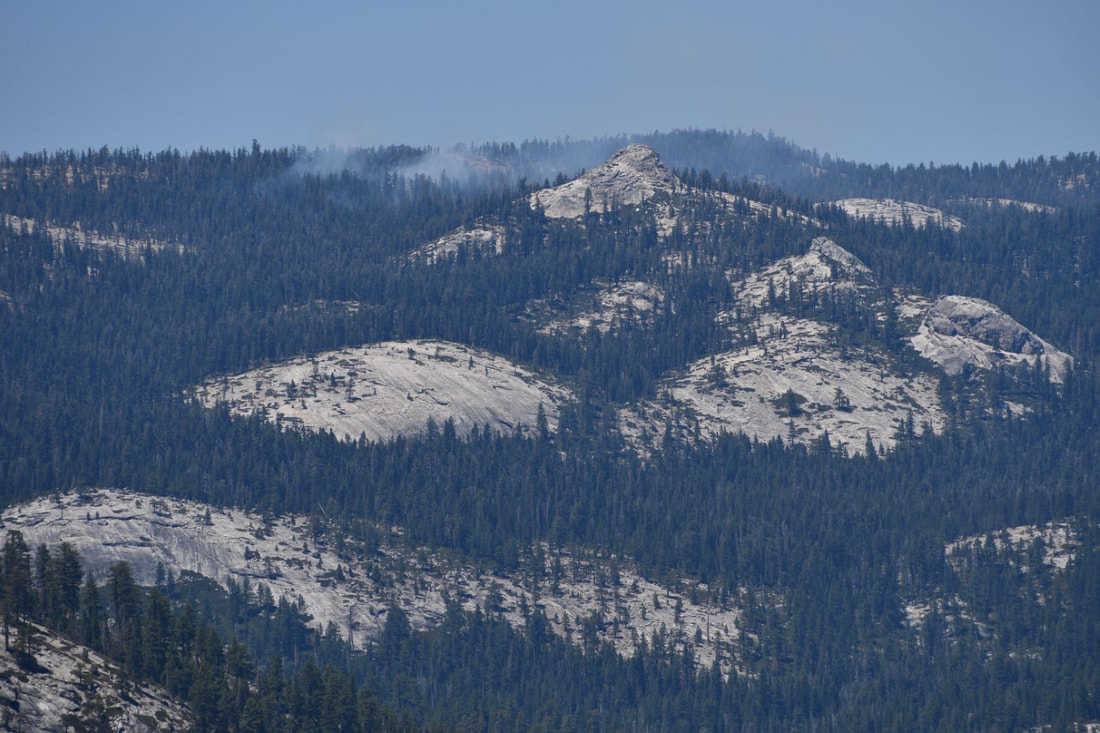
Blue Jay Fire Update August 10, 2020
Location: In the wilderness 4 miles south of White Wolf campground and 1 mile west of Lukens Lake trail at approximately 9,000 feet elevation.
Discovery Date: July 24, 2020 Size: 58 acres
Containment: 0% Strategy: Confine and contain
Cause: Lightning
The Blue Jay Fire was ignited by lightning on July 24th. It is not currently burning on or along any trails.The strategy for this fire is to confine and contain it to a specific area, utilizing natural barriers for the fire to burn into, such as granite and bare ground. This minimizes fire suppression impacts in the wilderness and reduce exposure to firefighters in a remote area of the park where there are no trails or campgrounds. Firefighters are on scene and will continue to monitor fire behavior. One Yosemite Wildfire Module (WFM) is committed to the incident.
The fire is creeping and smoldering through ground litter on the forest floor and burning in pockets of accumulated dead and down logs with some isolated single tree torching along its active perimeter. Smoke production has been light to moderate depending on fuels. Smoke has been lifting and rising 300 feet above tree tops and dispersing to the east.The fire is expected to continue creeping and smoldering as it burns through timber litter with an overstory of lodgepole and red fir.
The area the fire is burning in is a fire adapted ecosystem. There are currently no threats to infrastructure or access on maintained trails. The fire will be visible from Tioga Road, Glacier Point, and from high country viewpoints.
Park Managers are working with the local Air Quality Districts and will be monitoring smoke impacts to the park and local communities.
For the most up-to-date fire information: Inciweb
Blue Jay 8.10.20 update
