WawonaNews.com - September 2021
Fire Update August 28th, 2021
As of August 28th, Yosemite has had 44 fires started by lightning and 11 human-caused fires for the 2021 calendar year. The park is utilizing a mix of strategies to suppress, monitor, or contain these fires throughout Yosemite's fire-adapted ecosystems. Currently there are four active fires, and these have all been contained or in the process of being contained using control lines and natural barriers.
Fire management actions have adhered to Minimum Impact Suppression Techniques (MIST). This minimizes impacts in the wilderness while allowing the healthy ecological effects of natural fire. The overall strategy for managing all wildland fires is to provide for the safety of employees and the public and protect and enhance natural and cultural resources.
Smoke may be present in parts of Yosemite National Park due to other regional fires in California. Please see below for links to air quality and weather in Yosemite.
Tiltill
Location: North of Hetch Hetchy, Tiltill Valley.
Discovery Date: July 31. 2021 Size: 1,990 acres
Containment: 90% Strategy: Confine and Contain
Cause: Lightning
County Line
Location: Near Yosemite Creek Campground Road. 8361 elevation.
Discovery Date: June 28th, 2021 Size: 224 acres
Containment: 100% Strategy: Confine and Contain
Cause: Lightning
Lukens
Location: West of Lukens Lake, North of Tioga Road. 8243 elevation.
Discovery Date: June 28, 2021 Size: 867 acres
Containment: 100% Strategy: Confine and Contain
Cause: Lightning
Cold
Location: Three miles North of Glen Aulin, in Cold Canyon.
Discovery Date: August 14, 2021 Size: 8 acres
Containment: 50% Strategy: Confine and Contain
Cause: Lightning
Piute
Location: North of the Tuolumne River near Piute Mountain and Saddle Horse Lake.
Discovery Date: August 23, 2021 Size: 2 acres
Containment: 0% Strategy: Confine and Contain
Cause: Lightning
Yosemite Fires Update 8.28.2021 PDF printable
Yosemite Fires Map 8.26.2021 PDF printable
PWR Fire Current Fire Situation (arcgis.com)
-NPS-
- Air Quality: Yosemite Air Quality Page or airnow.gov or airnow.gov/fires
- Trail Closures: https://www.nps.gov/yose/planyourvisit/conditions.htm
- Fire Restrictions: https://www.nps.gov/yose/planyourvisit/firerestrictions.htm
- National Weather Service Yosemite area forecast: www.weather.gov/hanford
- Sign-up for Alerts: go.nps.gov/alert
- Yosemite National Park Fire Information webpage: go.nps.gov/yosefire
- Facebook: @YosemiteFire
- Twitter: @YosemiteFire
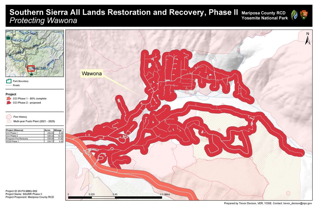 Map showing area along Wawona Road where most of the fuels reduction work has been completed, and the areas of Wawona which qualify for the new grant
Fuels Reduction Grant For Wawona
Wawona will soon be getting some much needed help with fuels reduction. Melinda Barret, from the Mariposa County Resource Conservation District has informed us that the county recently received a grant to do fuels reduction work in and around Wawona. At this time, the county is looking into project area boundaries and anyone who wants to participate will need to sign a Right of Entry and Environmental documents. The county will be coordinating with WAPPOA to make sure any residents who sign the necessary forms will qualify for this program.
Wawona will soon be getting some much needed help with fuels reduction. Melinda Barret, from the Mariposa County Resource Conservation District has informed us that the county recently received a grant to do fuels reduction work in and around Wawona. At this time, the county is looking into project area boundaries and anyone who wants to participate will need to sign a Right of Entry and Environmental documents. The county will be coordinating with WAPPOA to make sure any residents who sign the necessary forms will qualify for this program.
Excellent Documentary on State of Wildfires
Surprise Musical Performance by Tom Bopp
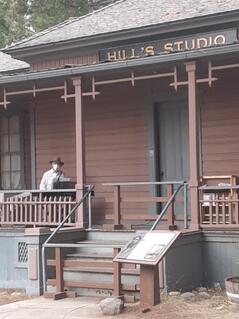
Tom Bopp sings a bit of “Wawona Moon” (by Kenneth Hall, 1925) on the front porch of Hill’s Studio across the lawn from the Wawona Hotel, Friday evening August 20, 2021 (video by Paul Beach).
Tom Bopp was sighted on the porch of Hill’s Studio last Friday evening, August 20th, playing his electric piano. He’s there as a National Park Service Volunteer, as Tom explained, “I’m trying out some random, unscheduled, free outdoor performances just to see how it all works for me and the audience.”
Asked why he wasn’t playing indoors, Tom explained, “Doctor’s orders – he’d be pretty cross if I let even a mild case of COVID undo the benefits of my open-heart surgery [in 2017]. Out here, with everybody masked within fifty feet of me per Park Service rules, I think we’re good.”
Hill’s Studio, within earshot of the Wawona Hotel’s diners, is doubling as the NPS Wilderness Permit Station and Visitor Center, but, as Tom points out, “For decades, Hill’s was the hub of entertainment at the Wawona Hotel.” Tom provided us with a little more historical background:
Built in 1884, the studio served artist Thomas Hill until his death in 1908. Eight years after that it was remodeled into what they called the “Club House,” featuring regular dances, parties, piano music, a bar and, after the 18th Amendment banned alcohol, a soda fountain, and a curio shop. In the 1950s and 60s the front porch of Hill’s hosted musical entertainment and puppet shows under the Yosemite Park & Curry Company.
“It’s fun to bring music back to Hill’s and sing the words to the same song they played for those dances in the late 1920s: ‘…beautiful Sierra night, underneath Sierra skies!’ And it’s nice to be performing again, if only a little – I haven’t played for a live audience since March of 2020.”
Tom’s been away from the hotel this summer, as he and his wife, Diane, have been preoccupied with the sale of their beloved home in Wawona and shopping for a new place. Their plan is to split the proceeds of the sale between a smaller home nearby, and a small condo somewhere on the central California coast, putting their home-base closer to medical care. They just finished moving into a temporary rental on the coast, but are still in the Wawona house with a few sticks of furniture, waiting for escrow to close.
Tom doesn’t know if or when his performances at Hill’s Studio might become regularly scheduled events, but if they do, he promises to let us know at WawonaNews.com.

Cancellation Notice:
Wawona Friends of the Bassett Memorial Library cancel the 2021Book/Bake/Craft Sale. If California were still using the color-coded Covid 19 county tracking system, Mariposa County would be in the Purple Stage with more than 7 cases per 100,000, or more that 8% of test results reported positive over seven days. For the safety of our library staff, community volunteers and book sale shoppers, this information supports our cancellation of the 2021Book/Bake/ Craft Sale. We are looking forward to having some mini-sales during the year if weather and Covid 19 cooperate. The Wawona Bassett Memorial Library remains open for curbside pickup only
Wawona Friends of the Bassett Memorial Library cancel the 2021Book/Bake/Craft Sale. If California were still using the color-coded Covid 19 county tracking system, Mariposa County would be in the Purple Stage with more than 7 cases per 100,000, or more that 8% of test results reported positive over seven days. For the safety of our library staff, community volunteers and book sale shoppers, this information supports our cancellation of the 2021Book/Bake/ Craft Sale. We are looking forward to having some mini-sales during the year if weather and Covid 19 cooperate. The Wawona Bassett Memorial Library remains open for curbside pickup only
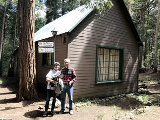 Yosemite Conservancy donors Sandra and Franklin Yee outside the cabin in Wawona that has been in Sandra’s family since the 1950s. Photo: Sabrina Diaz.
Chinese Laundry Opening Oct 1
With the new surge of Covid, the Oct 1st event will be limited to only 25 attendees in compliance with the NPS. So WAPPOA members will have to be apprised that the event will be press only for the Yosemite Conservancy. Even my family members will not be able to attend the event itself, or maybe they can be distanced since it’s an outdoor event.
I am just holding my breath that it will happen at all. It originally was supposed to open July 30 of last year.
If all goes well, the Laundry will be open to visitors in limited numbers following the event. So I hope WAPPOA members will want to visit Wawona’s newest educational project this fall. All are welcome!
Best,
Sandra Yee
Best,
Sandra Yee
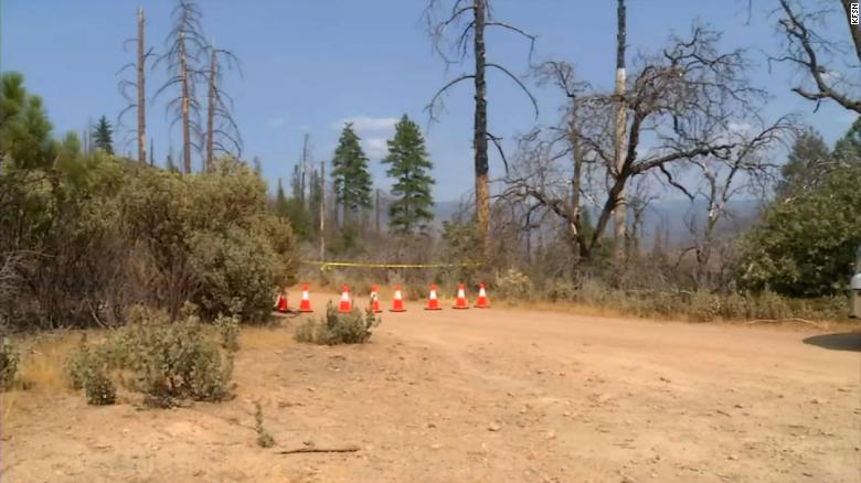
Family found dead on hiking trail near Yosemite. Authorities don't know what happened
By Cheri Mossburg and David Williams, CNN
Updated 7:28 PM ET, Thu August 19, 2021
Authorities in Mariposa County, California, are trying to determine why a family of three and their dog died on a remote hiking trail in the Sierra National Forest near Yosemite National Park.
Search and rescue workers found the bodies of John Gerrish, Ellen Chung, their one-year-old daughter, Miju, and the family dog on Tuesday near the Devil's Gulch area in the Southfork of the Merced River drainage, the Mariposa County Sheriff's Office said in a news release.
Authorities in Mariposa County, California, are trying to determine why a family of three and their dog died on a remote hiking trail in the Sierra National Forest near Yosemite National Park.
Search and rescue workers found the bodies of John Gerrish, Ellen Chung, their one-year-old daughter, Miju, and the family dog on Tuesday near the Devil's Gulch area in the Southfork of the Merced River drainage, the Mariposa County Sheriff's Office said in a news release. First responders initially treated the area as a possible hazmat scene because of concerns that carbon monoxide from nearby mines could have poisoned the family. Last month, the US Forest Service warned that toxic algae had been discovered in the Merced River and urged people not to swim, wade or allow their pets to drink the water.
The bodies have been recovered and are being autopsied, but Mitchell said they will likely have to wait for toxicology results -- which could take weeks -- to determine the cause of death.
"This is just a tragic, frustrating case for us," said Mitchell. "It will probably be a long, tedious investigation."
The family's bodies were found on the Savage-Lundy Trail, which is popular in the spring because of its colorful wildflower blooms. Mitchell said it is very hot at this time of year and there is little shade.
She said the family was well prepared for a day hike. There is no cell service in the area, so search and rescue crews had to rely on satellite phones for communication.
"This is never the outcome we want or the news we want to deliver, my heart breaks for their family. Our Sheriff's Chaplains and staff are working with their family and will continue to support them during this heartbreaking time," said Sheriff Jeremy Briese in a statement.
Fire Update August 20th, 2021
As of August 19th, Yosemite has had 43 fires started by lightning and 11 human-caused fires for the 2021 calendar year. The park is utilizing a mix of strategies to suppress, monitor, or contain these fires throughout Yosemite's fire-adapted ecosystems. Currently there are four active fires, and these have all been contained or in the process of being contained using control lines and natural barriers.
Fire management actions have adhered to Minimum Impact Suppression Techniques (MIST). This minimizes impacts in the wilderness while allowing the healthy ecological effects of natural fire. The overall strategy for managing all wildland fires is to provide for the safety of employees and the public and protect and enhance natural and cultural resources.
Smoke may be present in parts of Yosemite National Park due to other regional fires in California. Please see below for links to air quality and weather in Yosemite.
Tiltill
Location: North of Hetch Hetchy, Tiltill Valley.
Discovery Date: July 31. 2021 Size: 1,960 acres
Containment: 90% Strategy: Confine and Contain
Cause: Lightning
County Line
Location: Near Yosemite Creek Campground Road. 8361 elevation.
Discovery Date: June 28th, 2021 Size: 224 acres
Containment: 100% Strategy: Confine and Contain
Cause: Lightning
Lukens
Location: West of Lukens Lake, North of Tioga Road. 8243 elevation.
Discovery Date: June 28, 2021 Size: 867 acres
Containment: 100% Strategy: Confine and Contain
Cause: Lightning
Cold
Location: Three miles North of Glen Aulin, in Cold Canyon.
Discovery Date: August 14, 2021 Size: 6.6 acres
Containment: 10% Strategy: Confine and Contain
Cause: Lightning
Yosemite Fires Map 8.17.2021 PDF Printable
Yosemite Fires Update 8.20.2021 PDF Printable
PWR Fire Current Fire Situation (arcgis.com)
-NPS-
- Air Quality: Yosemite Air Quality Page or airnow.gov or airnow.gov/fires
- Trail Closures: https://www.nps.gov/yose/planyourvisit/conditions.htm
- Fire Restrictions: https://www.nps.gov/yose/planyourvisit/firerestrictions.htm
- National Weather Service Yosemite area forecast: www.weather.gov/hanford
- Sign-up for Alerts: go.nps.gov/alert
- Yosemite National Park Fire Information webpage: go.nps.gov/yosefire
- Facebook: @YosemiteFire
- Twitter: @YosemiteFire

Please Conserve Water in Wawona and Tuolumne Meadows
The Yosemite region typically experiences dry conditions and reductions in the available surface water flow in rivers and waterfalls each year as the spring snowpack melts off. This year's low snowpack followed by this summer's extremely hot and dry conditions has exacerbated drought conditions. The surface water flow in the South Fork Merced River dropped below 3 cfs earlier this summer, a clear indicator of serious drought conditions and a trigger for proactive conservation measures.
Water levels in both the South Fork Merced and the Tuolumne River continue to drop, and our traditionally driest month (September) lies ahead. During the coming months, please maintain your vigilance in conserving water to ensure we continue to protect our precious water resources.
Due to the ongoing drought conditions and decreased surface flow, particularly on the South Fork Merced River and the Tuolumne River, Yosemite National Park is implementing water conservation measures in Wawona. Similar measures may soon go into effect in Tuolumne Meadows as well.
You can help save water by taking the following actions:
Ensure faucets, toilet, pipes, and other water sources do not leak.
Take shorter showers and install water-saving shower heads or flow restrictors.
Don’t let the water run when brushing your teeth or shaving, use a wash basin.
Don’t let the faucet run while preparing food or cleaning and use your automatic washing-machine or
dish washer only for full loads.
Use a broom to clean driveways, sidewalks, and steps, and don’t run the hose while washing your car.
Water your lawn only when it needs it, do so when cool and avoid watering on windy days.
Want to Learn More? Check out
Yosemite Hydrology: http://www.nps.gov/yose/naturescience/hydrology.htm
Stream gage at Wawona:
https://cdec.water.ca.gov/jspplot/jspPlotServlet.jsp?sensor_no=15500&end=07%2F19%2F2021+15%3A15&geom=small&interval=10&cookies=cdec01 (J. Trust)
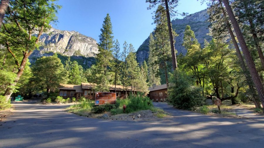 Yosemite Medical Clinic
COVID-19 UPDATES
Free COVID-19 Testing Provided by LHI is Available on Mondays and Thursdays in Yosemite Valley
Over the past week there has been a significant increase in positive COVID-19 cases in the greater Yosemite region. One of the best ways to protect yourself and our Yosemite Community from COVID-19 is through regular surveillance testing. Free COVID-19 testing provided by LHI is returning to Yosemite Valley.
Mondays: Yosemite Medical Clinic from 10:00 am to 6:00 pm
Thursdays: Curry Village Wellness Center from 10:00 am to 6:00 pm
To schedule an appointment, visit please https://www.lhi.care/covidtesting
Fire Update August 11th, 2021
As of August 11th, 2021, Yosemite has had 41 fires started by lightning and 11 human-caused fires for the 2021 calendar year. Fire management has taken on a mix of strategies to suppress, monitor, or contain these fires throughout Yosemite's fire-adapted ecosystems. All active fires are being monitored and have a low probability of spread with many natural barriers except for the Tiltill Fire which is being fully suppressed.
Fire management actions have adhered to Minimum Impact Suppression Techniques (MIST). This minimizes impacts in the wilderness while allowing the healthy ecological effects of natural fire. The overall strategy for managing all wildland fires is to provide for the safety of employees and the public and protect and enhance natural and cultural resources.
Smoke may be present in parts of Yosemite National Park due to other regional fires in California. Please see below for links to air quality and weather in Yosemite.
Tiltill
Location: North of Hetch Hetchy, Tiltill Valley.
Discovery Date: July 31. 2021 Size: 1,610 acres
Containment: 45% Strategy: Full Suppression
Cause: Lightning
County Line
Location: Near Yosemite Creek Campground Road. 8361 elevation.
Discovery Date: June 28th, 2021 Size: 224 acres
Containment: 100% Strategy: Confine and Contain
Cause: Lightning
Lukens
Location: West of Lukens Lake, North of Tioga Road. 8243 elevation.
Discovery Date: June 28, 2021 Size: 510 acres
Containment: 85% Strategy: Confine and Contain
Cause: Lightning
Yosemite Fires Update 8.11.2021 PDF Printable
Yosemite Fires Map 8.4.2021 PDF Printable
PWR Fire Current Fire Situation (arcgis.com)
-NPS-
- Air Quality: Yosemite Air Quality Page or airnow.gov or airnow.gov/fires
- Trail Closures: https://www.nps.gov/yose/planyourvisit/conditions.htm
- Fire Restrictions: https://www.nps.gov/yose/planyourvisit/firerestrictions.htm
- National Weather Service Yosemite area forecast: www.weather.gov/hanford
- Sign-up for Alerts: go.nps.gov/alert
- Yosemite National Park Fire Information webpage: go.nps.gov/yosefire
- Facebook: @YosemiteFire
- Twitter: @YosemiteFire

The Wawona Bassett Memorial Library will temporarily be open for curbside pick up only until further notice
The Board discussed our response as an employer to the latest wave of COVID-19 cases as part of their meeting this morning. Thank you for your comments and participation in that discussion. We received the following direction:
The Board directed these steps to be taken as soon as possible and not later than the end of this week. It is anticipated that these additional mitigations will be needed for at least the next ten days or until the level of community transmission in the CDC metrics drops from “high” to “moderate”.
Thank you for the steps you’ve already taken in this regard. Please take the additional steps that may be needed now and feel free to reach out to Eric, Joe and I as needed. Please share any questions as well, so we can make sure you have all of the information you need to implement the Board’s direction. Another discussion will be held on Tuesday to consider broader actions with community impact.
Stay well,
Dallin Kimble
County Administrative Office
The Board discussed our response as an employer to the latest wave of COVID-19 cases as part of their meeting this morning. Thank you for your comments and participation in that discussion. We received the following direction:
- Previous COVID-19 mitigation measures should be reinstated. This includes frequent cleaning of frequently-touched surfaces, use of barriers at service counters, telework wherever possible, and so on.
- Masks are now required for public and staff inside all County buildings.
- Staff will be required to prove vaccination or submit to weekly COVID-19 testing. HR and public health staff are working now to set up both verification and testing processes. More information on this will be distributed as we have it.
- Travel outside of the County for work should be limited. Last year, all travel required CAO approval. My inclination is to trust that each of you will manage this within your departments. Please feel free to discuss with me where you have questions.
- The public access portion(s) of our facilities should close where possible and alternative service delivery methods (appointments, curbside service delivery, outdoor meetings, etc.) should be used. Where closure is not possible, administration and public health should be involved to ensure sufficient mitigations for staff have been employed. Please let Rene and I know as soon as possible whether your offices will be open or closed so we can help provide notice to the public.
- Board meetings will remain open to the public with a restoration of social distancing, mask requirements, and so on.
The Board directed these steps to be taken as soon as possible and not later than the end of this week. It is anticipated that these additional mitigations will be needed for at least the next ten days or until the level of community transmission in the CDC metrics drops from “high” to “moderate”.
Thank you for the steps you’ve already taken in this regard. Please take the additional steps that may be needed now and feel free to reach out to Eric, Joe and I as needed. Please share any questions as well, so we can make sure you have all of the information you need to implement the Board’s direction. Another discussion will be held on Tuesday to consider broader actions with community impact.
Stay well,
Dallin Kimble
County Administrative Office

YOSEMITE-WAWONA ELEMENTARY CHARTER SCHOOL
Board of Directors Regular Meeting
Tuesday, August 10, 2021
5:30 P.M.
Wawona Elementary School
7925 Chilnualna Falls Road
Wawona, CA
MONTHLY ITEMS AND FINANCIAL REPORTS
3.1- Approval of Agenda
3.2– Approval of Minutes of the regular meeting of June 29
3.3 - Approve Warrants/Payroll
3.4 – Accept Donations to YWECS
ACTION ITEMS
INFORMATION ITEMS
Board of Directors Regular Meeting
Tuesday, August 10, 2021
5:30 P.M.
Wawona Elementary School
7925 Chilnualna Falls Road
Wawona, CA
- CALL TO ORDER
- ROLL CALL
MONTHLY ITEMS AND FINANCIAL REPORTS
- CONSENT AGENDA
3.1- Approval of Agenda
3.2– Approval of Minutes of the regular meeting of June 29
3.3 - Approve Warrants/Payroll
3.4 – Accept Donations to YWECS
- HEARING OF PERSONS WISHING TO ADDRESS THE BOARD
ACTION ITEMS
- APPROVAL OF A CONTRACT TO REPLACE THE EXISTING FIRE ALARM SYSTEM
- APPROVAL OF A RESOLUTION IDENTIFYING REPRESENTITIVES TO THE CALIFORNIA RISK MANAGEMENT ASSOCIATION’S (CRMA) BOARD OF DIRECTORS
INFORMATION ITEMS
- STAFF REPORTS
- BOARD MEMBER COMMENTS
- FUTURE AGENDA ITEMS
- NEXT BOARD MEETING
- ADJOURNMENT
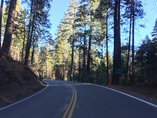
TREE REMOVAL PROJECT ON STATE ROUTE 41 IN MADERA COUNTY EXPECTED TO BEGIN NEXT WEEK
The California Department of Transportation (Caltrans), along with the U.S. Forest Service, announces the scheduled project to remove hundreds of felled or hazardous trees along State Route 41 in both Madera and Mariposa Counties.
The following will occur:
Closures may continue for longer periods of time if necessary, due to delays caused by weather or uncontrollable events that may occur.
The California Department of Transportation (Caltrans), along with the U.S. Forest Service, announces the scheduled project to remove hundreds of felled or hazardous trees along State Route 41 in both Madera and Mariposa Counties.
The following will occur:
- The project, roughly 6 miles long, is scheduled to begin Monday, August 9th and last 30 working days.
- During the project at least 350 felled or hazardous trees will be removed to help forest fire fuel reduction.
- The project will take place on State Route 41 starting in Madera County (about 4 miles south of the Madera/Mariposa County line) and into Mariposa County (approximately 2 miles north of the Mariposa/Madera County line.
- Portions of State Route-41 will have traffic control from 6:00 a.m. to 6:00 p.m., each week, Monday through Friday.
- The project will have one-way traffic control along the route depending where work is being performed. Be aware a pilot car may be present to guide motorists through the work zone so be prepared to stop.
- Motorists can expect delays of 5 to 10 minutes and a speed limit reduction in the work zone.
Closures may continue for longer periods of time if necessary, due to delays caused by weather or uncontrollable events that may occur.
